

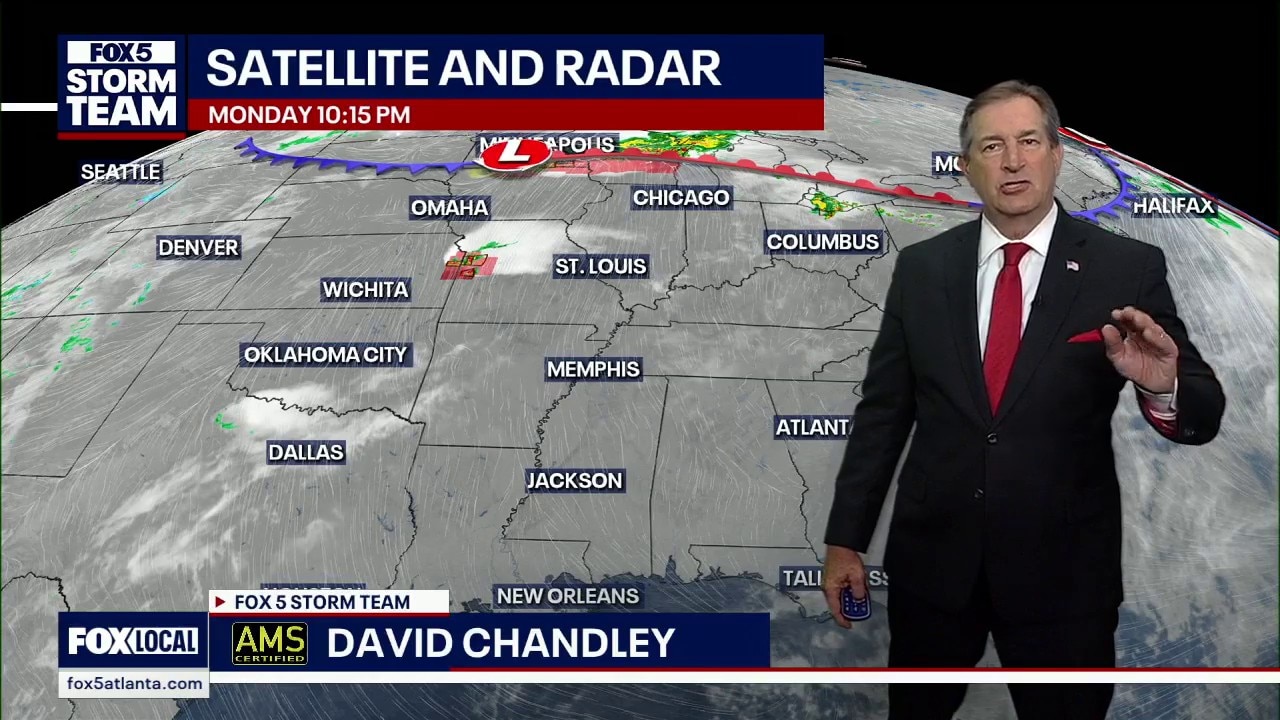
Monday night forecast
Atlanta is about to make weather history. We are tracking a heatwave that could "crush" records dating all the way back to 1878. With 90-degree temperatures possible by Saturday, we are looking at the earliest arrival of summer heat since records began.
Atlanta is about to make weather history. We are tracking a heatwave that could "crush" records dating all the way back to 1878. With 90-degree temperatures possible by Saturday, we are looking at the earliest arrival of summer heat since records began.


Disaster aid approved for seven states, others wait for a decision
Federal disaster relief is starting to flow as the White House approves major disaster declarations for seven states, yet multiple other regions remain in limbo after a series of severe storms and floods dating back to last year.
Federal disaster relief is starting to flow as the White House approves major disaster declarations for seven states, yet multiple other regions remain in limbo after a series of severe storms and floods dating back to last year.
Monday afternoon forecast
Atlanta is on the verge of history as we track a heatwave that hasn't been seen in nearly 150 years. We are forecasting the earliest 90-degree day since records began in 1878, bringing desert-dry air to North Georgia. Here is what this record-breaking stretch means for your weekend plans and your spring garden.
Atlanta is on the verge of history as we track a heatwave that hasn't been seen in nearly 150 years. We are forecasting the earliest 90-degree day since records began in 1878, bringing desert-dry air to North Georgia. Here is what this record-breaking stretch means for your weekend plans and your spring garden.
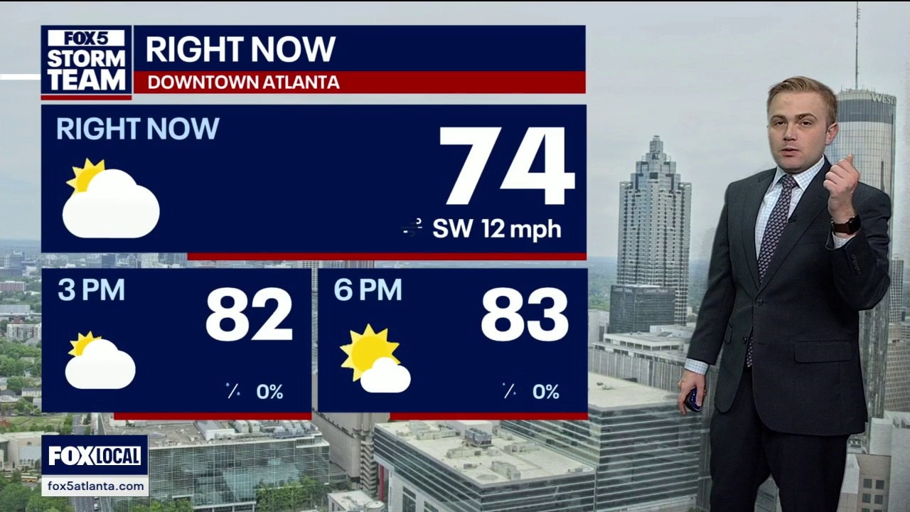
Monday midday weather forecast
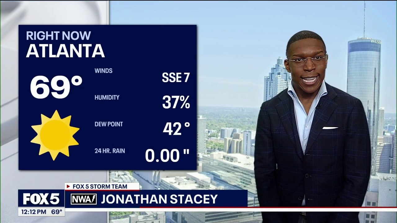
Temps are nearing 75 degrees at midday on Monday and will continue to rise this morning. Several counties are under a Red Flag Warning and fire risks remain high.
Temps are nearing 75 degrees at midday on Monday and will continue to rise this morning. Several counties are under a Red Flag Warning and fire risks remain high.


Fire reported on Buzzard Mountain in White County, burn warning issued
Fire crews are working to contain a wildfire in White County after officials say a spot fire has expanded the affected area.
Fire crews are working to contain a wildfire in White County after officials say a spot fire has expanded the affected area.
Near-record heat in metro Atlanta expected later this week
Unseasonably warm temperatures are settling into metro Atlanta this week, with a stretch of above-average highs that could challenge — and even break — daily records.
Unseasonably warm temperatures are settling into metro Atlanta this week, with a stretch of above-average highs that could challenge — and even break — daily records.
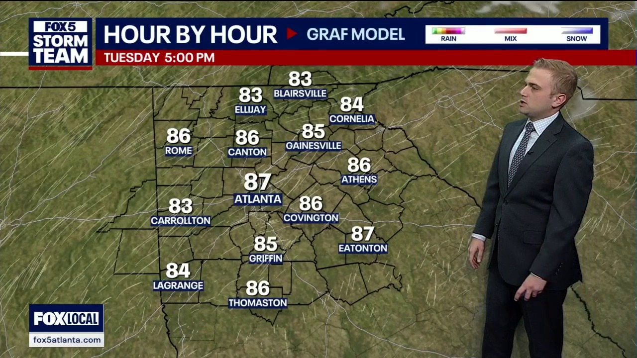
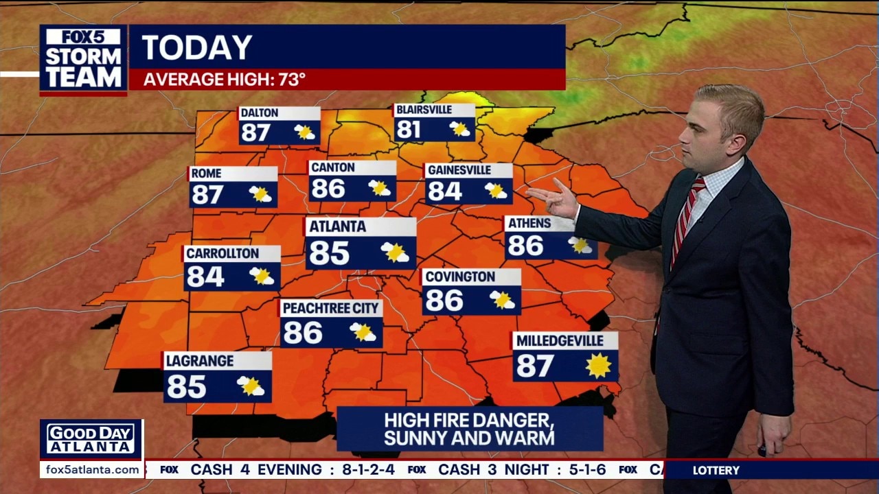
Monday morning weather forecast
Monday is the start of a hot week in North Georgia. Today will see a high around 83 degrees and is the coolest day this week.
Monday is the start of a hot week in North Georgia. Today will see a high around 83 degrees and is the coolest day this week.
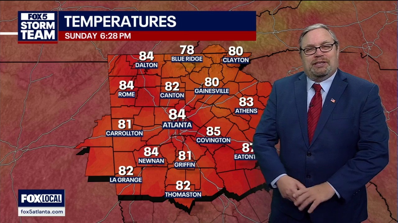
Sunday evening forecast
It's forecast to be a record-breaking week of heat in North Georgia. Here's your latest forecast update.
It's forecast to be a record-breaking week of heat in North Georgia. Here's your latest forecast update.


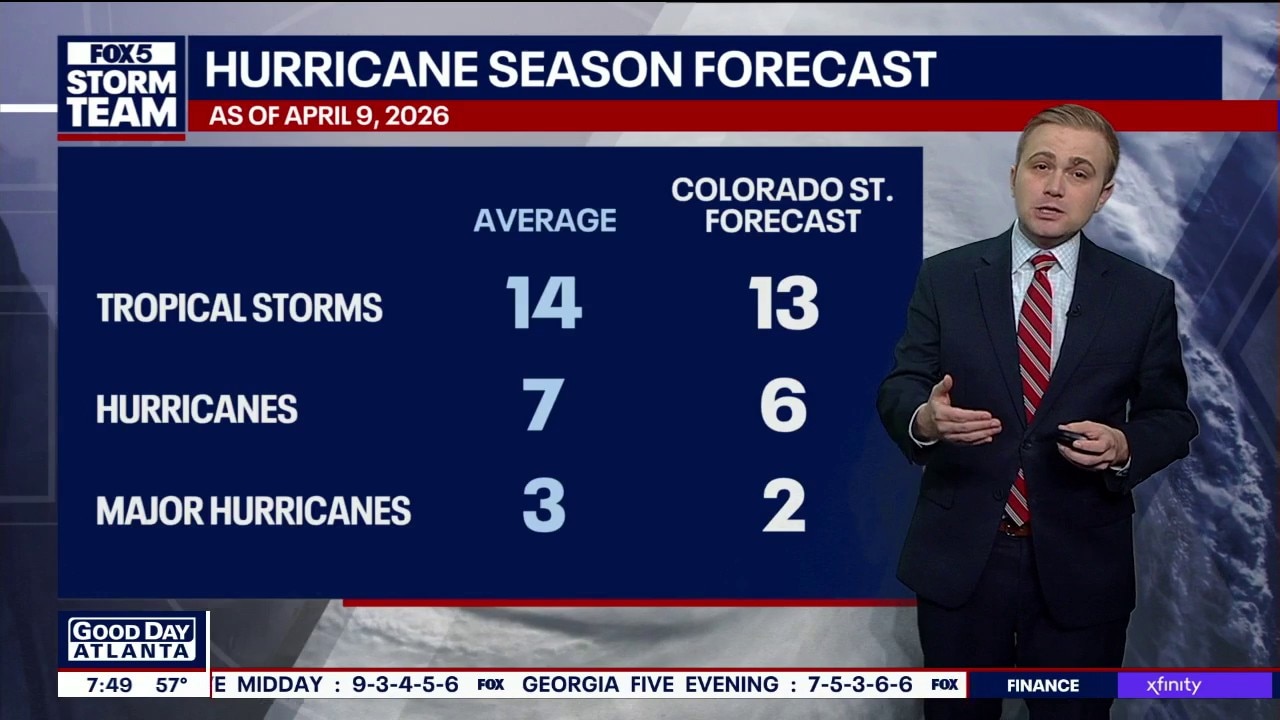
2026 Hurricane Season: Colorado State forecast calls for near-average storm count
Researchers at Colorado State University have released their initial forecast for the 2026 Atlantic hurricane season, expecting a somewhat below-average season, predicting 13 named storms.
Researchers at Colorado State University have released their initial forecast for the 2026 Atlantic hurricane season, expecting a somewhat below-average season, predicting 13 named storms.

2026 Hurricane Season: Colorado State forecast calls for near-average storm count
The transition to a robust El Niño is the primary reason for the quieter forecast, as it increases wind shear that suppresses storms.
The transition to a robust El Niño is the primary reason for the quieter forecast, as it increases wind shear that suppresses storms.
50 Days until Hurricane Season: 2026 Forecast
April 12 marks 50 days until the start of the 2026 Atlantic hurricane season.
April 12 marks 50 days until the start of the 2026 Atlantic hurricane season.
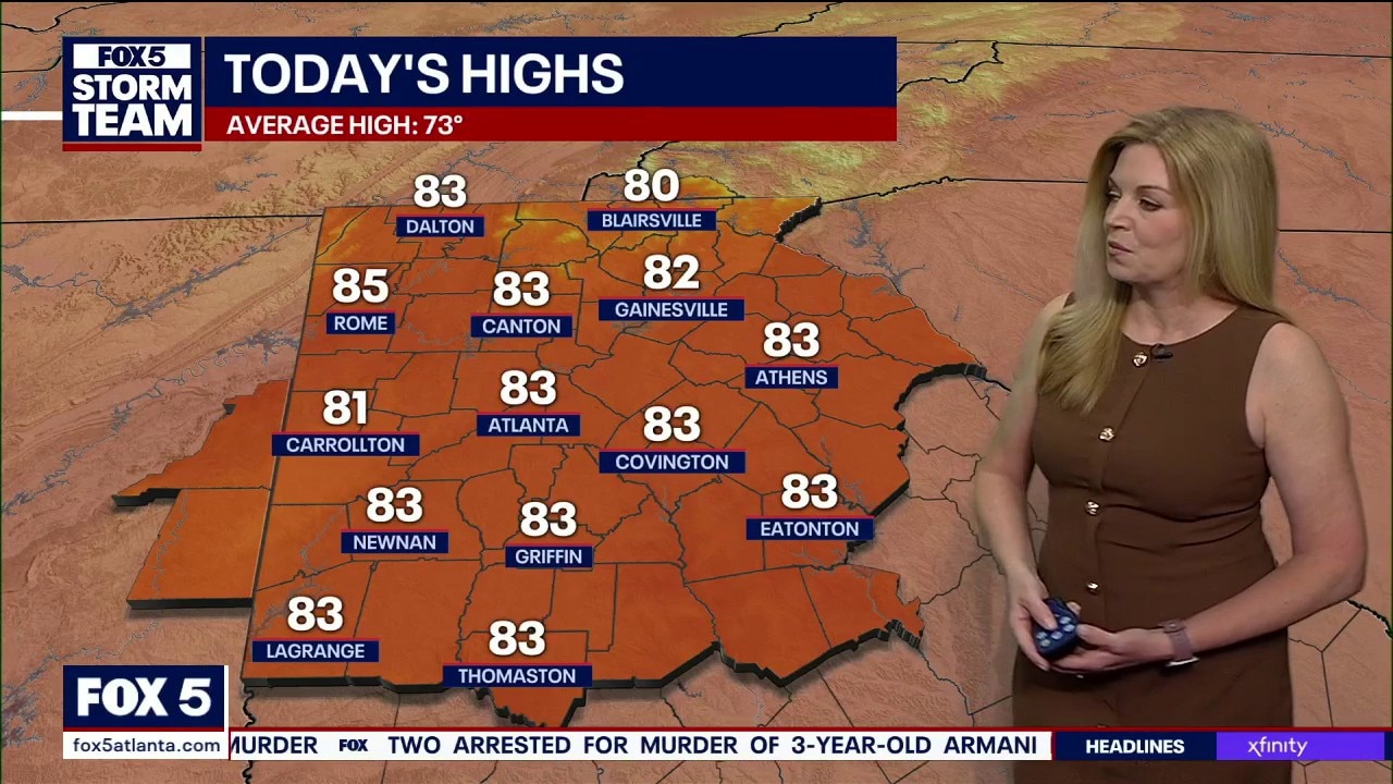
Sunday morning weather forecast
Record high temperatures will be broken in the days ahead.
Record high temperatures will be broken in the days ahead.
Sunday evening weather update
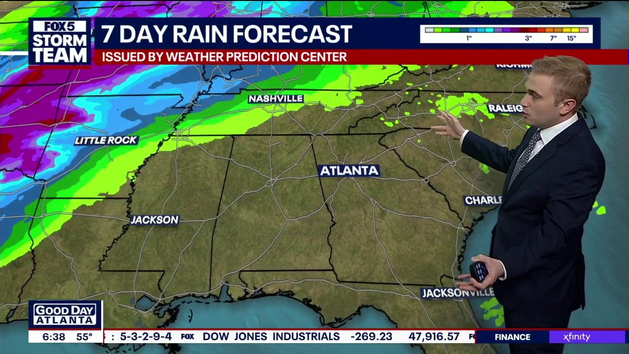
A hot week is ahead for North Georgia with temperatures expected to be record-breaking. No rain is in sight to quelch the ongoing drought. Here's your latest weather update.
A hot week is ahead for North Georgia with temperatures expected to be record-breaking. No rain is in sight to quelch the ongoing drought. Here's your latest weather update.
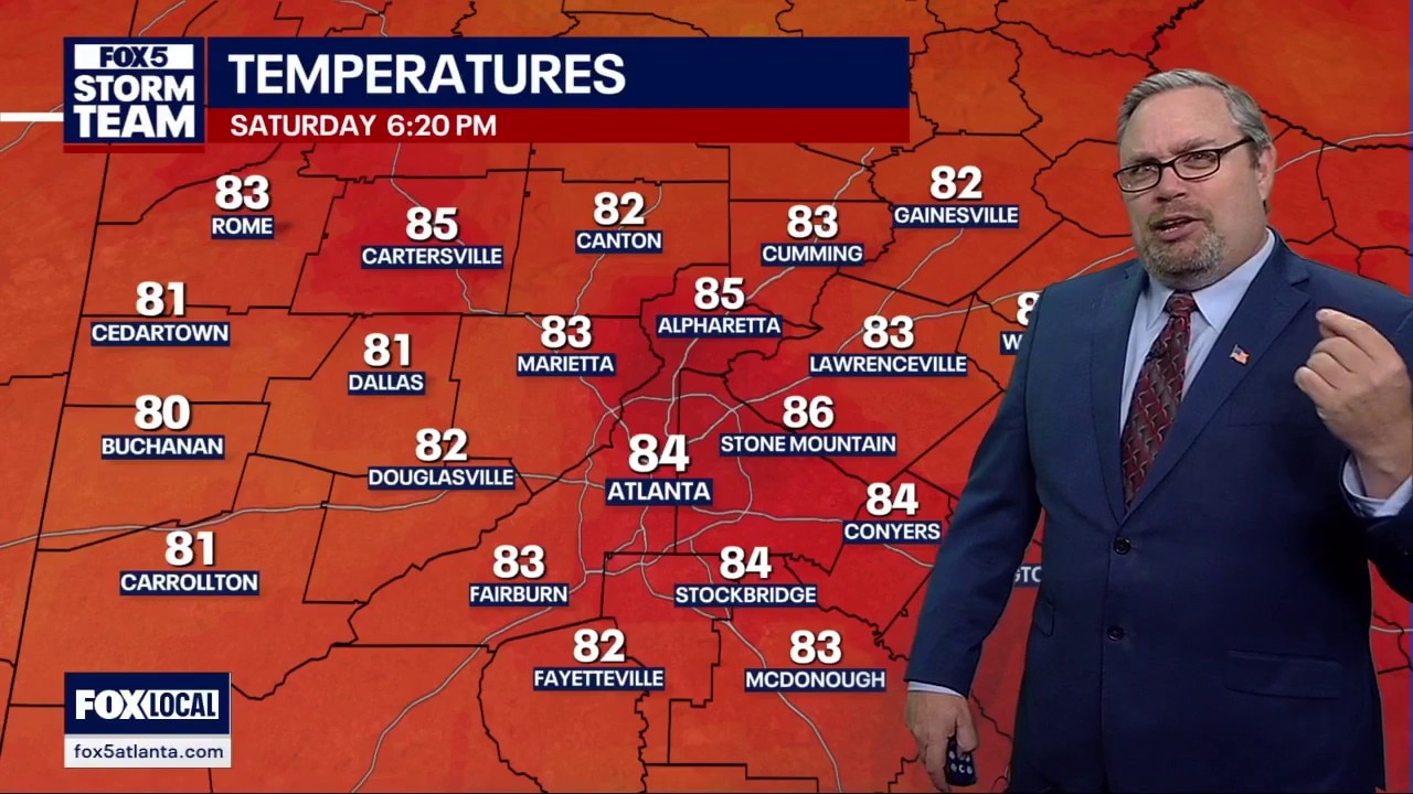
Saturday morning weather forecast
Sunny and warm with record high temperatures in jeopardy over the next week.
Sunny and warm with record high temperatures in jeopardy over the next week.
Weekend weather forecast
Get ready for summer-style heat in the middle of April. A massive area of high pressure is blocking cold fronts and sending Atlanta temperatures into record-breaking territory. We’re tracking highs near 90 degrees this week with "abnormal" conditions that show no sign of ending soon.
Get ready for summer-style heat in the middle of April. A massive area of high pressure is blocking cold fronts and sending Atlanta temperatures into record-breaking territory. We’re tracking highs near 90 degrees this week with "abnormal" conditions that show no sign of ending soon.
Friday evening forecast
Get ready for a major temperature shift as North Georgia moves from spring to a full-blown summer preview. We are tracking a heat wave that could push Atlanta toward 90 degrees by next Thursday, potentially breaking a record for the earliest 90-degree day ever recorded. No moisture is expected this weekend as high pressure holds firm.
Get ready for a major temperature shift as North Georgia moves from spring to a full-blown summer preview. We are tracking a heat wave that could push Atlanta toward 90 degrees by next Thursday, potentially breaking a record for the earliest 90-degree day ever recorded. No moisture is expected this weekend as high pressure holds firm.
Friday midday weather forecast
Temps are on the rise at midday on Friday, nearing 70 degrees for most areas. Tomorrow is going to be much warmer with the possibility of hitting 90s in the next 7 days.
Temps are on the rise at midday on Friday, nearing 70 degrees for most areas. Tomorrow is going to be much warmer with the possibility of hitting 90s in the next 7 days.


Warm, sunny weekend ahead for North Georgia — but fire danger rises
If you’ve got outdoor plans this weekend, the forecast is shaping up nicely — just be mindful of very dry conditions across metro Atlanta.
If you’ve got outdoor plans this weekend, the forecast is shaping up nicely — just be mindful of very dry conditions across metro Atlanta.
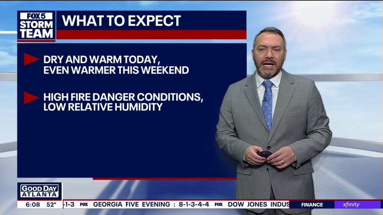
Friday morning weather forecast
Friday will be dry and warm. High fire danger conditions still exist. High temp of 79 expected. Even warmer starting Saturday.
Friday will be dry and warm. High fire danger conditions still exist. High temp of 79 expected. Even warmer starting Saturday.

Colorado State predicts below-average 2026 season
Colorado State University researchers project a slightly below-normal 2026 Atlantic hurricane season with 13 named storms and two major hurricanes.
Colorado State University researchers project a slightly below-normal 2026 Atlantic hurricane season with 13 named storms and two major hurricanes.