

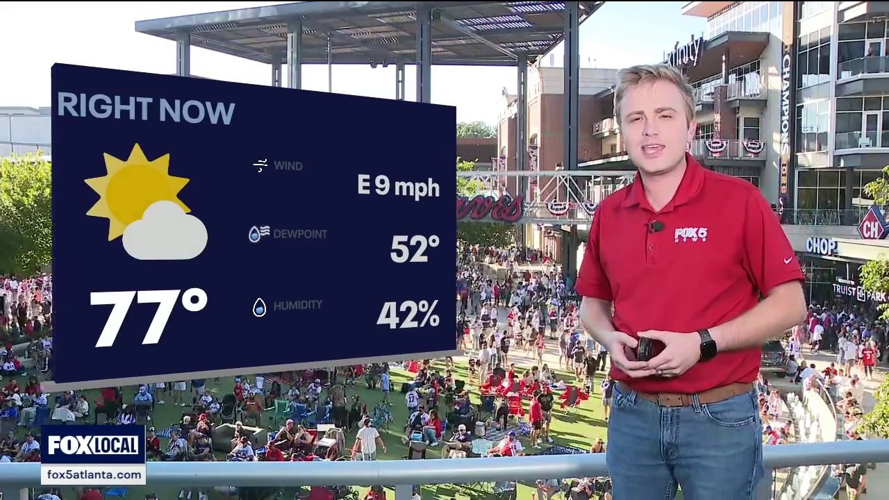
Braves-Dodgers forecast for NLDS Game 3
Braves fans heading to The Battery can expect ideal weather with temperatures dropping into the 60s. Clear conditions will persist through Wednesday before a developing storm system threatens the weekend. Meteorologists warn Tropical Depression Nine could become Hurricane Isaias and bring heavy rain.
Braves fans heading to The Battery can expect ideal weather with temperatures dropping into the 60s. Clear conditions will persist through Wednesday before a developing storm system threatens the weekend. Meteorologists warn Tropical Depression Nine could become Hurricane Isaias and bring heavy rain.
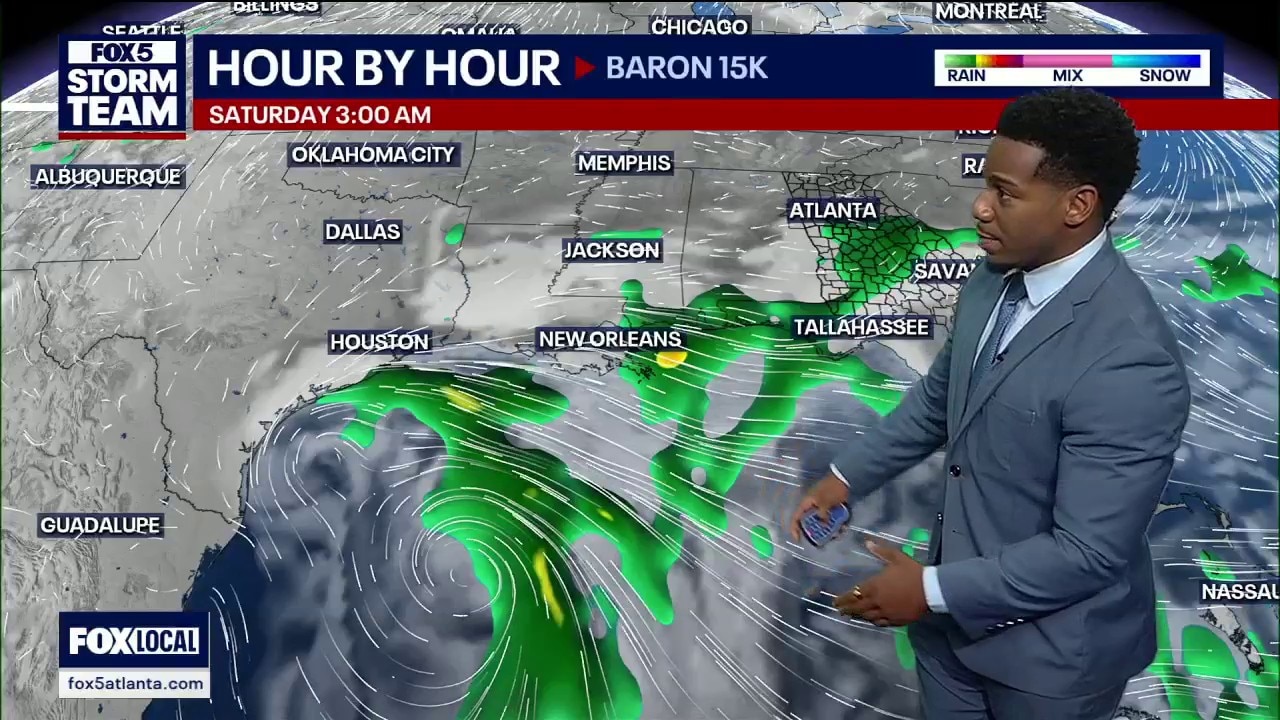
Tuesday afternoon weather forecast
Enjoy sunny, dry fall weather midweek with highs in the upper 70s and 80s. Big changes arrive this weekend as a tropical disturbance brings widespread heavy rain and potential flash flooding to North Georgia Saturday through Sunday, with 2 to 3 inches of rainfall possible.
Enjoy sunny, dry fall weather midweek with highs in the upper 70s and 80s. Big changes arrive this weekend as a tropical disturbance brings widespread heavy rain and potential flash flooding to North Georgia Saturday through Sunday, with 2 to 3 inches of rainfall possible.
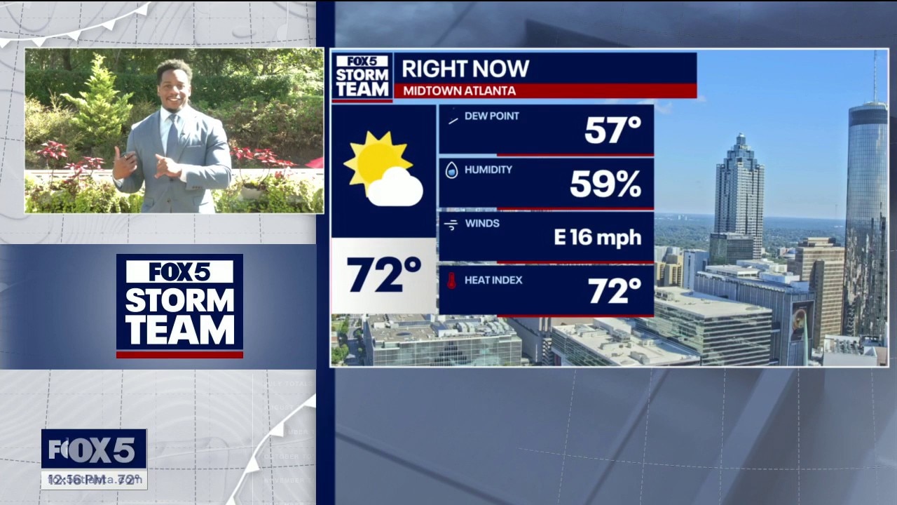
Tuesday midday weather forecast
Sunshine, lower humidity and a breezy afternoon bring comfortable weather to North Georgia on Tuesday, with a high near 78 degrees and favorable conditions for tonight’s Braves game at Truist Park. FOX 5 Storm Team meteorologist Marquise Meda tracks dry weather through Thursday before a developing tropical system could bring widespread rain this weekend. Rainfall totals of 3 to 4 inches are possible, raising concerns about flash flooding Saturday and Sunday, with some showers potentially lingering into early next week.
Sunshine, lower humidity and a breezy afternoon bring comfortable weather to North Georgia on Tuesday, with a high near 78 degrees and favorable conditions for tonight’s Braves game at Truist Park. FOX 5 Storm Team meteorologist Marquise Meda tracks dry weather through Thursday before a developing tropical system could bring widespread rain this weekend. Rainfall totals of 3 to 4 inches are possible, raising concerns about flash flooding Saturday and Sunday, with some showers potentially lingering into early next week.
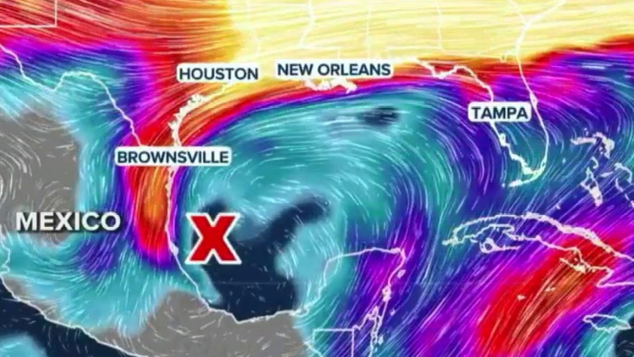
Tropical threat brewing in the Gulf
Fox Weather meteorologist Bryan Norcross tracks a tropical threat as it brings wet weather north toward the Atlanta area. Strong upper-level winds are expected to keep the disorganized system from turning into a hurricane before rain arrives over the weekend.
Fox Weather meteorologist Bryan Norcross tracks a tropical threat as it brings wet weather north toward the Atlanta area. Strong upper-level winds are expected to keep the disorganized system from turning into a hurricane before rain arrives over the weekend.
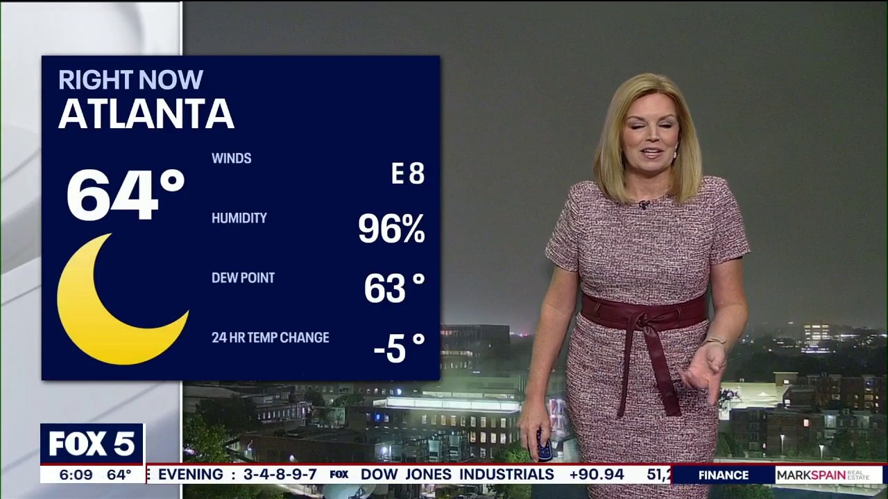
Tuesday morning weather forecast
Morning fog gives way to sunshine and a cooler, less humid day across North Georgia, with a high near 78 and wind gusts approaching 20 mph. Braves fans can expect mostly clear skies and temperatures in the low to mid-70s at first pitch, falling through the 60s during the game. Highs return to the 80s for the rest of the workweek, with overnight lows in the 50s, before a developing tropical system in the Gulf could bring a wetter weekend. Rain may spread north Saturday, with heavier rainfall and stronger winds possible Sunday before showers begin moving out Monday.
Morning fog gives way to sunshine and a cooler, less humid day across North Georgia, with a high near 78 and wind gusts approaching 20 mph. Braves fans can expect mostly clear skies and temperatures in the low to mid-70s at first pitch, falling through the 60s during the game. Highs return to the 80s for the rest of the workweek, with overnight lows in the 50s, before a developing tropical system in the Gulf could bring a wetter weekend. Rain may spread north Saturday, with heavier rainfall and stronger winds possible Sunday before showers begin moving out Monday.
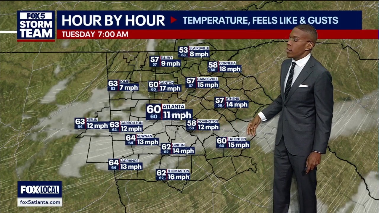
Monday night forecast
A tropical system brewing in the Bay of Campeche carries an 80 percent chance of developing into Tropical Storm Isaias and bringing heavy rain and gusty winds to North Georgia over the weekend.
A tropical system brewing in the Bay of Campeche carries an 80 percent chance of developing into Tropical Storm Isaias and bringing heavy rain and gusty winds to North Georgia over the weekend.
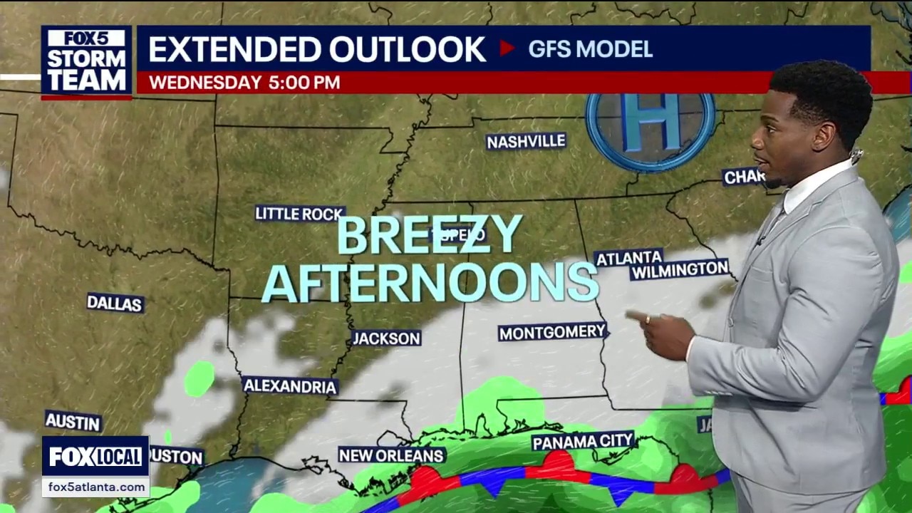
Monday afternoon forecast
A tropical system showing an 80 percent chance of development may bring up to three inches of rain to Atlanta following a warm mid-week stretch.
A tropical system showing an 80 percent chance of development may bring up to three inches of rain to Atlanta following a warm mid-week stretch.
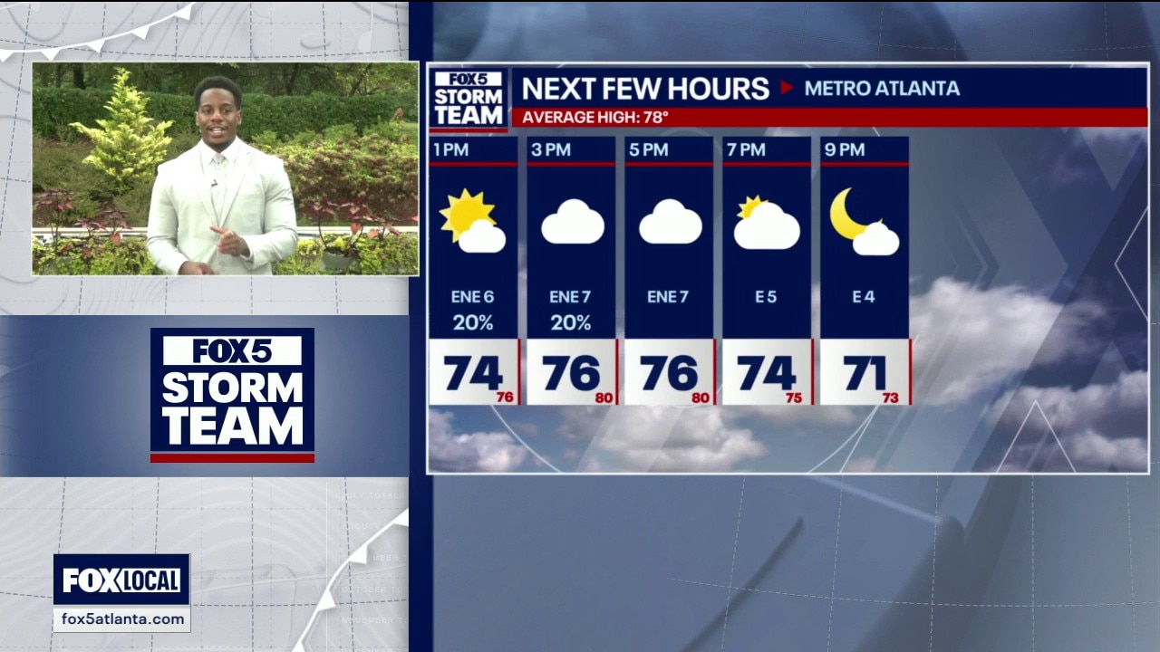
Monday midday weather forecast
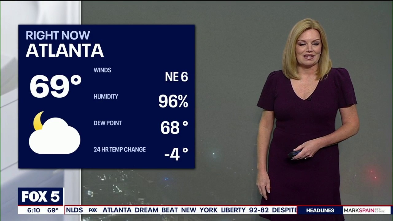
Gray skies and muggy conditions linger across Atlanta on Monday, with afternoon highs in the mid to upper 70s. FOX 5 Storm Team meteorologist Marquis Meda tracks the return of sunshine Tuesday and Wednesday, when wind gusts could reach 20 mph, followed by a warmup into the mid-80s Thursday. He also looks at potential tropical development that could send moisture toward Georgia, bringing weekend rain and cooler temperatures.
Gray skies and muggy conditions linger across Atlanta on Monday, with afternoon highs in the mid to upper 70s. FOX 5 Storm Team meteorologist Marquis Meda tracks the return of sunshine Tuesday and Wednesday, when wind gusts could reach 20 mph, followed by a warmup into the mid-80s Thursday. He also looks at potential tropical development that could send moisture toward Georgia, bringing weekend rain and cooler temperatures.
Monday morning weather forecast
Monday’s gloomy start brings thick clouds and areas of dense fog, with visibility reported at zero in Canton, before gradual clearing leads to sunshine and a comfortable, breezy evening. The last few showers are moving out, setting up mostly dry weather through the workweek and plenty of sunshine Tuesday and Wednesday. Forecasters are also watching a system in the Gulf that could send tropical moisture into Georgia this weekend. Its development remains uncertain, but Sunday currently has the highest chance of rain.
Monday’s gloomy start brings thick clouds and areas of dense fog, with visibility reported at zero in Canton, before gradual clearing leads to sunshine and a comfortable, breezy evening. The last few showers are moving out, setting up mostly dry weather through the workweek and plenty of sunshine Tuesday and Wednesday. Forecasters are also watching a system in the Gulf that could send tropical moisture into Georgia this weekend. Its development remains uncertain, but Sunday currently has the highest chance of rain.
Sunday night forecast
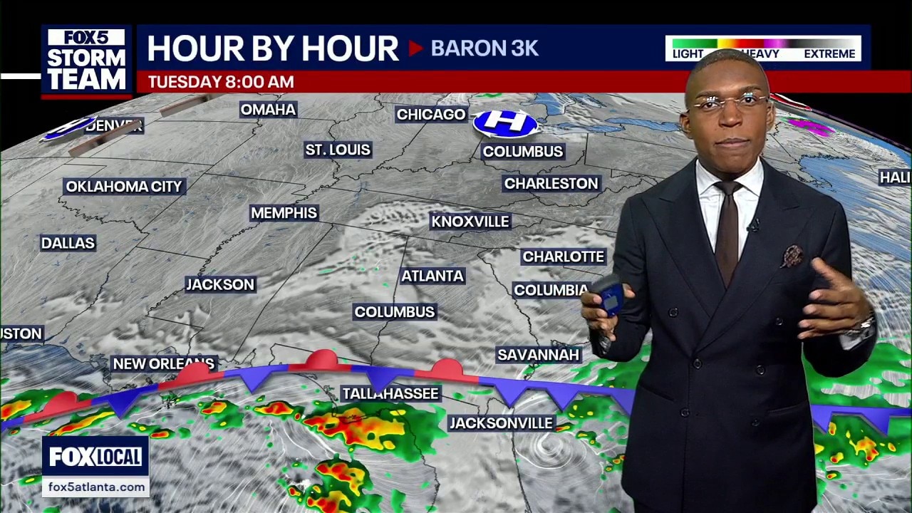
Atlanta weather cools as a double cold front clears rain before NLDS Game 3 between the Braves and Dodgers.
Atlanta weather cools as a double cold front clears rain before NLDS Game 3 between the Braves and Dodgers.

Lower rain totals expected as heaviest showers track south of metro Atlanta
Scattered afternoon showers and thick cloud cover across metro Atlanta will transition into a widespread rainstorm overnight into Sunday.
Scattered afternoon showers and thick cloud cover across metro Atlanta will transition into a widespread rainstorm overnight into Sunday.

Sunday morning weather forecast
Widespread rain likely today.
Widespread rain likely today.
Saturday night weather forecast
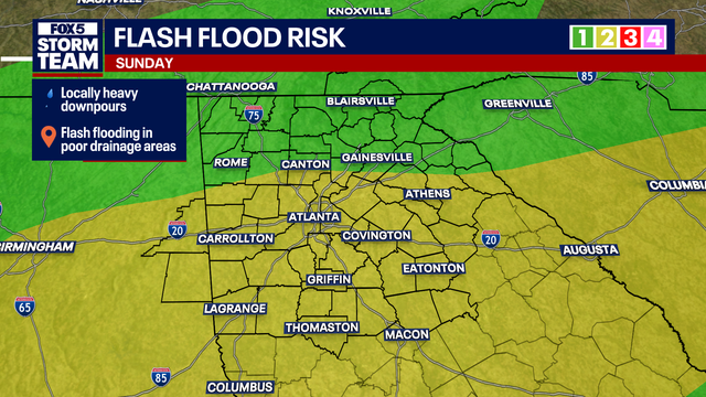
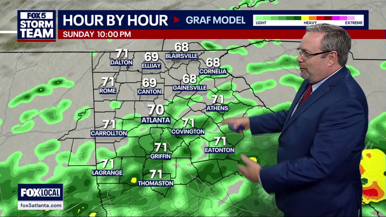
Forecast models have backed off on rainfall totals for North Georgia, with the heaviest rain staying south of Interstate 20. Expect scattered showers Sunday with high temperatures near 75 degrees. Cooler, drier fall air moves in by early next week as humidity drops significantly.
Forecast models have backed off on rainfall totals for North Georgia, with the heaviest rain staying south of Interstate 20. Expect scattered showers Sunday with high temperatures near 75 degrees. Cooler, drier fall air moves in by early next week as humidity drops significantly.
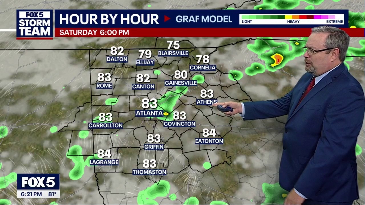
Saturday evening weather forecast
Rainfall totals are backing off for North Georgia, with the heaviest rain staying south. Expect spotty showers, overnight lows near 70, and highs in the 70s tomorrow. A brief Monday cool-down gives way to above-normal temperatures later in the week.
Rainfall totals are backing off for North Georgia, with the heaviest rain staying south. Expect spotty showers, overnight lows near 70, and highs in the 70s tomorrow. A brief Monday cool-down gives way to above-normal temperatures later in the week.
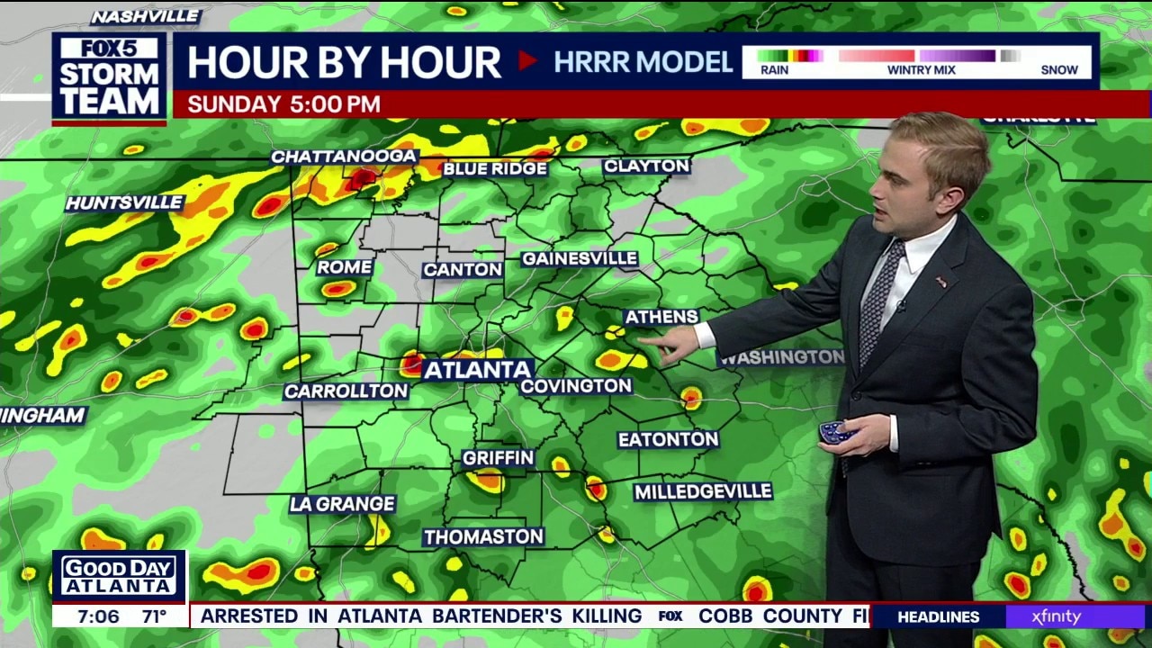
Saturday morning weather forecast
FOX 5 Storm Team Meteorologist Alex Forbes says widespread rain takes over on Sunday.
FOX 5 Storm Team Meteorologist Alex Forbes says widespread rain takes over on Sunday.
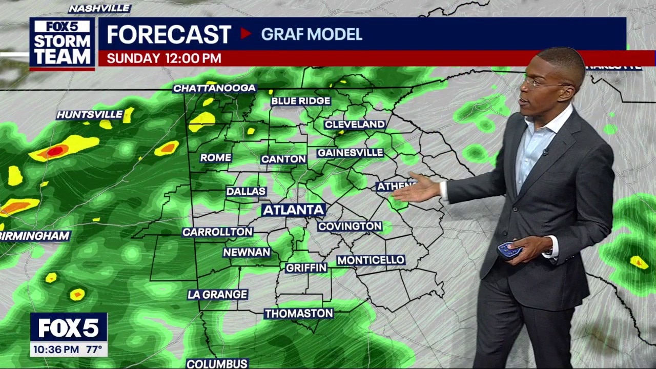
Friday night weather forecast
Saturday morning is your best bet for outdoor plans before scattered afternoon storms move in. Highs reach 85 degrees on Saturday, but Sunday brings widespread waves of rain and cooler highs near 75 degrees. Expect 1 to 3 inches of rainfall through Monday with a risk of flash flooding.
Saturday morning is your best bet for outdoor plans before scattered afternoon storms move in. Highs reach 85 degrees on Saturday, but Sunday brings widespread waves of rain and cooler highs near 75 degrees. Expect 1 to 3 inches of rainfall through Monday with a risk of flash flooding.
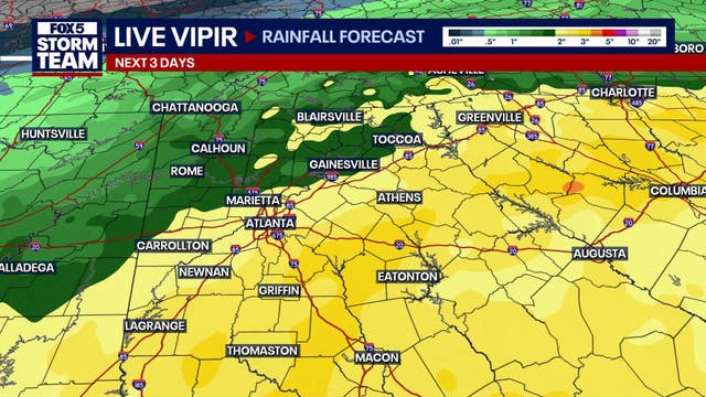

North Georgia: Weekend plans? Saturday starts dry, but Sunday looks soggy
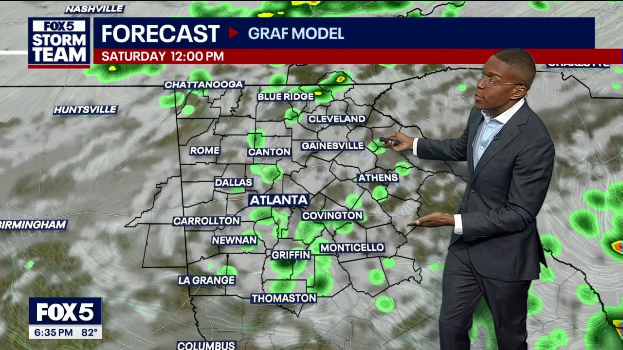
Saturday morning offers the best window for outdoor plans before showers and storms become more widespread in the afternoon.
Saturday morning offers the best window for outdoor plans before showers and storms become more widespread in the afternoon.
Friday evening weather forecast
Saturday starts dry and cloudy before scattered storms arrive in the afternoon. Sunday will bring waves of heavy rain, with up to three inches possible in some areas. High temperatures will plummet into the 60s and 70s, remaining below average through next week
Saturday starts dry and cloudy before scattered storms arrive in the afternoon. Sunday will bring waves of heavy rain, with up to three inches possible in some areas. High temperatures will plummet into the 60s and 70s, remaining below average through next week
Friday afternoon weather forecast
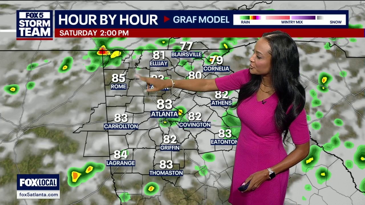
Expect isolated showers Friday before widespread storms arrive Saturday afternoon. Sunday is the main weather maker, bringing 1 to 2 inches of heavy rain and a significant temperature drop. Highs will fall into the mid-70s for a cool, fall-like start to the week.
Expect isolated showers Friday before widespread storms arrive Saturday afternoon. Sunday is the main weather maker, bringing 1 to 2 inches of heavy rain and a significant temperature drop. Highs will fall into the mid-70s for a cool, fall-like start to the week.
Friday midday weather forecast
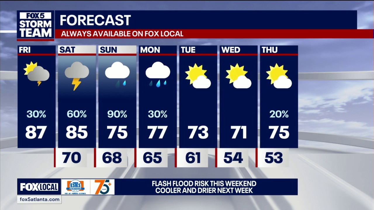
Friday will stay mostly dry, warm and muggy across North Georgia, with highs climbing into the 80s and a chance for a few isolated afternoon or evening storms. Any storm could bring a quick heavy downpour, lightning and gusty winds, with localized flash flooding possible. Rain chances increase Saturday, with more widespread heavy rain expected Sunday as a slow-moving front crosses the region. Some areas could receive 1.5 to 2 inches of rain by early Monday, while temperatures cool into the 70s behind the front.
Friday will stay mostly dry, warm and muggy across North Georgia, with highs climbing into the 80s and a chance for a few isolated afternoon or evening storms. Any storm could bring a quick heavy downpour, lightning and gusty winds, with localized flash flooding possible. Rain chances increase Saturday, with more widespread heavy rain expected Sunday as a slow-moving front crosses the region. Some areas could receive 1.5 to 2 inches of rain by early Monday, while temperatures cool into the 70s behind the front.