

Lower rain totals expected as heaviest showers track south of metro Atlanta
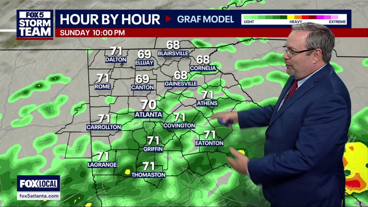
Saturday night weather forecast
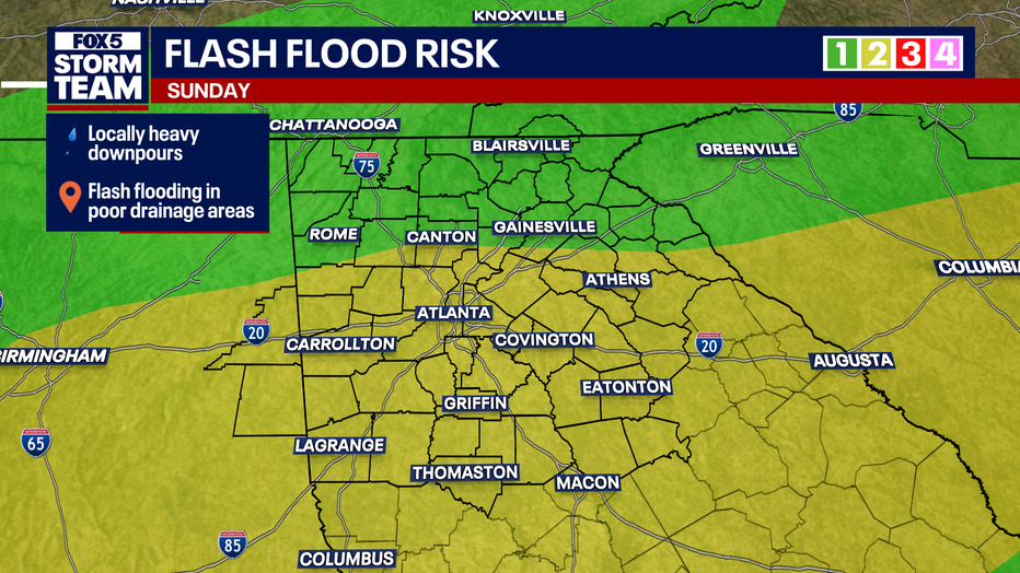
Forecast models have backed off on rainfall totals for North Georgia, with the heaviest rain staying south of Interstate 20. Expect scattered showers Sunday with high temperatures near 75 degrees. Cooler, drier fall air moves in by early next week as humidity drops significantly.
ATLANTA - Scattered afternoon showers and thick cloud cover across metro Atlanta will transition into a widespread rainstorm overnight into Sunday.
Warm, cloudy, scattered showers possible
What we know:
Rainfall totals across North Georgia are underperforming compared to earlier computer models.
Showers will remain scattered around metro Atlanta and North Georgia, while areas south of Interstate 20 face the highest potential for heavier, steadier rainfall on Sunday.
High temperatures on Sunday will reach around 75 degrees under mostly cloudy skies, providing cooler conditions than Saturday's highs in the 80s.
Drier, more comfortable fall air will filter into the region following brief Monday morning showers. Humidity levels will drop sharply, leading to pleasant daytime highs in the 70s and morning low temperatures dipping into the 50s through midweek.
What we don't know:
Computer forecast models have shown high variability over recent days, meaning exact neighborhood rainfall totals could fluctuate.
Sunday washout forecast
What's next:
Lingering morning showers will clear out Monday afternoon, making way for sunshine and a multi-day stretch of dry, mild fall weather.
The Source: The information in this story was gathered from weather forecasts from the FOX 5 Storm Team.