


Saturday Forecast
Plenty of sunshine this weekend with warmer temperatures on the way.
Plenty of sunshine this weekend with warmer temperatures on the way.

Friday late night forecast
The rain has moved out and soon the clouds will follow, but the cold has moved in, even though the sun will be returning Saturday. A look at the weekend forecast.
The rain has moved out and soon the clouds will follow, but the cold has moved in, even though the sun will be returning Saturday. A look at the weekend forecast.

Friday Night Weather Update
Feeling more like Winter Friday night and into Saturday morning as most areas will be sub-freezing by daybreak. Sunny and cool Saturday afternoon and then milder for Sunday. Here are the details.
Feeling more like Winter Friday night and into Saturday morning as most areas will be sub-freezing by daybreak. Sunny and cool Saturday afternoon and then milder for Sunday. Here are the details.
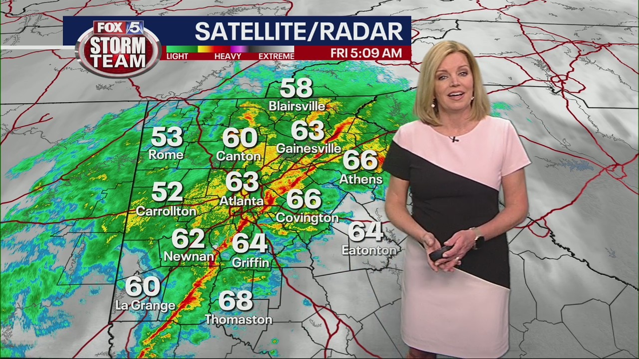
Friday morning weather forecast
After a few days of warm weather, the cold front is coming in to the metro Atlanta area. Heavy rain and gusty winds will continue sweeping through the area over the next morning hours,
After a few days of warm weather, the cold front is coming in to the metro Atlanta area. Heavy rain and gusty winds will continue sweeping through the area over the next morning hours,

Thursday late evening forecast
Periods of showers are expected overnight and maybe a rumble of thunder. The rain will move out by morning leaving much cooler temps and breezy conditions.
Periods of showers are expected overnight and maybe a rumble of thunder. The rain will move out by morning leaving much cooler temps and breezy conditions.

Thursday Night Weather Update
Rain and storms thru the night, with a few of the stroms strong with heavy rain and gusty winds. Temps will fall into the 50s by morning and then into the 40s with a clearing sky by Friday afternoon. Here is the breakdown.
Rain and storms thru the night, with a few of the stroms strong with heavy rain and gusty winds. Temps will fall into the 50s by morning and then into the 40s with a clearing sky by Friday afternoon. Here is the breakdown.

Thursday morning weather forecast
Don't be deceived by the weather during the day today. Very little rain is expected during the day, but we'll waste no time this evening bringing in heavy rain and gusty storms.
Don't be deceived by the weather during the day today. Very little rain is expected during the day, but we'll waste no time this evening bringing in heavy rain and gusty storms.
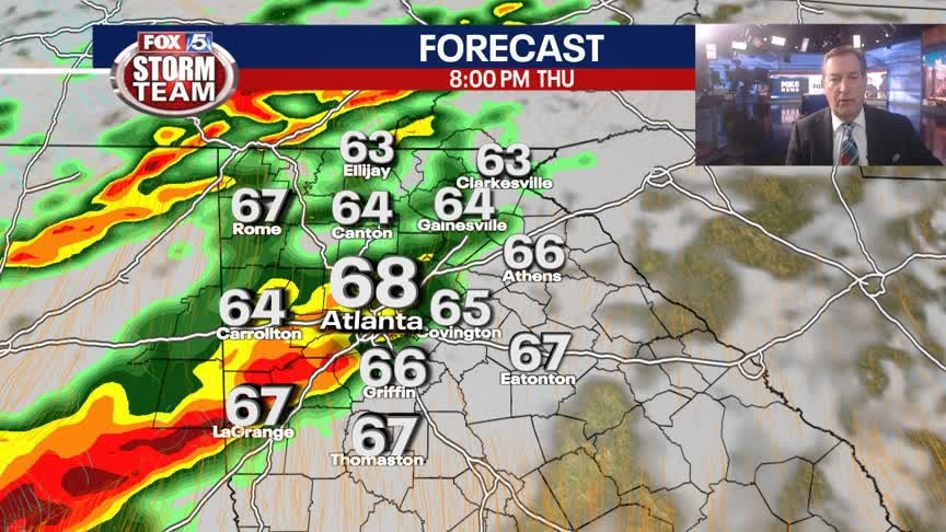
Wednesday Evening Weather Update
Mostly cloudy tonight with lows only in the 50s. Warm and breezy on Thursday with storng to severe storms arriving in the evening. Much colder on Friday. Here is the breakdown.
Mostly cloudy tonight with lows only in the 50s. Warm and breezy on Thursday with storng to severe storms arriving in the evening. Much colder on Friday. Here is the breakdown.

Wednesday morning weather forecast
Metro Atlanta is dodging a few showers today and a few during the day tomorrow, but stronger storms and heavier downpours will arrive after sunset tomorrow night.
Metro Atlanta is dodging a few showers today and a few during the day tomorrow, but stronger storms and heavier downpours will arrive after sunset tomorrow night.

Tuesday Evening Weather Update
Cloudy and mild into Wednesday morning with a few stray showers possible. Lows will be in the upper 40s to low 50s, around 10 degrees above the average. Cloudy and mild on Wednesday afternoon with highs in the 60s. Looking for strong t-storms by Thursday night. Here is the latest.
Cloudy and mild into Wednesday morning with a few stray showers possible. Lows will be in the upper 40s to low 50s, around 10 degrees above the average. Cloudy and mild on Wednesday afternoon with highs in the 60s. Looking for strong t-storms by Thursday night. Here is the latest.

Valentine's Day morning weather forecast
A chilly morning on Valentine's Day will warm up to a beautiful afternoon worth getting outdoors to enjoy.
A chilly morning on Valentine's Day will warm up to a beautiful afternoon worth getting outdoors to enjoy.
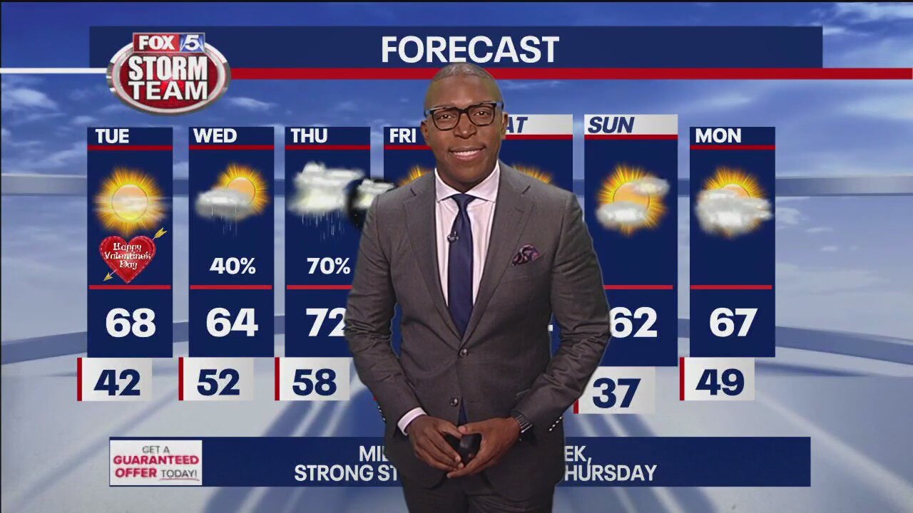
Monday evening forecast update
Temperatures will climb to the mid to upper 60s Tuesday afternoon under partly cloudy skies. A few showers will break out early Wednesday morning and will persist through the day. Heavier downpours and thunderstorms will move into the area late Thursday before exiting mid-morning Friday. While there's the risk that some of these storms could turn severe, the storms should weaken before crossing into Georgia late in the day. Rainfall amounts could reach 1.5" by Friday morning.
Temperatures will climb to the mid to upper 60s Tuesday afternoon under partly cloudy skies. A few showers will break out early Wednesday morning and will persist through the day. Heavier downpours and thunderstorms will move into the area late Thursday before exiting mid-morning Friday. While there's the risk that some of these storms could turn severe, the storms should weaken before crossing into Georgia late in the day. Rainfall amounts could reach 1.5" by Friday morning.

Monday morning weather forecast
Dress in layers because it's going to be a cold morning, but it'll warm up to mild temperatures by the afternoon.
Dress in layers because it's going to be a cold morning, but it'll warm up to mild temperatures by the afternoon.
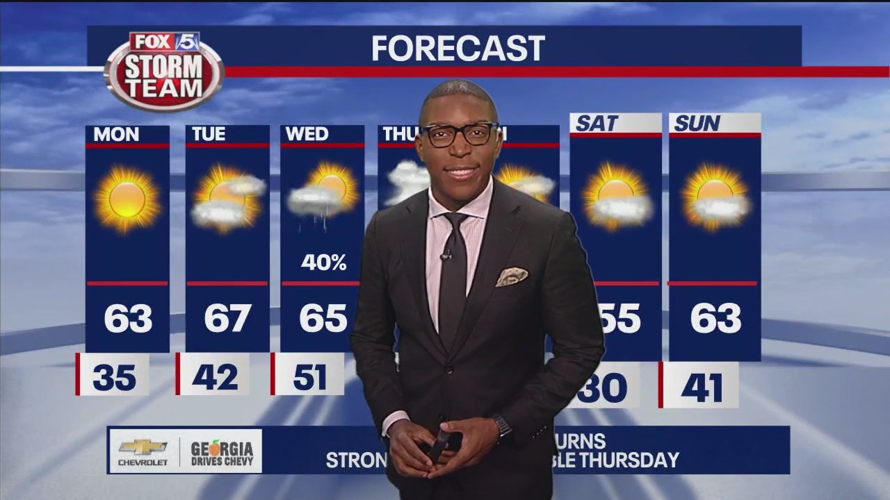
Sunday late night forecast update
Our chilly Sunday night will make way for bright and warm conditions Monday afternoon, but don't get too comfortable because it won't stay for long.
Our chilly Sunday night will make way for bright and warm conditions Monday afternoon, but don't get too comfortable because it won't stay for long.

Sunday Forecast
Decreasing clouds throughout the day with chilly temperatures.
Decreasing clouds throughout the day with chilly temperatures.

Saturday evening forecast update
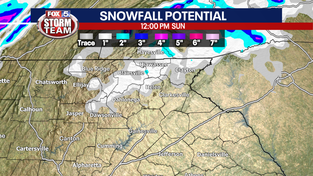
Rain rolls into Sunday morning with gusty winds. Temperatures in the upper 30s and low 40s. Only place to see a rain/snow mix will be the higher elevations of the northeast Georgia mountains. No travel issues are expected as temperatures will remain above freezing. Rain ends Sunday afternoon, then clear and chilly weather by Monday morning. We're looking at a sunny and nice to start the week, before spring-like storms hit later on.
Rain rolls into Sunday morning with gusty winds. Temperatures in the upper 30s and low 40s. Only place to see a rain/snow mix will be the higher elevations of the northeast Georgia mountains. No travel issues are expected as temperatures will remain above freezing. Rain ends Sunday afternoon, then clear and chilly weather by Monday morning. We're looking at a sunny and nice to start the week, before spring-like storms hit later on.

Expect a wet, windy Super Bowl Sunday with possibility of snow/wintry mix in parts of north Georgia
The FOX 5 Storm Team is currently tracking a complex weather system that will bring mostly rain, but keeping on the possibility there could be a changeover in some areas early Sunday morning.
The FOX 5 Storm Team is currently tracking a complex weather system that will bring mostly rain, but keeping on the possibility there could be a changeover in some areas early Sunday morning.
Saturday Night Weather Update
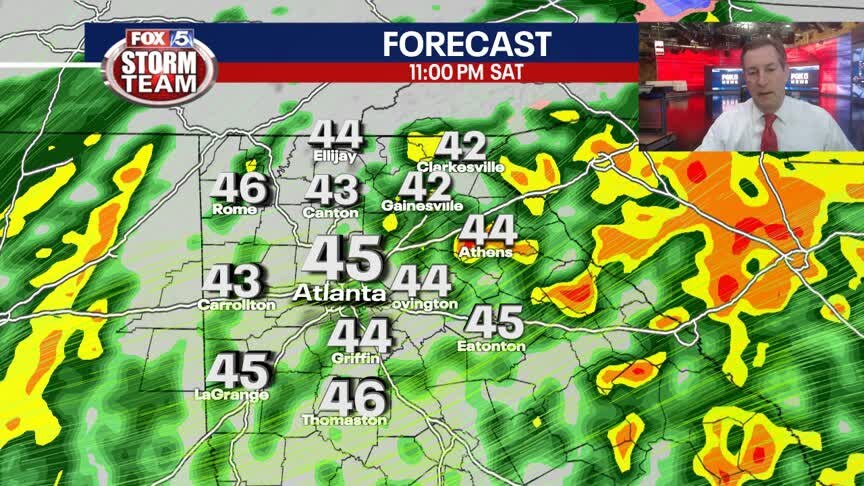
More rain overnight and into Sunday morning, at times locally heavy with an additional 1/2" to 1" possible. Wind Advisory until 7am for gusts to 40 mph. There is a chance for a rain/snow mix in the mountains. Here is the latest.
More rain overnight and into Sunday morning, at times locally heavy with an additional 1/2" to 1" possible. Wind Advisory until 7am for gusts to 40 mph. There is a chance for a rain/snow mix in the mountains. Here is the latest.

Saturday Forecast
Washout conditions likely this afternoon and evening with all eyes on the potential for a wintry mix Sunday morning.
Washout conditions likely this afternoon and evening with all eyes on the potential for a wintry mix Sunday morning.

Timeline: A wet weekend with the possibility of snow/wintery mix
The weekend will start out soggy on Saturday, but come early Sunday morning, a blast of cold air will move in to the area with the possibility of having some of that precipitation change over into a wintry mix or even snow. A look at the latest timing and intensity.
The weekend will start out soggy on Saturday, but come early Sunday morning, a blast of cold air will move in to the area with the possibility of having some of that precipitation change over into a wintry mix or even snow. A look at the latest timing and intensity.