

Atlanta severe weather timeline: Rain, damaging winds, tornadoes possible

Friday morning severe weather forecast
Georgia is starting off calm, but it won't stay that way. Be prepared for a line of storms that'll start to affect the area around noon and continue for hours.
ATLANTA - Severe storms continue to threaten Atlanta and north Georgia as another round of rain, damaging winds, and the chance of tornadoes is expected to end the work week. Unlike Tuesday's storm that moved in during the overnight hours, Friday's storm event will take place starting from the late morning through the afternoon.
Friday's storm precedes a dramatic drop in temperatures Saturday and Sunday, which culminates with the possibility of snow Monday night or Tuesday morning. Things could change though.
SCHOOL CLOSINGS & DELAYS AHEAD OF FRIDAY STORM | OTHER CLOSINGS & DELAYS
Let's talk about a timeline.
RAIN BEGINS
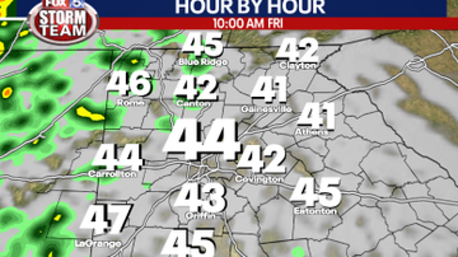
Friday, between 10 a.m. and 11 a.m.
While showers could appear early Friday, the warm front is expected to hit the state between 10 a.m. and 11 a.m., which could bring the highest threat of severe weather by midday.
The first possible severe weather will be individual storms that could spawn isolated tornadoes.
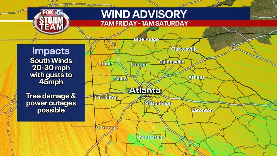
A Wind Advisory is up for all of north Georgia starting at 7 a.m. on Friday. Winds will be out of the south at 20 to 25 mph with wind gusts up to 45 mph possible.
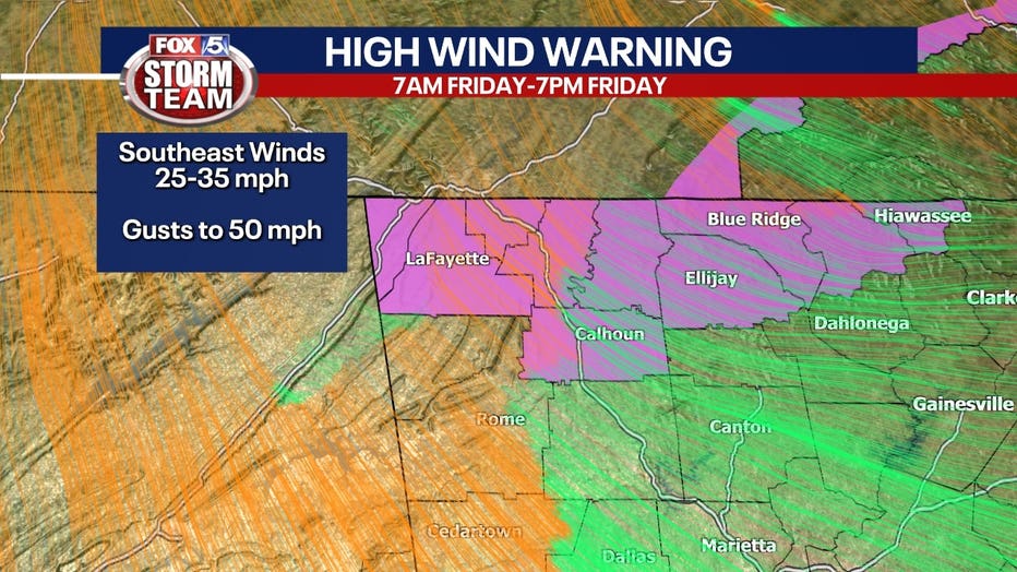
A High Wind Warning is in effect from 7 a.m. to 7 p.m. Friday for the higher elevations of the north Georgia mountains where winds could gust as high as 50 mph.
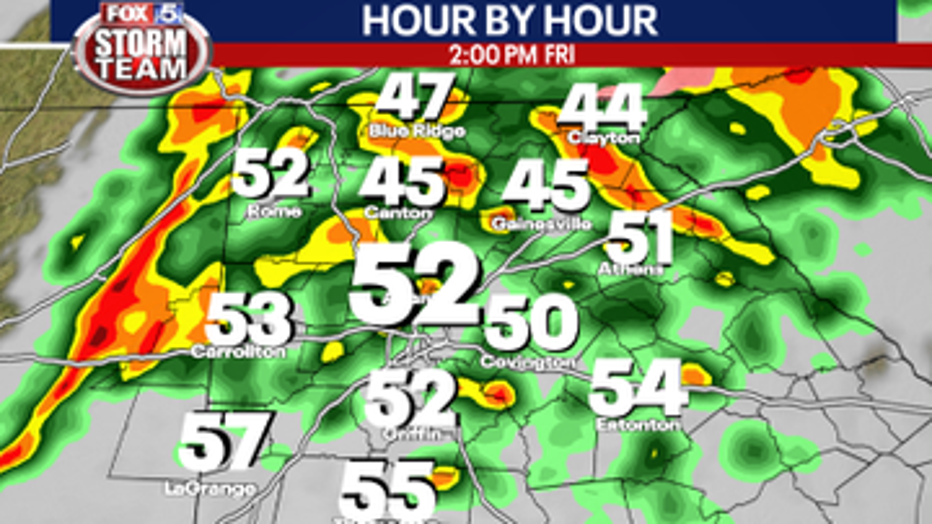
GREATEST OPPORTUNITY FOR SEVERE WEATHER TIME PERIOD
Friday, between 12 p.m. and 4 p.m.
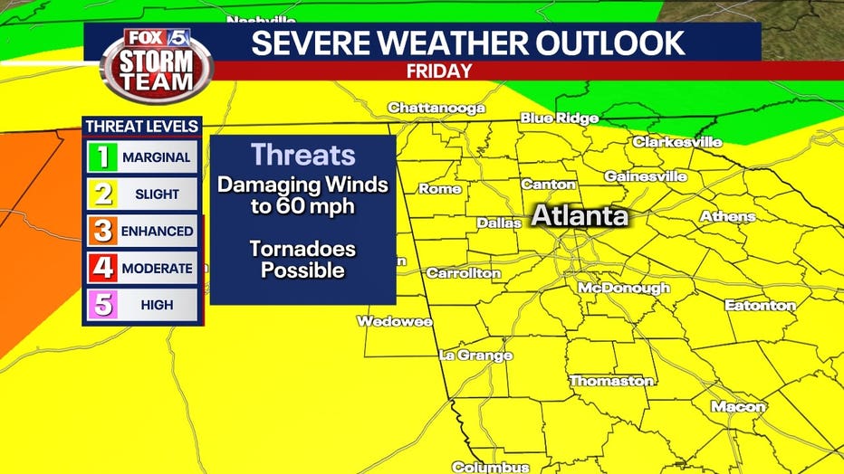
The threat for tornadoes has been scaled back to a level 2 out of 5 for all of north Georgia. The greatest threat appears to be damaging winds from severe storms that could reach up to 60 mph.
The full line of quick-moving storms that will cause the most serious impact is expected to pass through the area at around 2 p.m., bringing possible heavy rain and strong winds.
The good news is this front will likely produce much less rain than Tuesday's storms, due to the fast movement of the front.
That means drier weather for Friday night.

Tornado risk for Friday
Chances of tornadoes for Friday Jan. 12, 2024. More information on severe weather event impacting Atlanta and north Georgia.
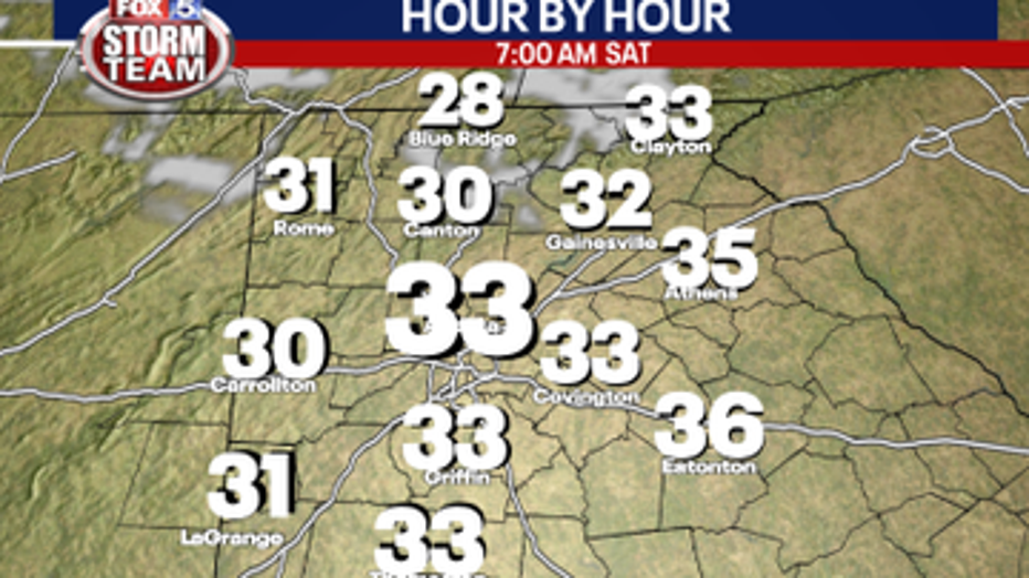
TEMPERATURES DROP
Late Friday night to overnight Saturday
The temperature will drop by about 30 degrees. Overnight lows will be around 30 degrees in Atlanta.
Saturday, the wind chill will have it feeling as low as the teens or low 20s early Saturday morning. It'll then warm up slightly and be sunny and chilly during the day.
ANOTHER TEMPERATURE DROP
Sunday through Monday
There will be another chance of showers on Monday, but not as significant as the storms which are forecast for Friday. Highs will be in the mid-40s but will be dropping dramatically moving into the overnight hours.
Highs will be in the low to mid-40s on Sunday with lows around 30 under clear to partly cloudy skies.
Sunday, highs will be near 50 with the low just above freezing in town.
There will be another chance of showers on Monday, but not as significant as the storms which are forecast for Friday.
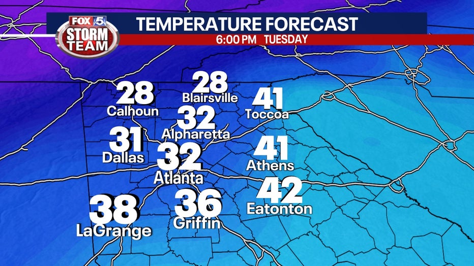
SNOW CHANCES
Monday night/overnight Tuesday
Highs will be in the mid-40s but will be dropping dramatically moving into the overnight hours.
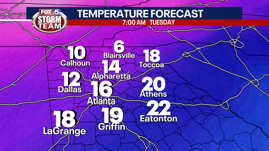
Monday evening will likely see temperatures in the mid-teens with a slight chance of rain and snow showers in north Georgia.
It is still too early to determine where or when that potential winter weather might be, but stick with the FOX 5 Storm Team for the latest.
KEEP UP WITH THE LATEST BY DOWNLOADING THE FREE FOX 5 STORM TEAM APP AND FOLLOWING @FOX5STORMTEAM ON X. CATCH THE LATEST FORECAST ON FOX LOCAL FOR YOUR SMART TV.