

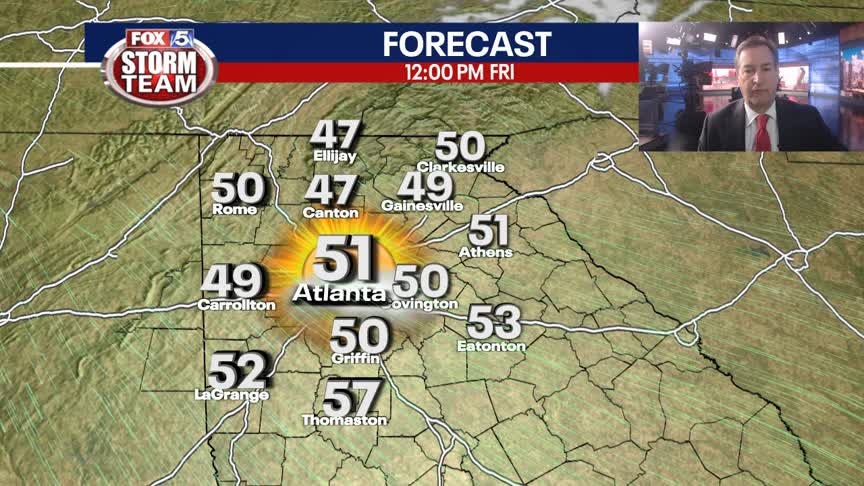
Thursday Evening Weather Outlook
Claer and crisp overnight and into Friday morning with lows in the 30s, feeling more like January. Sunny and cool on Friday, then milder and back into the 60s for Saturday. Expect scattered showers on Sunday. Here is the breakdown.
Claer and crisp overnight and into Friday morning with lows in the 30s, feeling more like January. Sunny and cool on Friday, then milder and back into the 60s for Saturday. Expect scattered showers on Sunday. Here is the breakdown.
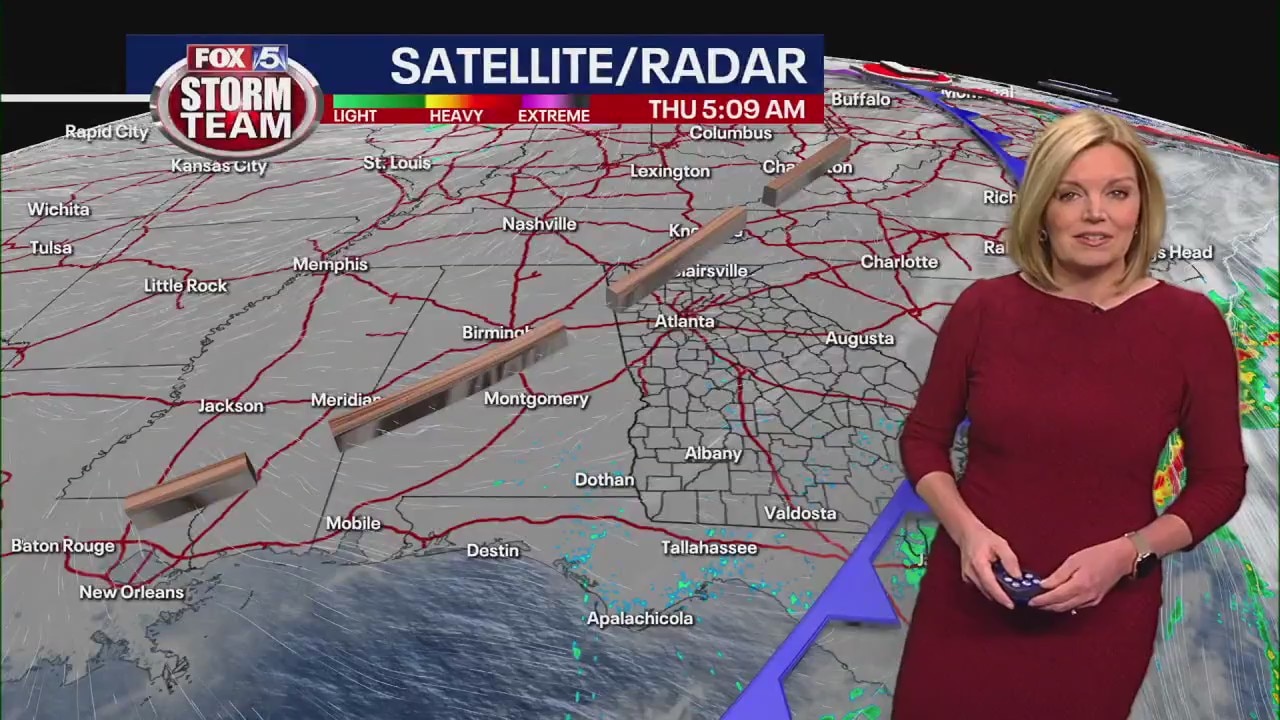
Thursday morning weather forecast
After all the rain, it's noticeable chillier this morning, but it's still a nice day for January.
After all the rain, it's noticeable chillier this morning, but it's still a nice day for January.

Wednesday Evening Weather Update
Clear and cooler overnight with lows in the 40s by Thursday morning, still above the average for early January. Sunny and mild by afternoon, calmer weather into the weekend. Here is the latest.
Clear and cooler overnight with lows in the 40s by Thursday morning, still above the average for early January. Sunny and mild by afternoon, calmer weather into the weekend. Here is the latest.
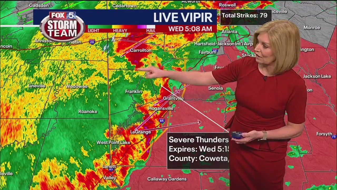
Wednesday morning weather forecast
Severe storms continue to pass through Georgia bringing with them heavy rain and the threats of damaging winds and tornadoes.
Severe storms continue to pass through Georgia bringing with them heavy rain and the threats of damaging winds and tornadoes.
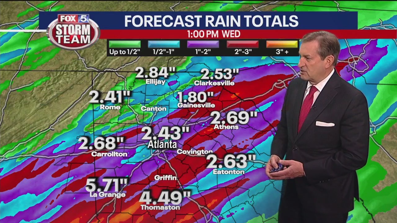
Tuesday evening forecast
Another round of strong to severe showers and thunderstorms are expected to move through Georgia overnight into early Wednesday morning.
Another round of strong to severe showers and thunderstorms are expected to move through Georgia overnight into early Wednesday morning.
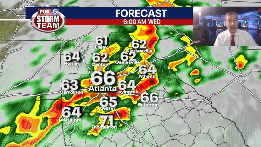
Tuesday Evening Weather Update
A few showers and storms overnight with a strong line of storms moving in early morning toward 6am. A few of those storms could be severe with damaging winds the main threat. Here is the latest.
A few showers and storms overnight with a strong line of storms moving in early morning toward 6am. A few of those storms could be severe with damaging winds the main threat. Here is the latest.

Tuesday early evening forecast
The storms have moved out for now, but the potential remains as a front continues to push its way into Georgia overnight into early Wednesday morning. Some of those storm, particularly south of I-20, could become severe.
The storms have moved out for now, but the potential remains as a front continues to push its way into Georgia overnight into early Wednesday morning. Some of those storm, particularly south of I-20, could become severe.
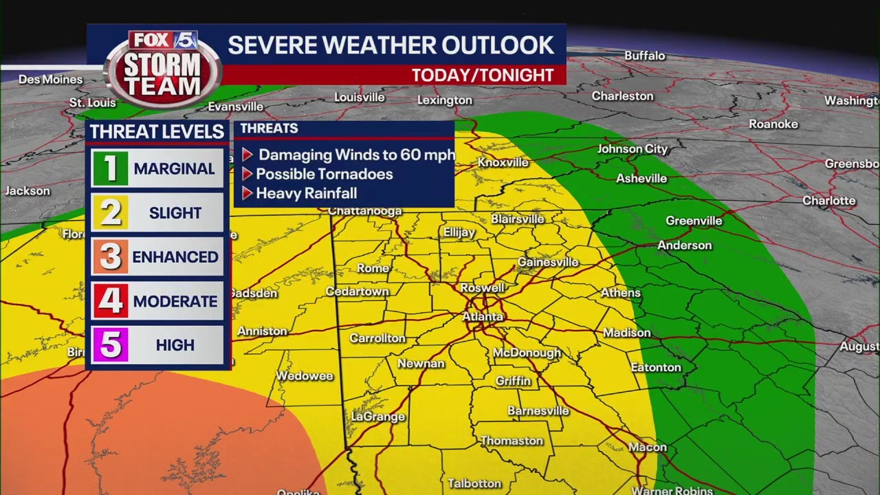
Tuesday afternoon storm forecast
All of metro Atlanta will be in a level 2 risk for severe storms and possible tornadoes as a storm system heads towards the East Coast late Tuesday afternoon and through the night.
All of metro Atlanta will be in a level 2 risk for severe storms and possible tornadoes as a storm system heads towards the East Coast late Tuesday afternoon and through the night.

Tuesday morning weather forecast
The unusually warm January morning will turn into waves of rain and storms starting in the afternoon and going throughout the night.
The unusually warm January morning will turn into waves of rain and storms starting in the afternoon and going throughout the night.
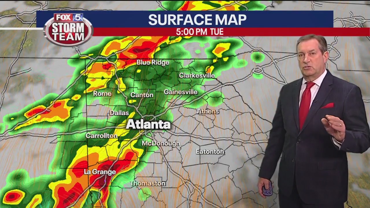
Threat of severe storms starting Tuesday afternoon
The FOX 5 Storm Team is tracking the potential for severe weather starting Tuesday afternoon and into the early morning hours on Wednesday. FOX 5 Storm Team Chief Meteorologist David Chandley has a look at the timing and impact of those storms.
The FOX 5 Storm Team is tracking the potential for severe weather starting Tuesday afternoon and into the early morning hours on Wednesday. FOX 5 Storm Team Chief Meteorologist David Chandley has a look at the timing and impact of those storms.
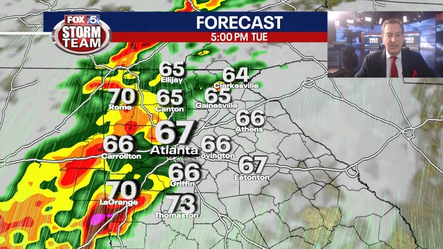
Monday Evening Weather Update
Clouds and dense fog overnight into Tuesday morning with lows around 60. Rain and t-storms likely by Tuesday afternoon and into Wednesday morning. A few of the storms could be strong to severe. Here is the latest.
Clouds and dense fog overnight into Tuesday morning with lows around 60. Rain and t-storms likely by Tuesday afternoon and into Wednesday morning. A few of the storms could be strong to severe. Here is the latest.

Monday afternoon forecast
Georgia will see its first severe weather threat of the New Year starting on Tuesday afternoon into Wednesday morning.
Georgia will see its first severe weather threat of the New Year starting on Tuesday afternoon into Wednesday morning.
Monday morning weather forecast
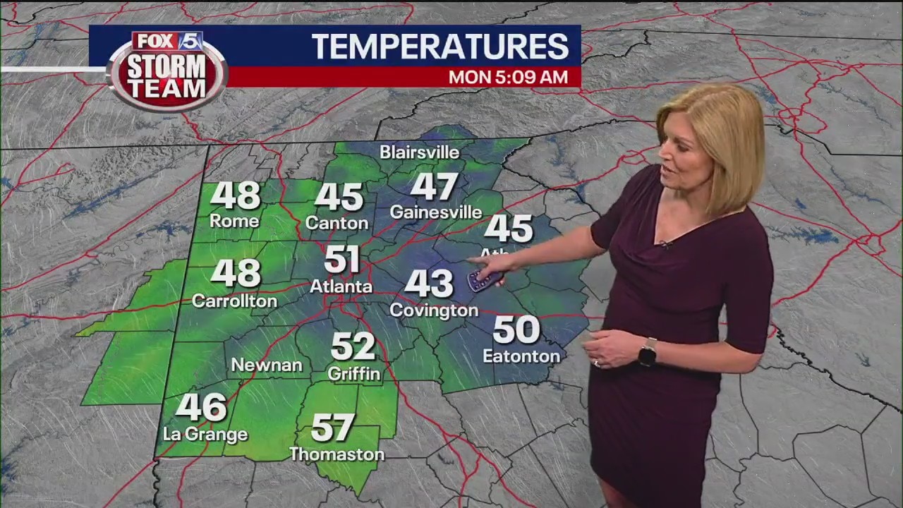
A foggy morning for parts of metro Atlanta will turn into a quiet and warm start of the week.
A foggy morning for parts of metro Atlanta will turn into a quiet and warm start of the week.
Sunday evening forecast update
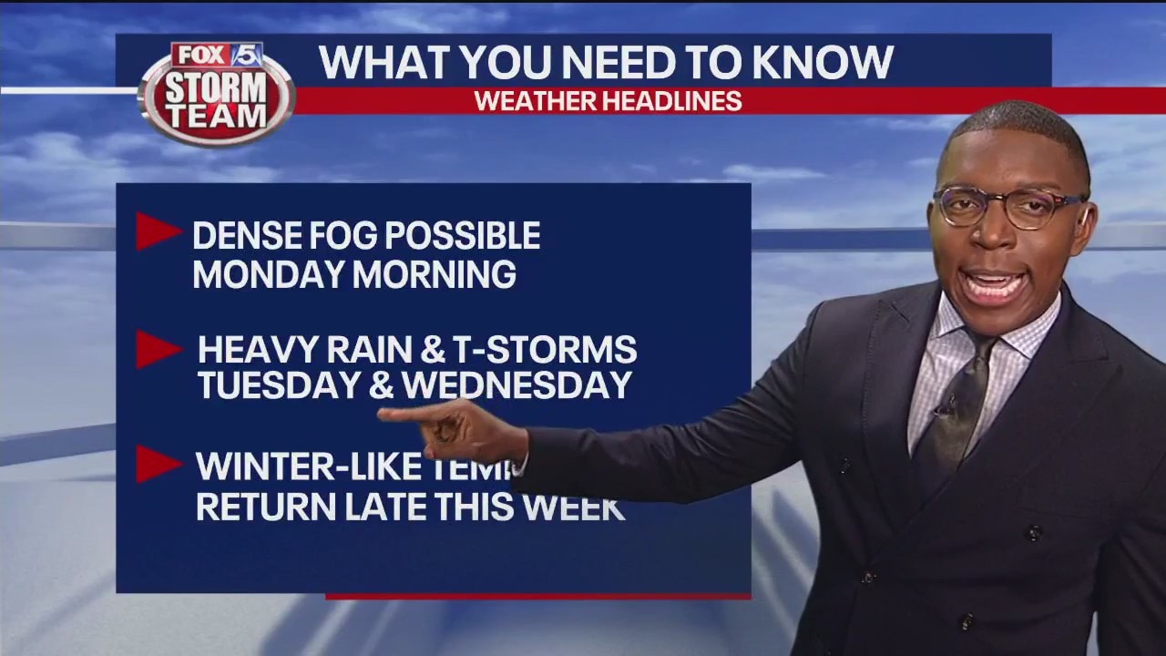
There will be pocket of dense fog Monday morning. Mostly cloudy skies will stick around through the day as temperatures return to the mid 60s. Showers may roll in late Monday into Tuesday before stronger storms move in late Tuesday lasting through Wednesday. The wet weather will be proceeded by return of seasonable temperatures.
There will be pocket of dense fog Monday morning. Mostly cloudy skies will stick around through the day as temperatures return to the mid 60s. Showers may roll in late Monday into Tuesday before stronger storms move in late Tuesday lasting through Wednesday. The wet weather will be proceeded by return of seasonable temperatures.
New Year's Day forecast
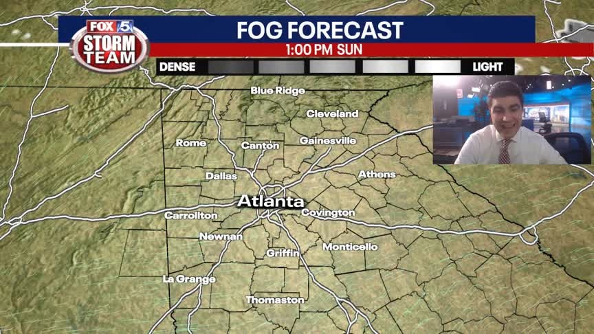
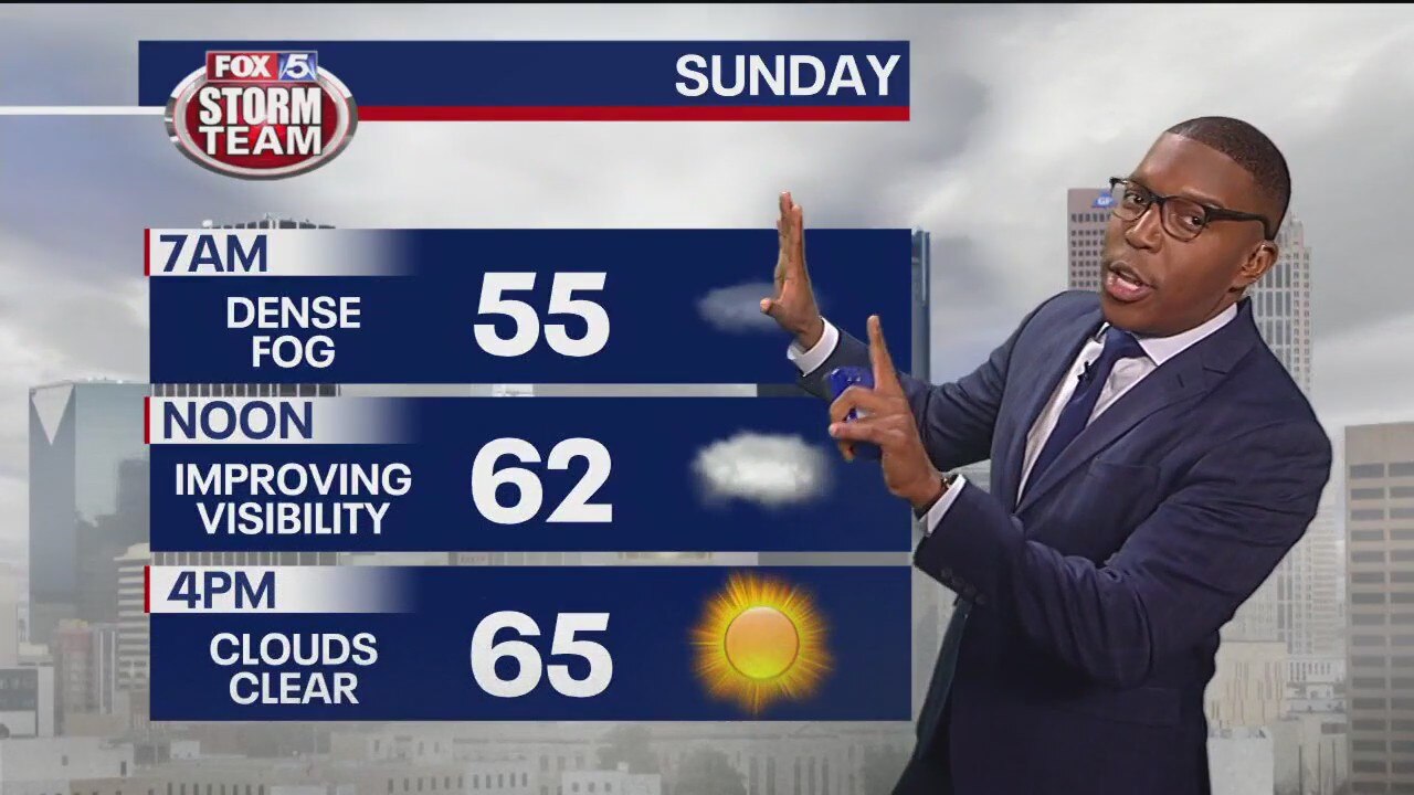
Increasing sunshine with unseasonably warm temperatures. Strong to severe storms likely Tuesday and Wednesday.
Increasing sunshine with unseasonably warm temperatures. Strong to severe storms likely Tuesday and Wednesday.
New Year's Eve evening forecast
The rain has subsided, but fog is rolling in tonight. Be careful on the roads after your New Year's Eve festivities. Visibility will be low.
The rain has subsided, but fog is rolling in tonight. Be careful on the roads after your New Year's Eve festivities. Visibility will be low.
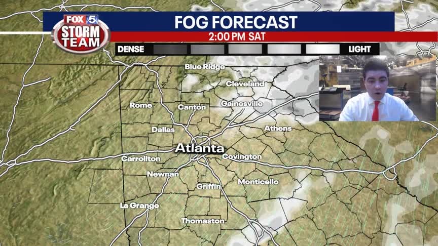
New Year's Eve Forecast
Improving conditions throughout the afternoon and evening. Rain will NOT be an issue, but patchy to dense fog is likely after 10pm.
Improving conditions throughout the afternoon and evening. Rain will NOT be an issue, but patchy to dense fog is likely after 10pm.
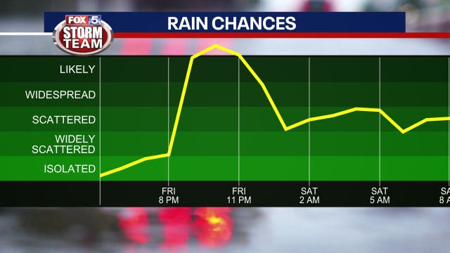

New Year's Eve forecast: Will it rain during the Peach Bowl or Peach Drop?
North Georgia will be impacted by a couple of weather systems that will bring widespread rainfall over the next days.
North Georgia will be impacted by a couple of weather systems that will bring widespread rainfall over the next days.

Friday afternoon forecast
Some showers and thunderstorms are trekking into north Georgia, but will it washout your New Year's Eve plans?
Some showers and thunderstorms are trekking into north Georgia, but will it washout your New Year's Eve plans?

Friday morning weather forecast
Strong storms and rain are moving in our direction just in time for the end of the year.
Strong storms and rain are moving in our direction just in time for the end of the year.