

Heavy rain, thunderstorms possible Wednesday evening through overnight

Severe weather outlook for Wednesday night
Heavy rain and winds are expected Wednesday night through the overnight hours into Thursday. FOX 5 Storm Team meteorologist Jeff Hill has the latest.
ATLANTA - Atlanta and parts of North Georgia have a marginal risk of severe weather Wednesday night as a storm system in the gulf pushes through.
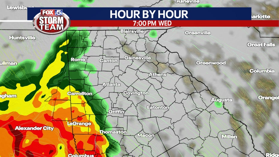
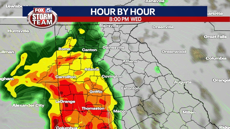
Heavy rain and thunderstorms are likely to develop late Wednesday and overnight into Thursday morning as the system rolls across the Southeast. This is the same storm system impacting New Orleans in Louisiana, where a Flash Flood Emergency is in effect.
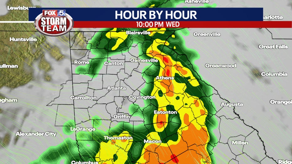
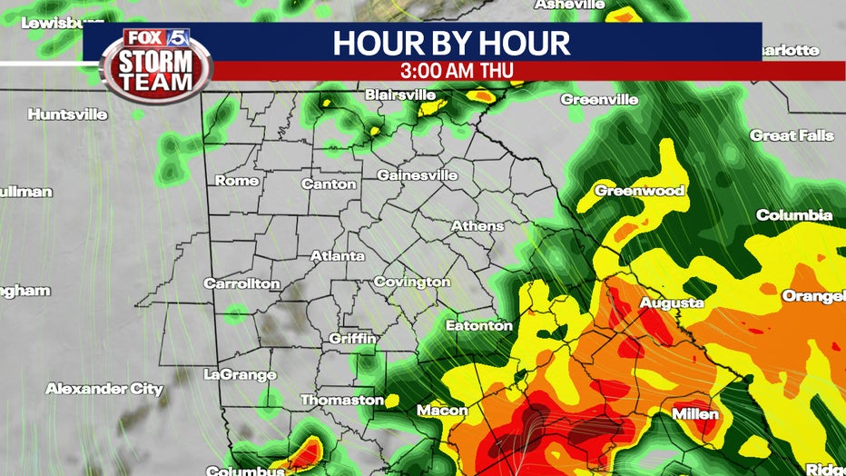
When will bad weather move through Georgia?
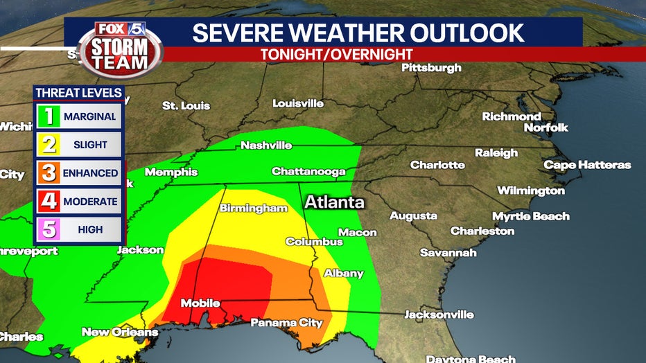
According to the National Weather Service, thunderstorms will move into west Georgia Wednesday afternoon and last through the overnight hours. There is a slight risk for severe thunderstorms for portions of western central Georgia, with damaging winds and a brief tornado being the primary hazards of concern.
Heavy rainfall will also be a concern, with some locations across western central Georgia seeing between 2 and 4 inches of rainfall. Localized flash flooding and river flooding will be possible through the overnight period in these locations.
Thursday, a Slight Risk for severe thunderstorms will be possible for portions of eastern central Georgia where damaging wind gusts and a brief tornado will be possible.
Weather in Atlanta for Wednesday & Thursday
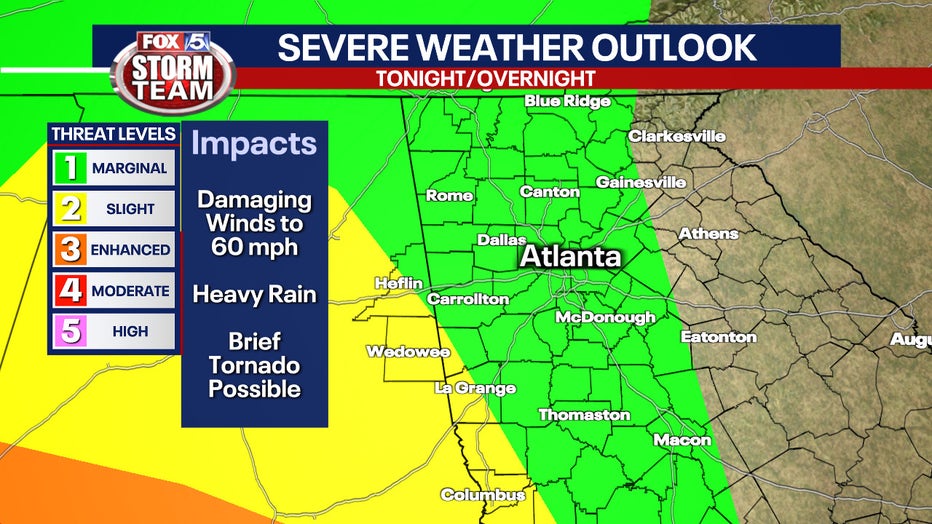
Right now, much of the FOX 5 viewing area, including metro Atlanta, is under a Level 1 risk for severe weather, and a small part of Heard, Troup, Cleburne and Randolph counties are under a Level 2, or slight risk.
Heavy rain and damaging winds up to 60 mph will be the main threats.
"The tornado threat is low, but not zero," said FOX 5 Storm Team meteorologist Jeff Hill. "We will also have a lot of wind in general with wind gusts later [Wednesday] and through the day on Thursday, gusting to 30-35mph."
Friday will be quite windy as well and a bit cooler. However, sunny skies and warmer temperatures are in store for the weekend.