

Sunday evening forecast
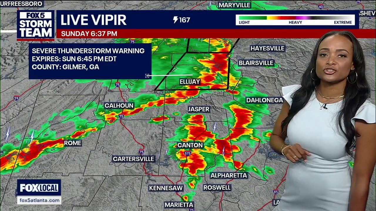
A powerful cold front is slicing through North Georgia this Sunday evening, unleashing severe thunderstorms, torrential downpours, and destructive wind gusts.
A powerful cold front is slicing through North Georgia this Sunday evening, unleashing severe thunderstorms, torrential downpours, and destructive wind gusts.
Sunday morning forecast
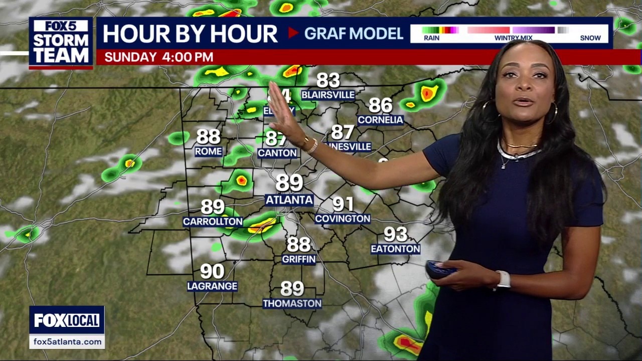
A fast-moving cold front is tracking across the region, bringing a risk of severe storms to northern Georgia and neighboring states late Sunday afternoon into the evening hours.
A fast-moving cold front is tracking across the region, bringing a risk of severe storms to northern Georgia and neighboring states late Sunday afternoon into the evening hours.
Saturday night forecast
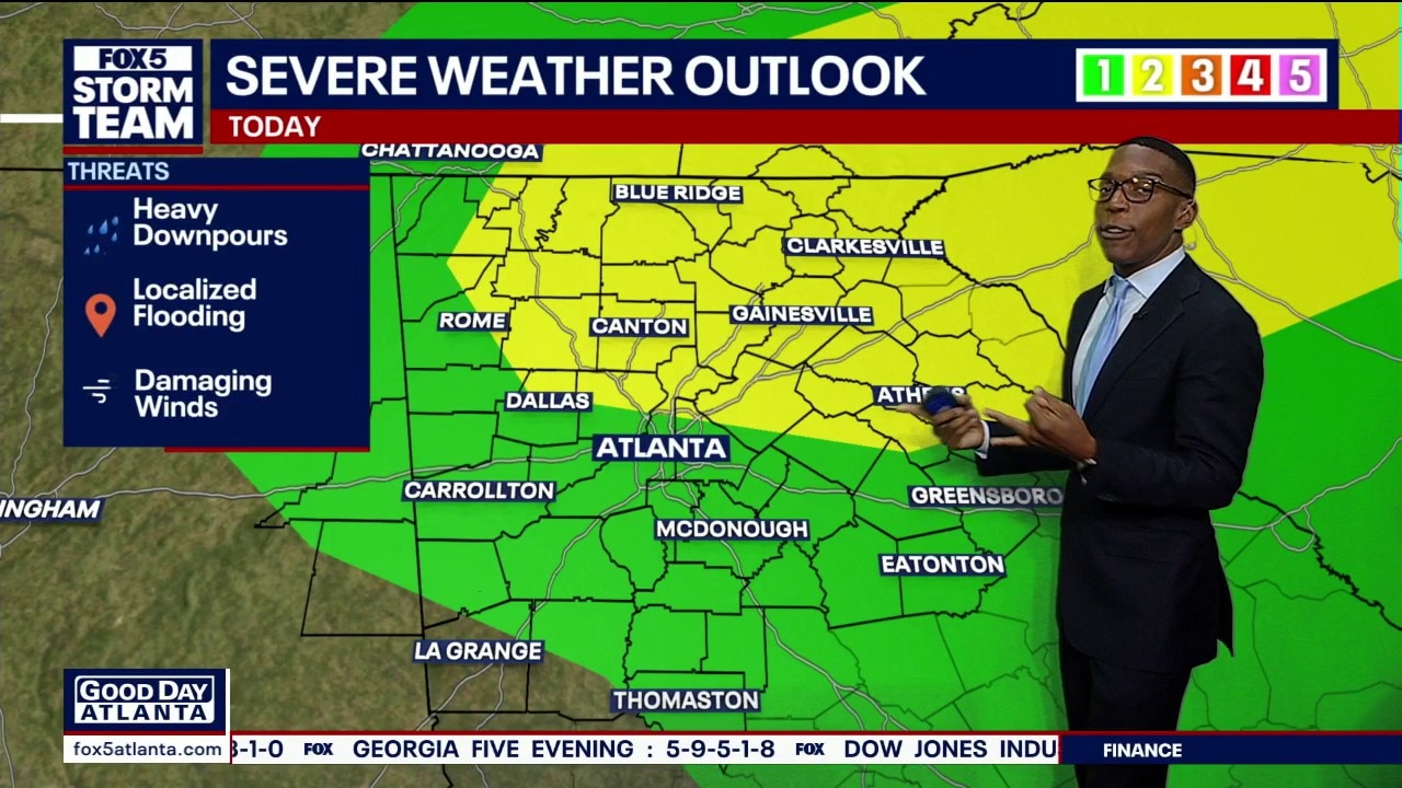
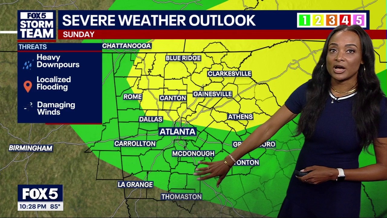
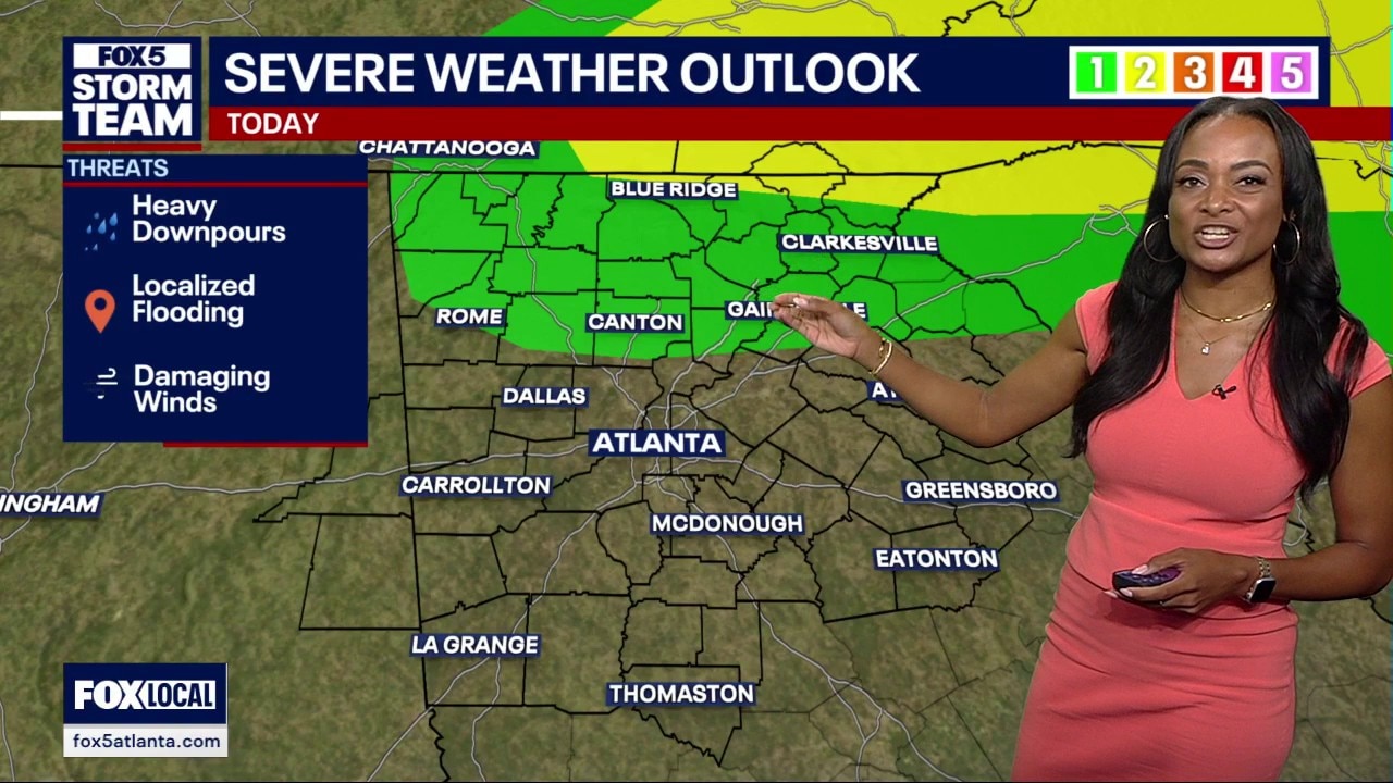
North Georgia is under a severe weather outlook for Sunday evening as heavy downpours and damaging winds could roll across metro Atlanta. Here's your latest forecast update.
North Georgia is under a severe weather outlook for Sunday evening as heavy downpours and damaging winds could roll across metro Atlanta. Here's your latest forecast update.
Saturday evening forecast
Extreme heat expected in North Georgia over the next few days before rain cools things down. Here's your latest forecast update.
Extreme heat expected in North Georgia over the next few days before rain cools things down. Here's your latest forecast update.


Weekend heat advisory: Hot and muggy
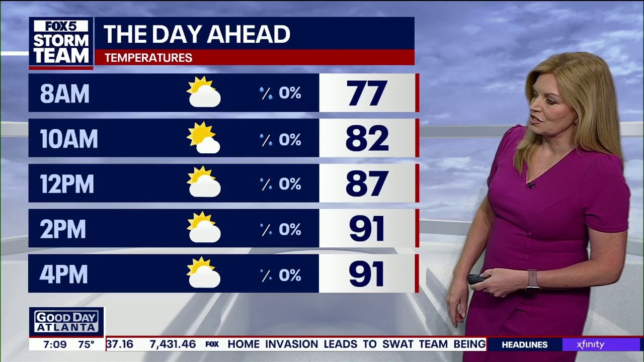
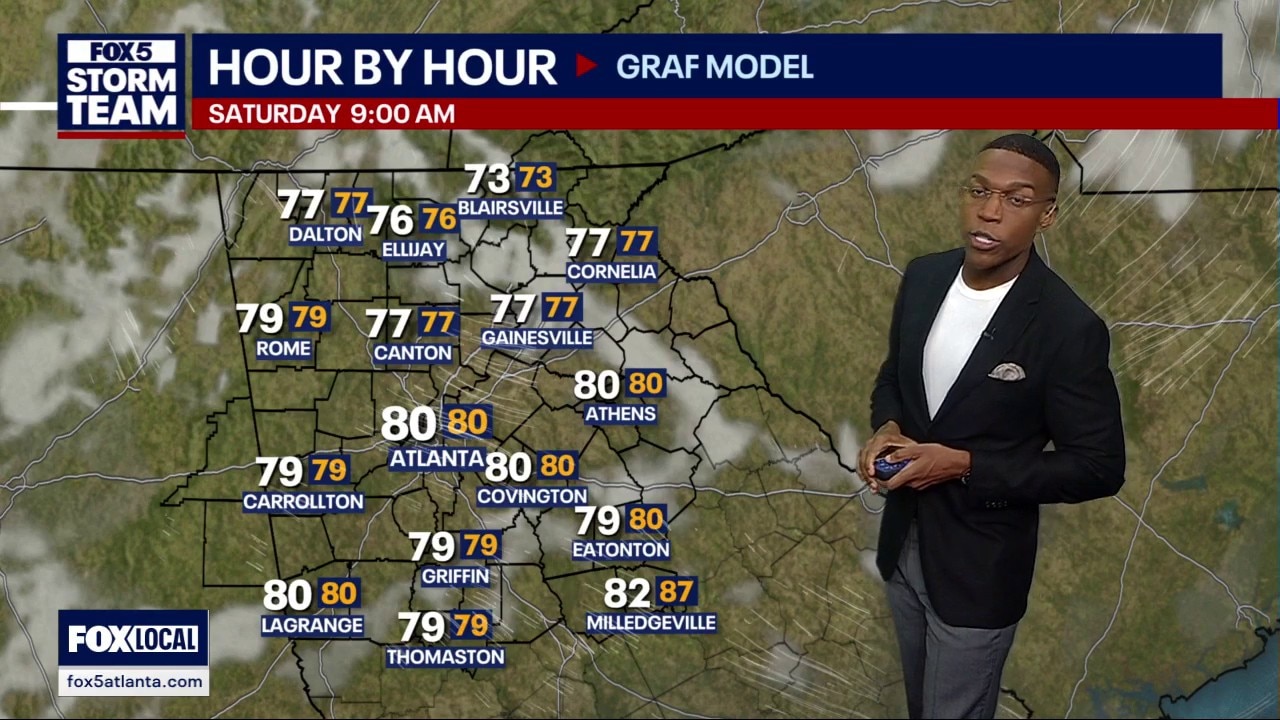
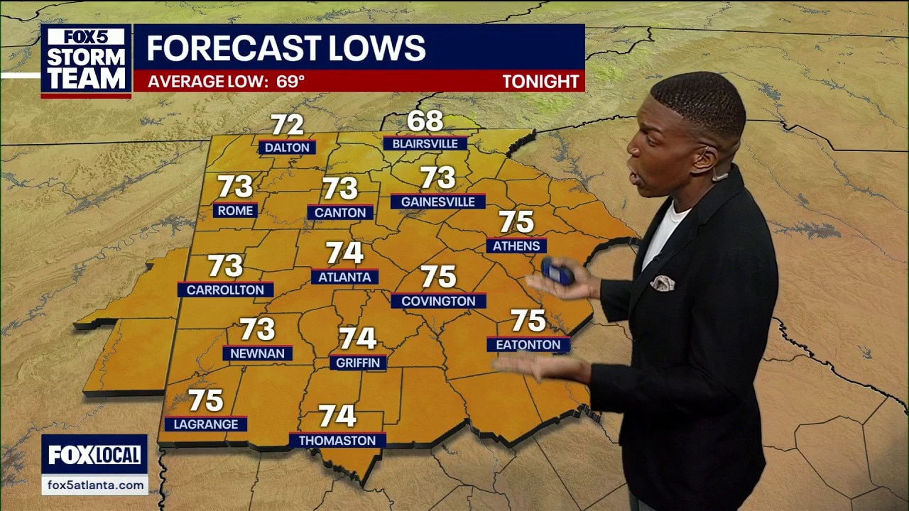
Heat and thick humidity will bake north Georgia through the weekend before a cold front moves into the area. Temperatures are expected to peak in the low 90s on Saturday.
Heat and thick humidity will bake north Georgia through the weekend before a cold front moves into the area. Temperatures are expected to peak in the low 90s on Saturday.
Saturday morning forecast
Heat and thick humidity will bake north Georgia through the weekend before a cold front moves into the area. Temperatures are expected to peak in the low 90s on Saturday.
Heat and thick humidity will bake north Georgia through the weekend before a cold front moves into the area. Temperatures are expected to peak in the low 90s on Saturday.
Friday night forecast
Atlanta will face a stifling weekend with Saturday heat indices climbing up to 106 degrees in parts of the region before tracking a wave of disruptive Sunday evening storms, according to the weather team forecast.
Atlanta will face a stifling weekend with Saturday heat indices climbing up to 106 degrees in parts of the region before tracking a wave of disruptive Sunday evening storms, according to the weather team forecast.
Friday evening forecast
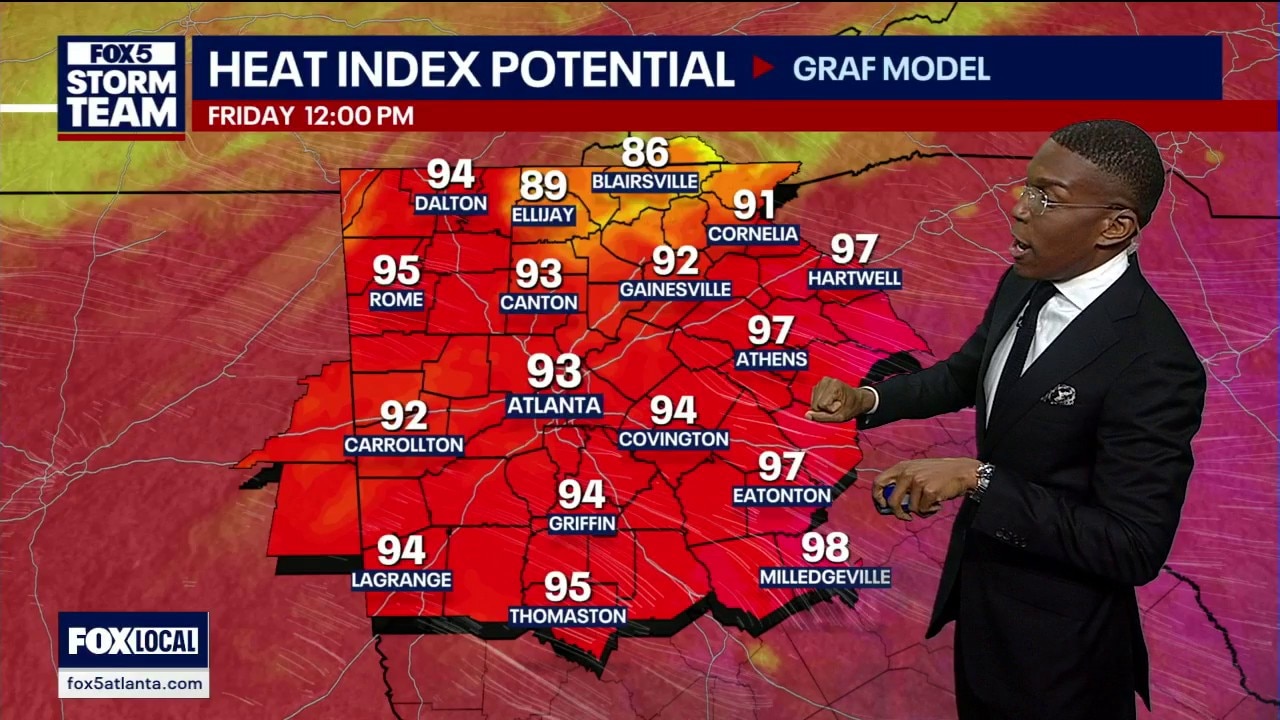
Atlanta weather shifts as high humidity grips the region. A passing cold front brings west winds at 13 miles an hour, while peak heat indices are expected to climb up to 98 degrees before rain returns on Sunday.
Atlanta weather shifts as high humidity grips the region. A passing cold front brings west winds at 13 miles an hour, while peak heat indices are expected to climb up to 98 degrees before rain returns on Sunday.
Friday afternoon forecast
Atlanta weather brings extreme heat index values in the triple digits before a weak front arrives. Showers over Lake Oconee have tracked southward, leaving Saturday mostly dry for outdoor activities. However, widespread storms are forecast for the first day of the FIFA World Cup on Monday.
Atlanta weather brings extreme heat index values in the triple digits before a weak front arrives. Showers over Lake Oconee have tracked southward, leaving Saturday mostly dry for outdoor activities. However, widespread storms are forecast for the first day of the FIFA World Cup on Monday.
Friday midday weather forecast
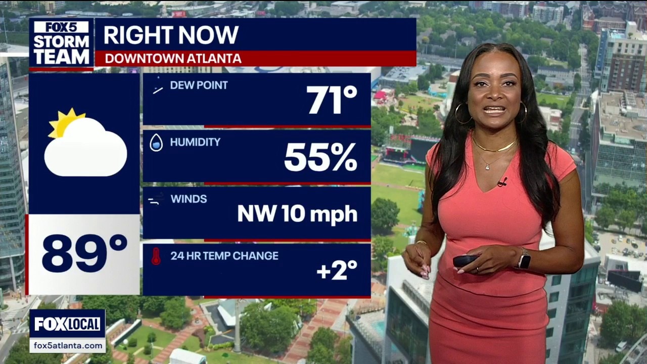
It was hot and humid at midday on Friday with a feel-like temperature of 95 degrees. The humidity is currently 55% and there's a chance for rain further north later today.
It was hot and humid at midday on Friday with a feel-like temperature of 95 degrees. The humidity is currently 55% and there's a chance for rain further north later today.
Friday morning weather forecast
Friday will be hot and humid again today with temps in the 90s. The heat index will make it feel several degrees hotter. There's a possibility of severe storms in far North Georgia later today.
Friday will be hot and humid again today with temps in the 90s. The heat index will make it feel several degrees hotter. There's a possibility of severe storms in far North Georgia later today.
Thursday night forecast
North Georgia neighborhoods face dangerous triple digit heat indices tomorrow. The National Weather Service issued a low level one out of five severe weather risk as an organized energy cluster tracks over the Appalachian Mountains. Widespread Sunday rain will finally offer relief by capping afternoon highs in the 80s.
North Georgia neighborhoods face dangerous triple digit heat indices tomorrow. The National Weather Service issued a low level one out of five severe weather risk as an organized energy cluster tracks over the Appalachian Mountains. Widespread Sunday rain will finally offer relief by capping afternoon highs in the 80s.
Thursday evening forecast
Widespread temperatures in the 90s combined with high humidity will keep the afternoon heat index above 95 degrees, according to the weather models.
Widespread temperatures in the 90s combined with high humidity will keep the afternoon heat index above 95 degrees, according to the weather models.
Thursday afternoon forecast
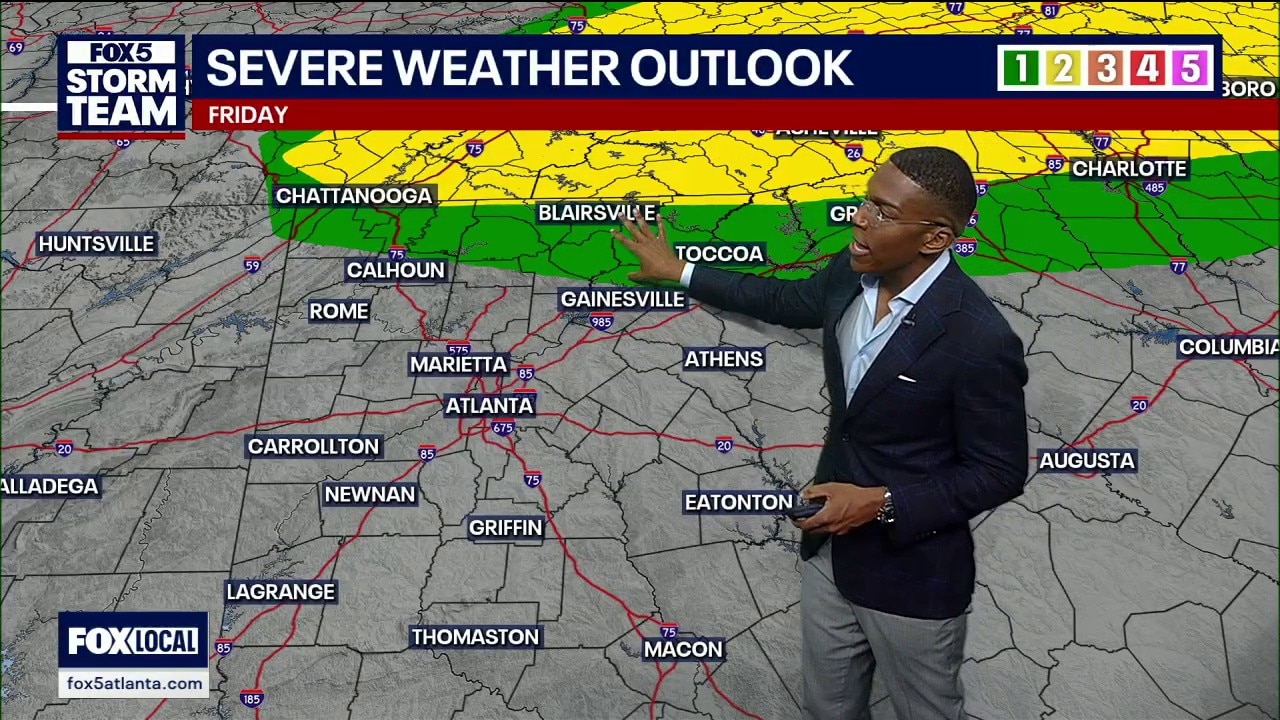
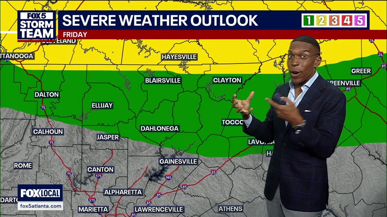
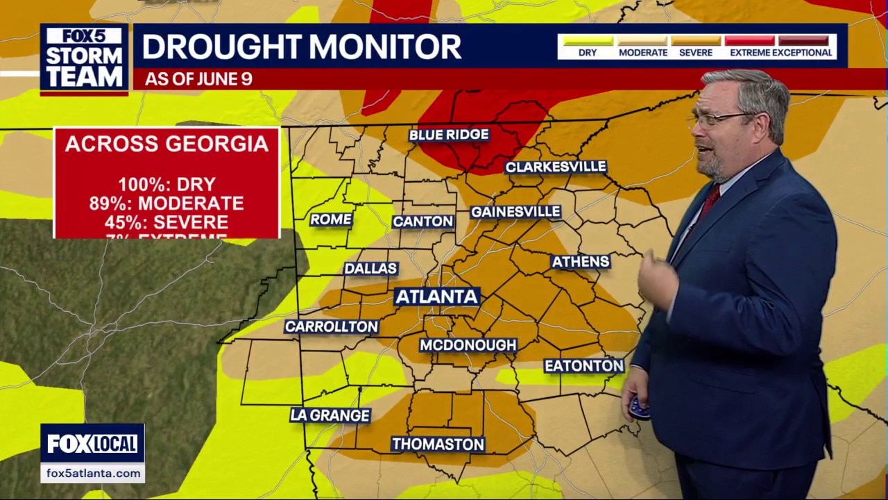
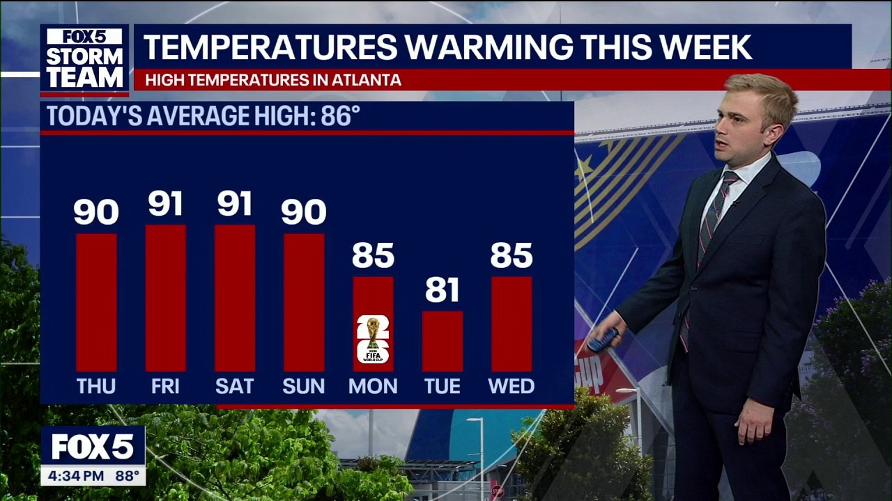
North Georgia weather shifts as extreme drought conditions drop from 24 percent down to 7 percent. A cold front moving in tomorrow evening threatens northern counties like Dalton and Toccoa with severe storms, though the system is expected to lose intensity before reaching the metro area.
North Georgia weather shifts as extreme drought conditions drop from 24 percent down to 7 percent. A cold front moving in tomorrow evening threatens northern counties like Dalton and Toccoa with severe storms, though the system is expected to lose intensity before reaching the metro area.
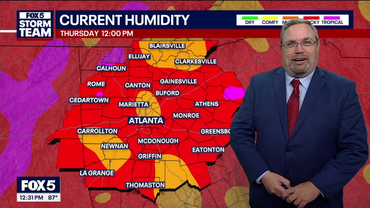
Thursday midday weather forecast
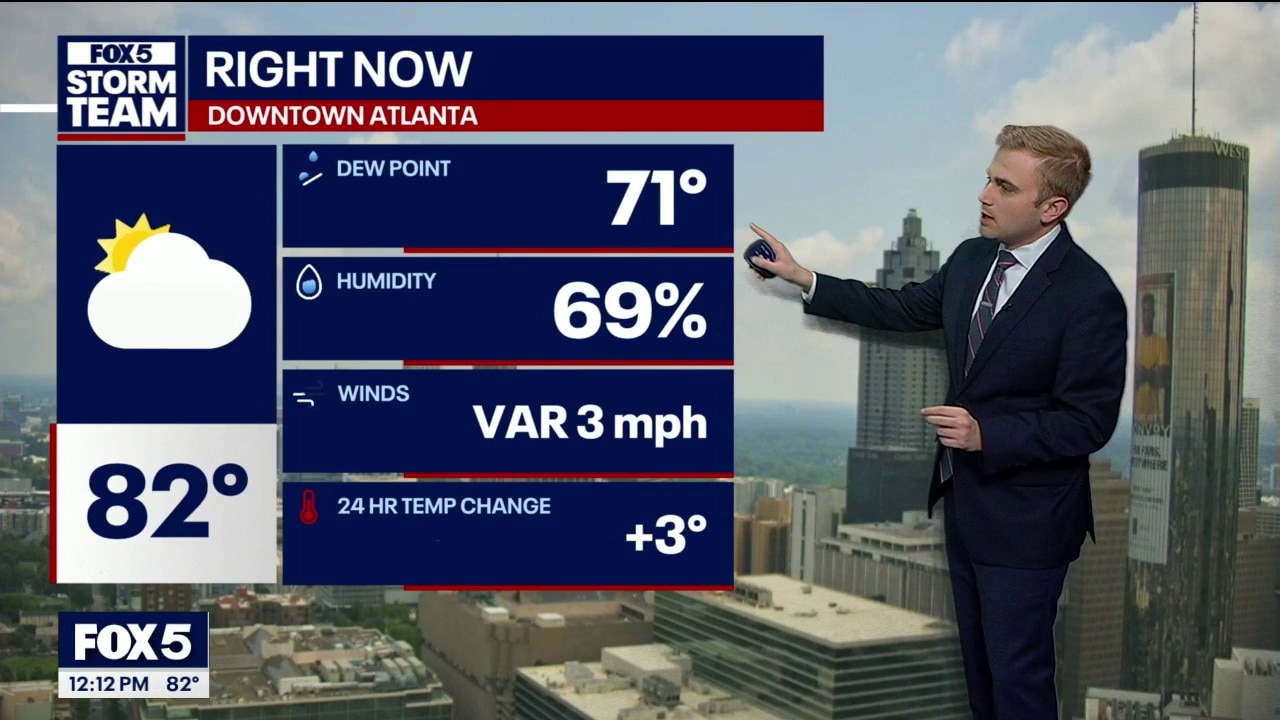
It's warm and humid in metro Atlanta and North Georgia and the temps are going to keep rising. There's a small chance of rain later today, but it shouldn't be widespread.
It's warm and humid in metro Atlanta and North Georgia and the temps are going to keep rising. There's a small chance of rain later today, but it shouldn't be widespread.
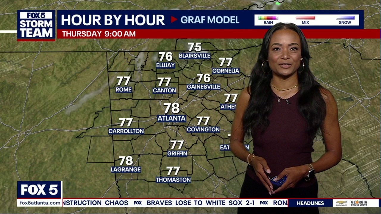
Thursday morning weather forecast
Hot and humid conditions will dominate metro Atlanta through the weekend, with highs in the low to mid-90s and heat index values approaching 100 degrees.
Hot and humid conditions will dominate metro Atlanta through the weekend, with highs in the low to mid-90s and heat index values approaching 100 degrees.
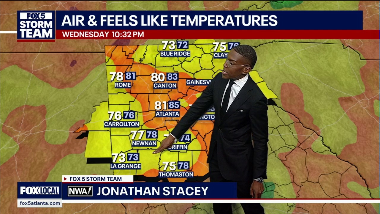
Wednesday night forecast
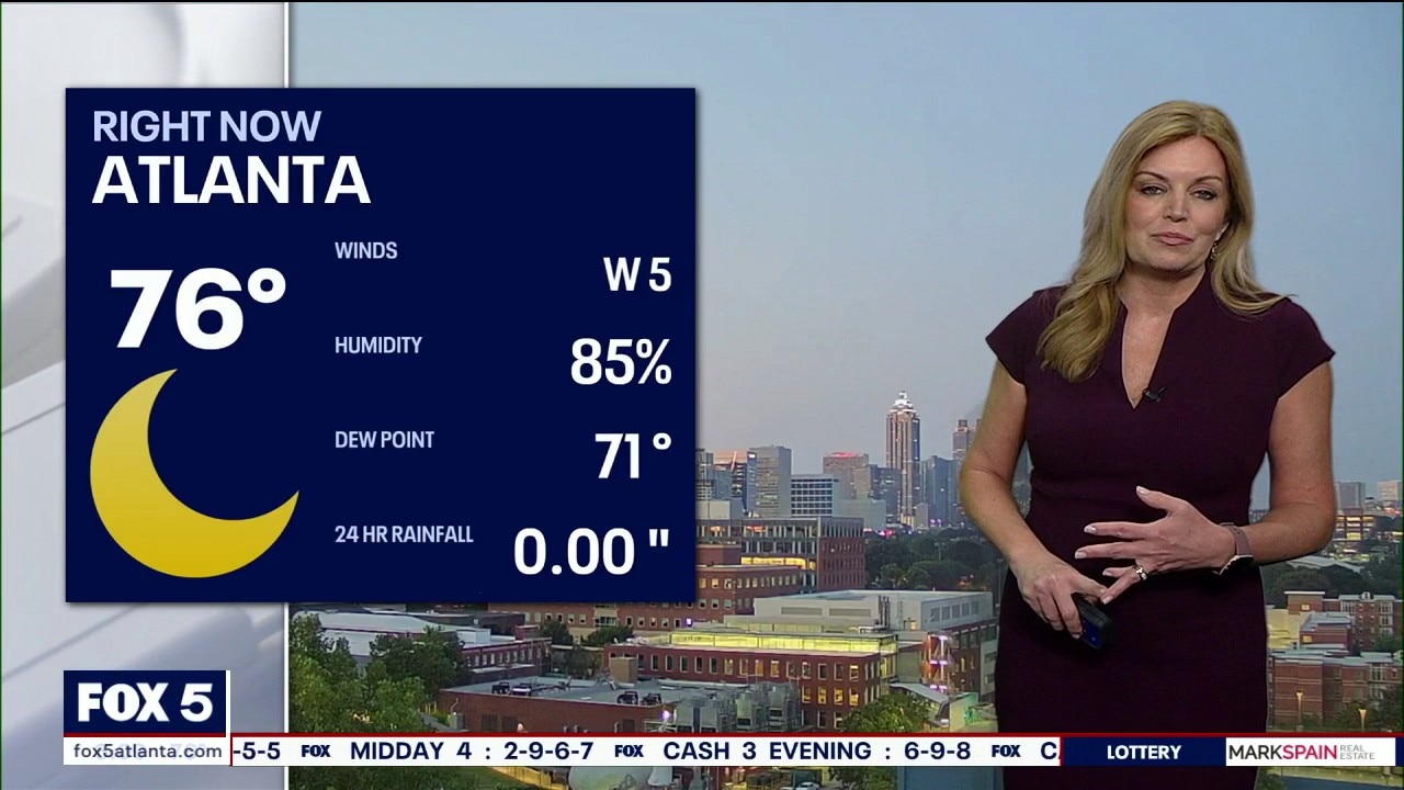
Atlanta is experiencing a lingering late-night heat index of 85 degrees as stagnant southwest winds pull moisture straight from the Gulf, according to the broadcast forecast.
Atlanta is experiencing a lingering late-night heat index of 85 degrees as stagnant southwest winds pull moisture straight from the Gulf, according to the broadcast forecast.
Wednesday evening forecast
Atlanta weather models show a weakening storm cell moving toward the bottom of the 285 perimeter. High humidity keeps a rain chance alive before temperatures drift into the 70s overnight. Another wave of intense heat is expected to arrive by Saturday.
Atlanta weather models show a weakening storm cell moving toward the bottom of the 285 perimeter. High humidity keeps a rain chance alive before temperatures drift into the 70s overnight. Another wave of intense heat is expected to arrive by Saturday.
Wednesday afternoon forecast
Rain and heat are the headlines for North Georgia weather over the next week. Here's your latest forecast update.
Rain and heat are the headlines for North Georgia weather over the next week. Here's your latest forecast update.
Wednesday midday weather forecast
Warm and muggy weather continues on Wednesday afternoon with scattered rain and some heavy downpours.
Warm and muggy weather continues on Wednesday afternoon with scattered rain and some heavy downpours.