

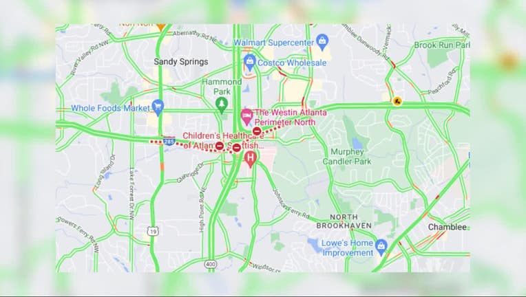
Google maps mistakenly showed I-285 East completely closed for construction
ATLANTA - It's not your fault for getting lost amid construction on Interstate 285, it's Google.
You may have noticed something off about the popular GPS application's routes passing the I-285 project on the top-end perimeter, which began with lane closures last week.
Google Maps showed I-285 East is completely closed between Roswell and Ashford Dunwoody Roads. Three lanes, however, remain open and two are blocked while crews work on a bridge in the area.
Google Maps now shows only I-285 ramps closed. There may be lanes open, but Hammond Drive is a potential alternate route for trawlers moving east on the north-end perimeter during rush hours.
The work could take about eight months to finish, officials said.
Westbound lanes in that area are expected to close in about a week.