

Rain moves out, but colder temperatures ahead for weekend
ATLANTA - Relentless rain has caused major impacts across north Georgia all day long and we will continue to see additional rain through Saturday afternoon.
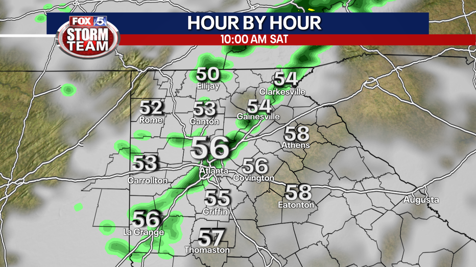
In the worst-case scenario, parts of north Georgia will see an additional 1”-2” of rain through Saturday afternoon. This would lead to localized flooding especially in low-lying areas and on the roads. In the best-case scenario, we will see only a nuisance rain with soggy conditions and rainfall totals less than an inch of rain.
Given our southernmost counties are feeling very spring-like, it’s possible those areas could see a few thunderstorms through sunset Friday. Again, the main concern with this storm system is the potential for more flooding.
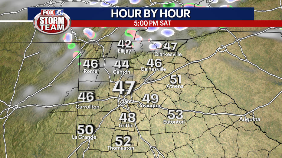
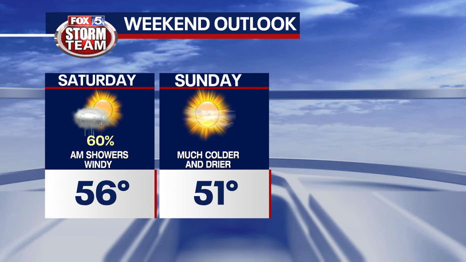
Once the cold front moves through your area on Saturday, you’ll see decreasing rain chances, increasing winds, and falling temperatures.
It’s important to note that with the saturated ground, it won’t take much for trees to fall with wind gusts over 20 mph Saturday afternoon.
By Sunday morning, we will be bone dry with wind chills in the 20s to teens.
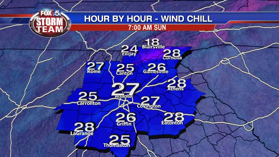
Even though the winter-chill returns Sunday, it will be the better of the two days this weekend for outdoor activities. Just make sure you dress warm!
-----
Keep up with the latest by downloading the FREE FOX 5 Storm Team app and following @FOX5StormTeam on Twitter.
DOWNLOAD the FREE FOX 5 Storm Team app to keep up with this extreme weather