

Georgia Winter Storm: Officials urge caution on roadways as refreeze expected
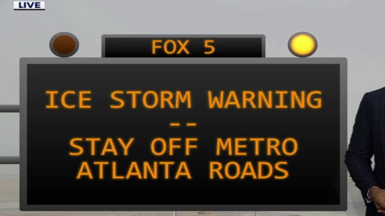
ATLANTA - An Ice Storm Warning is in effect until 10 a.m. Monday, but the area of that warning has diminished. That warned area now includes Banks, Barrow, Cherokee, Clarke, Clayton, Cobb, Dawson, DeKalb, Forsyth, Fulton, Greene, Gwinnett, Hall, Henry, Jackson, Lumpkin, Madison, Morgan, Newton, Oconee, Oglethorpe, Pickens, Rockdale, Taliaferro, Towns, Union, Walton, Warren, White, and Wilkes counties.
A Cold Weather Advisory has been extended for much of North and Central Georgia from 4 a.m. to 10 a.m. Monday. That area includes Banks, Barrow, Bartow, Bibb, Butts, Carroll, Catoosa, Chattahoochee, Chattooga, Cherokee, Clarke, Clayton, Cobb, Coweta, Crawford, Dade, Dawson, DeKalb, Douglas, Fannin, Fayette, Floyd, Forsyth, Gilmer, Gordon, Greene, Gwinnett, Hall, Haralson, Harris, Heard, Henry, Jackson, Jasper, Jones, Lamar, Lumpkin, Macon, Madison, Marion, Meriwether, Monroe, Morgan, Murray, Muscogee, Newton, North Fulton, Oconee, Oglethorpe, Paulding, Peach, Pickens, Pike, Polk, Putnam, Rockdale, Schley, South Fulton, Spalding, Stewart, Talbot, Taliaferro, Taylor, Towns, Troup, Union, Upson, Walker, Walton, Warren, Webster, White, Whitfield, and Wilkes counties.
Wind chill values are expected to plunge to between zero and 15 degrees across the region. Forecasters said a final line of heavy freezing rain moving through the area Sunday evening will likely increase ice accumulations, particularly in the northeast. The plummeting temperatures could "exacerbate icy roads" and create treacherous conditions for the Monday morning commute. Gusty winds combined with ice-laden branches also increase the risk of widespread power outages.
Gov. Kemp and other state officials will provide an update at 3 p.m. with the latest details. Check back here at that time to watch the press conference.
Stay connected with FOX LOCAL. For winter ice storm coverage—Download Now
Sunday, Jan. 25 | Live Updates
10:58 P.M. The National Weather Service has issued a special weather statement warning motorists of slick conditions across parts of north and central Georgia Sunday into Monday morning.
10:22 P.M. Gwinnett County says trash service will be suspended on Monday.
8:38 P.M. Officials with Hartsfield-Jackson Atlanta International Airport said "conditions have briefly improved locally," but the winter storm "continues to affect Hartsfield-Jackson, causing flight delays and cancellations. Treatment of our runways, taxiways, and roadways is ongoing and will continue as needed. Passengers are asked to stay in touch with their airlines for updates."
8 P.M. Both the City of Atlanta and DeKalb County have announced the suspension of solid waste, recycling, yard debris, and bulk collections on Monday.
7:14 P.M. DeKalb County reports that only a few spots on county roadways are causing issues. Most roads are passable.
6 P.M. Jackson EMC is continuing restoration. Crews are addressing 29 outages affecting 1,489 members and will continue working to restore service as quickly as conditions and safety procedures allow. More than 1,000 of those outages are in Gwinnett County, but crews are working to restore power in Banks, Lumpkin, Jackson, Barrow, and Hall counties.
5:27 P.M. All DeKalb County offices and buildings will remain closed through Tuesday, officials said. All programming is also canceled.
4:48 P.M. The City of Atlanta announced that solid waste, recycling and other collection services will be suspended on Monday.
4:35 P.M. Georgia Power said crews have restored services to over 70,000 customers since the winter storm knocked out grids in certain areas.
4:31 P.M. All Fulton County offices and facilities will be closed on Monday. Online services are still available and essential services will continue. The library system is extending holds and library materials from Saturday through Tuesday to Wednesday.
4:21 P.M. The Atlanta Hawks have changed Monday's start time for their game against the Indiana Pacers. The game was originally scheduled for 7:0 p.m. and will now be played at 1:30 p.m.
4:12 P.M. The City of Conyers said all government offices will be closed on Monday.
3:52 P.M. Forsyth County officials say trees are down at 2300 Keith Bridge Road. Power lines are reportedly down in several areas, including Castleberry Road and Bluff Heights Drive, Mullinax Road and Union Hill Road.
3:49 P.M. A tree crashes through a home in Sandy Springs, police report.

3:15 P.M. Troup County's superior and state courts have announced that all cases scheduled for Monday have been continued to Tuesday. All juvenile court cases scheduled for Monday will go forward.
The Barrow County government offices will also be closed on Monday. That includes their administrative offices, courts, senior center, animal shelter and facilities at Victor Lord Park.
All DeKalb County tax commissioner offices will be closed on Monday. An update will be posted about Tuesday on Monday night.
Cherokee County's government offices have also announced its offices will be closed.
3 P.M. More than 100K customers are now without power in North Georgia. Outages have increased in Fulton, Gwinnett, White, Rabun, DeKalb, Habersham, Lumpkin and Clayton.
2:30 P.M. More than 80,000 customers are currently without power in Georgia. We are now starting to see large numbers of customers in DeKalb, Fulton and Gwinnett County without power in addition to customers in White and Rabun. Outages have also been reported in Cobb, Clayton and Lumpkin counties.
1:45 P.M. Delays and cancellations continue at Hartsfield-Jackson Atlanta International Airport. As of 1:45 p.m., there were 243 delays and 1,133 cancellations, according to FlightAware.
12:45 P.M. City of Roswell reported several traffic issues in their area. Click here for more information about those closures and other updates from cities and counties in North Georgia.
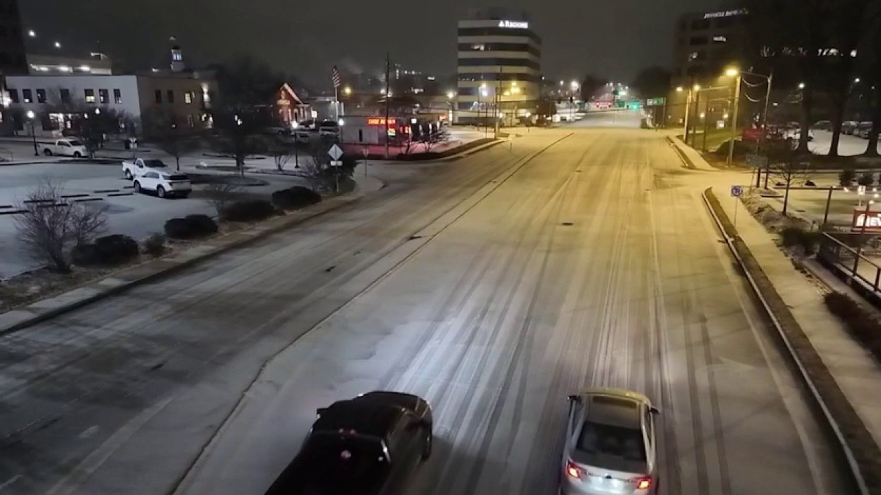
12:30 P.M. Even as crews continue treating major highways, conditions remain dangerous on secondary roads around Braselton, where untreated neighborhood streets are still freezing over despite nonstop work along I-85.
In Gainesville, ice is coating parking lots, cars and sidewalks, creating "skating rink–like" conditions in untreated areas. Treated roads remain passable, and officials say only a handful of crashes have been reported so far, crediting residents for staying off the roads.
Metro Atlanta is seeing a brief break as temperatures edge just above freezing, allowing rain instead of ice. Power crews are using the lull to restore service, but the FOX 5 Storm Team warns more rain later today could refreeze overnight, especially north of the city.
Ice Storm hits North Georgia -- Latest Headlines
An ice storm hit metro Atlanta and North Georgia on Sunday, Jan. 26. Here's a look at what's coming the rest of the day and conditions in North Georgia. Team coverage from FOX 5 Atlanta.
12 P.M. Georgia Department of Public Safety has released an update for number of crashes, assists and calls during the current winter storm through 12 p.m.
11:30 A.M. There are currently almost 35,000 customers without power in the state of Georgia. White County: 8,817; Rabun County, 7,640; Fulton County, 2,602; and Cobb County, 2,148.
10:50 A.M. Much of metro Atlanta and North Georgia is under Ice Storm Warnings, meaning extremely dangerous icing is expected. Heavy ice can bring down trees and power lines, cause power outages, and make roads nearly impassable. Travel should be avoided unless absolutely necessary, especially through Monday morning and, in some areas, into early Monday afternoon. Polk, Chattooga and Floyd counties are no longer included in the Ice Storm Warning.
Other counties are under Winter Weather Advisories, where icy roads and slick conditions are still likely. Cold Weather Advisories are also in effect late Sunday night into Monday, with temperatures dropping into the teens and 20s, allowing any moisture to refreeze. More details.

New weather alerts, warnings for North Georgia
New weather alerts and warnings have been issued by the National Weather Service for metro Atlanta and North Georgia. Much of metro Atlanta and North Georgia is under an Ice Storm Warning until 10 a.m. Monday.


10:40 A.M. Cherokee County Emergency management posted on Facebook, saying parts of the county saw approximately 0.1-0.25 inches of ice accumulation. They also said a few trees fell throughout the county.
10:30 A.M. A FOX 5 viewer sent videos of Grady EMC crews working to restore power in Rabun County.

Power crews in Rabun County
10:16 A.M. Duluth Police Department is asking everyone to stay inside if they don't have to be out.

Duluth police vehicle covered in ice
10:05 A.M. Due to severe winter weather, MARTA is operating on a limited schedule Sunday and Monday, running only lifeline bus routes to major medical facilities and reduced rail, streetcar and Mobility service. Trains are running every 20 minutes on select lines, while most bus routes are suspended, with service subject to further reductions if conditions worsen. Riders are urged to check MARTA’s website, app or social media for real-time updates before traveling. Click here for rail schedules.
10 A.M. More than 22,000 power outages reported in the state of Georgia. Most of the outages are in White and Rabun counties.
DeKalb County has activated its winter weather response under a declared State of Emergency as a significant ice storm moves into the area. County officials say the Emergency Operations Center is coordinating efforts across public safety, public works, utilities and state partners, with crews pre-treating roads and facilities, staging tree and debris teams, and ensuring generators and heating equipment are ready at critical locations. Police and fire departments report they are fully staffed and prepared, while GDOT and Georgia Power have crews in place to respond to hazardous roads and possible outages. Residents are urged to avoid unnecessary travel, prepare for power outages, protect pipes and pets, and monitor official DeKalb County updates as dangerous conditions and extreme cold continue.
Canton and Cherokee County are dealing with icy conditions after the winter storm moved in overnight, bringing freezing rain and sleet. City officials say roads are mostly passable for now but slushy, with public works crews treating major roadways and trouble spots, and police monitoring conditions overnight. Temperatures may rise slightly today but are expected to drop quickly tonight, meaning slush will refreeze into ice by Monday morning. Residents are urged to stay off the roads if possible, avoid touching downed trees or limbs near power lines, and prepare for continued impacts.
9:50 A.M. Hartsfield-Jackson Atlanta International Airport is reporting a ground delay of approximately 117 minutes. Departures have been delayed to 20 cities at this time. The ground delay is currently scheduled to end at 7 p.m.
At this time, 1,051 cancellations and 77 delays have been reported at Hartsfield.
9:13 A.M. Acworth mayor provides an update, saying there were no power outages overnight.
9:06 A.M. Georgia Department of Safety trooper provides look at a road in Hartwell territory.
9 A.M. Georgia Power is now reporting there are about 15,000 outages in their area. Georgia EMC is reporting approximately 7,600 customers without power, mostly in the north and northeast part of the state.
8:52 A.M. Duluth Police Department is reporting there are no current road closures in the City of Duluth, but roads are wet and slush throughout the area.

8:45 A.M. Ice is making elevated surfaces especially dangerous across metro Atlanta. FOX 5 meteorologist Paul Milliken reported from the FOX 5 Weather Deck in DeKalb County that the deck is covered in a solid sheet of ice — so slick that he said it was unsafe to walk or head back down.
Milliken said decks, balconies, stairs and landings freeze first because cold air circulates underneath them. He noted that while lower stairs had some traction, the top landing had "zero traction," a situation many homeowners are likely facing right now. Ice measured on the Weather Deck railing was about a tenth of an inch.
Milliken also warned that ice continues to weigh down trees, with cracking sounds already being reported. A tree branch left out overnight was frozen solid in place, and while treated parking lots are in better shape, cars and trees remain icy. He urged people to stay indoors when possible and avoid standing under trees due to the risk of falling limbs.

How to measure ice accumulation
FOX 5's Paul Milliken walks you through how to measure ice as the winter weather moves through Georgia
8 A.M. The City of Alpharetta Emergency Operations Center is reporting that Alpharetta has not yet experienced any major roadway issues, downed tress, or widespread power outages.
7:45 A.M. Gov. Brian Kemp posted an update on social media Sunday morning, urging Georgians to "stay hunkered down" to help first responders and road treatment teams do their jobs. Kemp also said that Georgia is about halfway through the storm.
7:45 A.M. CLAYTON COUNTY
Clayton County has announced that its Board of Commissioners administrative offices, libraries, senior centers, parks and recreation centers and all events will be closed/canceled, reopening on Jan. 27.
7:37 A.M. LUMPKIN COUNTY
The Lumpkin County Government is reporting that their roads are becoming "increasingly dangerous" and crews are out now plowing and spreading salt.
7:30 A.M. As wintry weather continues across north Georgia, FOX 5 meteorologists say freezing rain remains the main threat, even as a few spots briefly see sleet or light snow mixed in.
Meteorologist Joanne Feldman says warmer air just above the ground is causing most precipitation to fall as rain and then freeze on contact — a setup that can be sneaky and dangerous. Roads and trees can ice over quickly, even when it looks like "just rain."
Freezing rain continues north of I-20, especially in the north metro and northeast Georgia, including areas near Gainesville, Dahlonega and Athens. Some parts of metro Atlanta may briefly switch to rain later today, but more moisture is expected, and that could actually add to ice problems as temperatures drop again overnight.
With lows expected in the teens and 20s Monday morning, any leftover moisture could refreeze, leading to another icy start to the week
7 A.M. PICKENS COUNTY
Pickens County Emergnecy Management is reporting multiple roads that are closed or impassable. . They include Highway 136 and Monument Road, Highway 53E and Steve Tate Road; Wood Bridge Road; Highway 53W at Jerusalem Church Road; Hill City Road between Highway 53 and Hill Circle; and all roads in Big Canoe.
7:15 A.M. Georgia Power is reporting approximately 4,500 customers without power.
7 A.M. The City of Snellville is reporting icy spots, but no closed roads at this time. Additionally, they have not had any reports of downed trees or power lines.
7 A.M. In Braselton, freezing rain that started overnight has coated trees, cars and parking lots with ice, with some areas already seeing at least a tenth of an inch. Crews have been spreading salt in spots, but roads remain slick, and drivers are being urged to stay off the roads if possible.
Freezing rain still falling in Hall County
Ice is accumulating in Hall County where its still raining. FOX 5's Rey Llerena says the roads have a solid sheet on them, but he's seen some drivers still out, but moving slow.
In Gainesville, the change has been dramatic. FOX 5 crews showed drone video from just hours earlier with no ice, compared to now, where roads, cars and parking lots are covered in a thick glaze. Officials say northeast Georgia could see up to a half inch of ice overnight, with more possible through Sunday.
6:10 A.M. The tree that fell between Cascade Road and Campbellton Road has been cleared.

Tree cleared after falling during ice storm
Fire crews were able to move a fallen tree in southwest Atlanta. The crew said the tree also pulled down phone and internet lines.
5:50 A.M. The City of Brookhaven says they are seeing some icing on elevated surfaces, but most of their roadways are not iced over yet.
5:45 A.M. Conditions were a bit warmer at Buc-ee's in Calhoun early Sunday morning, with steady rain falling instead of freezing rain for now. FOX 5 crews say wind gusts have been strong at times, making it tough to hold an umbrella, and rain has been pooling in parking lots near I-75 and Highway 53.

Buc-ee’s Calhoun: Travel hub stays open during ice storm
Calhoun is currently in a "pocket of warmer air" with light rain at 34°F. While temperatures remain above freezing, significant wind gusts and 110,000 gallons of brine treatment are being managed by GDOT crews as they prepare for an expected drop in temperature. Standing water in areas like the local Buc-ee's parking lot poses a major refreeze risk for the Monday morning commute.
5:40 A.M. The City of Milton says there are no road closures or downed trees at this time.
5:30 A.M. Conditions are starting to change in south Henry County as temperatures dip into the low 30s. After a heavy downpour earlier this morning, the rain has stopped, but FOX 5 crews say a light glaze of ice is beginning to form on vegetation as temperatures fall to around 31 degrees.
So far, surface streets and Interstate 75 near Exit 212 have been mostly wet and passable, with traffic moving normally. However, with temperatures continuing to drop, officials say roads could start freezing over quickly in the coming hours.

How far south are the icy conditions?
Icy conditions are rapidly moving south into Henry County, where temperatures have dropped to 31°F. While interstate travel on I-75 remains mostly unaffected as of Sunday morning, local surface streets are beginning to see a glaze of ice on railings and vegetation following a massive rain downpour. Residents are urged to use the Fox Local app for real-time updates on weather, power outages, and school closings.
5:20 A.M. As of about 5:20 a.m., freezing rain is falling across much of metro Atlanta and north Georgia. Temperatures are sitting right at 32 degrees in places like Carrollton and Griffin, so rain is freezing as it hits the ground.
Heavier freezing rain is continuing in northeast Georgia, including Gainesville, Jasper and toward Athens, while lighter rain farther south is still cold enough to cause icing. Meteorologist Alex Forbes says more moisture later today could add to ice totals, increasing the risk of slick roads, downed trees and power outages.
There may be a brief lull later this morning, but rain and freezing rain are expected to return this afternoon, keeping conditions dangerous.
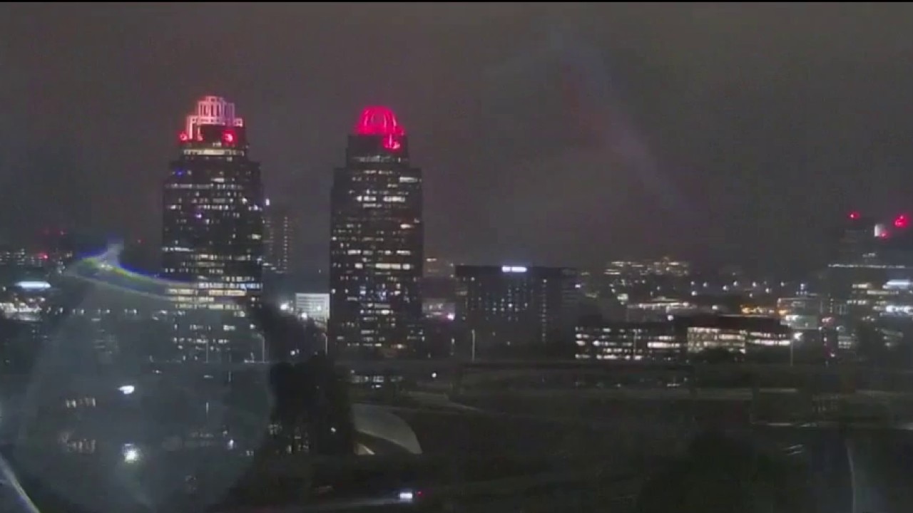
Incredible timelapse of icing in progress
The FOX 5 camera which faces the iconic King and Queen Buildings saw a massive build up during Sunday morning's ice storm. A timelapse shows a four hour period of accumulation on the lens. Check it out and other images pouring into our newsroom.
5:15 A.M. Ice is starting to take a toll across metro Atlanta. In southwest Atlanta, a large tree came down early Sunday on Children’s Drive, blocking the road and bringing down a power line.
The tree fell around 3:30 a.m. near Cascade Road, between Cascade Road and Campbellton Road, close to South Utoy Creek. Officers were on scene blocking traffic because the road is not passable.
Georgia Power responded and says the downed line is affecting streetlights, but nearby homes are not impacted. Drivers are being urged to avoid the area.

Tree collapse: 60-foot oak blocks southwest Atlanta road
Fallen trees and power lines are causing significant hazards in Southwest Atlanta as ice continues to accumulate. Local officials have identified trees as the most vulnerable infrastructure during this storm. On Children's Drive, a 60-foot tree collapsed across the roadway, severing power lines and completely blocking traffic. While the downed line has extinguished street lights, nearby residential power remains largely unaffected in that specific area. Georgia Power crews and local law enforcement are currently on-site managing the dangerous scene.
5:15 A.M. Radar is currently showing freezing rain continuing across much of the region, with the heaviest icing happening in northeast Georgia. Areas just south of Interstate 20 are currently seeing a mix of rain and occasional sleet, while farther south precipitation is mostly rain.

Ice Storm Warning: Half-inch totals for NE Georgia
A significant ice storm is gripping the region, with freezing rain glazing trees and surfaces as a "wedge" of Arctic air pushes through. While a brief transition to heavy rain is expected, the combination of accumulating ice and 30 mph wind gusts is already causing power outages and treacherous road conditions. Forecasters warn that overnight moisture will refreeze, potentially dropping wind chills into the single digits by Monday morning.
"We are already seeing ice glazing tree limbs, and with gusty winds, that’s not a good combination," meteorologist Joanne Feldman said shortly after 5 a.m.
Freezing rain is expected to continue through much of the morning, with some areas transitioning to plain rain later in the date as temperatures rise slightly.

Georgia ice storm: Trees coated, travel hazardous
A major ice storm is currently impacting Georgia, with freezing rain and sleet coating trees and vehicles in at least a tenth of an inch of ice. Temperatures in areas like Braselton are holding at approximately 27°F, leading to a hazardous "slushy mix" on surfaces. While a brief midday lull is expected, a second round of precipitation will move in before a "bitterly cold" refreeze on Monday morning.
In Braselton, thick ice has coated trees and vehicles and temperature are hovering around 27 degrees. Conditions are similar in Gainesville and Hall County officials are reporting between a third and a half-inch of ice that accumulated overnight.

Gainesville glazed: Up to one inch of ice forecasted
Gainesville is currently facing severe winter weather as an ice storm coats the city in a dangerous glaze. While the exact amount of ice on the ground is difficult to pinpoint, vehicles and sidewalks are already showing a "pretty good glaze" from ongoing precipitation. Local officials are warning residents to stay off the roads as conditions remain slippery and hazardous.
5 A.M. Georgia Power reports more than 1,200 customers without service. The Chastain Park neighborhood continues to be the largest section.
Jackson EMC is reporting they have no widespread outages at this time. Jackson EMC covers the area from around Lilburn up to Gainesville and Dahlonega and over to Athens and Lavonia.
4:50 A.M. Stay off the roads! That's imploring message is being echoed across many local government-run social media accounts. The Cherokee County EMA reports that a mixture of freezing rain, sleet and freezing temperatures is causing ice to form on roadways. Officials say most elevated surfaces have not glazed over, causing slick spots. Henry County is asking residents to stay home to accommodate emergency vehicles. The Douglasville Police Department put it best writing: "PLEASE STAY HOME!"
4:26 A.M. Reports of trees down along Cascade Road near I-285.
4:20 A.M. Georgia Power nearly 800 customers are experiencing an outage, with about half of those in the Chastain Park neighborhood of Atlanta. The Georgia EMCs report an additional 140 customers are without power across the state.
4:04 A.M. MARTA will continue operating on an inclement weather service plan on Sunday.
Rail Service:
- Trains will begin service at 6 a.m., arriving every 20 minutes.
- Red Line in service from North Springs to Lindbergh Center.
- Gold Line in service from Doraville to Airport.
- Green Line in service from Bankhead to Vine City.
- Blue Line in service from Indian Creek to H.E. Holmes.
- Bus Service: The following lifeline bus routes will begin operating at 5 a.m. on special frequencies: Routes 6, 8, 19, 40, 107, 110, 111, 123, 185, & 196.
- Mobility Service: Pre-booked medically necessary trips will be honored as safe conditions permit. Only next-day reservations are accepted. The Reservations Call Center will open at 9:30 a.m.
- Streetcar Service: Service will begin at 8:21 a.m. on a regular Sunday schedule with shuttle vans.
- The Customer Information Call Center will be open from 7 a.m. – 7 p.m. for routing and scheduling inquiries.
3:48 A.M. A Cold Weather Advisory has been issued for Rabun County from 4 a.m. until 10 a.m. Monday. The dangerously cold wind chills as low as 5 below zero could result in hypothermia or frostbite if precautions are not taken. Avoid prolonged exposure if possible and have a safe heating source, particularly for those who may experience power outages.
3:31 A.M. Multiple counties are reporting deteriorating conditions on surface streets.
2:28 A.M. The Atlanta airport is now officially reporting freezing rain.
2:27 A.M. Pickens County is reporting multiple trees down with some blocking the roadway.
2:24 A.M. The Hall County Sheriff's Office is reporting that ice is settling in and that conditions are deteriorating. They reiterate to stay at home and off the roadways.
2:18 A.M. Forecasters are reminding residents that just because freezing rain has not started in your neighborhood, does not mean that the storm is a "bust." The National Weather Serivce says it just means the freezing rain has not yet started in your area.
2:10 A.M. Some roads in northeast Georgia report icy patches. SEE THE LIST: Georgia weather-related road closures
- Icy patches were reported on SR 60 and both directions are closed at Industrial Boulevard. GDOT says the anticipated reopening is 10 a.m.
- SR 11/ Cleveland Highway is closed in both directions past River View Driver. The anticipated reopening is 2:30 a.m.
- SR 136 at Monument Road has all lanes closed due to icy patches. The anticipated reopening is 2:30 a.m.
2:06 A.M. FOX 5 Storm chief meteorologist David Chanley reported Sunday morning that an ice storm is in full swing across North and Northeast Georgia, with several hours of heavy accumulation expected. Temperatures continue to plummet into the 20s as moisture runs into a freezing layer of air, creating widespread freezing rain across the metro area and the Interstate 85 and 985 corridors. Impacted areas include Lilburn, Lawrenceville, Sugar Hill, Roswell, and North Fulton County. Forecasters noted that a "wedge" of cold air has solidified over the region, which will keep temperatures below freezing for much of Sunday, potentially causing rain to freeze on contact with any elevated surfaces or roads.
The storm is projected to leave behind between a quarter to a half-inch of ice in many locations, a total that can significantly disrupt travel and bring down trees and power lines. While the precipitation is expected to end by Sunday afternoon, a secondary surge of bitter cold will arrive on Sunday night and persist through Monday, with temperatures dropping into the teens and 20s. These freezing temperatures, combined with gusty winds out of the northwest, are expected to drive wind chills down into the single digits.
1:08 A.M. Temperatures drop to freezing, shifting rainfall to the beginnings of freezing rain in metro Atlanta. Freezing rain is witnessed by FOX 5 viewers in DeKalb County.

Ice starts to accumulate in North Georgia
Freezing rain is falling across North Georgia with many reporting frozen trees and ice sheets across vehicles. The FOX 5 Storm Team is continuing to track as this winter storm moves in.
Saturday, Jan. 24
11:40 P.M. Freezing temperatures are spreading farther into Georgia, with significant glazing expected soon in places like Canton, Gainesville, and Blairsville. A wedge of Arctic air is surging, driving temperatures into the 20s and low 30s, moving steadily toward metro Atlanta.

North Georgia glazing begins as temps drop to the 20s
As a dense wedge of arctic air anchors itself over North Georgia, temperatures in cities like Dahlonega and Cornelia have plummeted into the 20s, signaling the start of significant ice glaze on trees and power lines. FOX 5 Storm Team Chief Meteorologist David Chandley warns that as moisture from the Gulf meets this "wedge," freezing rain will intensify through Sunday morning, keeping the region below the freezing mark well into lunchtime. While a brief afternoon lull may occur, a secondary front is expected to sweep through Sunday night, flash-freezing any residual moisture and dropping Tuesday morning temperatures into the teens
11:19 P.M. An emergency warming center has opened at the Lay Park Community Center in Athens. The center is at 297 Hoyt Street and is equipped with a backup generator in case of potential power outages. Despite warnings and the University of Georgia closing, several students have been observed walking through downtown Athens.

Emergency warming center opens in Athens
In downtown Athens, the typical storm warnings are being met with a surprising scene as college students flood the bars on foot to celebrate the cancellation of Monday classes. While students roam Clayton Street without coats in 35-degree weather, city officials have opened an emergency warming center at the Lay Park Community Center for those seeking shelter from the impending ice. With temperatures dropping by the minute, volunteers are providing warm food and cots for dozens of residents bracing for the most dangerous overnight conditions.
11:03 P.M. Frigid Arctic air is making its way down into North Georgia, with temperatures dropping to 29 degrees in Cornelia and 31 degrees in Toccoa. Although icing hasn't begun in most areas, it is expected to intensify rapidly around midnight. Modeling shows the freezing rain will expand into metro Atlanta by early morning hours on Sunday.

Arctic air surges: Long night of freezing rain ahead
Arctic air is surging down the Appalachians, dropping temperatures into the lower 30s and 20s across Northeast Georgia as moisture rolls in. FOX 5 Storm Team Meteorologist David Chandley warns of a "long night" of freezing rain, with high-resolution modeling showing the icy "pink" zones expanding into metro Atlanta by the wee hours. While the South Side may see mostly rain, cities like Gainesville, Athens, and Canton are bracing for a treacherous mess by 5 a.m.
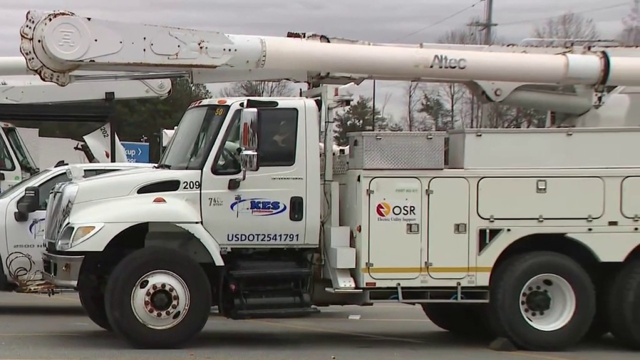
10:53 P.M. About 600 utility contractors and tree removal crews are staged across northeast Georgia, including Gainesville, to clean debris from limbs that may fall once ice begins to weigh limbs down.

Hall County braces for up to one inch of ice
In Gainesville, the temperature is dropping rapidly as Hall County prepares for a significant ice storm expected to bring 0.5 to 1 inch of ice. Power and tree companies are already staged and ready to work, while the Sheriff’s Office has moved to 12-hour shifts to handle the coming emergencies. Officials are warning residents that power restoration could take days, making it vital to stay off the roads and hunker down with essential supplies.
10:44 P.M. Georgia has activated its Operation Center, which will allow coordination with state and local agencies and emergency responders in anticipation of widespread power outages. State officials are urging all residents impacted by the storm to stay in their homes for the next 48 hours.

Atlanta braces for ice storm: Officials say hunker down
As a major ice storm approaches metro Atlanta, state officials are urging residents to "hunker down" and stay off the roads for at least 48 hours. Brine trucks are working around the clock to treat interstates, but experts warn of inevitable power outages and downed trees as the freeze sets in overnight.
10:34 P.M. Linemen are staged across northeast Georgia, including Dahlonega and Gainesville, in preparation for expected power outages. Residents in the North Georgia mountains are bracing for significant ice totals ranging from 0.5 to 1 inch, which could lead to mass power outages. Lumpkin County officials directed all residents to be off the roads by 6 p.m.

Dahlonega braces for an inch of ice; 600 crews staged
The northern reaches of Georgia are currently seeing consistent rain as Winter Storm Fern begins its descent, with temperatures hovering at or below the freezing mark. In Dahlonega, the situation is critical; authorities are expecting up to an inch of ice accumulation, prompting the staging of over 600 utility contractors to handle inevitable power outages. Local residents have been advised to prepare for being hunkered down for up to four days, as memories of a jackknifed 18-wheeler during last year's storm remain a sharp warning for those considering the roads.
10:27 P.M. Officials in DeKalb County have issued a state of emergency as the area prepares for a winter storm to set in. Road teams have used 2,500 tons of salt and 10,000 tons of sand to treat critical roadways. However, they urge residents to stay inside once the brunt of the storm hits. Main roads, bridges and access to hospitals are top priority.

Road crews working overtime ahead of ice storm
As a state of emergency takes hold in DeKalb County, residents are swarming local gas stations for last-minute essentials and tire air to combat the dropping temperatures. CEO Lorraine Cochran-Johnson issued the order as road crews mobilized 2,500 tons of salt and 10,000 tons of sand to treat critical infrastructure, including hospitals and bridges. While traffic peaked around 6:00 PM with locals grabbing groceries, the streets are now emptying as people "hunker down" for a storm spanning the entire East Coast.
10:21 P.M. Over 300 flights were canceled Saturday with more than 1,000 disruptions expected through Sunday. Crews deployed over 300,000 gallons of brine and 100 tons of sand-salt mix in an effort to keep runways open. Several airlines have announced flexible rescheduling policies due to the impending winter storm.

Atlanta airport working to limit delays amid ice storm
Hartsfield-Jackson Altanta International Airport is facing significant operational challenges as an ice storm sweeps across the Southeast. While over 300 flights were canceled by Saturday evening, disruptions are expected to skyrocket to approximately 1,000 flights between today and Sunday. Despite the chaos, the terminal remains unusually quiet as travelers proactively utilize free rescheduling options to avoid being stranded. To combat the freeze, crews have deployed 300,000 gallons of liquid brine and nearly 100 tons of sand-salt mix to keep runways clear.
10:01 P.M. All Fulton County Board of Health clinics and offices will be closed on Monday, officials said.
9 P.M. A "destructive" ice storm began moving into North Georgia on Saturday night, with meteorologists warning of heavy icing and power outages through the weekend. While temperatures in Atlanta hovered at 40 degrees early in the evening, the "feels like" temperature had already hit the freezing mark as moisture moved in from the west. Forecasters expect the storm to arrive in metro Atlanta around midnight, while residents in Rome and Dacula have already reported sleet.
The system is expected to be particularly dangerous on Sunday due to a combination of heavy ice and high winds. Northeast Georgia cities like Toccoa and Dahlonega are in the bullseye for significant accumulation, with some areas potentially seeing a half-inch of ice. "For the average tree size, a half an inch of ice adds 2,500 pounds," the FOX 5 Storm Team warned, noting that 30 mph gusts Sunday afternoon could easily snap ice-coated limbs and power lines.
Beyond the freezing rain, the dynamic system may trigger a low-end risk for severe thunderstorms and a "quick spin-up" tornado in the metro area as a warm front pushes against the cold air. Residents are urged to monitor conditions through Monday, as a secondary freeze is expected to keep roads and surfaces hazardous into Tuesday morning.
7:40 P.M. Hartsfield-Jackson Atlanta International Airport has had 298 cancellations and 268 delays, according to FlightAware.com. More than 3,500 delays and nearly 4,500 cancellations have been reported nationwide as the winter storm sweeps into the East Coast.
7:16 P.M. The FOX 5 Storm Team continues to track the ice storm threat to North Georgia. The latest data suggests the timing of the freezing rain has been pushed back close to 10 p.m.

Heavy winds, ice expected from winter storm
A winter storm is bringing damaging amounts of ice to North Georgia. Forecasters say high winds and ice will start Saturday evening and persist into Sunday. Here's the latest update.
7:13 P.M. Due to predicted winter weather conditions and the declaration of a State of Emergency, upcoming DeKalb County Board of Commissioners and committee meetings will be conducted via teleconference (Zoom) to ensure public safety and continuity of government operations.
6:57 P.M. The following schools have just announced they are closing on Monday:
- Georgia Gwinnett College
- UGA Athens campus
- All Coweta Schools
6:56 P.M. Light rain began falling across the region Saturday evening, marking the first phase of a winter storm expected to bring dangerous ice accumulations overnight. As of now, temperatures remained above freezing at approximately 43 degrees, but meteorologists warn that conditions will deteriorate rapidly as the sun sets and temperatures drop toward the freezing mark over the next few hours. Winds are also beginning to pick up, adding a breeze to the steady precipitation that has already made outdoor surfaces slick.
To provide accurate data, officials suggest measuring ice on flat surfaces with a ruler. For uneven surfaces like tree limbs, residents should measure both the thickest and thinnest points of accumulation to provide an average. Local crews remain on standby as the transition from rain to ice is expected to occur in the late evening hours.
6:51 P.M. Six warming centers have opened across Gwinnett County as officials brace for severe winter weather and potential multi-day power outages starting Saturday evening. The largest facility, located in the jury assembly room of the Gwinnett Justice Center, began welcoming residents at 4:30 p.m. While only one person had checked in by early evening, officials expect a significant uptick in arrivals around 10:00 p.m. as temperatures drop and road conditions deteriorate.
Managed by the Emergency Management Office and the Gwinnett County Sheriff’s Office, the centers are fully equipped with sleeping bags, pillows, hygiene kits, and food. Notably, the facilities are pet-friendly and provide food for both humans and animals. Residents are urged to arrive at a center before overnight travel becomes impossible, as county officials do not expect to provide transportation for those stranded by the storm.
6:48 P.M. Road crews in Habersham County are working around the clock to prepare for a "treacherous" ice event expected to hit the region Saturday evening. Unlike typical snow events, officials warn that accumulating ice will pose a significant threat to power lines, trees, and travel safety, making road conditions far more dangerous than standard winter weather. Public works teams began pre-treating bridges and emergency routes early Saturday afternoon, deploying a fleet of snow plows and trucks loaded with salt and sand to mitigate the impact.
The Habersham County Sheriff’s Office is urging all residents to stay off the roads as temperatures continue to drop. Officials noted that ice is much more difficult to plow than snow and cautioned that any motorists who get stranded would divert critical emergency resources. "Tonight’s really going to be the worst night," a department spokesperson said, advising the community to stay home, stay warm, and monitor local broadcasts for further updates.
6:36 P.M. All Henry County schools will be closed Monday.
6:31 P.M. The University of West Georgia has canceled in-person classes on Monday, including the Newnan campus. Students will receive online learning instruction from faculty. Chattahoochee Technical College will also be closed.
6:26 P.M. MARTA says it will reduce rail and paratransit services on Sunday. Lifeline bus routes will run as normal with service starting at 6 a.m.
6:18 P.M. Rome City Schools are set to be closed on Monday as school officials said the district will have a flexible learning day.
6 P.M. In it's 6 p.m. update, Hall County officials didn't report any issues so far, but the county said they're expecting 0.3 to 0.5 inches of ice overnight.
5:50 P.M. The following state parks serve as warming centers for anyone who needs them: A.H. Stephens, Cloudland Canyon, Crooked River, Elijah Clark, F.D. Roosevelt, Florence Marina, General Coffee, Hard Labor Creek, Indian Springs, Kolomoki Mounds, Magnolia Springs, Richard B. Russell, Seminole, Vogel, Amicalola Falls, Georgia Veterans, Unicoi.
5:30 P.M. Griffin-Spalding County Schools will be closed on Monday.
5:15 P.M. All Atlanta Public Schools will be closed on Monday. School district offices will be closed.
5:10 P.M. Gov. Brian Kemp said President Donald Trump approved the state's emergency declaration.
5:08 P.M. Cherokee County and Oconee County schools will be closed on Monday due to impending winter weather, school districts announced. Cherokee County said they are still monitoring before making a decision regarding Tuesday operations. Rockdale County schools will have a virtual learning day on Monday.
4:45 P.M. Douglas and Cobb Counties, as well as Marietta City, announced schools will be closed on Monday. Gwinnett County Public Schools and Forsyth County Schools will have a digital learning day on Monday.
4:26 P.M. Gov. Kemp has activated 120 Georgia National Guard members for deployment to Northeast Georgia. The Guardsmen will act as a strike team responding to the hardest areas once the winter storm starts moving in.
4:16 P.M. As a winter storm approaches North Georgia and metro Atlanta, FOX 5 Storm Team Meteorologist Jonathan Stacey provides the latest update. Freezing rain is expected to start pelting the region around 6 p.m. on Saturday, with ice accumulations building overnight.

Saturday evening update on GA winter storm
A winter storm system is approaching North Georgia with the first impacts to be felt Saturday evening followed by a steady period of ice accumulation. Here is your latest update.
4:45 P.M. DeKalb County government offices, buildings, and County-sponsored programming closed beginning at 4 p.m. through Monday. The county said it made its decision based off the forecast of "anticipated inclement weather."
See all the latest weather-related closings
3:30 P.M. People in Dahlonega said they're excited to see power trucks staging in the area ahead of the ice storm. Some were so happy, they treated the workers to snacks. FOX 5's Tyler Fingert is in Lumpkin County tracking the latest conditions.
Dahlonega residents excited to see power trucks
People in Dahlonega said they're excited to see power trucks staging in the area ahead of the ice storm. Some were so happy, they treated the workers to snacks.
3:08 P.M. All DMV and Tax Commissioner offices in Gwinnett County will be closed on Monday, officials said. Online services will remain accessible and offices are expected to open once weather conditions improve. Gwinnett County courts will be closed on Monday with all court hearings and trials canceled that day. The community services and parks and recreation facilities are closing Saturday.
2:15 P.M. Gordon County officials said they are now opening three shelters. The third center will be at the Fairmount Community Center. It will open Saturday evening.
1:55 P.M. Carroll County Sheriff's Office announced it is opening a shelter in partnership with Impact West Georgia. The shelter is located at 970 Hays Mill Road and will open at 4 p.m. on Saturday. The office said space is limited.
1:47 P.M. The University of Georgia announced that classes are canceled on Monday due to the predicted hazardous travel conditions following the snow storm.
Stay up to date with the latest weather-related closings
1 P.M. Hall County government officials notified FOX 5 that they opened the Emergency Operations Center at 12 p.m. Saturday. Representatives from essential county departments are present to monitor roadways and coordinate crews who stand ready to clear roads and assist public safety personnel throughout the event. The county said it will give updates every six hours.
12:45 P.M. So far Saturday, Hartsfield-Jackson Atlanta International Airport has seen more than 270 flight cancellations.
12:30 P.M. The National Weather Service in Peachtree City issued a Cold Weather Advisory for all of North Georgia, which will begin Monday after the ice storm moves out. Wind chills will be falling between 5º and 15º as the precipitation moves away.

11 A.M. State officials said resources have been "staged" across North Georgia and are ready to respond once the ice begins. Officials said everyone should be in place by 6 p.m. and expect to stay there for several days. They said if people stay off the roads, it will help the brine take effect.
8 A.M. A FOX 5 user sent in a picture of sleet in Dawsonville.

Sleet in Dawsonville
7:15 A.M. Viewers in northwest Georgia reported seeing sleet.
7 A.M. A Winter Weather Watch went into effect across North and central Georgia.
The Source: Information in this article comes from the FOX 5 Storm Team, the National Weather Service, and previous FOX 5 reporting. FOX Weather contributed to this report.