

Snow in Georgia less likely this weekend: What models show

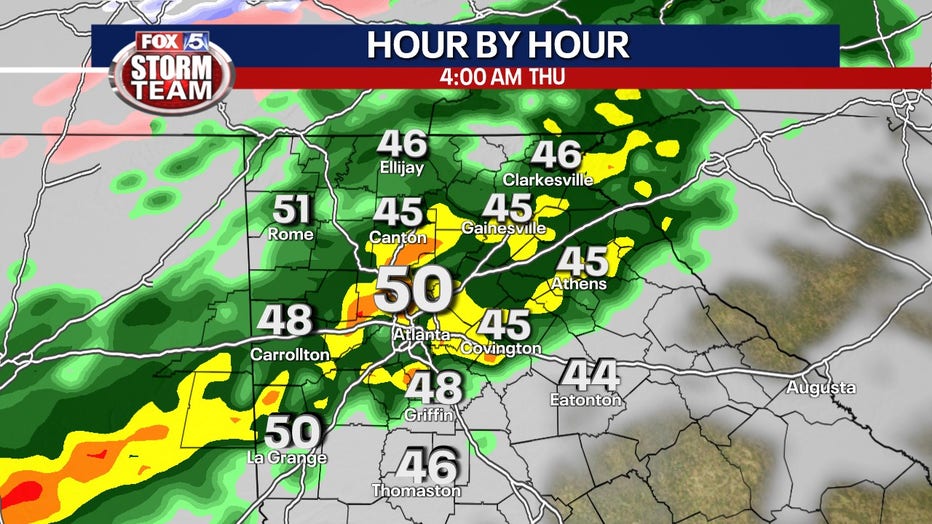
Thursday morning weather forecast
Thursday is beginning with a soggy start. Don't be tricked by the not-too-chilly temperatures this morning. This is the warmest we'll be all day. The numbers fall lower into the 40s this afternoon.
Wintry precipitation is less likely this weekend or at least less severe as models forecast lower moisture in the atmosphere following a line of storms on Wednesday evening and Thursday morning.
The FOX 5 Storm Team is tracking the chance of wintry precipitation. Keep up with the latest by downloading the FREE FOX 5 Storm Team app.
Expect storms overnight Wednesday and Thursday morning. Once the rain clears on Thursday afternoon, expect cloud cover to linger.
(FOX 5 Atlanta)
Temperatures will drop into the 30s on Friday.
There's a chance those lingering clouds squeeze out some snow flurries.
Neither of the main models the FOX 5 Storm Team is monitoring are as aggressive in forecasting a second consecutive weekend of snow and ice in North Georgia. Most of the wintry precipitation is expected to stay east of Georgia.
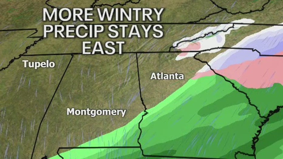
Snow and wintry precipitation could stay east of Georgia on Jan. 22.
As of Wednesday, models are backing off on the amount of moisture available to form wintry precipitation in north Georgia and metro Atlanta.
Saturday's temperatures project highs in the mid-40s and lows in the high 20s.
Stay weather-aware heading into the weekend as the FOX 5 Storm Team continues to track the event.
WATCH: FOX 5 NEWS LIVE COVERAGE