


Monday Evening Weather Update
A quick moving cold front will usher in some clouds and a few showers overnight. Temps will be milder toward morning and then Tuesday will be sunny, breezy and mild. Some winter weather possible by late week. Here is your latest outlook.
A quick moving cold front will usher in some clouds and a few showers overnight. Temps will be milder toward morning and then Tuesday will be sunny, breezy and mild. Some winter weather possible by late week. Here is your latest outlook.

Monday Afternoon Forecast Update
High clouds will increase later this afternoon with a few sprinkles possible late tonight.
High clouds will increase later this afternoon with a few sprinkles possible late tonight.

Monday morning forecast
Monday has seasonably cool weather with clouds increasing later on and possible sprinkles in the late-night hours.
Monday has seasonably cool weather with clouds increasing later on and possible sprinkles in the late-night hours.

Sunday evening forecast
Besides a weak upper wave increasing clouds a bit Monday night, expect a tranquil stretch of weather through midweek. Our next system arrives late Thursday-early Friday bringing the next chance for showers.
Besides a weak upper wave increasing clouds a bit Monday night, expect a tranquil stretch of weather through midweek. Our next system arrives late Thursday-early Friday bringing the next chance for showers.

Sunday morning forecast
Temperatures have dropped since yesterday and the wind chill is going to make it feel even colder.
Temperatures have dropped since yesterday and the wind chill is going to make it feel even colder.
Saturday evening forecast
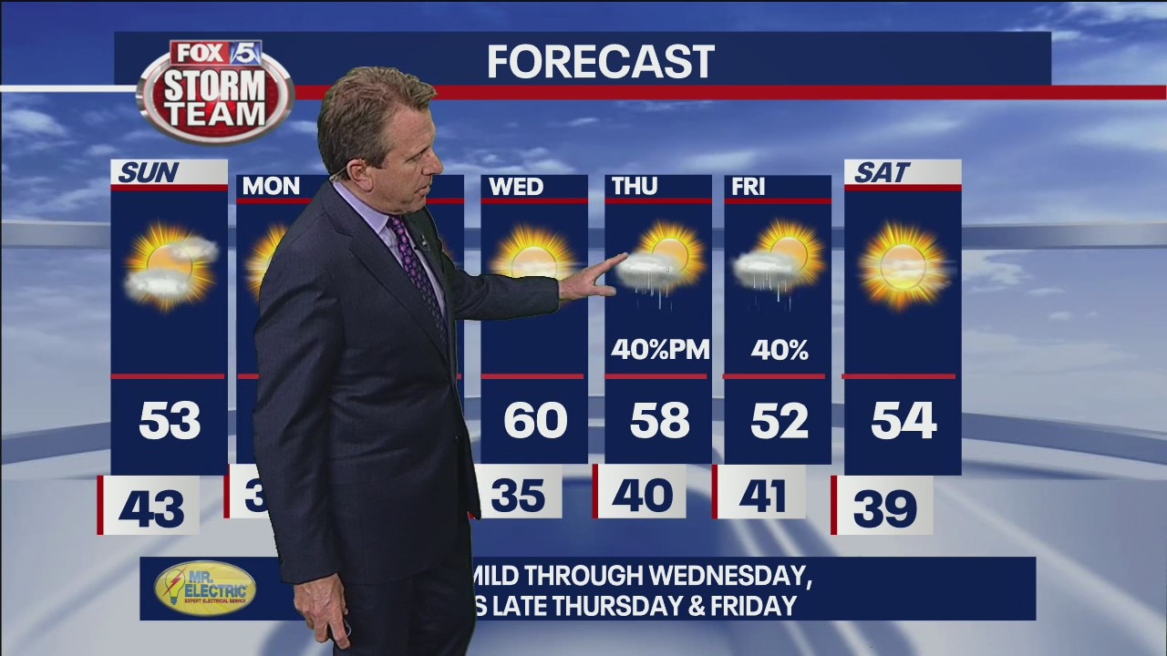
Highs Sunday return to the mid 40s to low 50s. The quiet, seasonably cool conditions will last for a few days next week. Models differ on timing but bring shower chance back late week with the arrival of a trough.
Highs Sunday return to the mid 40s to low 50s. The quiet, seasonably cool conditions will last for a few days next week. Models differ on timing but bring shower chance back late week with the arrival of a trough.
Saturday evening forecast
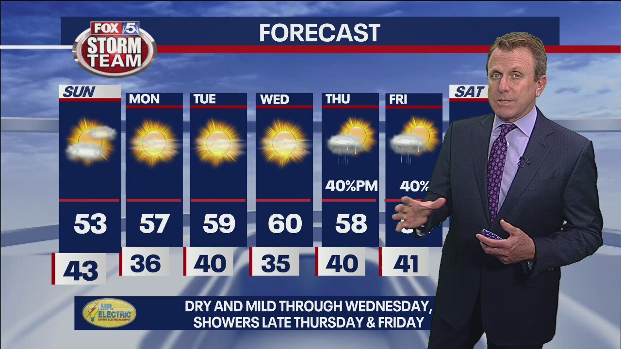
Highs Sunday return to the mid 40s to low 50s. The quiet, seasonably cool conditions will last for a few days next week. Models differ on timing but bring shower chance back late week with the arrival of a trough.
Highs Sunday return to the mid 40s to low 50s. The quiet, seasonably cool conditions will last for a few days next week. Models differ on timing but bring shower chance back late week with the arrival of a trough.

Saturday morning forecast
It's going to be a warm weekend with temperatures are a good 20 degrees warmer than the seasonal norms and highs in the low 60s.
It's going to be a warm weekend with temperatures are a good 20 degrees warmer than the seasonal norms and highs in the low 60s.

Friday Night Forecast
Nice break from the rain Saturday morning and afternoon, but showers are possible after sunset.
Nice break from the rain Saturday morning and afternoon, but showers are possible after sunset.

Friday morning forecast
We've got a stormy start to 2021 planned with stronger storms coming in later this afternoon.
We've got a stormy start to 2021 planned with stronger storms coming in later this afternoon.

Thursday Night Forecast
Strong to severe storms are likely Friday with multiple rounds of moderate to heavy rain. Remain weather aware with the FOX 5 Storm Team app.
Strong to severe storms are likely Friday with multiple rounds of moderate to heavy rain. Remain weather aware with the FOX 5 Storm Team app.

New Years Eve forecast
A rainy New Years Eve Day followed by a mild, mostly dry week to start off 2021.
A rainy New Years Eve Day followed by a mild, mostly dry week to start off 2021.

Wednesday Evening Weather Update
Clouds overnight with a few spotty light showers and milder temps. Scattered showers on New Year's Eve Day with highs reaching to around 60. A few showers will ring in 2021 at midnight. Rain and storms are likely on New Year's Day with a few strong to severe storms by afternoon. Here is the breakdown.
Clouds overnight with a few spotty light showers and milder temps. Scattered showers on New Year's Eve Day with highs reaching to around 60. A few showers will ring in 2021 at midnight. Rain and storms are likely on New Year's Day with a few strong to severe storms by afternoon. Here is the breakdown.

Wednesday Afternoon Weather Update
Cloudy, breezy and cool with a few light showers possible. Big storm system Thursday and Friday with strong to severe storms possible.
Cloudy, breezy and cool with a few light showers possible. Big storm system Thursday and Friday with strong to severe storms possible.

Wednesday morning forecast
Above average temperatures on Wednesday, with rain and possible storms on New Year's Eve and New Year's Day
Above average temperatures on Wednesday, with rain and possible storms on New Year's Eve and New Year's Day

Tuesday night forecast
Rain and storms likely Thursday through Friday. Unsettled Saturday and Sunday.
Rain and storms likely Thursday through Friday. Unsettled Saturday and Sunday.
Tuesday evening weather update
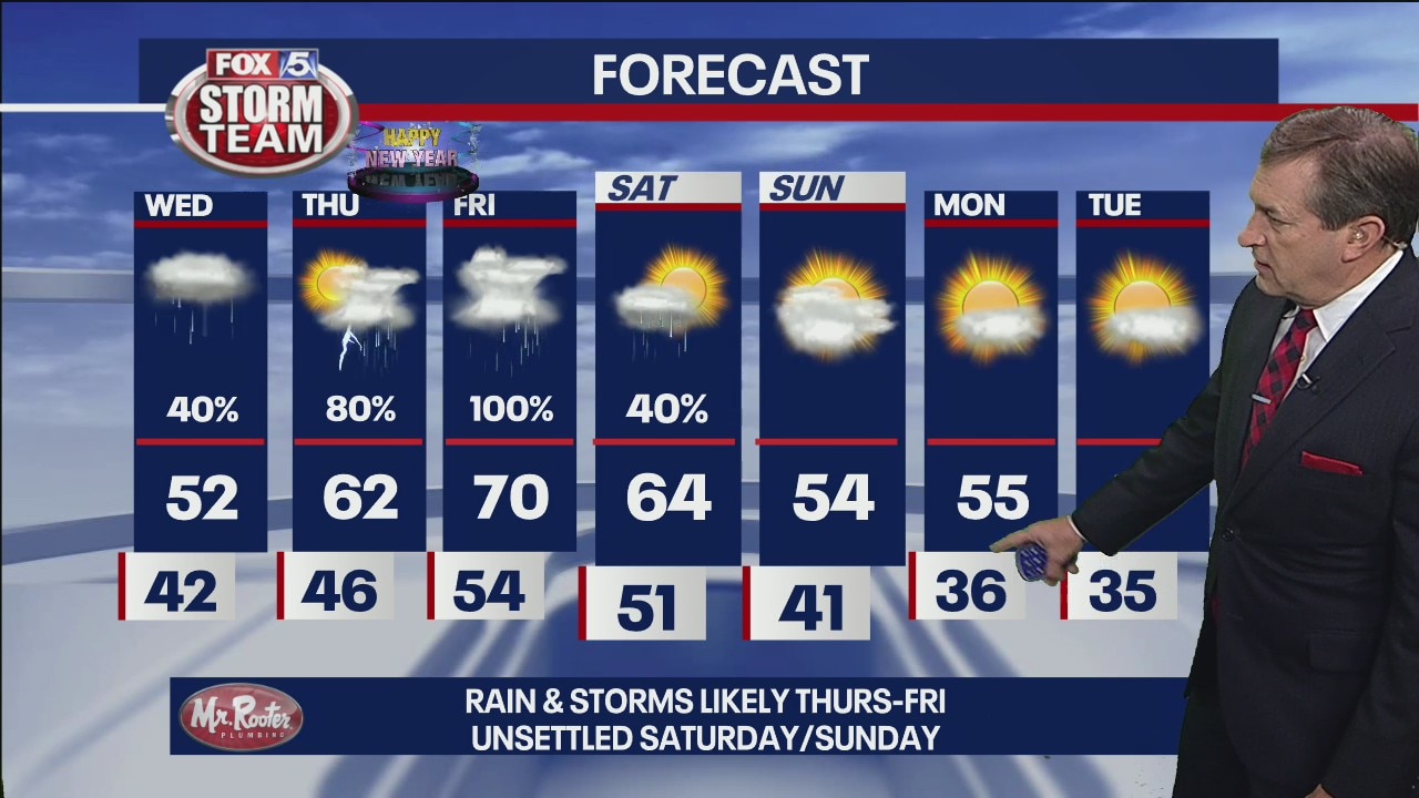
Rain and storms likely Thursday-Friday. Unsettled Saturday-Sunday.
Rain and storms likely Thursday-Friday. Unsettled Saturday-Sunday.

Tuesday morning forecat
A foggy start to Tuesday followed by milder temperatures before ending the year with rain
A foggy start to Tuesday followed by milder temperatures before ending the year with rain

Monday night forecast
Rain and storms for New Year's, mild to warm temperatures.
Rain and storms for New Year's, mild to warm temperatures.

Monday Evening Weather Update
Breaks in the clouds tonight and into Tuesday morning with lows in the 30s. A mix of sun and clouds on Tuesday with highs well into the 50s. Tracking rain and t-storms for the New Year. Here is the latest.
Breaks in the clouds tonight and into Tuesday morning with lows in the 30s. A mix of sun and clouds on Tuesday with highs well into the 50s. Tracking rain and t-storms for the New Year. Here is the latest.