

Saturday Forecast
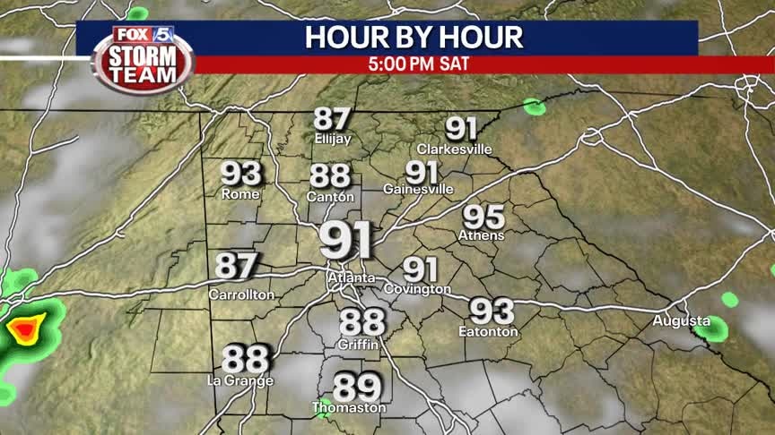
Hot and humid with temperatures feeling near or above 100 degrees. A few pop-up storms are possible, but most will stay dry.
Hot and humid with temperatures feeling near or above 100 degrees. A few pop-up storms are possible, but most will stay dry.
Friday Afternoon Forecast
Heat Advisory in effect until 8pm this evening for heat index values as high as 108.
Heat Advisory in effect until 8pm this evening for heat index values as high as 108.
Friday morning forecast
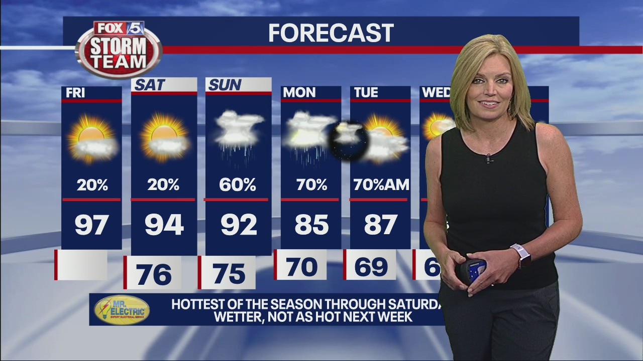
Your air conditioning will be working overtime today. Do your best to stay cool and stay safe in this heat.
Your air conditioning will be working overtime today. Do your best to stay cool and stay safe in this heat.
Thursday Evening Weather Update
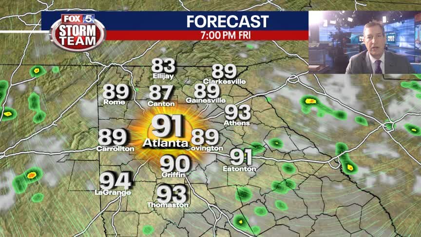
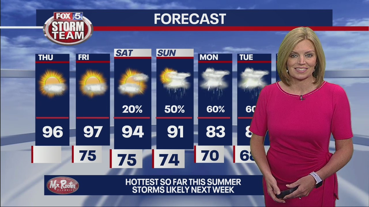
More heat and humidity in the days ahead. But there is some relief over the horizon. Here is the latest on our summer weather thru the Weekend.
More heat and humidity in the days ahead. But there is some relief over the horizon. Here is the latest on our summer weather thru the Weekend.
Thursday Afternoon Forecast
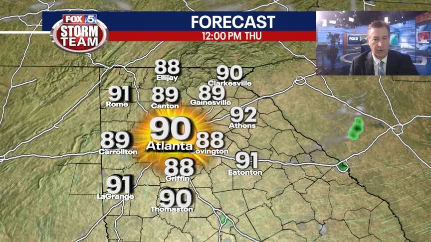
Heat Advisory in effect today and tomorrow for heat index values to 106.
Heat Advisory in effect today and tomorrow for heat index values to 106.
Thursday morning forecast
It is all about the heat this afternoon. A Heat Advisory is in effect from noon until 8pm. Expect one tomorrow too.
It is all about the heat this afternoon. A Heat Advisory is in effect from noon until 8pm. Expect one tomorrow too.
Wednesday Evening Weather Update
The hot temps will get even hotter in the days ahead. T-Storms will be scarce, so nights will be slow to cool. Here is the latest weather outlook into the Weekend.
The hot temps will get even hotter in the days ahead. T-Storms will be scarce, so nights will be slow to cool. Here is the latest weather outlook into the Weekend.
Wednesday Afternoon Forecast
More sun than clouds today with heat index values near 100!
More sun than clouds today with heat index values near 100!
Wednesday morning forecast
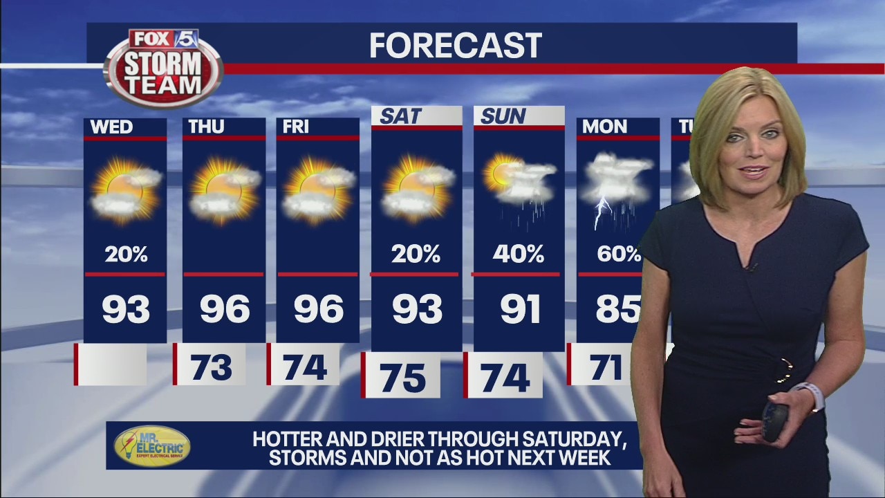
Hotter and drier are the key words for the next few days. After some patchy, but dense, morning fog, we'll have a sunny and steamy day.
Hotter and drier are the key words for the next few days. After some patchy, but dense, morning fog, we'll have a sunny and steamy day.
Tuesday Evening Weather Update
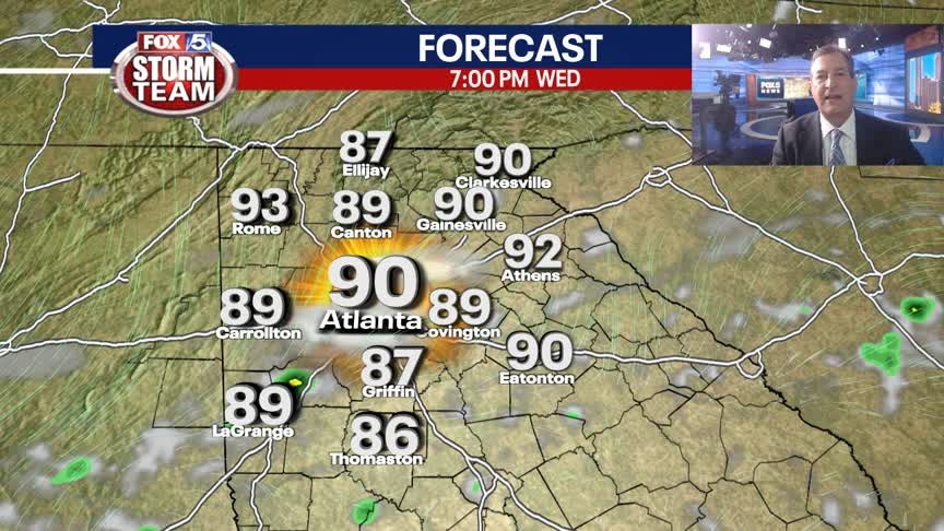
Strong to severe t-storms this evening across metro ATL will give way to warm and muggy conditions overnight and into Wednesday. The hottest days of the year are straight ahead. Here is the breakdown.
Strong to severe t-storms this evening across metro ATL will give way to warm and muggy conditions overnight and into Wednesday. The hottest days of the year are straight ahead. Here is the breakdown.
Tuesday Afternoon Forecast
High heat & humidity will produce heat index values above 100 in some spots this afternoon.
High heat & humidity will produce heat index values above 100 in some spots this afternoon.
Tuesday morning forecast
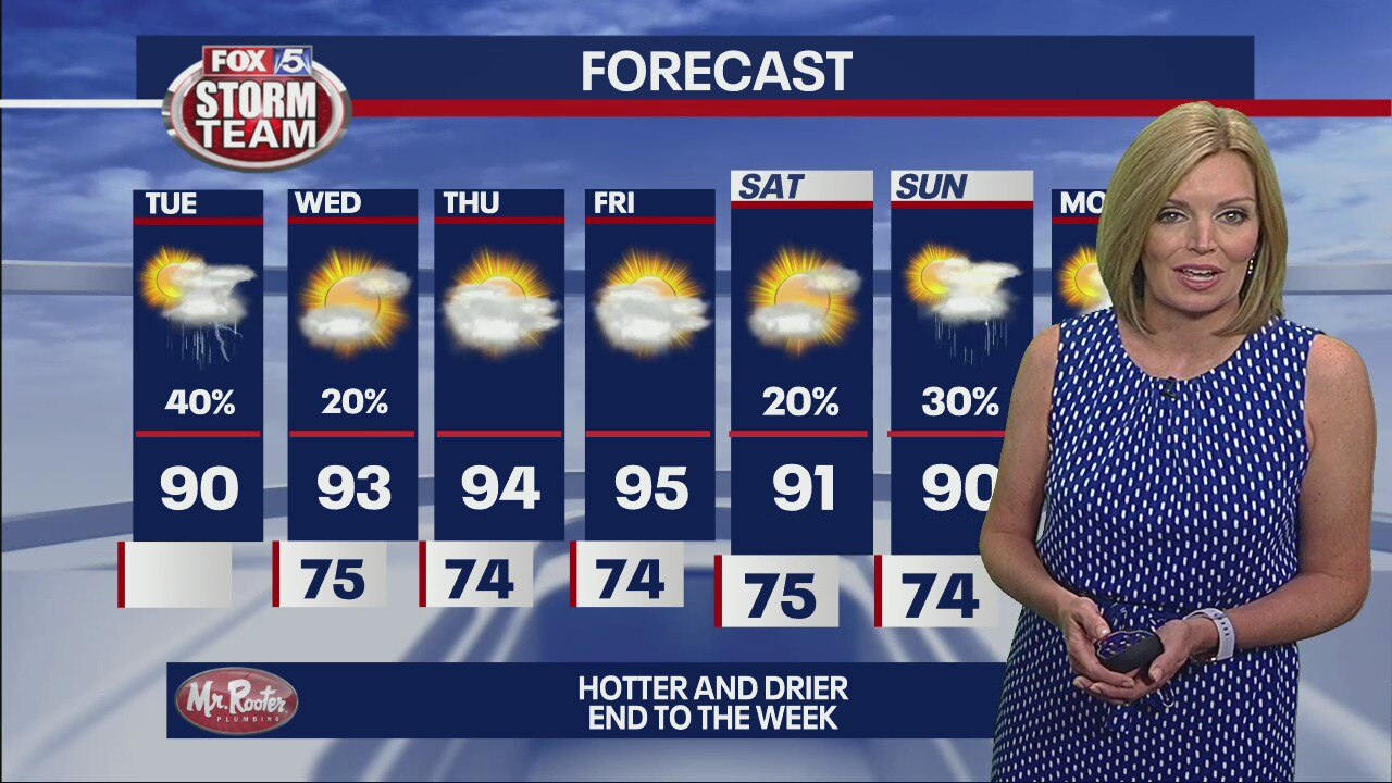
We're setting up for scattered downpours again especially in the afternoon and evening. They may be numerous enough to keep some temperatures below 90, but the humidity will make it feel like it is in the 90s anyway.
We're setting up for scattered downpours again especially in the afternoon and evening. They may be numerous enough to keep some temperatures below 90, but the humidity will make it feel like it is in the 90s anyway.
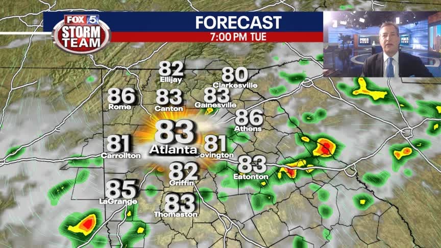
Monday Evening Weather Update
Hot and sticky into our Monday night with temps slow to cool toward morning. A few t-storms on Tuesday, otherwise hot again and temps will be rising toward the end of the week. Here is the latest weather outlook.
Hot and sticky into our Monday night with temps slow to cool toward morning. A few t-storms on Tuesday, otherwise hot again and temps will be rising toward the end of the week. Here is the latest weather outlook.
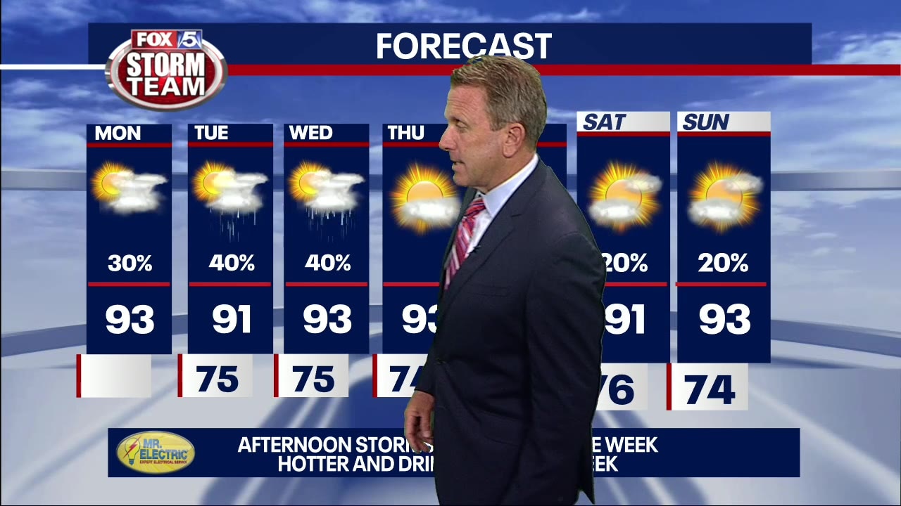
Monday Afternoon Forecast
Hazy, hot and humid with isolated t-showers this afternoon.
Hazy, hot and humid with isolated t-showers this afternoon.
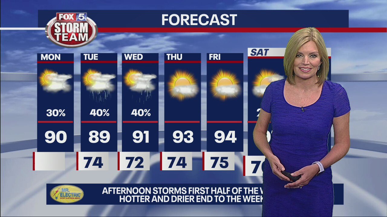
Monday morning forecast
Much like the last few days, there won't necessarily be many storms. But the ones we do get will move slowly and bring heavy rain for an extended period of time.
Much like the last few days, there won't necessarily be many storms. But the ones we do get will move slowly and bring heavy rain for an extended period of time.
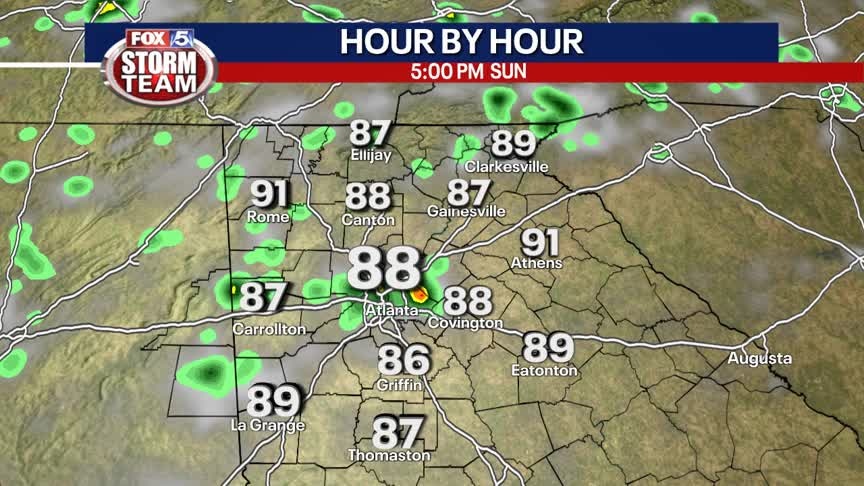
Sunday Forecast
Hot and humid with pop-up storms. The hazy and smoky conditions will stick around a few more days.
Hot and humid with pop-up storms. The hazy and smoky conditions will stick around a few more days.
Saturday Forecast
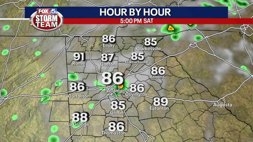
Hot and humid with hit or miss storms. The hazy and smoky conditions will stick around through the weekend.
Hot and humid with hit or miss storms. The hazy and smoky conditions will stick around through the weekend.
Friday Afternoon Forecast
Smoke from the western wildfires will continue to spill into north Georgia.
Smoke from the western wildfires will continue to spill into north Georgia.
Friday morning forecast
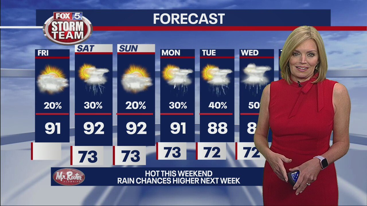
Prepare a hazy, hot, and day with wildfire smoke from out west affecting the metro Atlanta skies. Like yesterday, only a few will get an storm in the afternoon or evening, But the ones that do develop will move slowly and bring heavy rain.
Prepare a hazy, hot, and day with wildfire smoke from out west affecting the metro Atlanta skies. Like yesterday, only a few will get an storm in the afternoon or evening, But the ones that do develop will move slowly and bring heavy rain.
Thursday Evening Weather Update
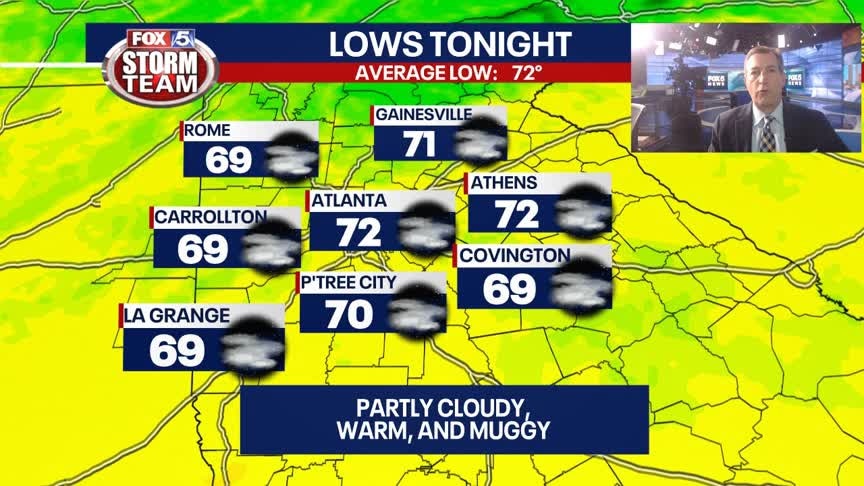
Slow to cool overnight with lows around 70, more heat on Friday as highs reach the upper 80s to low 90s. It will be hazy and smokey thanks to the western wildfires. Here is the breakdown.
Slow to cool overnight with lows around 70, more heat on Friday as highs reach the upper 80s to low 90s. It will be hazy and smokey thanks to the western wildfires. Here is the breakdown.