


Weekend forecast
Dry and cloudy weekend. Thunder showers possible Tuesday and Wednesday.
Dry and cloudy weekend. Thunder showers possible Tuesday and Wednesday.
Friday Evening Forecast
Warmer temperatures return Saturday, but the sunshine doesn't.
Warmer temperatures return Saturday, but the sunshine doesn't.

Friday evening forecast
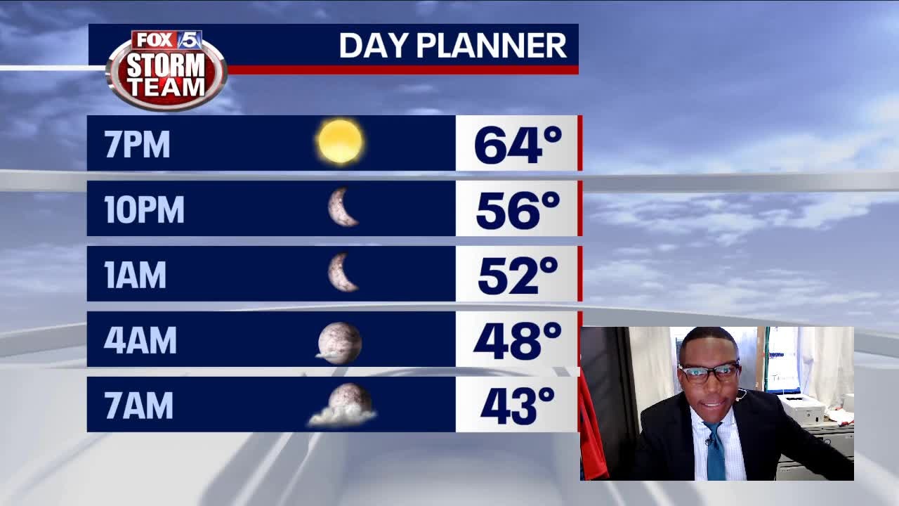
Temperatures will fall into the high 40s Friday night before clouds increase Saturday.
Temperatures will fall into the high 40s Friday night before clouds increase Saturday.

Friday Afternoon Forecast
Sunny, breezy and cooler this afternoon.
Sunny, breezy and cooler this afternoon.

Friday morning weather forecast
It's much cooler this morning in the wake of yesterday's rain, but it will be a nice April day and a nice weekend. A northwest breeze and sunshine today will put afternoon temperatures in the low to mid 60s.
It's much cooler this morning in the wake of yesterday's rain, but it will be a nice April day and a nice weekend. A northwest breeze and sunshine today will put afternoon temperatures in the low to mid 60s.

Thursday night forecast
Dry weather for the rest of the week. The extended outlook doesn't bode well for The Master's next week.
Dry weather for the rest of the week. The extended outlook doesn't bode well for The Master's next week.

Thursday Evening Forecast
Cool breeze and clear skies will send temperatures into the 40s tonight. Short-lived sunshine returns Friday.
Cool breeze and clear skies will send temperatures into the 40s tonight. Short-lived sunshine returns Friday.

Thursday morning weather forecast
After a night full of rain and heavy winds, things will calm down late Thursday morning and the afternoon will turn out pleasant.
After a night full of rain and heavy winds, things will calm down late Thursday morning and the afternoon will turn out pleasant.

Wednesday Evening Weather Update
Strong to severe t-storms overnight. Damaging winds and heavy rain will be the main threats. Here is the latest.
Strong to severe t-storms overnight. Damaging winds and heavy rain will be the main threats. Here is the latest.

Wednesday afternoon forecast
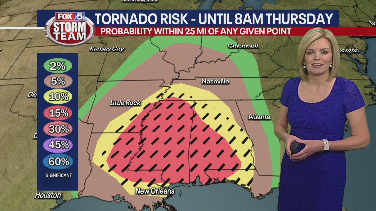
Heavy rain and clouds on the way to Georgia. Strong storms overnight with risk of damaging winds, hail and tornadoes. The storm should weaken as it enters the state.
Heavy rain and clouds on the way to Georgia. Strong storms overnight with risk of damaging winds, hail and tornadoes. The storm should weaken as it enters the state.
Wednesday morning weather forecast
The key words for Wednesday will be windy and warm with temperatures in the 80s. There is no rain or storms yet, but we'll watch them explode today and tonight through Louisiana into Alabama.
The key words for Wednesday will be windy and warm with temperatures in the 80s. There is no rain or storms yet, but we'll watch them explode today and tonight through Louisiana into Alabama.
Tuesday Evening Weather Update
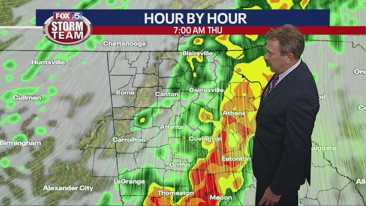
Clouds roll in tonight with mlder temps. Warm and windy on Wednesday with highs into the 80s. Storms arrive late Wed nite into Thursday. Some storms will carry damaging winds and heavy rain. Here is the breakdown.
Clouds roll in tonight with mlder temps. Warm and windy on Wednesday with highs into the 80s. Storms arrive late Wed nite into Thursday. Some storms will carry damaging winds and heavy rain. Here is the breakdown.
Tuesday afternoon weather forecast
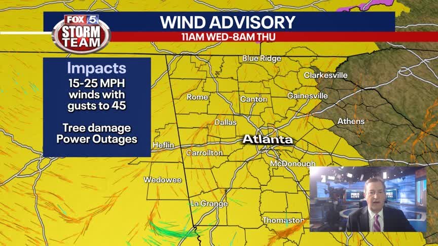
Wind advisory on Wednesday ahead of a cold front working its way from the west. Round of thunderstorms early Thursday morning in northwest Georgia.
Wind advisory on Wednesday ahead of a cold front working its way from the west. Round of thunderstorms early Thursday morning in northwest Georgia.

Tuesday Afternoon Forecast
Mostly sunny skies and temperatures in the 70's for this afternoon.
Mostly sunny skies and temperatures in the 70's for this afternoon.

Tuesday morning weather forecast
It's a bit cooler over northeast Georgia than surrounding areas today. Most of us are feeling the impact of a warm front today, and it gets even warmer tomorrow.
It's a bit cooler over northeast Georgia than surrounding areas today. Most of us are feeling the impact of a warm front today, and it gets even warmer tomorrow.

Monday Night Weather Update
Calm and cool overnight with lows in the 40s. Sunny and warmer on Tuesday, most areas in the low 70s, cooler to the NE of ATL. Warmer still on Wed. with temps climbing to around 80. Rain and storms overnight and into Thursday morniing. Here is the timeline.
Calm and cool overnight with lows in the 40s. Sunny and warmer on Tuesday, most areas in the low 70s, cooler to the NE of ATL. Warmer still on Wed. with temps climbing to around 80. Rain and storms overnight and into Thursday morniing. Here is the timeline.
Monday afternoon forecast
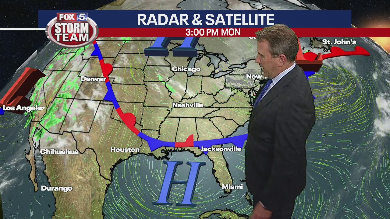
Sunshine before storms return mid-week. Wednesday could set temperatures in the 80s before storms come in overnight.
Sunshine before storms return mid-week. Wednesday could set temperatures in the 80s before storms come in overnight.

Monday midday forecast
High pollen counts, but not as bad as usually for the time of year. Warm, sunny weather early this week. Tracking severe weather threat mid-week.
High pollen counts, but not as bad as usually for the time of year. Warm, sunny weather early this week. Tracking severe weather threat mid-week.
Monday morning weather forecast
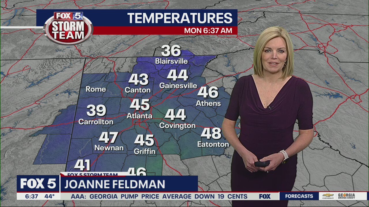
Monday is virtually a repeat of Sunday's nice, spring day with a chilly morning transitioning into a mild afternoon in the 60s. Temperatures rise considerably through Wednesday, when we should reach the low 80s.
Monday is virtually a repeat of Sunday's nice, spring day with a chilly morning transitioning into a mild afternoon in the 60s. Temperatures rise considerably through Wednesday, when we should reach the low 80s.

Sunday night forecast
Temperatures are expected to drop into the low 40s overnight.
Temperatures are expected to drop into the low 40s overnight.