

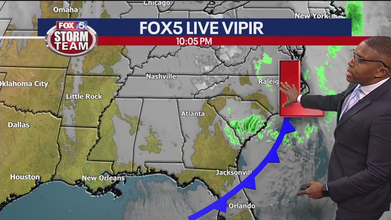
Friday evening forecast
Some wintery precipitation is expected overnight for extreme north Georgia, but the cold settles in elsewhere. Winds will make it feel a whole lot colder than it is. A warm up is on the way as well as rain midweek next week.
Some wintery precipitation is expected overnight for extreme north Georgia, but the cold settles in elsewhere. Winds will make it feel a whole lot colder than it is. A warm up is on the way as well as rain midweek next week.

Friday midday forecast
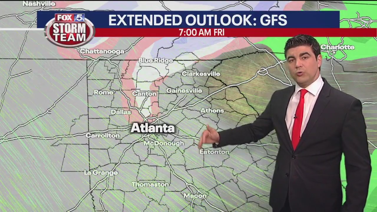
Northeast Georgia could see some measurable snowfall as temperatures drop overnight. It will stay cool but be less windy on Saturday.
Northeast Georgia could see some measurable snowfall as temperatures drop overnight. It will stay cool but be less windy on Saturday.
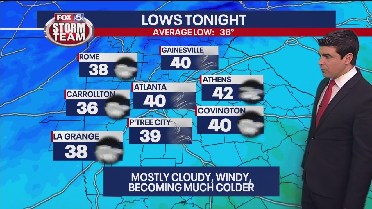
Thursday forecast update
Turning windy and much colder. Thunderstorms again next Tuesday.
Turning windy and much colder. Thunderstorms again next Tuesday.
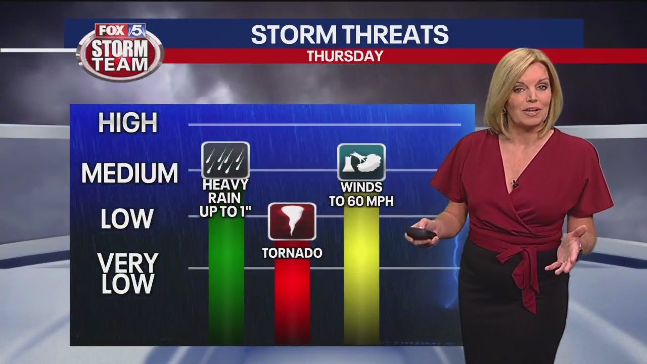
Thursday morning weather forecast
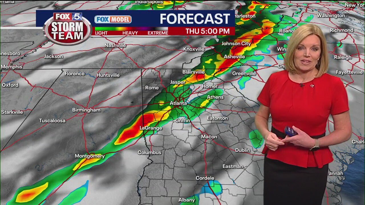
The severe weather threat in north Georgia has increased to a level 3 as a line of storms heads to hit the state this afternoon. Expect rain and a lot of wind.
The severe weather threat in north Georgia has increased to a level 3 as a line of storms heads to hit the state this afternoon. Expect rain and a lot of wind.

Wednesday Evening Weather Update
Cloudy and warm overnight with morning fog. A line of rain and storms will impact North Georgia on Thursday with some strong to severe storms expected. Time line is early afternoon thru sunset. Threats will be damaging winds, heavy rain and possible brief tornado. Much colder on Friday. Windy too.
Cloudy and warm overnight with morning fog. A line of rain and storms will impact North Georgia on Thursday with some strong to severe storms expected. Time line is early afternoon thru sunset. Threats will be damaging winds, heavy rain and possible brief tornado. Much colder on Friday. Windy too.

Midday forecast update
Chance of severe storms Thursday. Colder to begin the weekend.
Chance of severe storms Thursday. Colder to begin the weekend.

Wednesday morning weather forecast
Things are quiet and cloudy now, but that's going to be changing by Thursday afternoon when the weather gets messy.
Things are quiet and cloudy now, but that's going to be changing by Thursday afternoon when the weather gets messy.
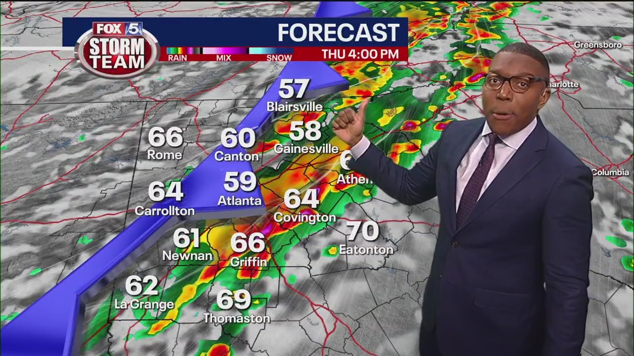
Tuesday evening forecast
Season temperature and weather is in store for Wednesday, but the FOX 5 Storm Team is monitoring a dynamic storm that is capable of producing strong to severe storms on Thursday afternoon.
Season temperature and weather is in store for Wednesday, but the FOX 5 Storm Team is monitoring a dynamic storm that is capable of producing strong to severe storms on Thursday afternoon.
Tuesday morning weather forecast
Tuesday is starting out cold and quiet with some frost probably popping up on your car's windshield.
Tuesday is starting out cold and quiet with some frost probably popping up on your car's windshield.

Monday morning weather forecast
Today we're getting lots of sunshine with temperatures warming up until it hits the mid-50s.
Today we're getting lots of sunshine with temperatures warming up until it hits the mid-50s.

Sunday evening forecast update
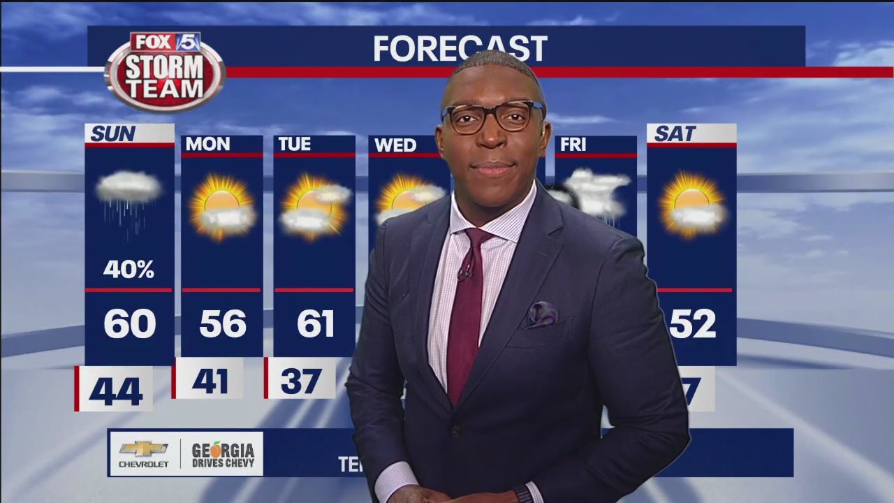
Expect a brisk and chilly start to Monday with sunshine and seasonable temperatures. Temperatures will climb into the 60s during the middle of the week ahead of a vigorous storm system expected to hit Thursday. Temperatures will take a steep fall going into next weekend.
Expect a brisk and chilly start to Monday with sunshine and seasonable temperatures. Temperatures will climb into the 60s during the middle of the week ahead of a vigorous storm system expected to hit Thursday. Temperatures will take a steep fall going into next weekend.

Sunday Forecast
Occasional showers with cooler temperatures.
Occasional showers with cooler temperatures.
Sunday morning forecast
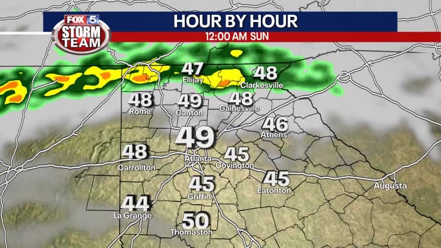
Rain falls in north Georgia with some impactful downpours in some areas. Temperatures will be slow to warm throughout the day because of the lack of sunshine.
Rain falls in north Georgia with some impactful downpours in some areas. Temperatures will be slow to warm throughout the day because of the lack of sunshine.
Saturday evening forecast update
Pack an umbrella, showers return to our area Sunday. Rainfall amounts will be very low. Temperatures will remain above average through next week with storms possibly returning Thursday into Friday.
Pack an umbrella, showers return to our area Sunday. Rainfall amounts will be very low. Temperatures will remain above average through next week with storms possibly returning Thursday into Friday.
Saturday Forecast
Sunshine with temperatures in the 50s and 60s. Make it a great day before the rain returns Sunday.
Sunshine with temperatures in the 50s and 60s. Make it a great day before the rain returns Sunday.

Saturday morning forecast
Saturday is forecasted to be the driest day of the weekend. Rain on the way overnight Saturday into Sunday.
Saturday is forecasted to be the driest day of the weekend. Rain on the way overnight Saturday into Sunday.
Forecast Update
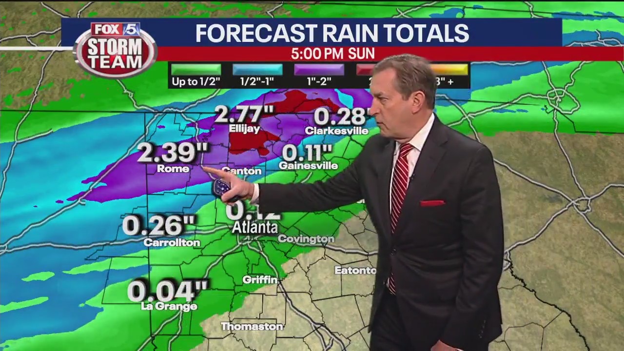
Showers return on Sunday. Above average temperatures heading through next week.
Showers return on Sunday. Above average temperatures heading through next week.
Forecast Update
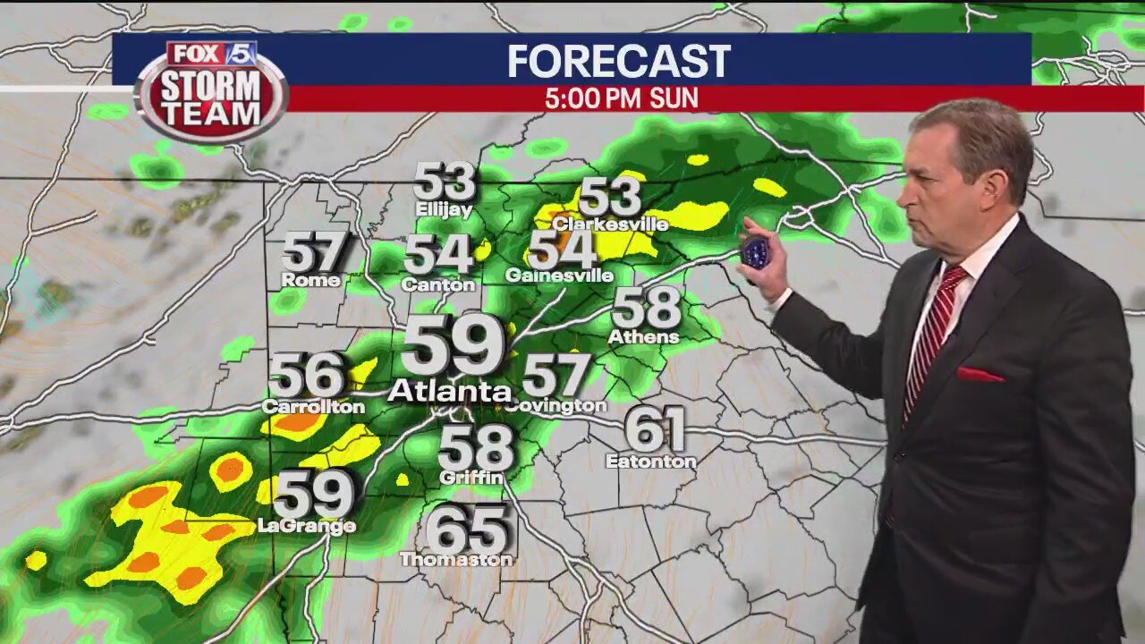
Showers return on Sunday. Temperatures above normal.
Showers return on Sunday. Temperatures above normal.
Friday midday forecast
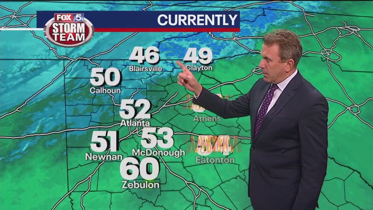
Friday provides a break from record highs of the past week, but things will likely warm up against this weekend.
Friday provides a break from record highs of the past week, but things will likely warm up against this weekend.
Friday morning forecast
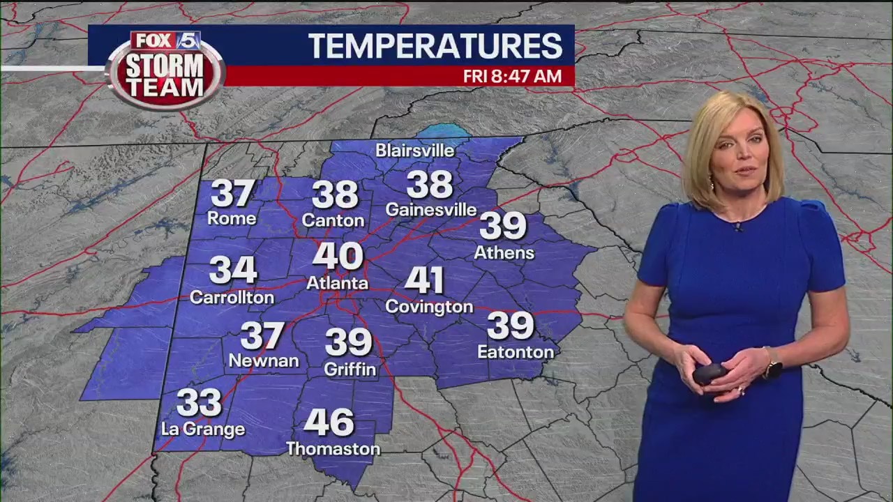
The day is off to a cool start, but expect things to warm up again in the coming days. There's rain in the forecast this weekend.
The day is off to a cool start, but expect things to warm up again in the coming days. There's rain in the forecast this weekend.