

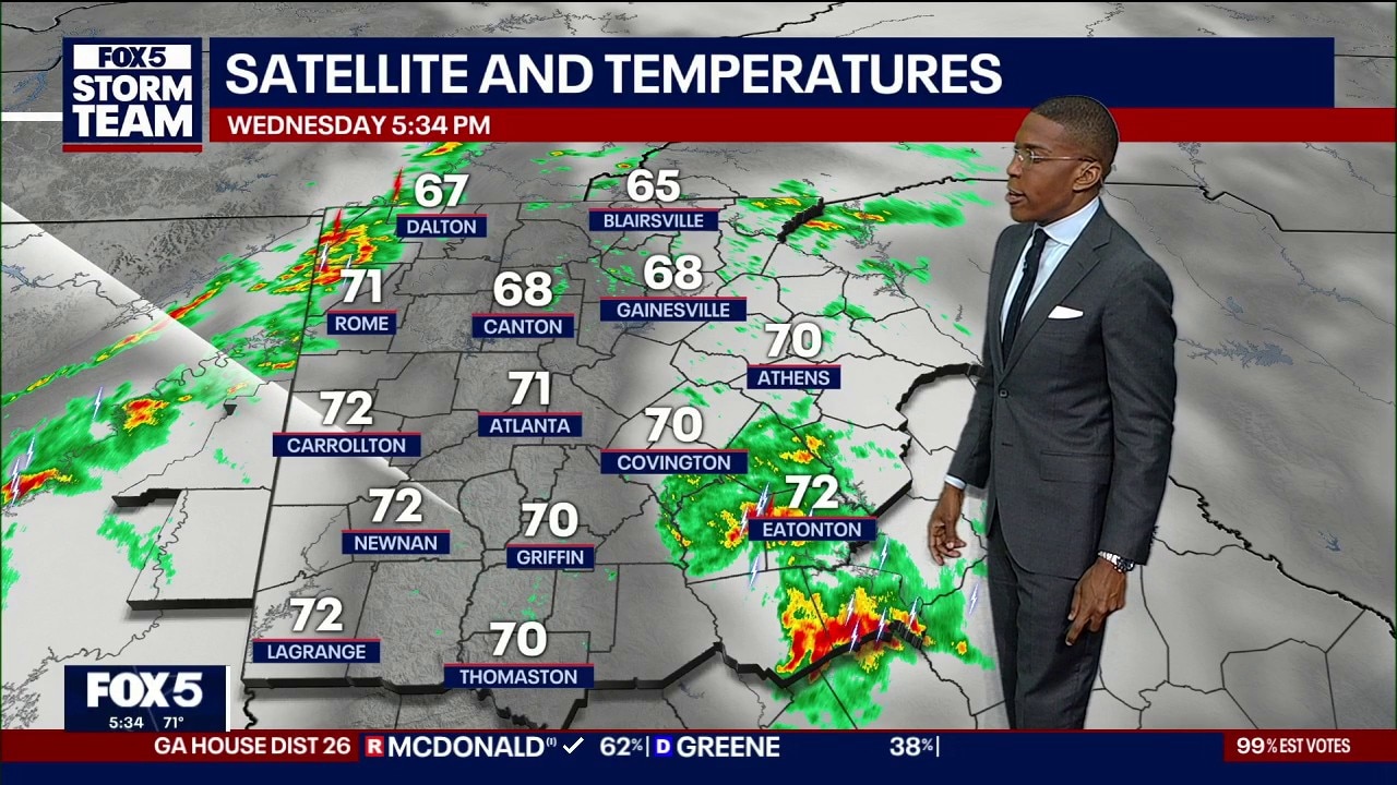
Wednesday evening forecast
A line of severe storms moving across west Georgia toward Interstate 20 and Interstate 85 threatens saturated communities with heavy lightning, downed trees, and isolated tornado rotation before calmer weather arrives Thursday
A line of severe storms moving across west Georgia toward Interstate 20 and Interstate 85 threatens saturated communities with heavy lightning, downed trees, and isolated tornado rotation before calmer weather arrives Thursday
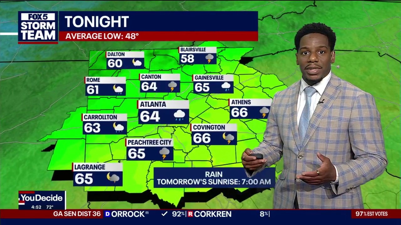
Wednesday afternoon weather forecast
Severe drought across north Georgia gave way to widespread roadway ponding as a storm front triggered flood risks and threatened to dump more than 2 inches of rain across the region before midnight Wednesday.
Severe drought across north Georgia gave way to widespread roadway ponding as a storm front triggered flood risks and threatened to dump more than 2 inches of rain across the region before midnight Wednesday.
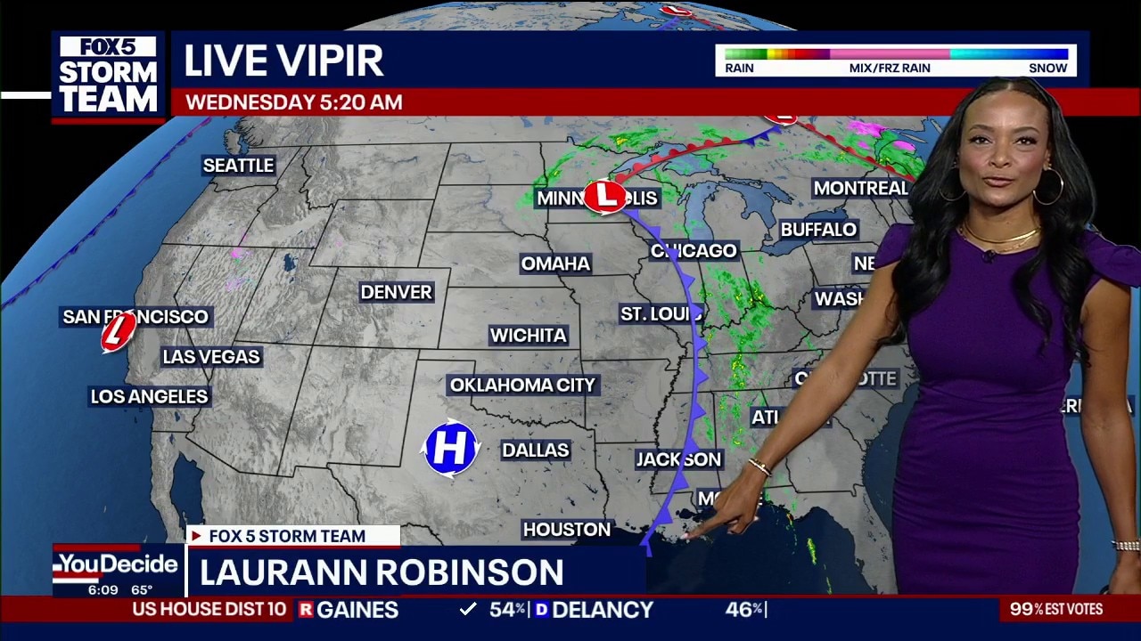
Wednesday morning weather forecast
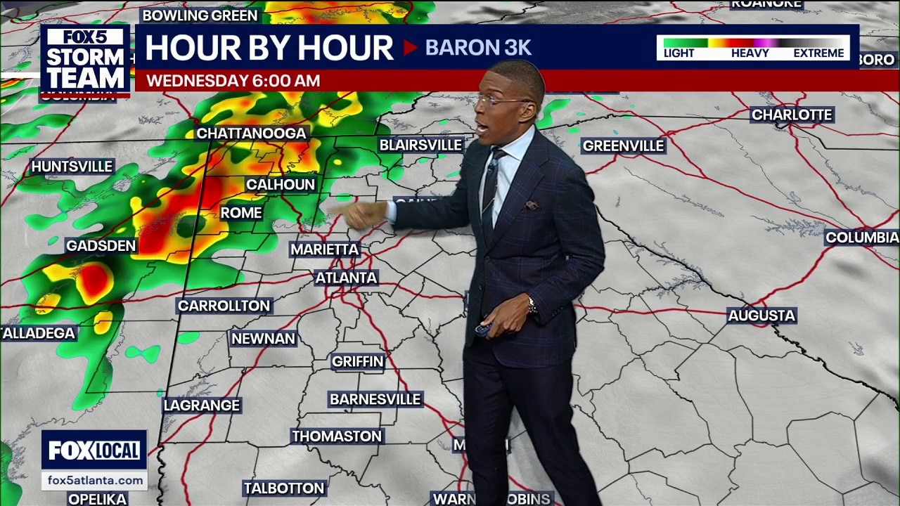
A powerful cold front moving across the country is bringing showers and thunderstorms to metro Atlanta and North Georgia on Wednesday, with some storms potentially turning severe. Rain is expected to spread eastward throughout the day, bringing heavy downpours, lightning, gusty winds and the possibility of damaging winds, localized flooding and a few brief tornadoes. North Georgia is under a Level 1 out of 5 severe weather risk, with isolated stronger storms possible during the afternoon and evening. Scattered showers and storms could linger overnight and into early Thursday.
A powerful cold front moving across the country is bringing showers and thunderstorms to metro Atlanta and North Georgia on Wednesday, with some storms potentially turning severe. Rain is expected to spread eastward throughout the day, bringing heavy downpours, lightning, gusty winds and the possibility of damaging winds, localized flooding and a few brief tornadoes. North Georgia is under a Level 1 out of 5 severe weather risk, with isolated stronger storms possible during the afternoon and evening. Scattered showers and storms could linger overnight and into early Thursday.
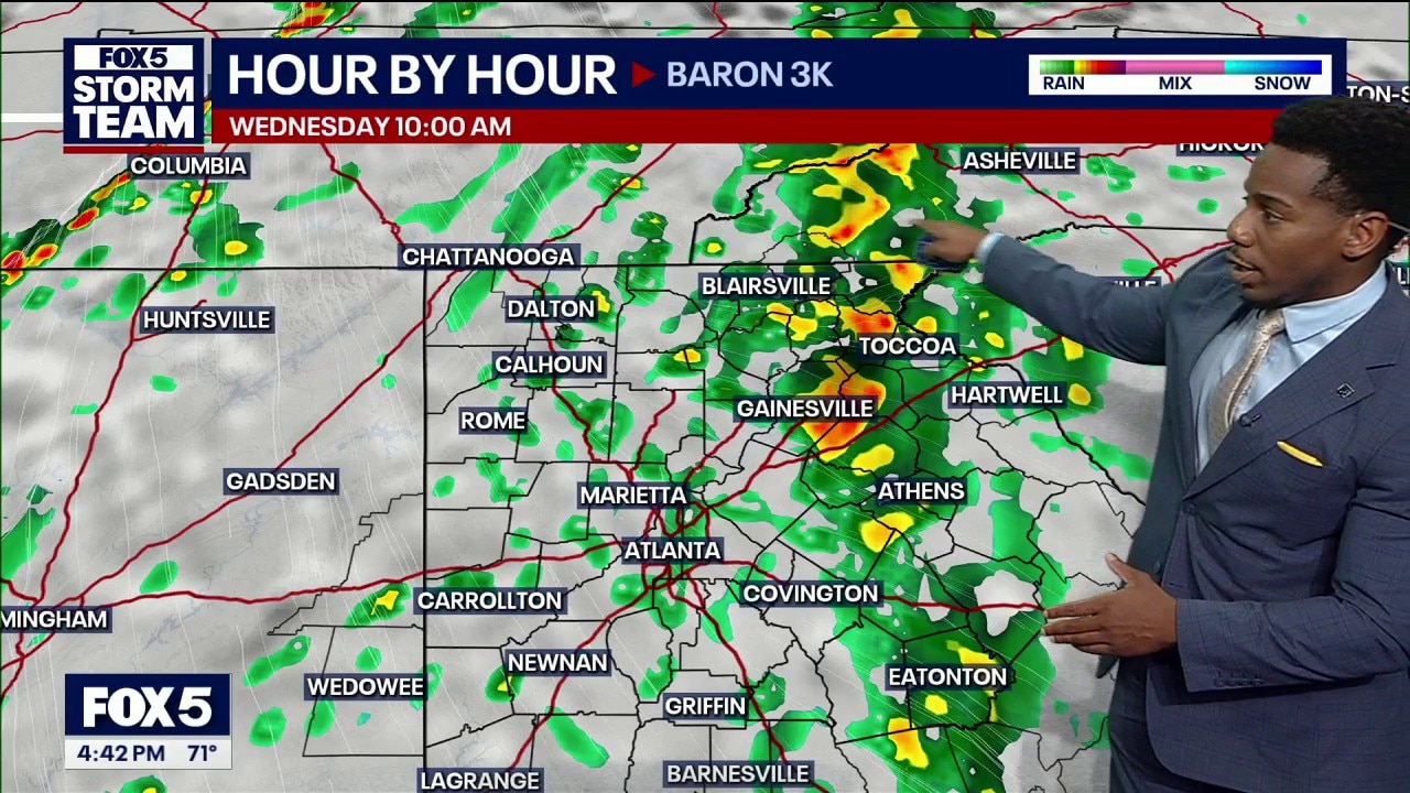
Tuesday evening weather forecast
A frontal boundary bringing up to two inches of rain and flood risks to northern Georgia follows a 1-in-1,000-year rain event in Brevard County, Florida, as forecasters monitor tropical energy south of Bermuda.
A frontal boundary bringing up to two inches of rain and flood risks to northern Georgia follows a 1-in-1,000-year rain event in Brevard County, Florida, as forecasters monitor tropical energy south of Bermuda.
Tuesday midday weather forecast
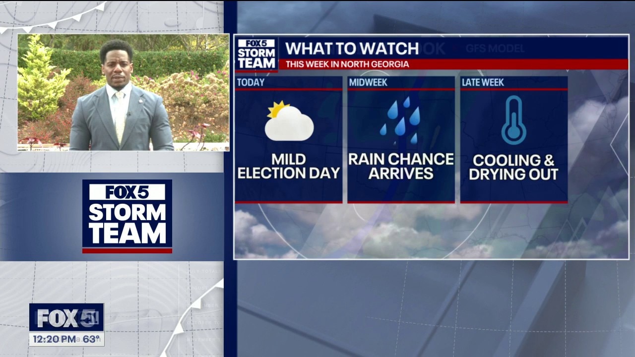
North Georgia will have a mostly cloudy, cooler Election Day, with highs near 70 to 72 degrees in Atlanta and a few showers possible south of I-20. Rain becomes more widespread Wednesday and could bring 1 to 4 inches in localized areas, especially north and east, raising the risk of flash flooding in low-lying spots. Showers may linger into Thursday morning before sunshine returns. A cold front will bring cooler, drier weather for the weekend, with temperatures dropping into the 60s.
North Georgia will have a mostly cloudy, cooler Election Day, with highs near 70 to 72 degrees in Atlanta and a few showers possible south of I-20. Rain becomes more widespread Wednesday and could bring 1 to 4 inches in localized areas, especially north and east, raising the risk of flash flooding in low-lying spots. Showers may linger into Thursday morning before sunshine returns. A cold front will bring cooler, drier weather for the weekend, with temperatures dropping into the 60s.
Tuesday morning weather forecast
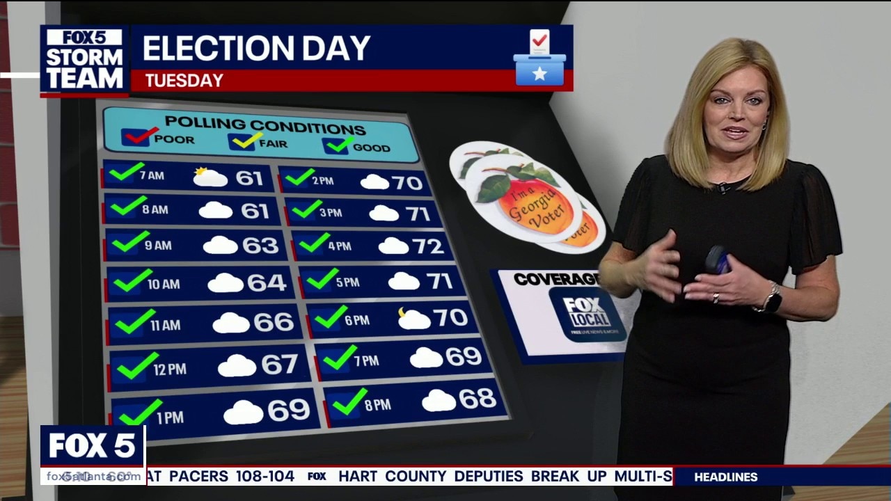
Election Day will be mostly cloudy and breezy across metro Atlanta, with highs in the low 70s and only a small chance of a sprinkle or stray shower south and southwest of the city late in the day. A cold front is expected to bring heavier rain and scattered storms Wednesday, with some areas possibly seeing 1 to 2 inches or more and localized flash flooding in poor-drainage areas. Showers should move out early Thursday, followed by sunshine through the weekend and cooler temperatures Sunday and Monday.
Election Day will be mostly cloudy and breezy across metro Atlanta, with highs in the low 70s and only a small chance of a sprinkle or stray shower south and southwest of the city late in the day. A cold front is expected to bring heavier rain and scattered storms Wednesday, with some areas possibly seeing 1 to 2 inches or more and localized flash flooding in poor-drainage areas. Showers should move out early Thursday, followed by sunshine through the weekend and cooler temperatures Sunday and Monday.
Monday night weather forecast
Election Day morning temperatures will begin around 60 degrees inside the Atlanta perimeter and in the 50s for surrounding areas, well above the historical average low of 48 degrees for early November.
Election Day morning temperatures will begin around 60 degrees inside the Atlanta perimeter and in the 50s for surrounding areas, well above the historical average low of 48 degrees for early November.
Monday evening forecast
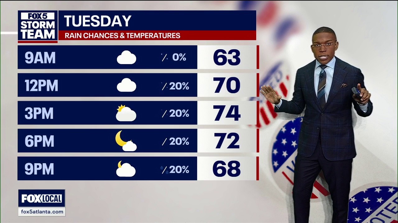
Georgia voters will encounter mild temperatures reaching 75 degrees and mostly dry conditions for Election Day before an incoming cold front brings widespread rainfall Wednesday.
Georgia voters will encounter mild temperatures reaching 75 degrees and mostly dry conditions for Election Day before an incoming cold front brings widespread rainfall Wednesday.
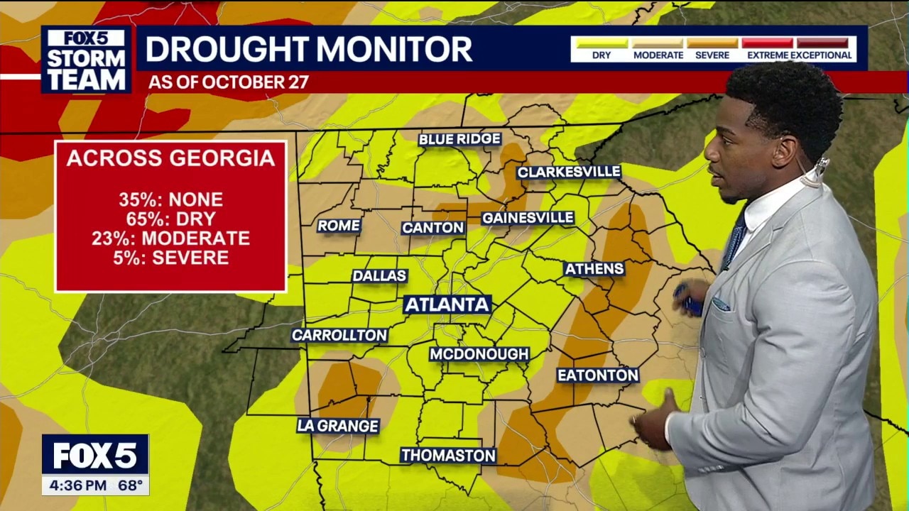
Monday afternoon weather forecast
The Weather Prediction Center issued a 1 out of 4 risk for strong scattered storms with potential flooding on Wednesday.
The Weather Prediction Center issued a 1 out of 4 risk for strong scattered storms with potential flooding on Wednesday.
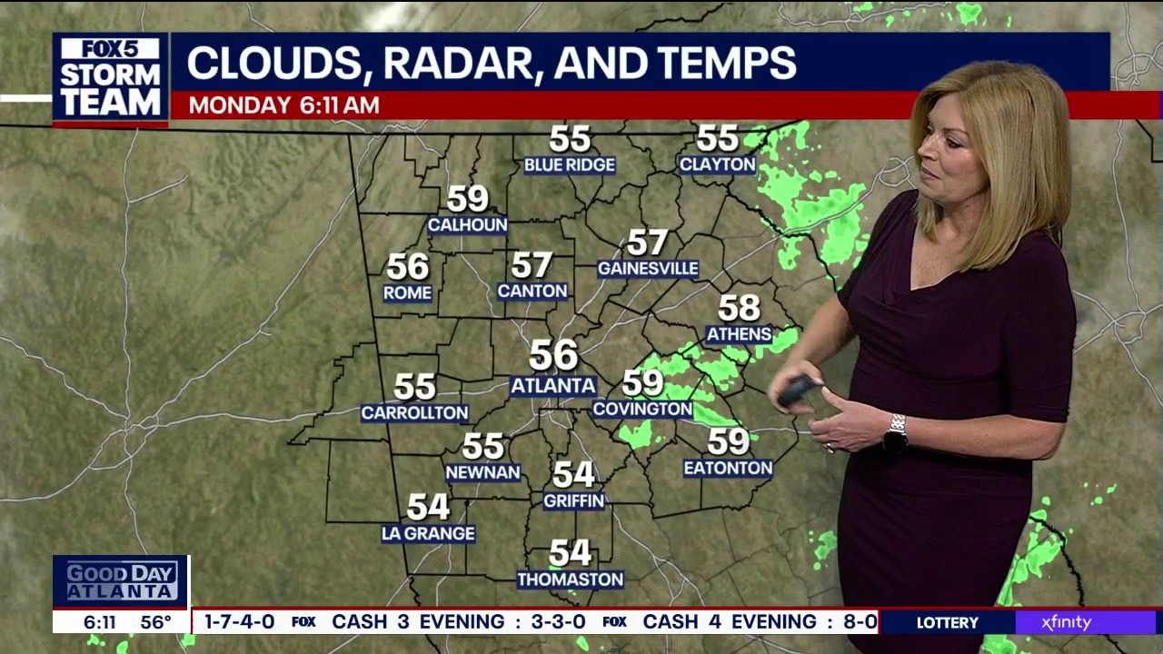
Monday morning weather forecast
North Georgia starts the day in the 50s, with a cool morning and a mild, breezy afternoon reaching the low 70s. A few areas could see light rain Tuesday evening, with storms and heavier downpours most likely Wednesday into Wednesday evening. Some spots could receive 1 to 2 inches of rain or more, bringing a risk of localized flash flooding. Stronger storms are expected to favor areas north of Georgia, but the storms should still be monitored. The rain could help ease drought conditions before sunshine and highs near 70 return for the rest of the workweek and weekend.
North Georgia starts the day in the 50s, with a cool morning and a mild, breezy afternoon reaching the low 70s. A few areas could see light rain Tuesday evening, with storms and heavier downpours most likely Wednesday into Wednesday evening. Some spots could receive 1 to 2 inches of rain or more, bringing a risk of localized flash flooding. Stronger storms are expected to favor areas north of Georgia, but the storms should still be monitored. The rain could help ease drought conditions before sunshine and highs near 70 return for the rest of the workweek and weekend.
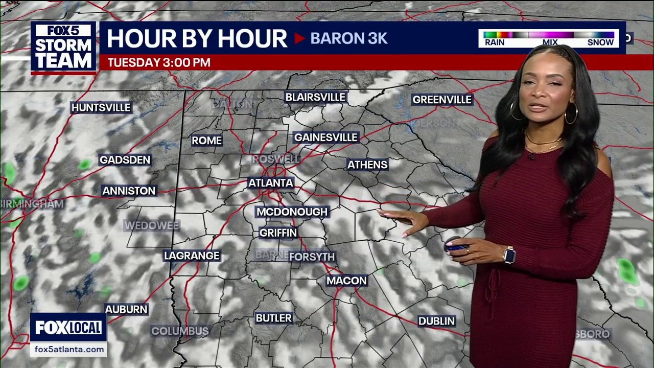
Sunday night weather forecast
Atlanta and North Georgia experienced light rain and gusty winds reaching 25 mph as scattered showers moved across the region. Rainfall remained mostly under a quarter of an inch, though LaGrange recorded more than half an inch. A drier interval will hold until a stronger cold front delivers renewed showers and storms by Wednesday.
Atlanta and North Georgia experienced light rain and gusty winds reaching 25 mph as scattered showers moved across the region. Rainfall remained mostly under a quarter of an inch, though LaGrange recorded more than half an inch. A drier interval will hold until a stronger cold front delivers renewed showers and storms by Wednesday.
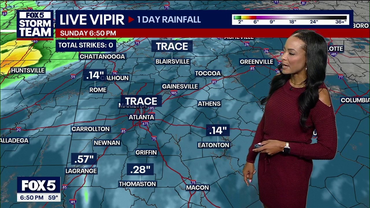
Sunday evening weather forecast
Most of metro Atlanta and north Georgia recorded under a tenth of an inch of rain, remaining well below levels needed to relieve ongoing drought conditions.
Most of metro Atlanta and north Georgia recorded under a tenth of an inch of rain, remaining well below levels needed to relieve ongoing drought conditions.
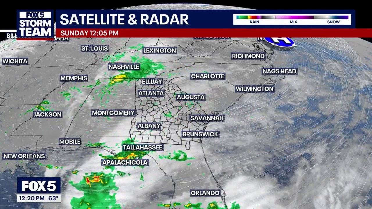
Sunday afternoon: scattered showers linger in North Georgia
Patchy drizzle and isolated light showers will linger across North Georgia through early this evening, holding afternoon temperatures in the lower 60s without easing widespread severe drought conditions. Rain tapers off overnight ahead of warmer, drier conditions Monday, before a stronger storm system brings heavier rainfall late Wednesday.
Patchy drizzle and isolated light showers will linger across North Georgia through early this evening, holding afternoon temperatures in the lower 60s without easing widespread severe drought conditions. Rain tapers off overnight ahead of warmer, drier conditions Monday, before a stronger storm system brings heavier rainfall late Wednesday.
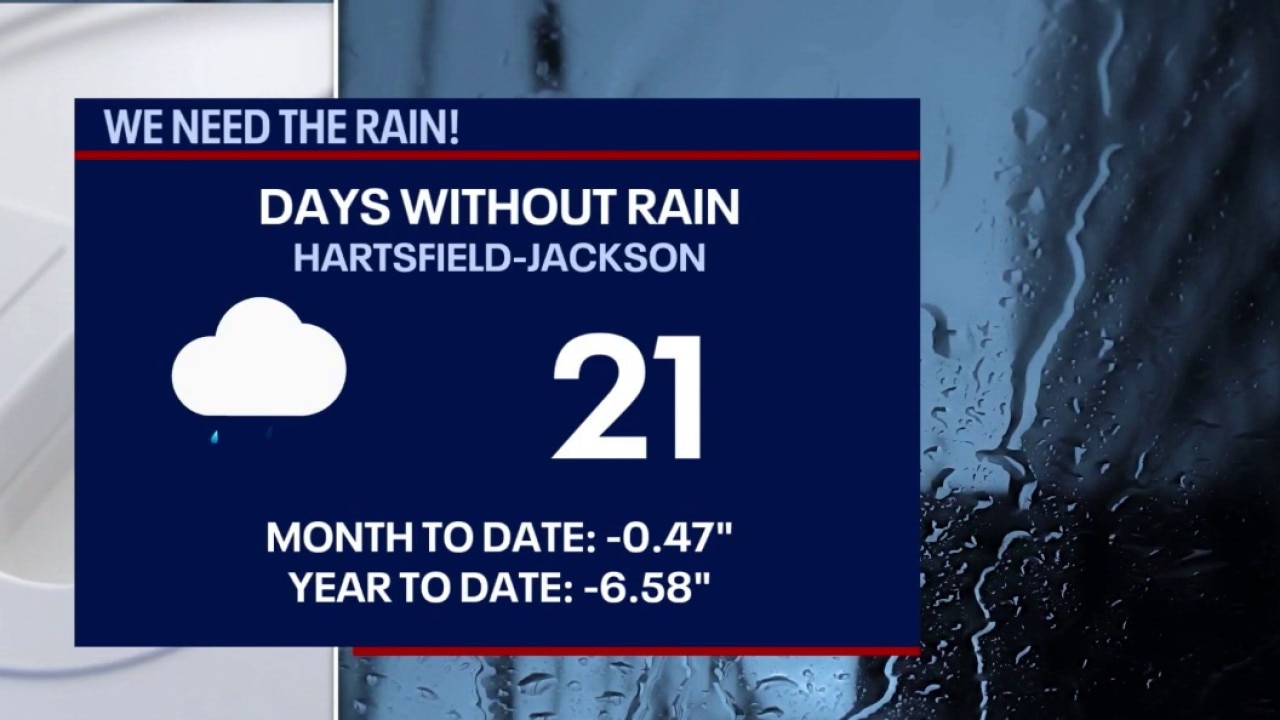
Sunday morning: overcast skies, breeze & isolated showers
Overcast skies, a steady breeze, and isolated nuisance showers will keep North Georgia cool Sunday, with afternoon temperatures struggling to reach the low 60s. The light rain will do little to dent ongoing severe drought conditions, though heavier downpours could arrive late Wednesday into Thursday.
Overcast skies, a steady breeze, and isolated nuisance showers will keep North Georgia cool Sunday, with afternoon temperatures struggling to reach the low 60s. The light rain will do little to dent ongoing severe drought conditions, though heavier downpours could arrive late Wednesday into Thursday.
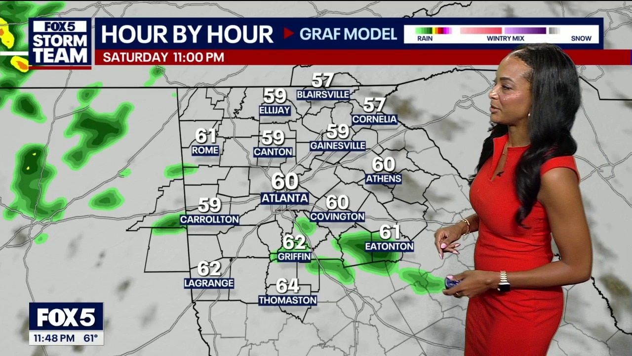
Saturday night weather forecast
Temperatures across north Georgia will plunge into the 60s on Sunday as an incoming weather system spreads up to three-quarters of an inch of drought-relieving rain across the region.
Temperatures across north Georgia will plunge into the 60s on Sunday as an incoming weather system spreads up to three-quarters of an inch of drought-relieving rain across the region.
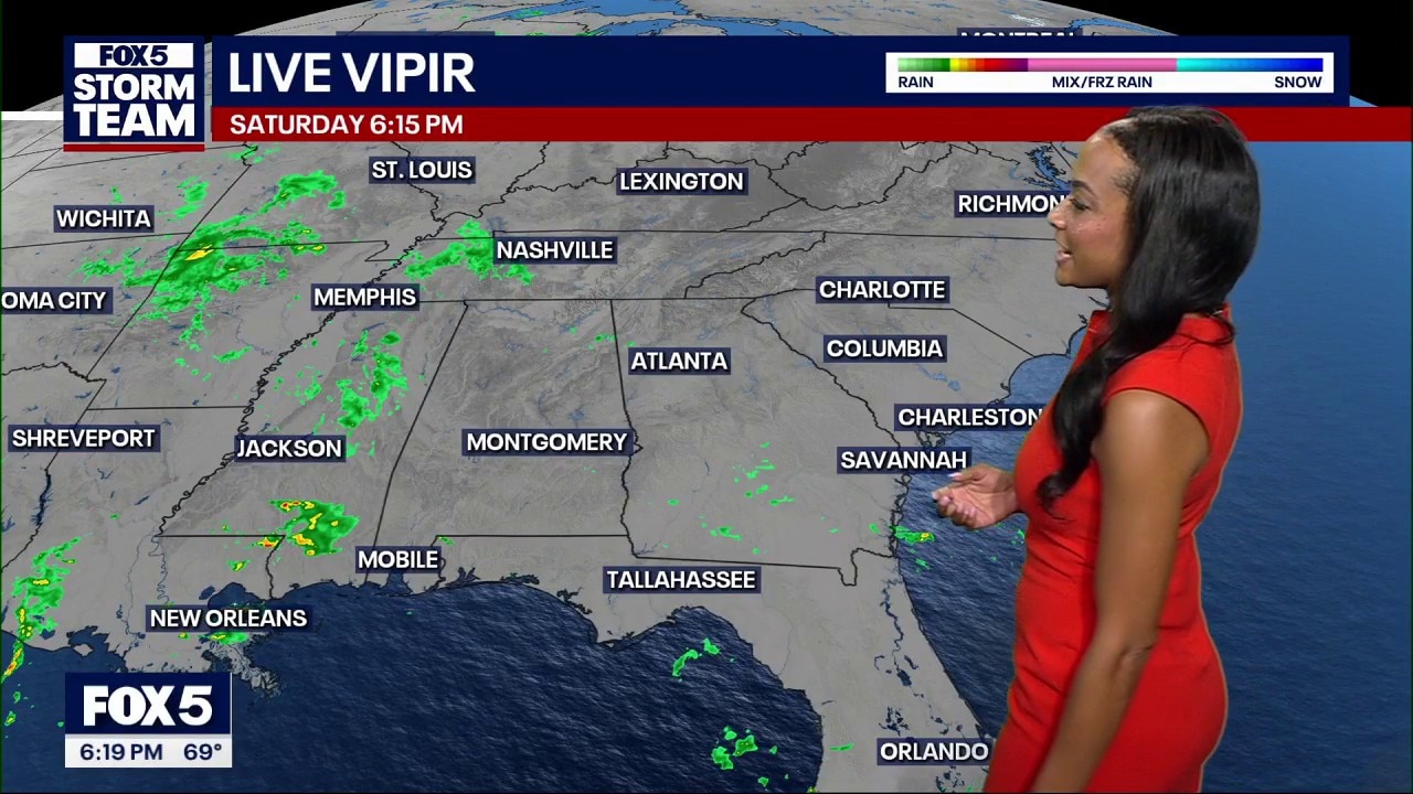
Saturday evening weather forecast
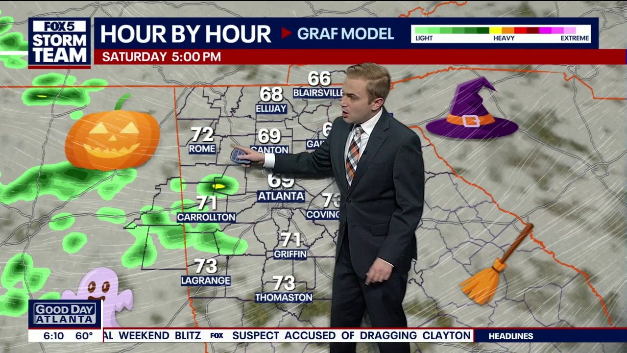
Light Halloween showers in far western counties will yield to intermittent rain and cooler 60s across north Georgia on Sunday before drier conditions return for the start of the workweek.
Light Halloween showers in far western counties will yield to intermittent rain and cooler 60s across north Georgia on Sunday before drier conditions return for the start of the workweek.
Saturday morning weather forecast
Halloween will bring treats for most, with some tricks possible in western Georgia.
Halloween will bring treats for most, with some tricks possible in western Georgia.
Friday night weather forecast
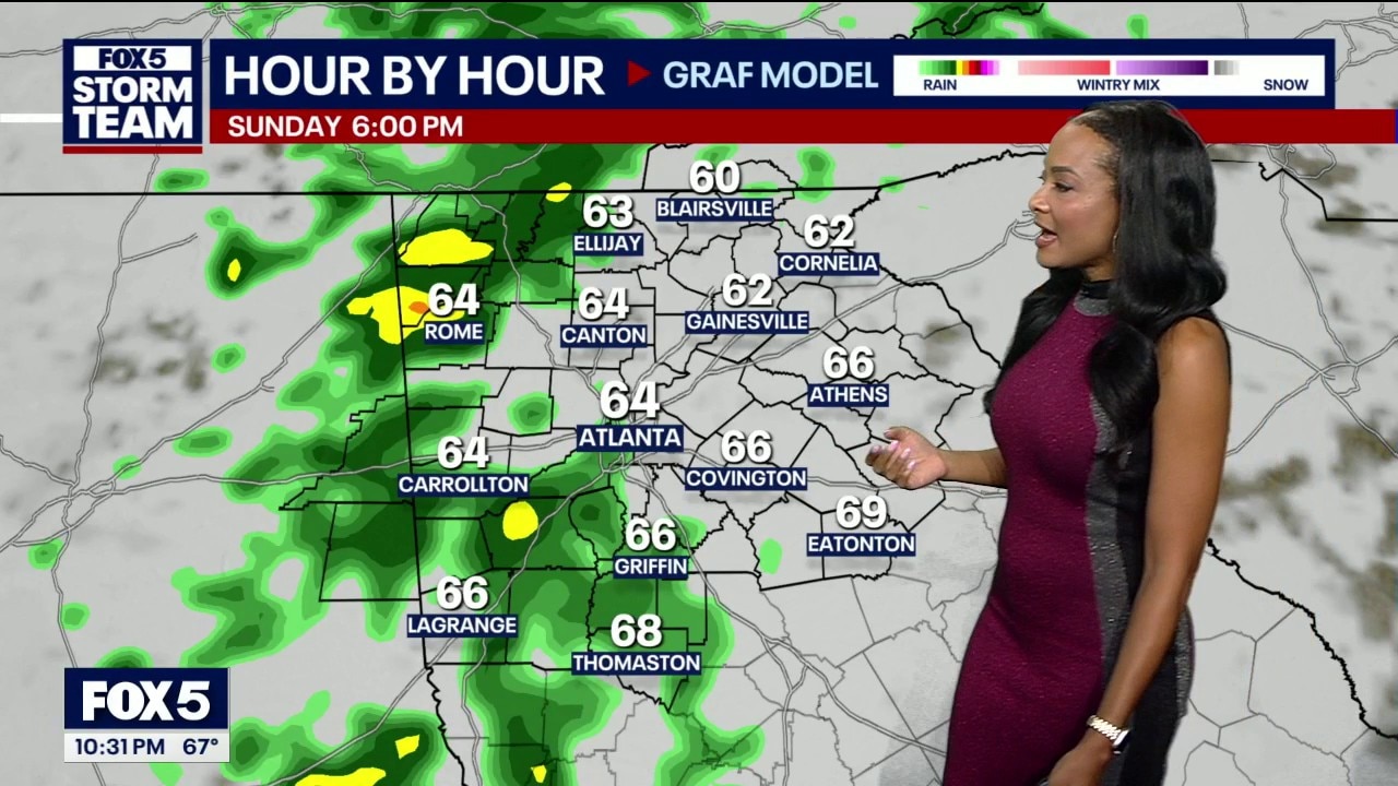
Unseasonable warmth in the 80s will give way to breezy low 70s for Halloween before an incoming weather system brings up to an inch of rain and low 60s to north Georgia on Sunday.
Unseasonable warmth in the 80s will give way to breezy low 70s for Halloween before an incoming weather system brings up to an inch of rain and low 60s to north Georgia on Sunday.
Friday evening weather forecast
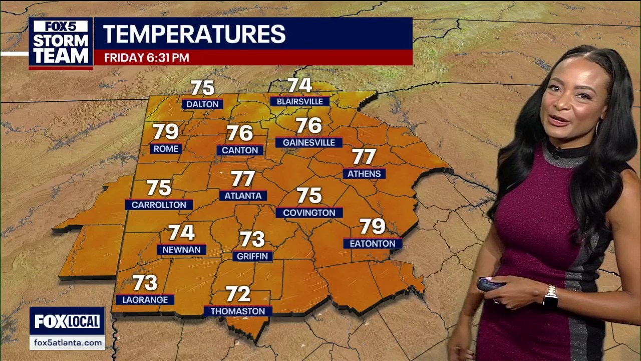
Temperatures that peaked in the 80s across north Georgia will drop into the low 70s under cloudy skies for Halloween before an incoming weather system brings an inch of rain and low 60s on Sunday.
Temperatures that peaked in the 80s across north Georgia will drop into the low 70s under cloudy skies for Halloween before an incoming weather system brings an inch of rain and low 60s on Sunday.
Friday afternoon weather forecast
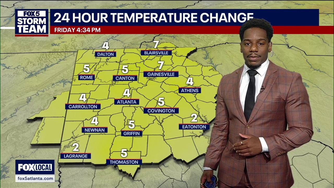
Unseasonable warmth in the low 80s across north Georgia will quickly give way to cloudy skies and 60s for Halloween evening before overnight rain triggers a Sunday cooldown and begins a stretch bringing up to two inches of rain.
Unseasonable warmth in the low 80s across north Georgia will quickly give way to cloudy skies and 60s for Halloween evening before overnight rain triggers a Sunday cooldown and begins a stretch bringing up to two inches of rain.