

Threat of severe storms, flooding on Wednesday

Wednesday morning update
The FOX 5 Storm Team is tracking a wet and stormy day ... and a big cold blast that will follow tonight.
ATLANTA - A strong cold front will move through north Georgia on Wednesday bringing the prospect of heavy rain and strong to severe storms. After the front passes it will be windy and cold Thursday with freezing temps likely on Friday morning.
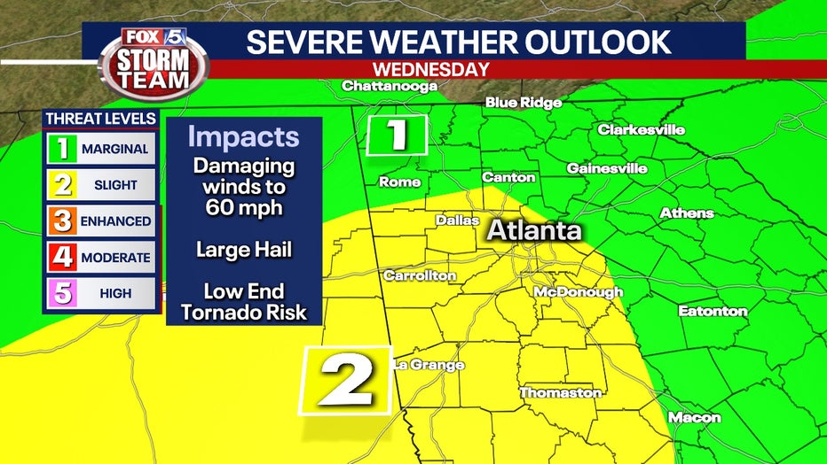
The severe storm risk is "Slight" or a 2 out of 5 for parts of metro Atlanta. The greatest threat will be damaging winds, some hail, and a low-end risk for a quick spin-up tornado.
The greatest threat for flooding will be in north and northwest Georgia where the ground is already saturated and stream flows are running high.
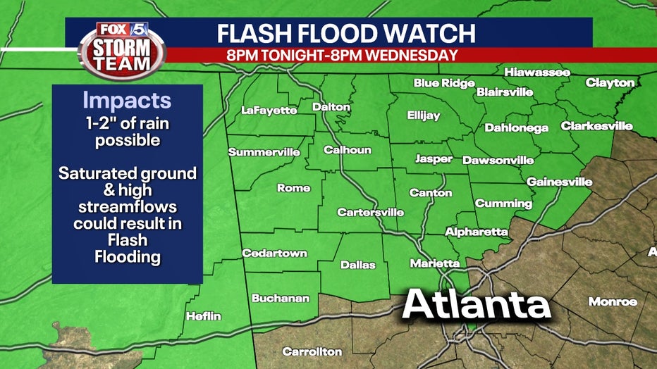
A Flash Flood Watch is in effect until 8 p.m. Wednesday for Cherokee, Cobb, Dawson, Fannin, Forsyth, Gilmer, Hall, Lumpkin, North Fulton, Pickens, Union, Towns, White, Bartow, Catoosa, Chattooga, Dade, Floyd, Gordon, Haralson, Murray, Paulding, Polk, Walker and Whitfield counties
About 1 to 2 inches of rain is expected with this system with some areas seeing up to 2.5 inches.
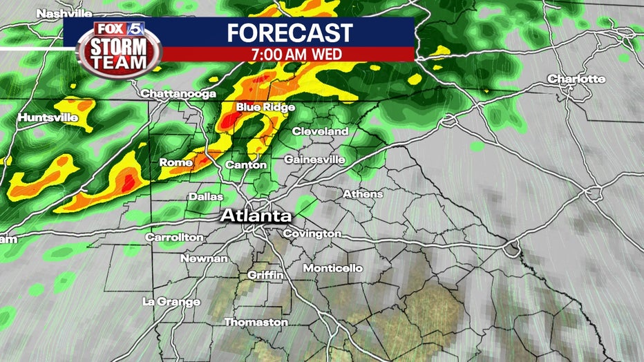
Some isolated showers will move into the area overnight, but that will become more widespread as the morning progresses.
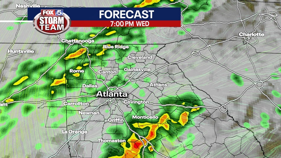
Some of those showers will turn into thunderstorms as the day progresses.
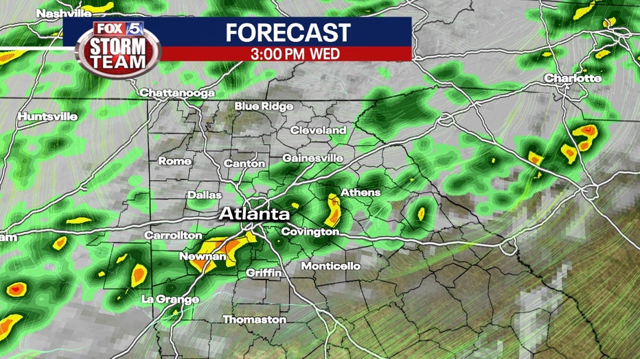
The larger thunderstorms that could potentially become severe are expected later in the afternoon and the first part of the evening.
Colder air then moves in behind the front.

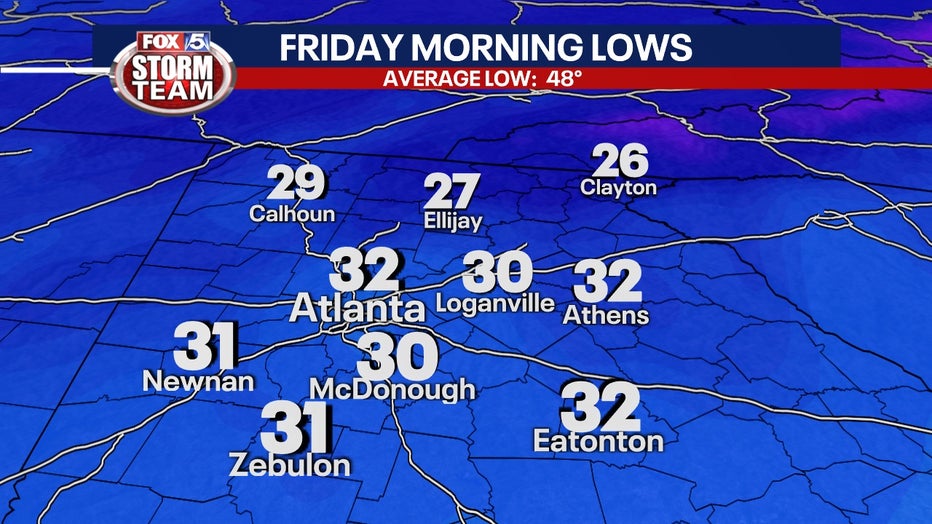
Temperatures by Friday morning will be around and below freezing.
Keep up with the latest by downloading the FREE FOX 5 Storm Team app and following @FOX5StormTeam on Twitter.
WATCH: FOX 5 Atlanta live news coverage
_____
Sign up for FOX 5 email alerts
Download the FOX 5 Atlanta app for breaking news and weather alerts.