

More rain and slight warm-up on the way for Friday, possible wintry mix Saturday

More rain on the way with a warm-up for Friday
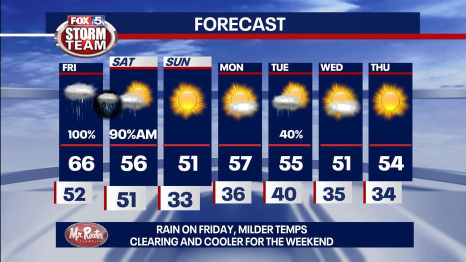
More rain is on the way for Friday, but temperatures are going to rise. A wintry mix is possible Saturday.
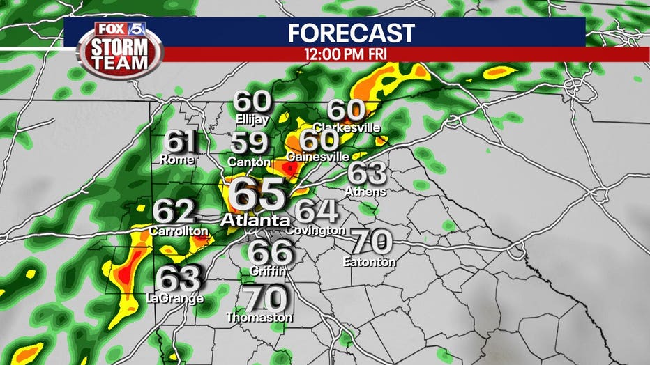
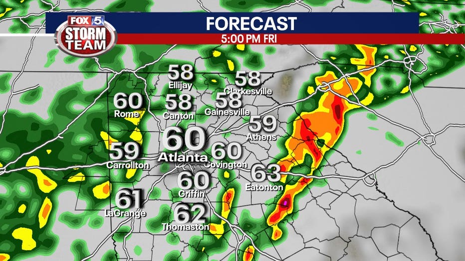
ATLANTA - More rain will continue to move through north Georgia Thursday into Friday with the potential for flooding in several areas. Flash flooding is expected to begin shortly in the Crooked Creek normally prone areas.
Some locations that will experience flooding include Sandy Springs, Roswell, Duluth, Norcross and Berkeley Lake.
With up to two to four inches of rain possible in the northwest corner of the state, a Flood Watch is posted through Friday evening for Dade, Walker, Catoosa, Whitfield, Murray, Chattooga, Gordon, and Floyd counties.
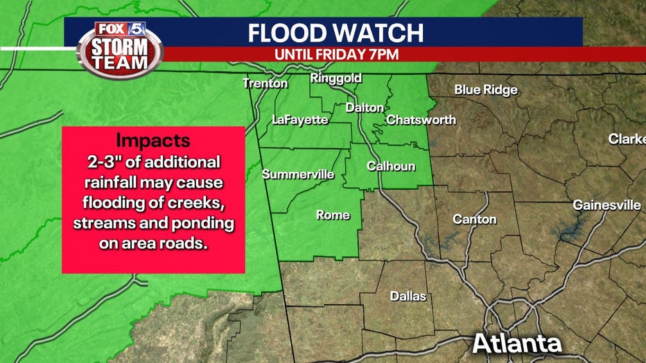
Some creeks, rivers, and streams can rise, and low lying areas may also experience some flooding.
Oddly, temperatures will rise overnight with a strong southerly wind that could usher in a few thunderstorms. Temperatures will reach the mid 60s on Friday before cooling over the weekend.
As the last of the rain moves out during the day Saturday, colder air moves in. Moisture wrapping around into the north Georgia mountains may result in a period of a wintry mix of precipitation in the higher elevations.
For most of our viewing area Saturday, the story will be drier conditions and tumbling temperatures.
Download the FOX 5 Storm Team app to get up to the second alerts on weather conditions in your area.