

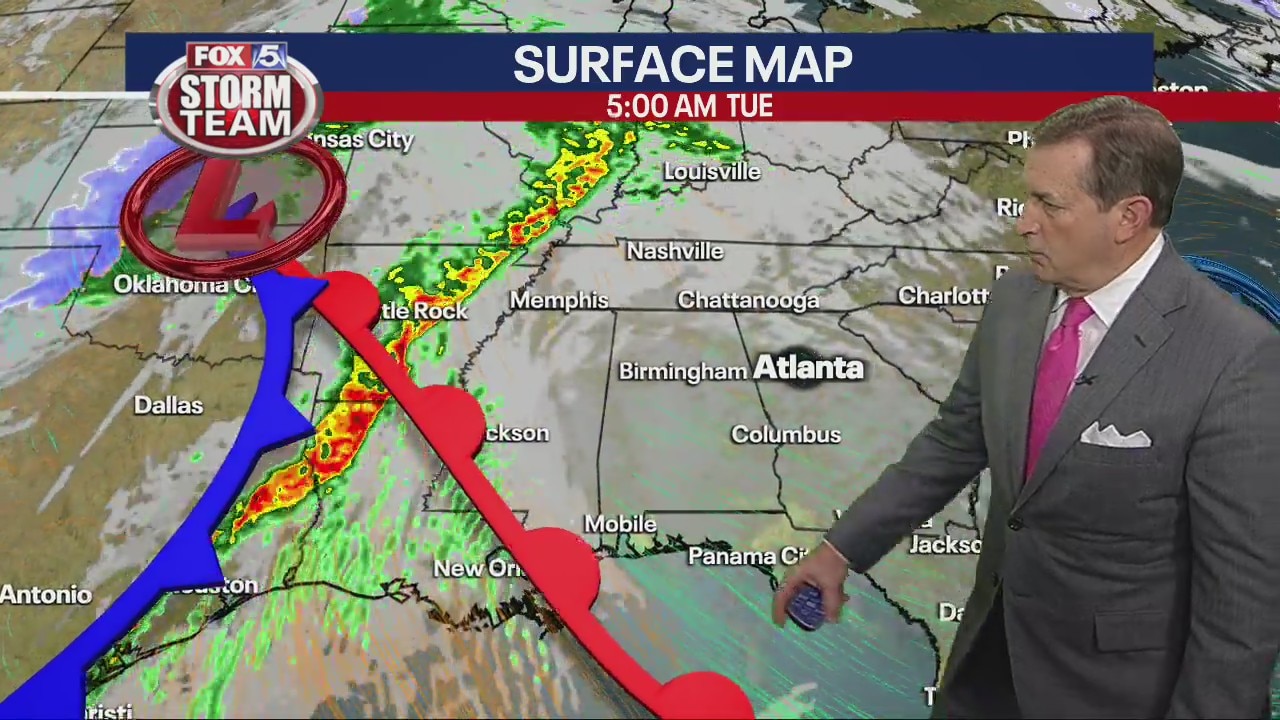
Monday night forecast update
Severe storms possible Wednesday. Sunny and cooler rest of the week.
Severe storms possible Wednesday. Sunny and cooler rest of the week.
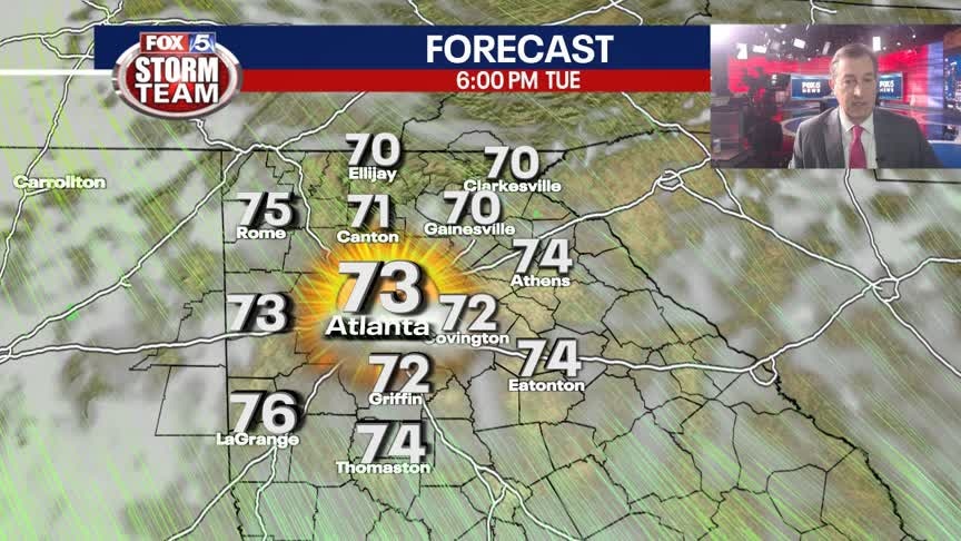
Late Monday Night Weather Update
Quiet weather thru sunset on Tuesday with mild to warm temps. Lows Tuesday morning in the 40s to low 50s, and then highs into the 70s. Rain and storms begin late Tuesday night and into Wednesday. Strong to severe storms are possible. Here is the latest.
Quiet weather thru sunset on Tuesday with mild to warm temps. Lows Tuesday morning in the 40s to low 50s, and then highs into the 70s. Rain and storms begin late Tuesday night and into Wednesday. Strong to severe storms are possible. Here is the latest.
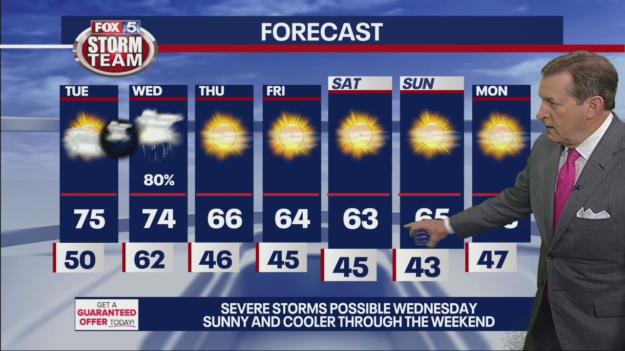
Monday evening forecast
Severe storms possible Wednesday. Sunny and cooler through weekend.
Severe storms possible Wednesday. Sunny and cooler through weekend.

Monday midday forecast
Clear, warm days leading up to severe weather Tuesday night into Wednesday.
Clear, warm days leading up to severe weather Tuesday night into Wednesday.
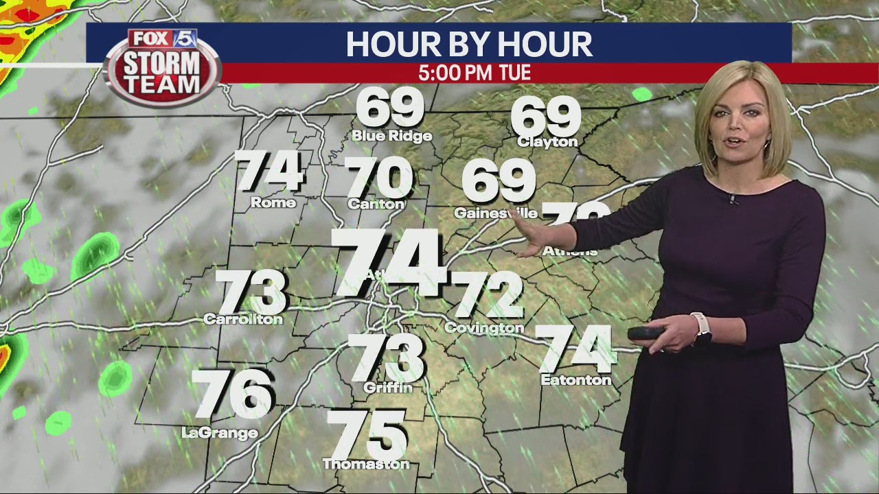
Monday morning weather forecast
It's a nice start for the first full day of spring. Our chilly morning will warm up nicely to near or above 70 by the end of the day.
It's a nice start for the first full day of spring. Our chilly morning will warm up nicely to near or above 70 by the end of the day.

Monday Forecast
Sunshine and seventies are back Monday and Tuesday before strong to severe storms move in Wednesday.
Sunshine and seventies are back Monday and Tuesday before strong to severe storms move in Wednesday.

Sunday Forecast
First day of spring and it will feel like it with plenty of sunshine and temperatures near 70 degrees.
First day of spring and it will feel like it with plenty of sunshine and temperatures near 70 degrees.
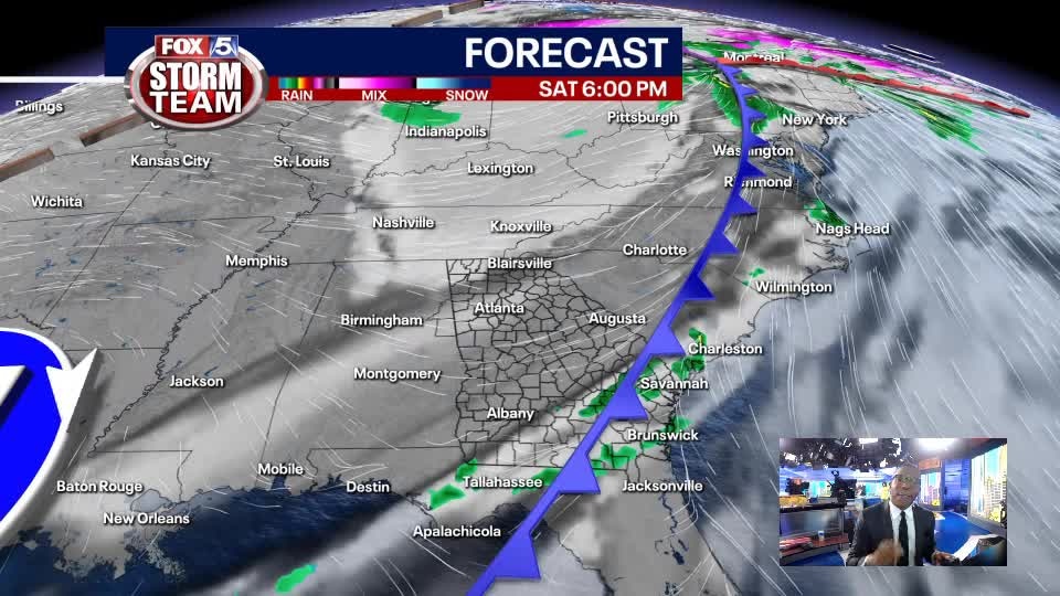
Saturday Evening Weather Update
Decreasing clouds leads to bright sunshine, breezes and seasonable temperatures Sunday on the first day of spring.
Decreasing clouds leads to bright sunshine, breezes and seasonable temperatures Sunday on the first day of spring.
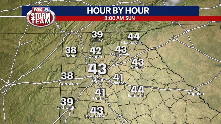
Saturday Forecast
Sunshine returns with cool temperatures and breezy conditions. Warm and dry to start the week.
Sunshine returns with cool temperatures and breezy conditions. Warm and dry to start the week.
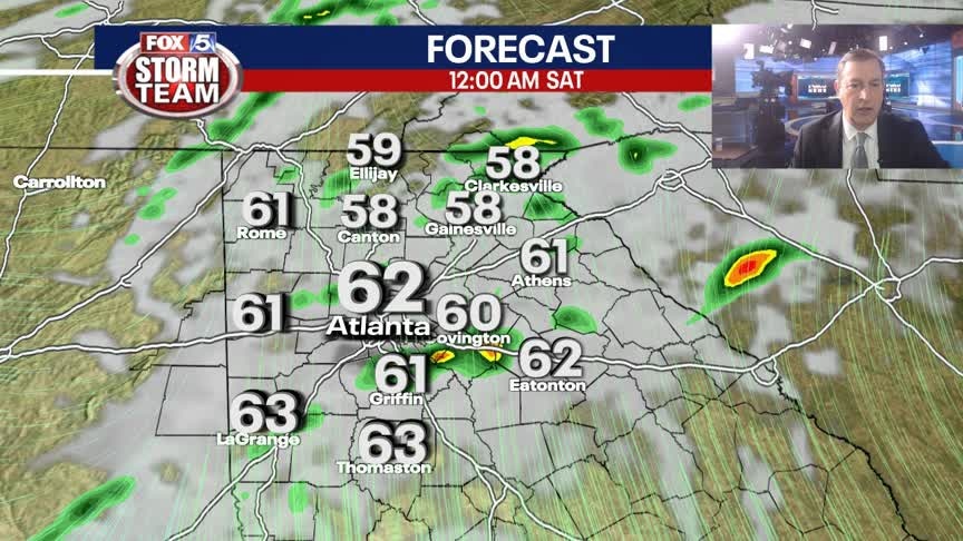
Friday Evening Weather Update
Waiting on the cold front tonight that could produce some brief heavy rain and strong t-storm. Clearing trend toward Saturday morning. It will be sunny and breezy to start the Weekend. Here is the latest.
Waiting on the cold front tonight that could produce some brief heavy rain and strong t-storm. Clearing trend toward Saturday morning. It will be sunny and breezy to start the Weekend. Here is the latest.

Friday evening severe weather outlook
Rain ended in the metro Atlanta area late Friday afternoon, but the FOX 5 Storm Team continues to track possible damaging winds and any other severe weather.
Rain ended in the metro Atlanta area late Friday afternoon, but the FOX 5 Storm Team continues to track possible damaging winds and any other severe weather.

Severe weather afternoon update
The storm system that moved in from Alabama has already begun to drench parts of the metro Atlanta area. The intense line of thunderstorms are bringing a lot of lightening, heavy winds, and the chance of hail and tornadoes.
The storm system that moved in from Alabama has already begun to drench parts of the metro Atlanta area. The intense line of thunderstorms are bringing a lot of lightening, heavy winds, and the chance of hail and tornadoes.
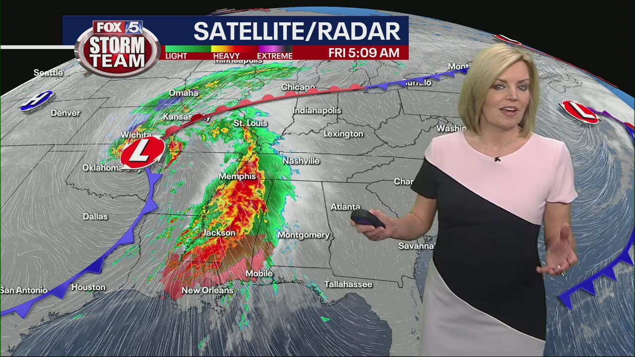
Friday morning weather forecast
While things are quiet early Friday morning, by roughly 10 a.m. big storms will roll in from the west. Stay weather aware today through the afternoon and into the evening.
While things are quiet early Friday morning, by roughly 10 a.m. big storms will roll in from the west. Stay weather aware today through the afternoon and into the evening.

Thursday Evening Weather Update
A very nice St. Patrick's Day evening with a mostly clear sky and pleasant temps. Storms are expected on Friday beginning late morning. Heavy rain and damaging winds will be the greatest threats, but there is a low end risk for a tornado. Here is the latest.
A very nice St. Patrick's Day evening with a mostly clear sky and pleasant temps. Storms are expected on Friday beginning late morning. Heavy rain and damaging winds will be the greatest threats, but there is a low end risk for a tornado. Here is the latest.

Thursday evening forecast
Possible severe weather moves into the area beginning tomorrow afternoon after a Thursday that featured plenty of sunshine.
Possible severe weather moves into the area beginning tomorrow afternoon after a Thursday that featured plenty of sunshine.

Thursday morning weather forecast
After some dense fog this morning it'll be a beautiful day with sunshine and 70s. Enjoy while you can because lots of rain and storms are headed our way tomorrow.
After some dense fog this morning it'll be a beautiful day with sunshine and 70s. Enjoy while you can because lots of rain and storms are headed our way tomorrow.
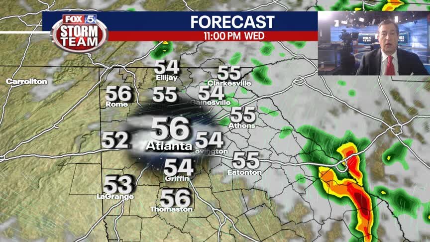
Wednesday Evening Weather Update
Strong t-storms will end before midnight and then cooler and foggy conditions will arrive by Thursday morning. St. Patrick's Day will be sunny and warm with highs in the 70s. More storms expected for Friday. Here is the latest update.
Strong t-storms will end before midnight and then cooler and foggy conditions will arrive by Thursday morning. St. Patrick's Day will be sunny and warm with highs in the 70s. More storms expected for Friday. Here is the latest update.

Wednesday Afternoon Forecast
Another round of showers and t-showers is on the way for late this afternoon and evening.
Another round of showers and t-showers is on the way for late this afternoon and evening.

Wednesday morning weather forecast
Wednesday will be soggy off and on throughout metro Atlanta. We'll trade in some steady, early morning rain for a few lulls later this morning and and scattered storms this afternoon and evening.
Wednesday will be soggy off and on throughout metro Atlanta. We'll trade in some steady, early morning rain for a few lulls later this morning and and scattered storms this afternoon and evening.

Tuesday Evening Weather Update
Periods of rain for Tuesday night into Wednesday morning. At times the rain will be moderate to heavy. Temps holding in the 50s. A chance for a few t-storms early Wednesday morning, then scattered showers by afternoon. Here is the latest.
Periods of rain for Tuesday night into Wednesday morning. At times the rain will be moderate to heavy. Temps holding in the 50s. A chance for a few t-storms early Wednesday morning, then scattered showers by afternoon. Here is the latest.