


Thursday Afternoon Forecast
More scattered showers and storms on tap today.
More scattered showers and storms on tap today.
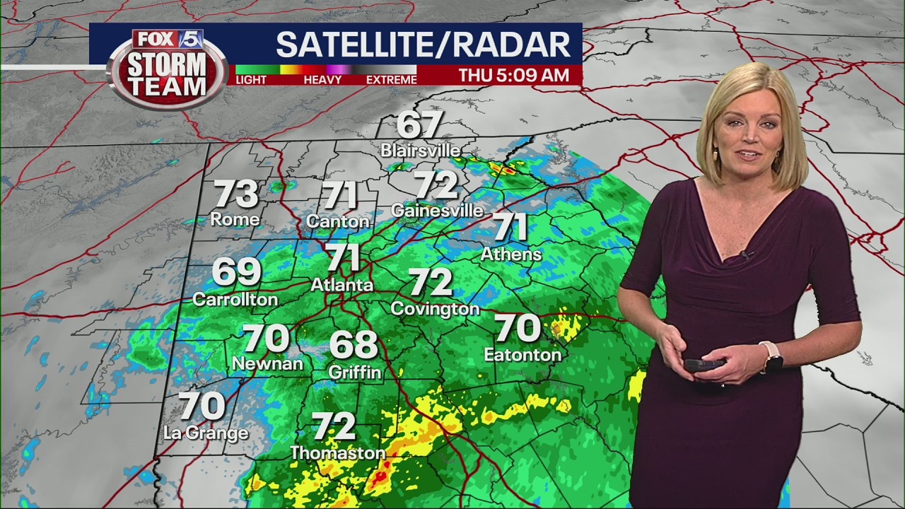
Thursday morning weather forecast
Thursday morning is off to a soggy start, and temperatures will stay cooler in many areas of north Georgia today as a result.
Thursday morning is off to a soggy start, and temperatures will stay cooler in many areas of north Georgia today as a result.
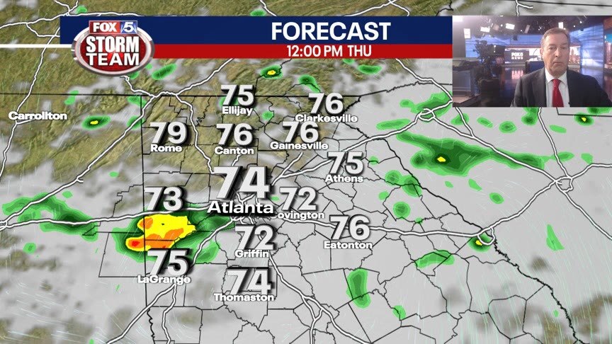
Wednesday Evening Weather Update
Clouds with scattered showers thru the overnight with temps around 70 by morning. More scattered showers and storms on Thursday and that will keep most of North Georgia in the 70s. Here is the latest.
Clouds with scattered showers thru the overnight with temps around 70 by morning. More scattered showers and storms on Thursday and that will keep most of North Georgia in the 70s. Here is the latest.
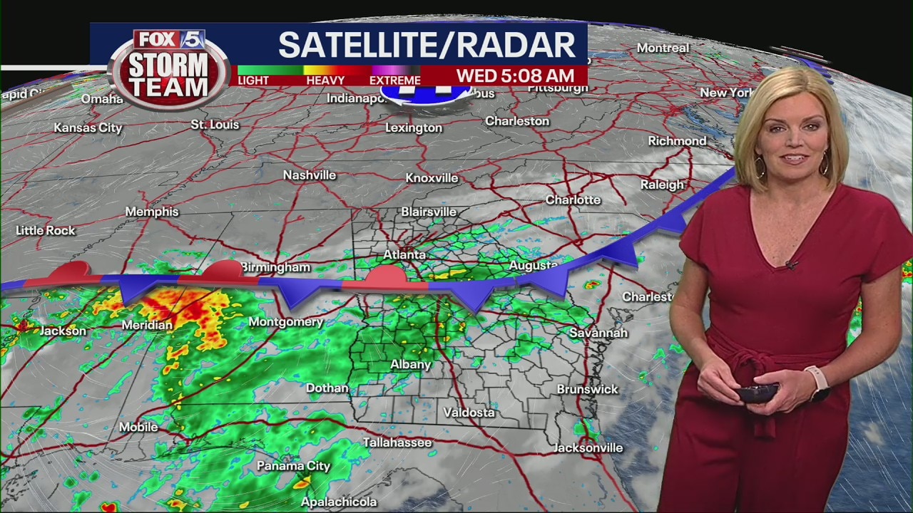
Wednesday morning weather forecast
It's going to take a while for the metro Atlanta area to see much sunshine, but it'll come out later today. Get ready for more rain tonight as well.
It's going to take a while for the metro Atlanta area to see much sunshine, but it'll come out later today. Get ready for more rain tonight as well.
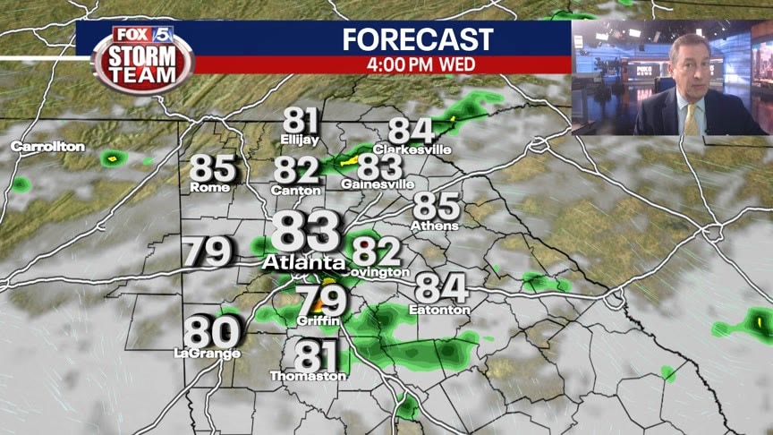
Tuesday Evening Weather Update
Mostly cloudy thru the overnight with a few showers possible. The rain chance will be rising in the days ahead, but high temperatures will remain on the mild side. Here are the details.
Mostly cloudy thru the overnight with a few showers possible. The rain chance will be rising in the days ahead, but high temperatures will remain on the mild side. Here are the details.

Tuesday morning forecast
Temperatures remain below average, but not significantly. Weather could add to rainfall total but it may be scattered in the afternoon.
Temperatures remain below average, but not significantly. Weather could add to rainfall total but it may be scattered in the afternoon.

Monday Evening Weather Update
Mostly cloudy and mild overnight and into Tuesday with a few stray showers. The unsettled pattern will continue into the week with high rain chances by mid week. Here is the breakdown.
Mostly cloudy and mild overnight and into Tuesday with a few stray showers. The unsettled pattern will continue into the week with high rain chances by mid week. Here is the breakdown.

Monday midday weather forecast
Storms are moving the I-20 corridor to the southeast. More making their way in from the west. Chance of overnight showers and storms.
Storms are moving the I-20 corridor to the southeast. More making their way in from the west. Chance of overnight showers and storms.

Monday morning forecast
A cloudy but dry start to the day. Rain could pop up in areas as temperatures creep toward 80 degrees.
A cloudy but dry start to the day. Rain could pop up in areas as temperatures creep toward 80 degrees.

Sunday Evening Forecast
0Isolated showers and storms are possible Sunday evening. Thick clouds and few spotty showers early Monday will keep temperatures below 80 degrees for most of the day.
0Isolated showers and storms are possible Sunday evening. Thick clouds and few spotty showers early Monday will keep temperatures below 80 degrees for most of the day.

Sunday Forecast
More clouds than sun with scattered showers and thunderstorms. Some storms could be strong to severe.
More clouds than sun with scattered showers and thunderstorms. Some storms could be strong to severe.

Sunday morning forecast
A muggy start to the day. Not much high-impact rain to start the day, but showers can pop up. Thunderstorms move in from Alabama and Tennessee after susnset.
A muggy start to the day. Not much high-impact rain to start the day, but showers can pop up. Thunderstorms move in from Alabama and Tennessee after susnset.

Saturday Evening Forecast
Scattered thunderstorms and heavy downpours will continue to hit north Georgia late Saturday evening into early Sunday morning.
Scattered thunderstorms and heavy downpours will continue to hit north Georgia late Saturday evening into early Sunday morning.
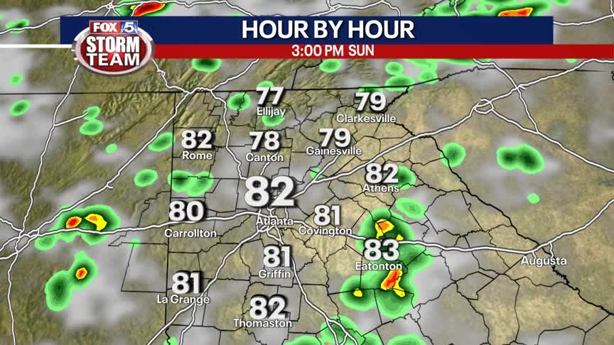
Saturday Forecast
Warm and muggy with scatttered showers and thunderstorms.
Warm and muggy with scatttered showers and thunderstorms.

Saturday morning forecast
Still unseasonably cool, but more sunshine than previous days. Thunderstorms forming Saturday afternoon and evening. They could continue into early Sunday morning.
Still unseasonably cool, but more sunshine than previous days. Thunderstorms forming Saturday afternoon and evening. They could continue into early Sunday morning.

Friday Evening Forecast
Scattered showers and isolated thunderstorms chance gradually diminish tonight before returning Saturday afternoon.
Scattered showers and isolated thunderstorms chance gradually diminish tonight before returning Saturday afternoon.

Friday morning forecast
The clouds will linger longer and bring more rain than the previous few days. By the end of the afternoon, temperatures may be in the high 70s in some areas.
The clouds will linger longer and bring more rain than the previous few days. By the end of the afternoon, temperatures may be in the high 70s in some areas.
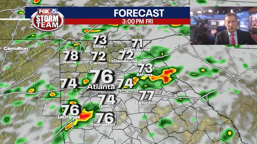
Thursday Evening Weather Update
More clouds and showers in the coming days and that will keep the daytime highs down below the average for mid August. Here is the latest on our wet weather into the Weekend.
More clouds and showers in the coming days and that will keep the daytime highs down below the average for mid August. Here is the latest on our wet weather into the Weekend.

Thursday noon forecast
The day is off to a gloomy start. Watching Friday afternoon storms.
The day is off to a gloomy start. Watching Friday afternoon storms.

Thursday morning forecast
Some areas may touch the low 80s, but not for long. Chances of rain in some areas, particularly northeast Georgia. Heavy rain projected for Friday.
Some areas may touch the low 80s, but not for long. Chances of rain in some areas, particularly northeast Georgia. Heavy rain projected for Friday.