


Thursday evening forecast
The warmer temperatures are settling in, but things about about to get wetter this weekend. How will it impact you New Year's Eve plans?
The warmer temperatures are settling in, but things about about to get wetter this weekend. How will it impact you New Year's Eve plans?
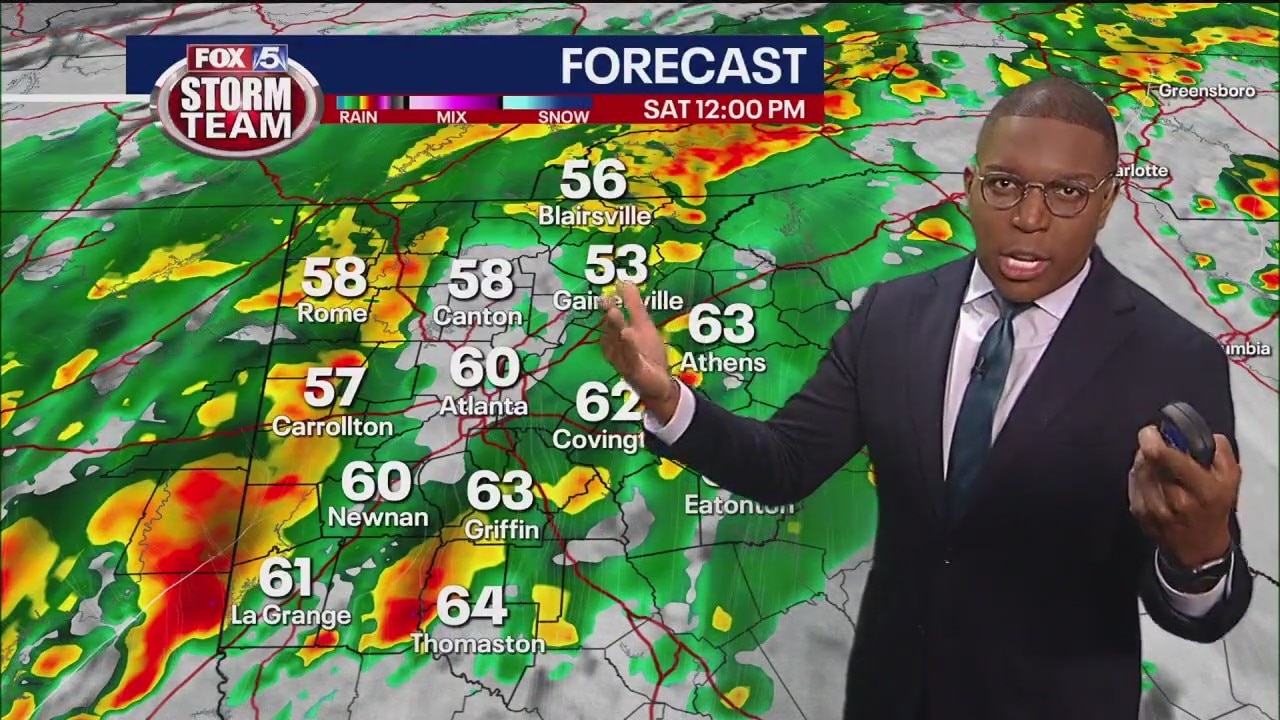
Thursday afternoon forecast
The warmer temperatures are settling in, but things about about to get wetter this weekend. How will it impact you New Year's Eve plans?
The warmer temperatures are settling in, but things about about to get wetter this weekend. How will it impact you New Year's Eve plans?

Thursday morning weather forecast
It's a much warmer start this morning compared to the last few days. Take advantage of the warm and dry day because heavy rain is on the way.
It's a much warmer start this morning compared to the last few days. Take advantage of the warm and dry day because heavy rain is on the way.
Wednesday Evening Weather Update
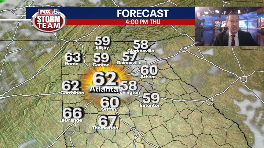
Some clouds overnight and temps not nearly as cold as they have been, expecting lows in the 30s to low 40s in town. Sunny and milder on Thursday with highs in the low 60s. Chance for rain increases late Friday and into Saturday. New Year's Eve will be dry for most and then a lovely New Year's Day. Here is the breakdown.
Some clouds overnight and temps not nearly as cold as they have been, expecting lows in the 30s to low 40s in town. Sunny and milder on Thursday with highs in the low 60s. Chance for rain increases late Friday and into Saturday. New Year's Eve will be dry for most and then a lovely New Year's Day. Here is the breakdown.

Wednesday morning weather forecast
For the first time in almost a week, the high temperatures will reach - and maybe surpass - the average for the season.
For the first time in almost a week, the high temperatures will reach - and maybe surpass - the average for the season.
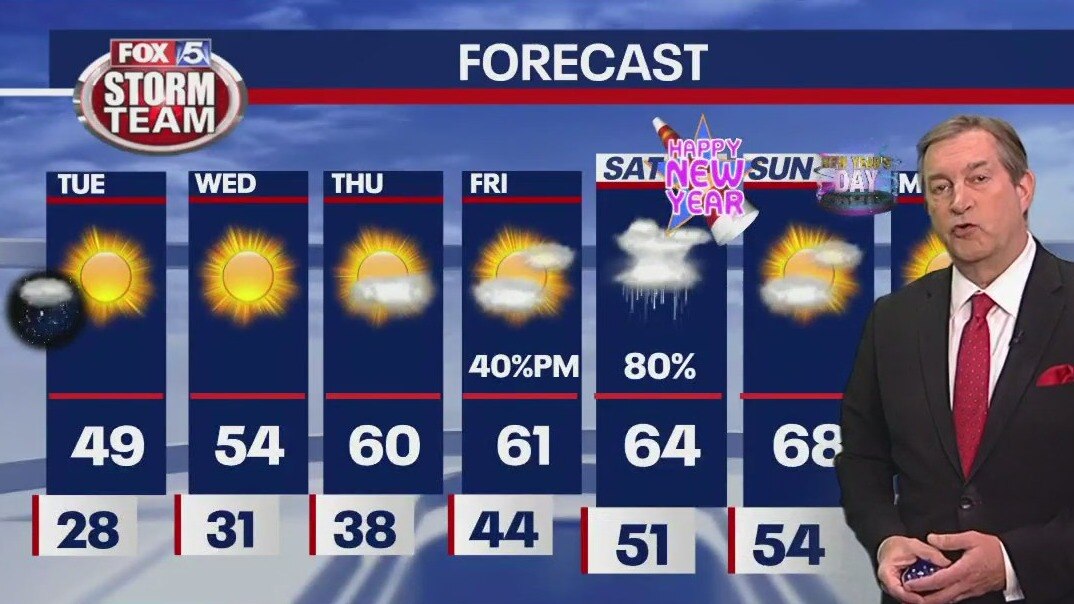
Tuesday Evening Weather Update
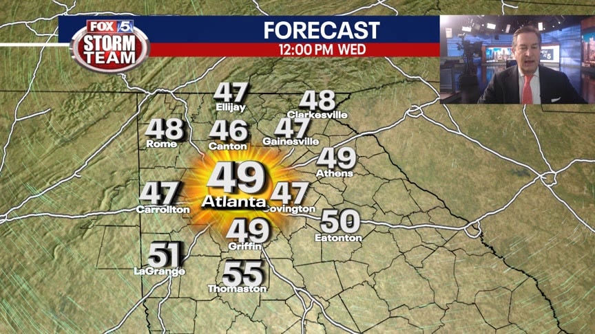
Let the warm up continue and last into the New Year. Still chilly for Wed morning, but highs will reach the 60s by Thursday. Chance for rain returns for late Friday and Saturday. Here is the breakdown.
Let the warm up continue and last into the New Year. Still chilly for Wed morning, but highs will reach the 60s by Thursday. Chance for rain returns for late Friday and Saturday. Here is the breakdown.

Tuesday morning weather forecast
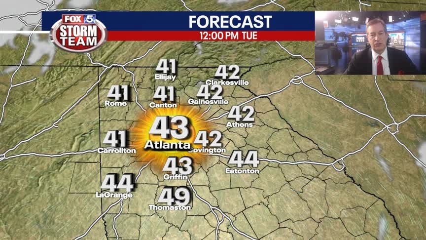
While the threat of snow is over, there's a strong possibility for black ice while temperatures remain below the average. By the afternoon, we'll go up to a relatively high temperature in the 40s.
While the threat of snow is over, there's a strong possibility for black ice while temperatures remain below the average. By the afternoon, we'll go up to a relatively high temperature in the 40s.

Monday evening forecast update
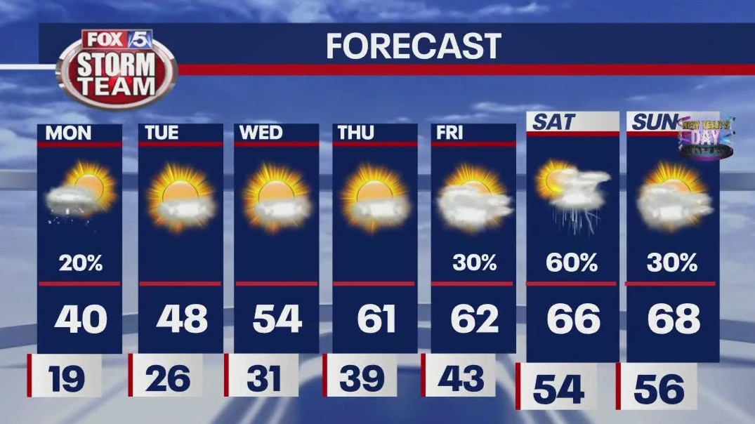
Areas of snow showers late tonight could cause some patchy travel concerns thru the night and into the morning. The snow showers will end early in the morning, then clearing and cold with lows in the 20s. Plenty of sun on Tuesday and temps will warm into the 40s. The 50s return on Wednesday and then 60s by the end of the week. Next chance for rain will be late Friday and then possible t-storms on Saturday.
Areas of snow showers late tonight could cause some patchy travel concerns thru the night and into the morning. The snow showers will end early in the morning, then clearing and cold with lows in the 20s. Plenty of sun on Tuesday and temps will warm into the 40s. The 50s return on Wednesday and then 60s by the end of the week. Next chance for rain will be late Friday and then possible t-storms on Saturday.
Monday Evening Weather Update
Some evening snow showers across North Georgia tonight with a possible dusting in the mountains. A few isoalted slick spots on some roads. Then a big warming trend this week. Here is the latest.
Some evening snow showers across North Georgia tonight with a possible dusting in the mountains. A few isoalted slick spots on some roads. Then a big warming trend this week. Here is the latest.
Monday Evening Forecast Update
While nearly all of North Georgia was above freezing this afternoon, some Georgians may continue to see snow flurries and snow showers later this evening.
While nearly all of North Georgia was above freezing this afternoon, some Georgians may continue to see snow flurries and snow showers later this evening.

Monday morning weather forecast
There's a large ribbon of snow moving in the direction of north Georgia. Coverage could be vast across north Georgia and there could be flurries.
There's a large ribbon of snow moving in the direction of north Georgia. Coverage could be vast across north Georgia and there could be flurries.
Christmas evening forecast
While the worst of the cold temperatures seems to be behind us, precipitation is in this week's forecast. Here's what you need to know about the weather in this last week of 2022.
While the worst of the cold temperatures seems to be behind us, precipitation is in this week's forecast. Here's what you need to know about the weather in this last week of 2022.

Christmas Eve evening forecast update
It seems Santa forgot to add "warmer temperatures" to his list for Christmas Day, the weather forecast is looking bright for the last week of 2022! Thaw begins Tuesday and we will be above average by Thursday.
It seems Santa forgot to add "warmer temperatures" to his list for Christmas Day, the weather forecast is looking bright for the last week of 2022! Thaw begins Tuesday and we will be above average by Thursday.

Christmas Eve Forecast
Near record cold throughout the day. Temperatures will be warmer by next week.
Near record cold throughout the day. Temperatures will be warmer by next week.
Friday Evening Weather Update
Mostly clear and frigid overnight with lows in the single digits and low teens. Wind chills will be below Zero. Staying real cold into Christmas Day. Here are the numbers.
Mostly clear and frigid overnight with lows in the single digits and low teens. Wind chills will be below Zero. Staying real cold into Christmas Day. Here are the numbers.

Friday morning weather forecast
Strong winds from the arctic blast will hopefully dry up any moisture left on the roads before it freezes, but drivers should still be careful.
Strong winds from the arctic blast will hopefully dry up any moisture left on the roads before it freezes, but drivers should still be careful.

Thursday Evening Weather Update
Arctic arives tonight driving temps into the teens and windchills below Zero. The deep freeze remains for the Christmas Holiday Weekend. Here is the latest.
Arctic arives tonight driving temps into the teens and windchills below Zero. The deep freeze remains for the Christmas Holiday Weekend. Here is the latest.
Thursday morning weather forecast
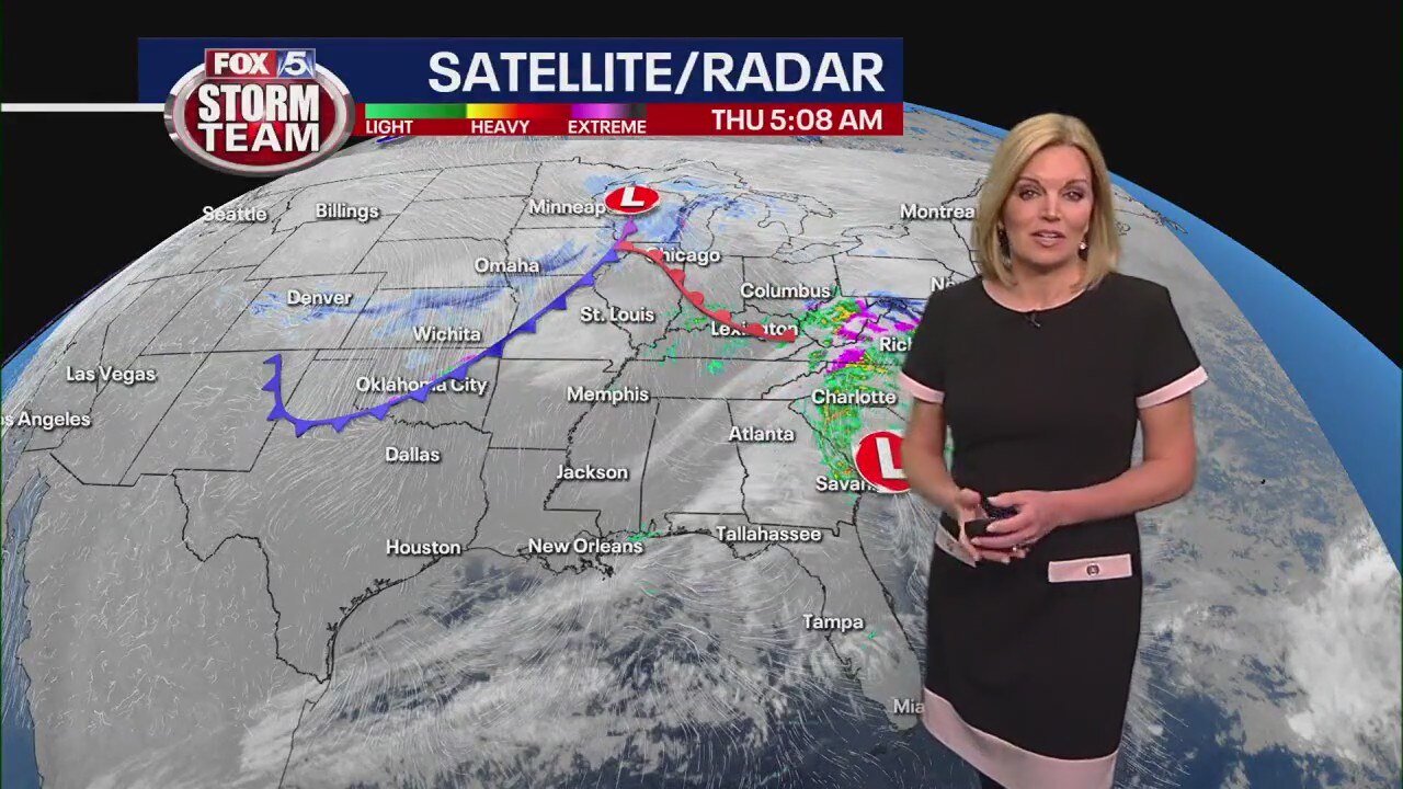
It's relatively warm this morning but the temperature change will come quickly tonight and drop to sub-zero wind chills by sunrise Friday.
It's relatively warm this morning but the temperature change will come quickly tonight and drop to sub-zero wind chills by sunrise Friday.
Wednesday evening forecast update
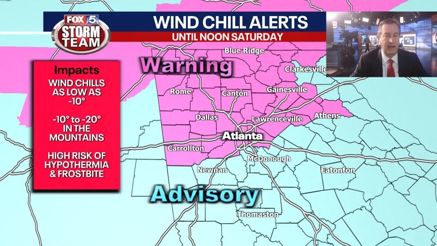
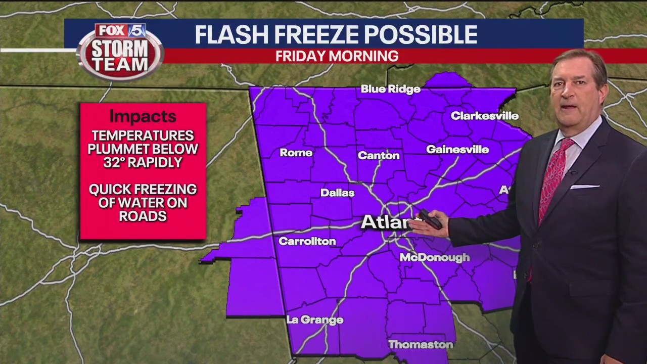
Temps will fall from the 40s to low 50s to the teens by Friday morning. A few showers will give way to snow showers, still not expecting any accumulations. Wind chills will be dangerous, we will have a Wind Chill Warning for North Georgia mountains and a Wind Chill Advisory for Metro Atlanta. Values will be below zero. Temps remaining below freezing until Sunday afternoon.
Temps will fall from the 40s to low 50s to the teens by Friday morning. A few showers will give way to snow showers, still not expecting any accumulations. Wind chills will be dangerous, we will have a Wind Chill Warning for North Georgia mountains and a Wind Chill Advisory for Metro Atlanta. Values will be below zero. Temps remaining below freezing until Sunday afternoon.

Arctic blast Christmas: Georgia to see coldest temperatures in 5 years
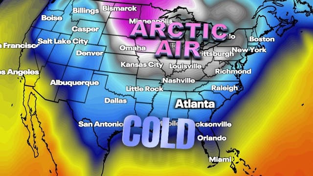
Friday morning will see some of the coldest air in five years move into Georgia just in time for Christmas.
Friday morning will see some of the coldest air in five years move into Georgia just in time for Christmas.