

Saturday evening forecast update
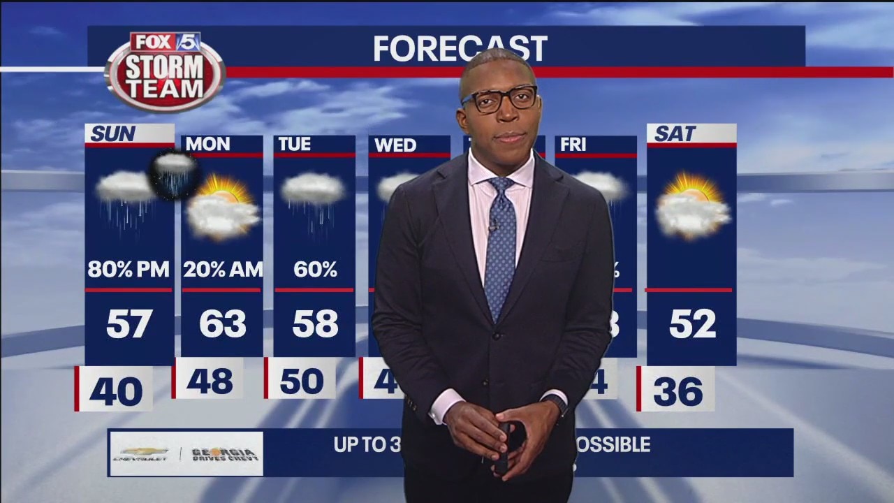
Rain returns late Sunday and tappers off early Monday morning. This will be first wave of several wave of wet (non-severe) weather expected in the week ahead. Meanwhile, temperatures will stay near or slightly above seasonal averages.
Rain returns late Sunday and tappers off early Monday morning. This will be first wave of several wave of wet (non-severe) weather expected in the week ahead. Meanwhile, temperatures will stay near or slightly above seasonal averages.
Saturday Evening Forecast
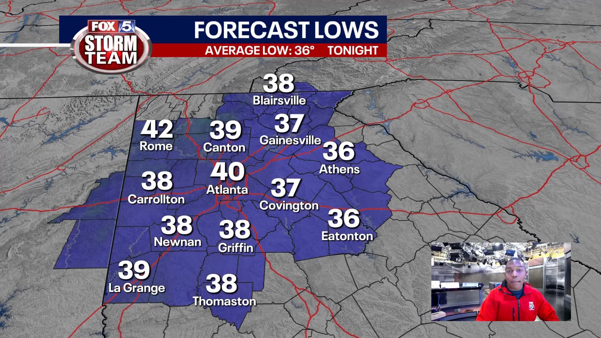
Showers return to north Georgia late Sunday.
Showers return to north Georgia late Sunday.
Saturday Forecast
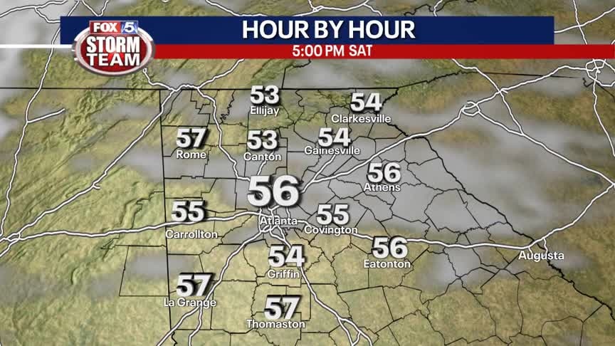
This Saturday will be the better of the two days this weekend for outdoor activities. Rain will return Sunday especially in the late afternoon and evening hours.
This Saturday will be the better of the two days this weekend for outdoor activities. Rain will return Sunday especially in the late afternoon and evening hours.
Friday Evening Weather Update
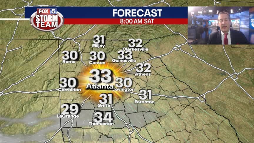
Clear and chilly overnight and into Saturday morning with lows around 32. Sunny and mild by afternoon with temps well into the 50s. Increasing clouds on Sunday with rain likely by Sunday evening. Here is the timeline.
Clear and chilly overnight and into Saturday morning with lows around 32. Sunny and mild by afternoon with temps well into the 50s. Increasing clouds on Sunday with rain likely by Sunday evening. Here is the timeline.
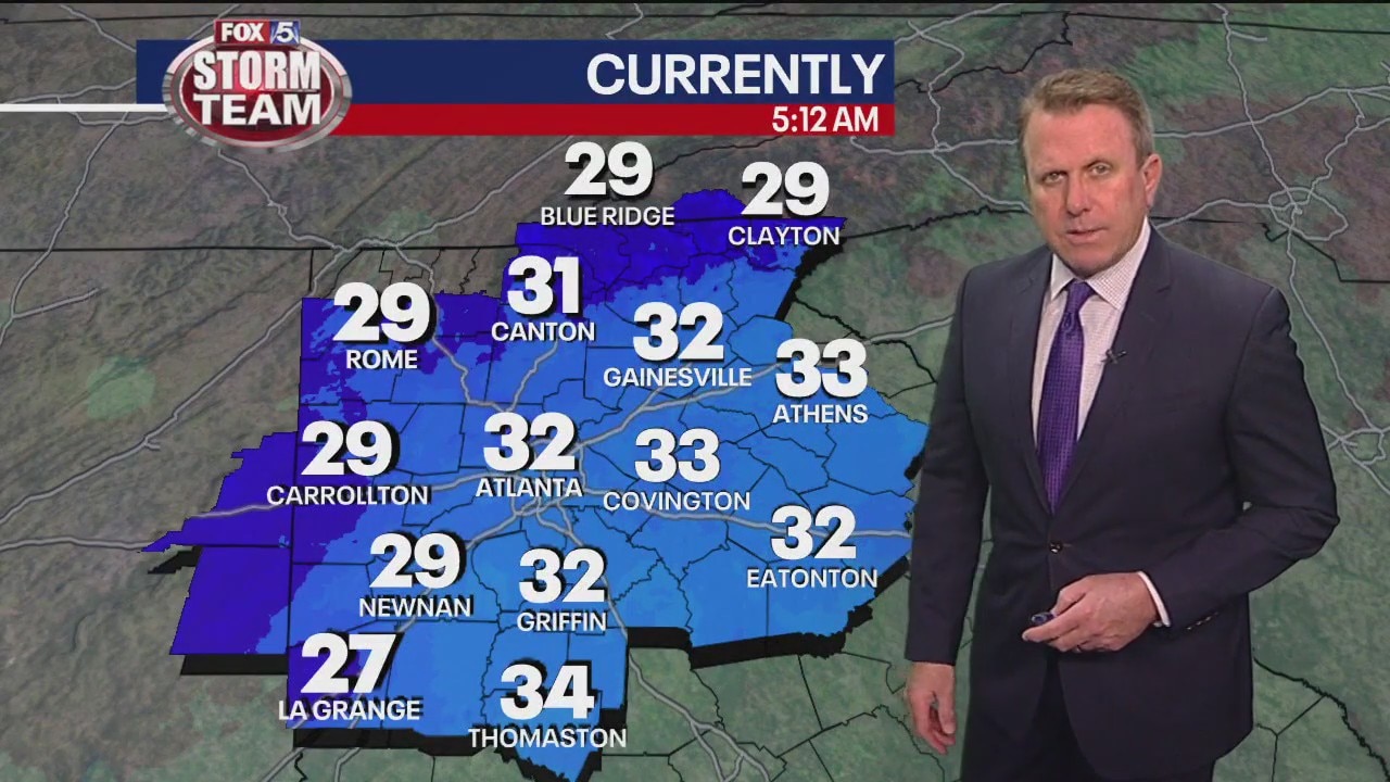
Friday morning weather forecast
We're staring the day even colder than yesterday and that chill will continue all day. It should be clear and dry skies until Sunday.
We're staring the day even colder than yesterday and that chill will continue all day. It should be clear and dry skies until Sunday.
Thursday Evening Weather Update
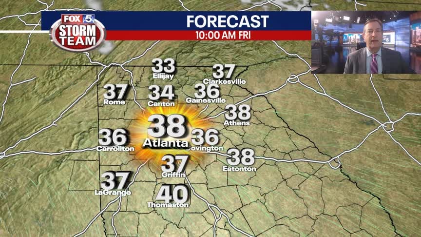
Mostly clear and getting colder tonight with lows by Friday morning in the 20s and low 30s. Sunny, breezy and cool Friay afternoon, highs near 50. Plenty of sun on Saturday and then rain likely on Sunday. Here is the breakdown.
Mostly clear and getting colder tonight with lows by Friday morning in the 20s and low 30s. Sunny, breezy and cool Friay afternoon, highs near 50. Plenty of sun on Saturday and then rain likely on Sunday. Here is the breakdown.
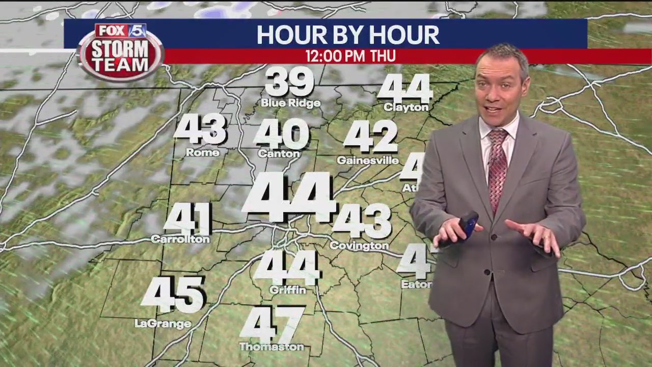
Thursday morning weather forecast
It's going to be much cooler today with highs only making it to the upper 40s. Expect a lot of breezy and partly cloudy weather in the afternoon.
It's going to be much cooler today with highs only making it to the upper 40s. Expect a lot of breezy and partly cloudy weather in the afternoon.

Wednesday Evening Weather Outlook
Cloudy and breezy into Thursday morning with seasonal temps in the 30s. A mix of sun and clouds on Thursday, but still cool, highs only in the 40s. Dry and cool thru Saturday before more wet weather by Sunday. Here is the latest.
Cloudy and breezy into Thursday morning with seasonal temps in the 30s. A mix of sun and clouds on Thursday, but still cool, highs only in the 40s. Dry and cool thru Saturday before more wet weather by Sunday. Here is the latest.
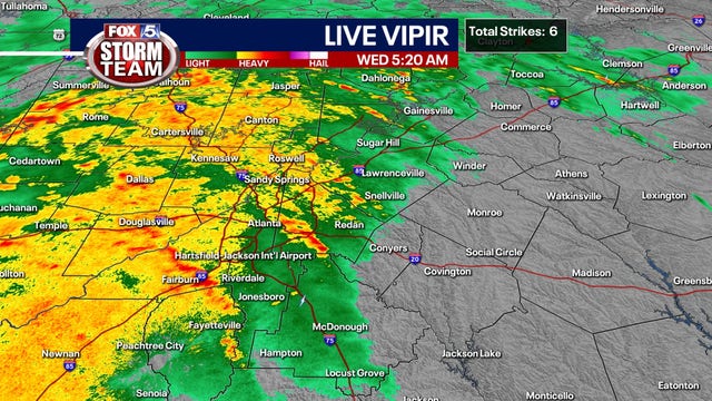

Heavy rains, gusty winds head into Georgia; Some districts delay start of school
More showers, thunderstorms, and heavy winds are bringing headaches for commuters and causing delays in some Georgia school systems Wednesday morning.
More showers, thunderstorms, and heavy winds are bringing headaches for commuters and causing delays in some Georgia school systems Wednesday morning.

Wednesday morning weather forecast
The strong winds this morning are ushering in warm temperatures but also showers and thunderstorms - making your commute a lot more difficult this morning.
The strong winds this morning are ushering in warm temperatures but also showers and thunderstorms - making your commute a lot more difficult this morning.
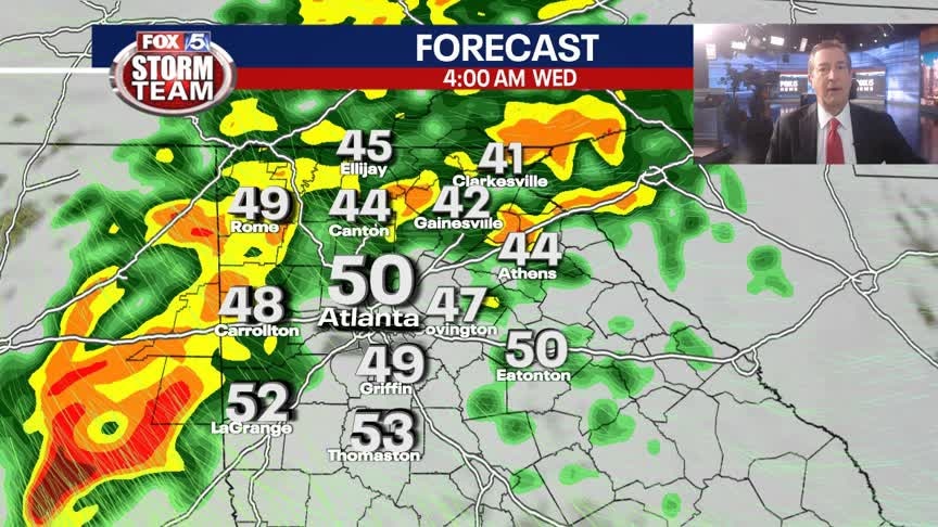
Tuesday Evening Weather Update
Rain and a possible t-storm likely overnight and into early Wednesday morning. Greatest threat for North Georgia will be gusty winds and brief heavy rain. Here are the details.
Rain and a possible t-storm likely overnight and into early Wednesday morning. Greatest threat for North Georgia will be gusty winds and brief heavy rain. Here are the details.

Tuesday morning weather forecast
A bit of sunshine will return to metro Atlanta on Tuesday, but the increasing breezes during the second half of the day are preceding the arrival of storms overnight.
A bit of sunshine will return to metro Atlanta on Tuesday, but the increasing breezes during the second half of the day are preceding the arrival of storms overnight.
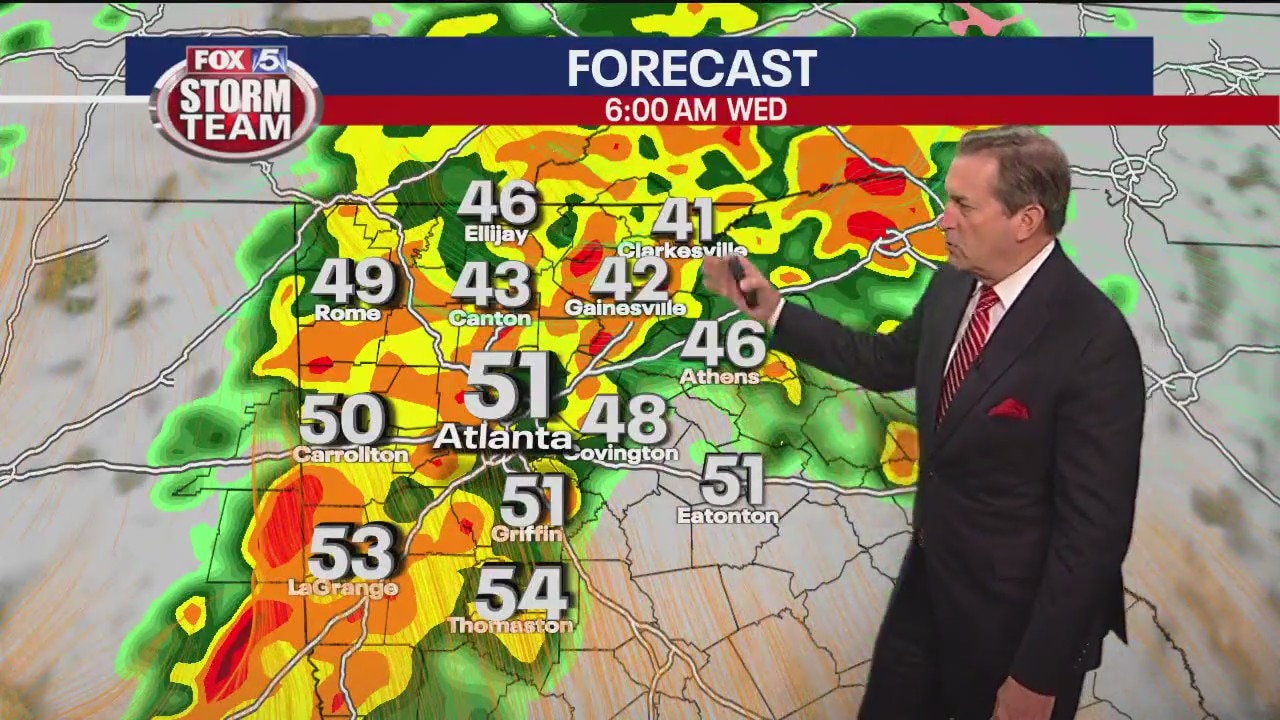
Monday night forecast update
More rain on the way Wednesday. Temperatures closer to normal.
More rain on the way Wednesday. Temperatures closer to normal.
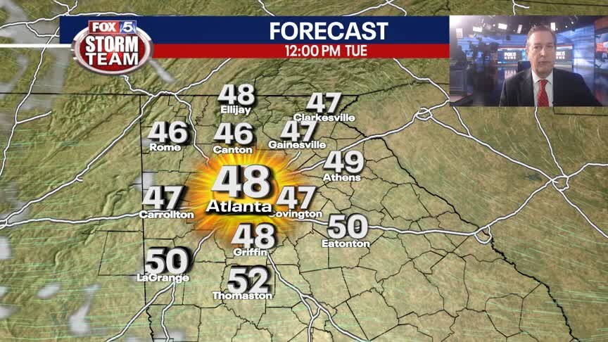
Monday Evening Weather Update
Clear and chilly overnight with most areas below freezing by Tuesday morning. Sunny and milder by afternoon with highs in the mid 50s. Clouds increase Tuesday night with rain and few storms likely early Wednesday morning. Here are the details.
Clear and chilly overnight with most areas below freezing by Tuesday morning. Sunny and milder by afternoon with highs in the mid 50s. Clouds increase Tuesday night with rain and few storms likely early Wednesday morning. Here are the details.
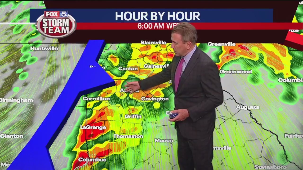
Monday afternoon forecast update
More rain on the way Wednesday. Temperatures closer to normal.
More rain on the way Wednesday. Temperatures closer to normal.

Monday morning weather forecast
After a rainy Sunday, today will be drier but still have chilly temperatures and wind up to 30 mph.
After a rainy Sunday, today will be drier but still have chilly temperatures and wind up to 30 mph.
Sunday evening forecast update
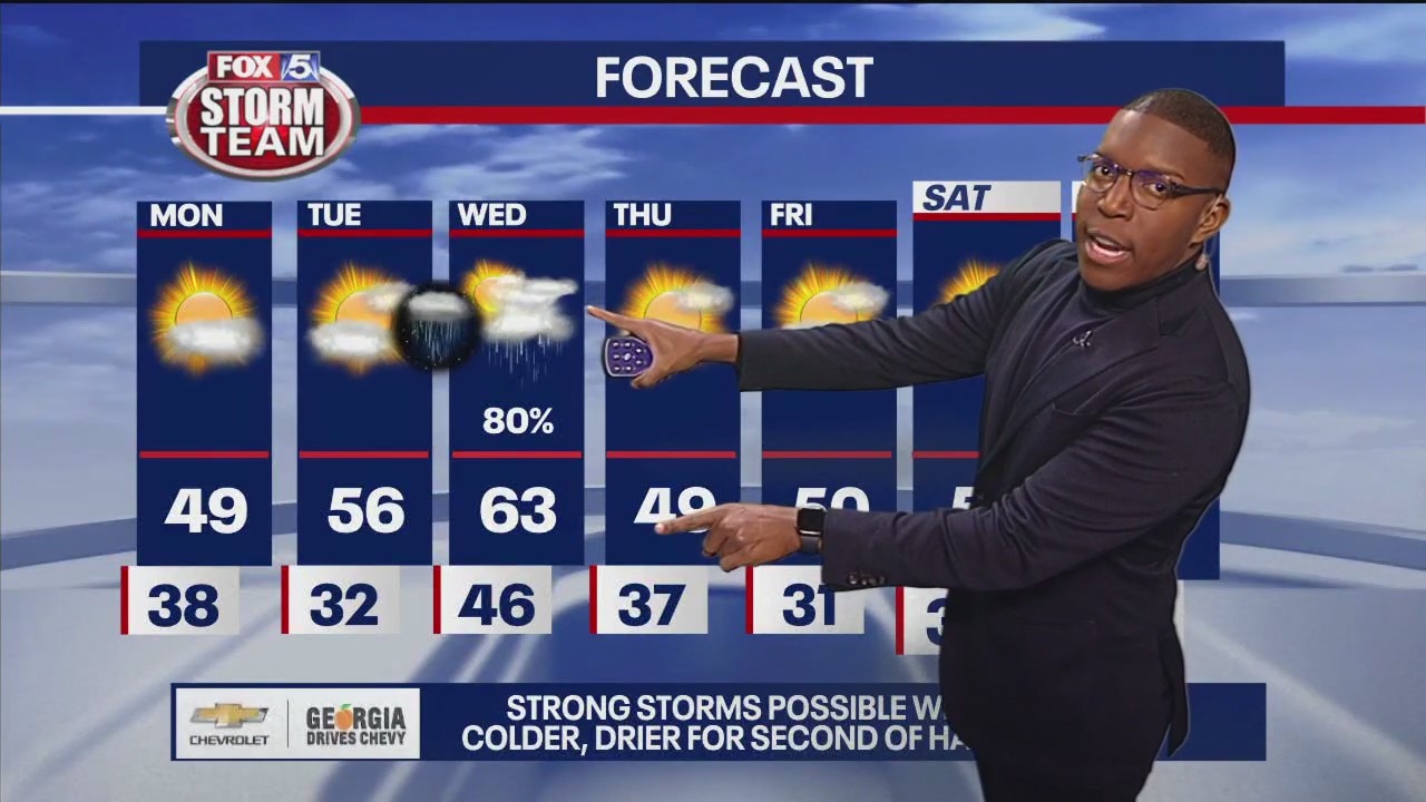
A few flurries may fly across the north Georgia mountains overnight, but accumulation will be minimal. Overall, Monday is calm and cold. High temperatures will only reach the upper 40s despite the increase in sunshine throughout the day. Temperatures will fall to our below freezing Monday night into Tuesday. Strong storms are possible late Tuesday into first half of the day Wednesday.
A few flurries may fly across the north Georgia mountains overnight, but accumulation will be minimal. Overall, Monday is calm and cold. High temperatures will only reach the upper 40s despite the increase in sunshine throughout the day. Temperatures will fall to our below freezing Monday night into Tuesday. Strong storms are possible late Tuesday into first half of the day Wednesday.
Saturday Forecast
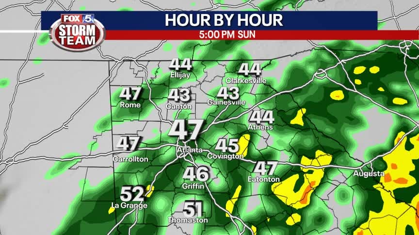
Occasional showers with unseasonably cool temperatures.
Occasional showers with unseasonably cool temperatures.
Sunday morning forecast
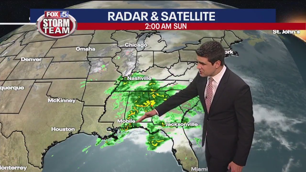
Not much dry time today as rain is persistent, but there's no chance of wintry precipitation. It could break Sunday afternoon before the downpours return.
Not much dry time today as rain is persistent, but there's no chance of wintry precipitation. It could break Sunday afternoon before the downpours return.
Saturday evening forecast update
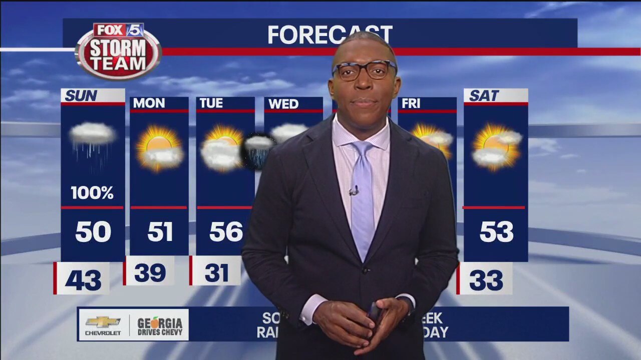
Expect showers overnight with possible thunderstorms in the early morning. Between half an inch to three quarters of an inch worth of rainfall is possible.
Expect showers overnight with possible thunderstorms in the early morning. Between half an inch to three quarters of an inch worth of rainfall is possible.