

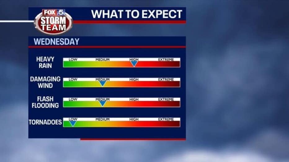
Waves of rain, thunderstorms increase potential for flash flooding Wednesday

WEATHER EXTRA: Strong to severe storms likely after sunset Wednesday
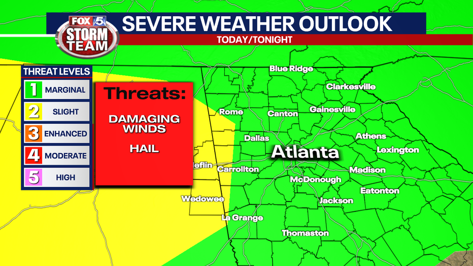
The FOX 5 Storm Team is watching a storm complex in the Mississippi Delta closely as it will bring widespread strong to severe storms across north Georgia Wednesday evening through Thursday morning.
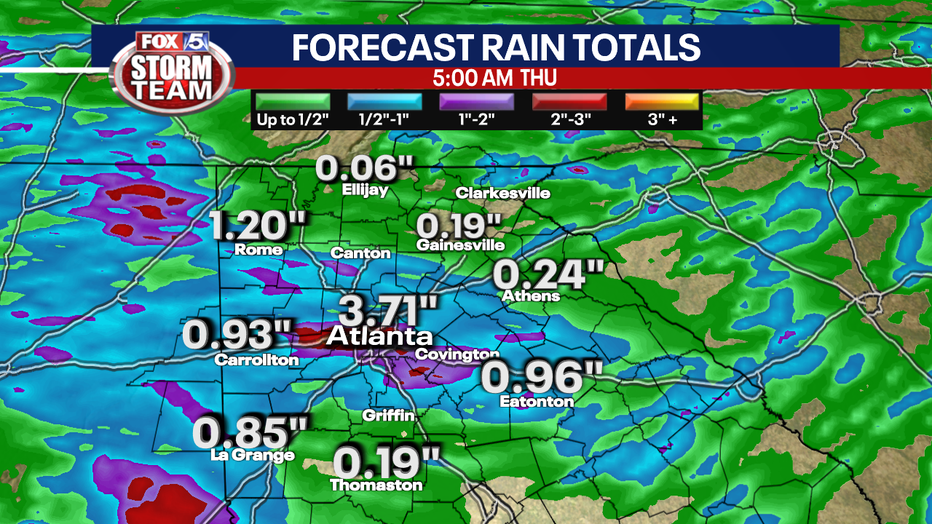
ATLANTA - The FOX 5 Storm Team is tracking the potential for flash flooding as multiple waves of rain and thunderstorms roll across north Georgia Wednesday.
Keep up with the latest by downloading the FREE FOX 5 Storm Team app and following @FOX5StormTeam on Twitter.
Isolated to scattered thunderstorms are possible beginning early in the day Wednesday and lasting into the afternoon and evening. Some of these storms may become severe, with damaging winds, isolated large hail, and cloud- to-ground lightning being the primary threats.
After a couple of rounds of rain earlier this week, the ground is saturated and additional 1" to 3" of rainfall over the next 24 hours will increase the potential for flooding, especially along and near waterway waters. The highest rainfall amounts will mainly be across west Georgia.
The risk for tornadoes is very low, but it can't be completely ruled out at this time.
Meanwhile, temperatures will remain in the 80s through Saturday before reaching towards the lower 90s by next week thanks to drier weather.