

North Georgia weather: Rain clears out of metro Atlanta
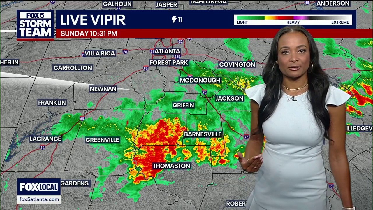
Sunday night weather
Although severe storms have filtered out, more rain could be on the way. Here's your latest forecast update. q
ATLANTA - A sluggish cold front is clearing out dense humidity across North Georgia this Sunday evening, paving the way for a sunny, dry workweek just in time for stadium crowds on Monday.
Sunday morning forecast
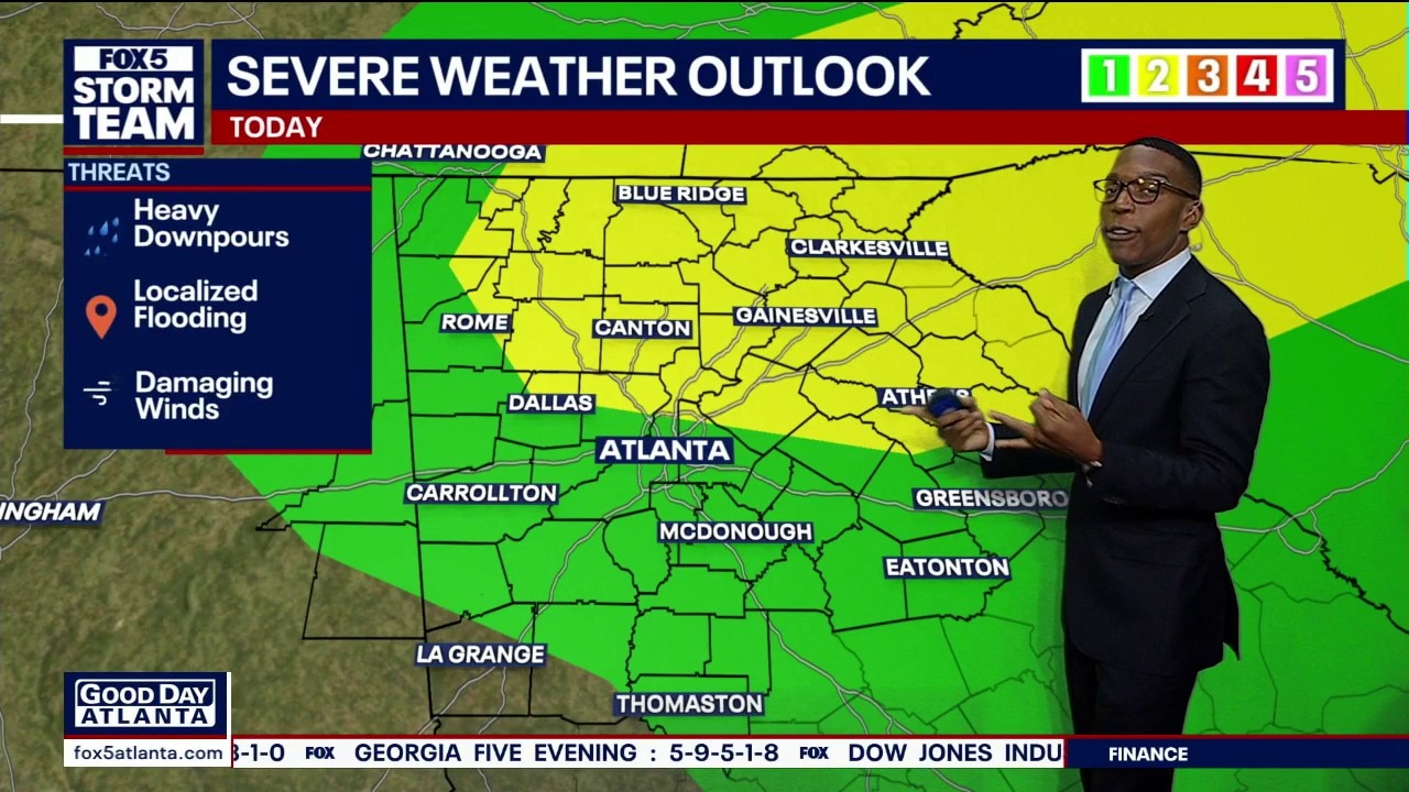
A fast-moving cold front is tracking across the region, bringing a risk of severe storms to northern Georgia and neighboring states late Sunday afternoon into the evening hours.
What we know:
A heavy round of afternoon showers and storms dumped over half an inch of rain into local gauges earlier today. Lingering storms are still pushing through the area, traveling from the northwest toward the southeast out of the region. Responding radar systems show the heaviest downpours are currently focused across northern portions of Upson County, moving through Barnesville, into Griffin, south of Jackson, and down toward Macon.
While these lingering cells are packing gusty winds and heavy downpours that could trigger localized flooding, weather officials confirmed that none of the remaining storms are severe. Metro Atlanta is already drying up as the cold front pushes the dense moisture southward. Behind the frontal boundary, relative humidity—which peaked at a muggy 87% alongside a evening temperature of 73 degrees—will drop significantly as crisp, dry air moves into the state.
Initial meteorological models predicted a very soggy multi-day stretch for northern Georgia. However, a major atmospheric shift has squeezed the rain dynamics further south into central and southern portions of the state. Skies will clear entirely overnight, leaving the area dry for Monday, Tuesday, and Wednesday, with only a very hit-or-miss shower possible.
The dry trend is a major relief for fans heading out to celebrate local FIFA events and tournament play. Monday morning will bring widespread sunshine and temperatures in the warm 70s. By the time the high-stakes noon kickoff begins at Atlanta stadium, spectators will see a comfortable mix of sun and clouds with temperatures hovering in the upper 70s to low 80s. Winds will remain light out of the west at around 9 mph.
What's next:
The region will catch a welcome break from intense summer heat over the next few days. Afternoon highs will drop out of the 90s, cooling down into the lower-to-middle 80s through Wednesday.
However, weather teams are already tracking the next weather system. A secondary front will start moving in from the northwest on Thursday night. This system will push a fresh round of storms back into the area by Friday, potentially impacting regional Juneteenth celebrations as temperatures begin to warm back up.
The Source: The information in this article comes from the FOX 5 Storm Team.