

Scattered storms trigger regional warnings across North Georgia
Sunday evening weather forecast
A stalled weather system stretching across the Southeast is triggering a round of storms and downpours that will bring cooler temperatures to North Georgia over the next two days.
ATLANTA - A stalled weather system stretching across the Southeast is triggering a round of storms and downpours that will bring cooler temperatures to North Georgia over the next two days.
What we know:
Scattered showers and storms are flaring up across the area due to a boundary sitting over the Southeast. The stormy pattern is bringing heavy downpours, lightning and gusty winds to multiple cities.
A severe thunderstorm warning recently clipped eastern areas near Augusta, while Habersham also saw an earlier warning. Heavy rains have been spotted on the north side of Atlanta near Sandy Springs and the King and Queen building, and storms are now popping up in downtown Atlanta.
While downtown reached a steamy high of 92 degrees earlier today, areas experiencing rainfall have already seen quick temperature drops. Duluth cooled to 79 degrees, while Manchester dropped to 78 degrees during the afternoon downpours.
Showers and storms will continue throughout this evening before settling down during the early morning hours.
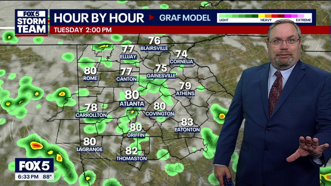
An upper-level disturbance parked along the Alabama-Georgia state line will keep weather conditions unsettled through Monday and Tuesday. This system will provide a temporary summer break by capping Tuesday afternoon temperatures at 80 degrees.
Total rainfall could reach between 1 and 3 inches by Tuesday night, and some areas may see locally heavy downpours. However, forecasters warn that the cooler weather will not last, as temperatures are set to heat up significantly heading into next weekend.
A ground delay is in effect for Hartsfield-Jackson International Airport until at least 7 p.m.
A severe thunderstorm watch is in place for parts of North Georgia until 9 p.m. Sunday.
What we don't know:
Officials noted that Monday's risk for severe weather remains relatively low and is primarily focused toward eastern zones. Because these summer patterns can change daily, meteorologists have not yet confirmed if the low-risk zone will shift back into central north Georgia.
The exact locations that will experience the heaviest localized flooding or rainfall totals of up to 3 inches also remain uncertain until the storm bands line up.
The backstory:
The current pattern mirrors the unpredictable weather seen on Saturday, where one spot experienced pouring rain while a location less than three miles away stayed completely bone dry. Forecasters warn that daytime heating will continue to fester these localized popcorn storms through the evening hours.
Why you should care:
Even if it is not raining in your exact neighborhood, lightning strikes can still hit dry ground nearby. While the radar is expected to briefly calm down after the afternoon heat, a second round of scattered showers and storms will pop up on the radar for some areas between 9 p.m. and 11 p.m.
What's next:
Wet weather will linger into the week, with a 70% chance of rain forecast for Monday and Tuesday. Tropical moisture begins to dwindle by Wednesday, dropping the rain chance to 40% just in time for the FIFA match day kickoff at 3 p.m., which features a high temperature of 86 degrees. High temperatures will jump right back into the 90s by Friday as the rain entirely clears out.
The Source: The information in this story was gathered from a live weather broadcast by meteorologist Alex Forbes, who detailed current radar tracking, regional temperature readings, and the weekly meteorological outlook.