

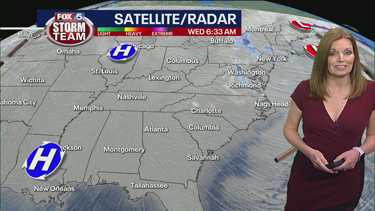
Wednesday morning forecast
It'll be sunny and cool and breezy at times today, but winds won't be nearly as gusty as yesterday.
It'll be sunny and cool and breezy at times today, but winds won't be nearly as gusty as yesterday.
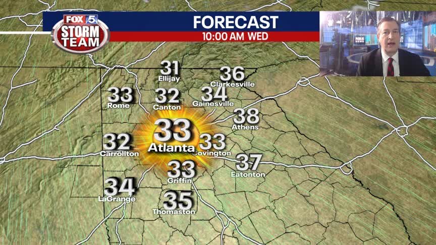
Tuesday Evening Weather Update
Clear and cold overnight and with a gusty NW wind, windhcills will land in the teens and low 20s. Sunny and cool on Wednesday, rain returns by Friday morning. Here is the latest.
Clear and cold overnight and with a gusty NW wind, windhcills will land in the teens and low 20s. Sunny and cool on Wednesday, rain returns by Friday morning. Here is the latest.
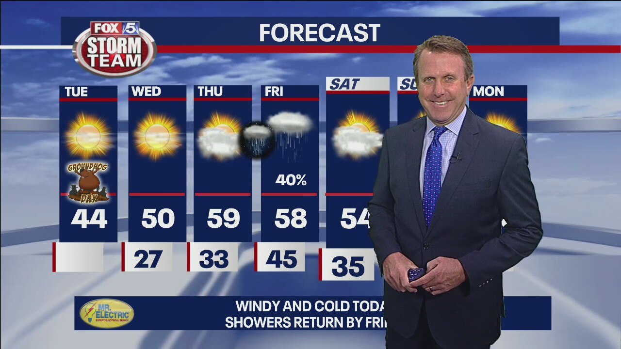
Wednesday Afternoon Forecast Update
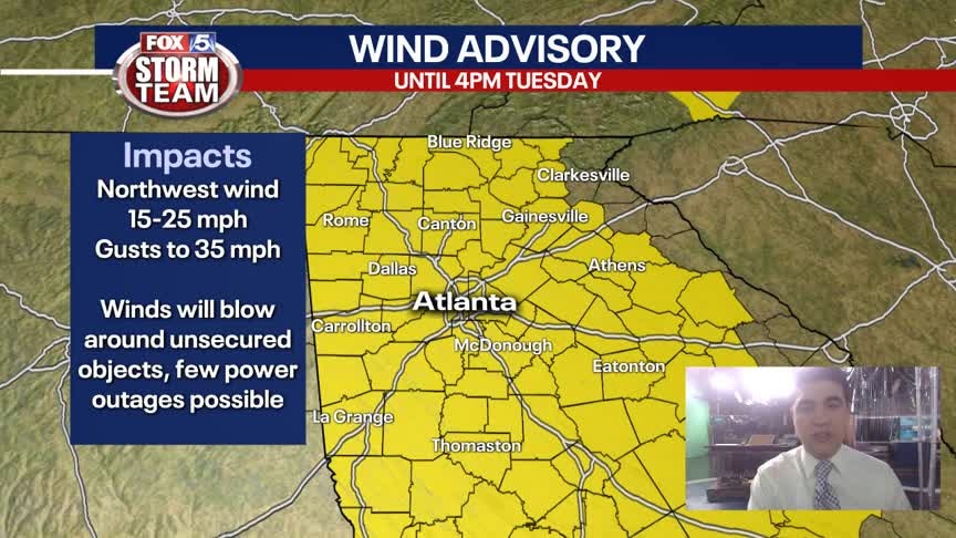
Wind Advisory is in effect until 7 pm for wind gusts to 40 mph.
Wind Advisory is in effect until 7 pm for wind gusts to 40 mph.
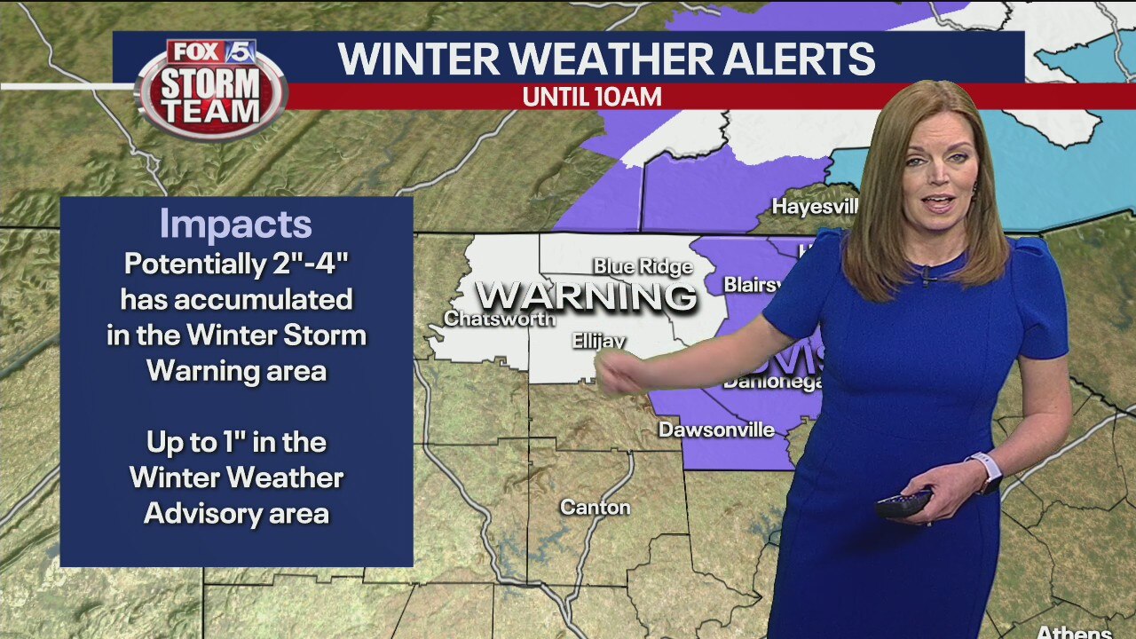
Tuesday morning forecast
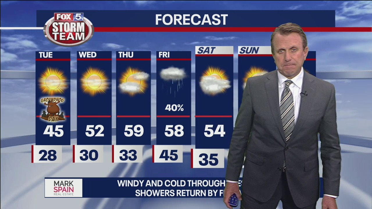
Expect lots of sunshine today and tomorrow, then an increase in clouds Thursday ahead of Friday's rain.
Expect lots of sunshine today and tomorrow, then an increase in clouds Thursday ahead of Friday's rain.
Monday evening forecast
Very cold and windy through Tuesday afternoon and really for the most part into Wednesday morning although not as windy. Next system arrives Friday. Both GFS and Euro agree on initial precipitation early Friday then it all goes haywire for the weekend. Think it will take a few more runs to iron it out. Very cold for Sunday into early next week with a blast arctic air that makes it all the way to here in the south.
Very cold and windy through Tuesday afternoon and really for the most part into Wednesday morning although not as windy. Next system arrives Friday. Both GFS and Euro agree on initial precipitation early Friday then it all goes haywire for the weekend. Think it will take a few more runs to iron it out. Very cold for Sunday into early next week with a blast arctic air that makes it all the way to here in the south.

Monday evening forecast
Sunshine returns tomorrow, but it stays breezy and cold. Nice warm up for the rest of the week. Near or above 60 starting Thursday. But a similar cold blast will return by the end of the weekend.
Sunshine returns tomorrow, but it stays breezy and cold. Nice warm up for the rest of the week. Near or above 60 starting Thursday. But a similar cold blast will return by the end of the weekend.
Monday Forecast
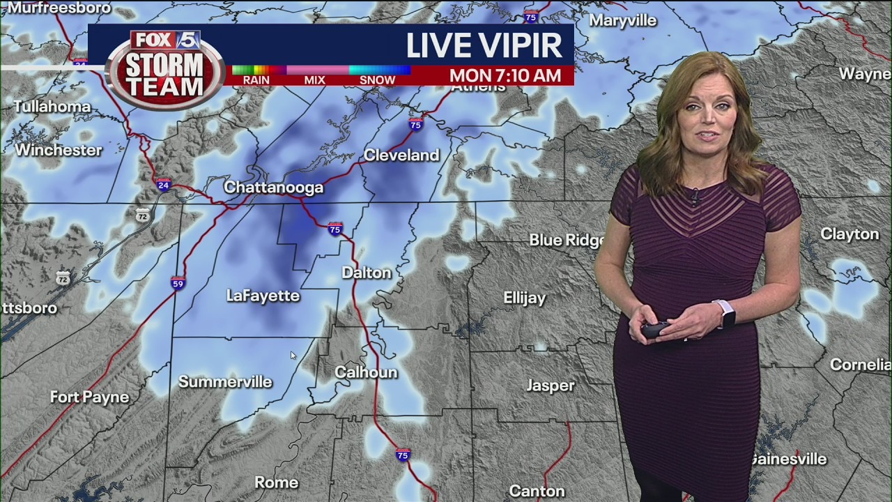
Cold and windy with light snow showers in the mountains.
Cold and windy with light snow showers in the mountains.
Monday morning forecast
The big nor'easter affecting the North is leaving hints of snow flurries in the upper reaches of Georgia.
The big nor'easter affecting the North is leaving hints of snow flurries in the upper reaches of Georgia.
Sunday Night Forecast Update
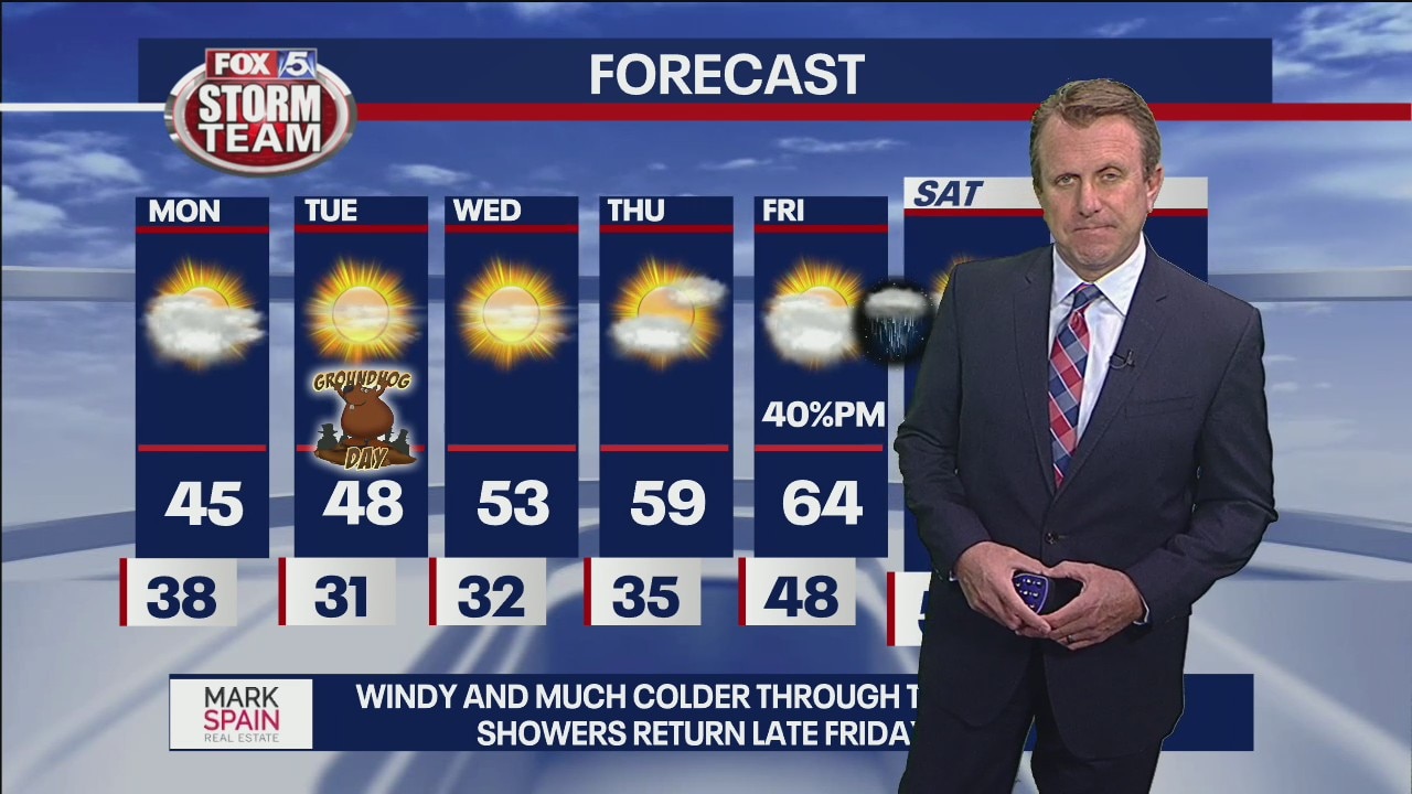
a few showers this evening and then windy and much colder conditions arrive for Monday and Tuesday.
a few showers this evening and then windy and much colder conditions arrive for Monday and Tuesday.
Sunday Forecast
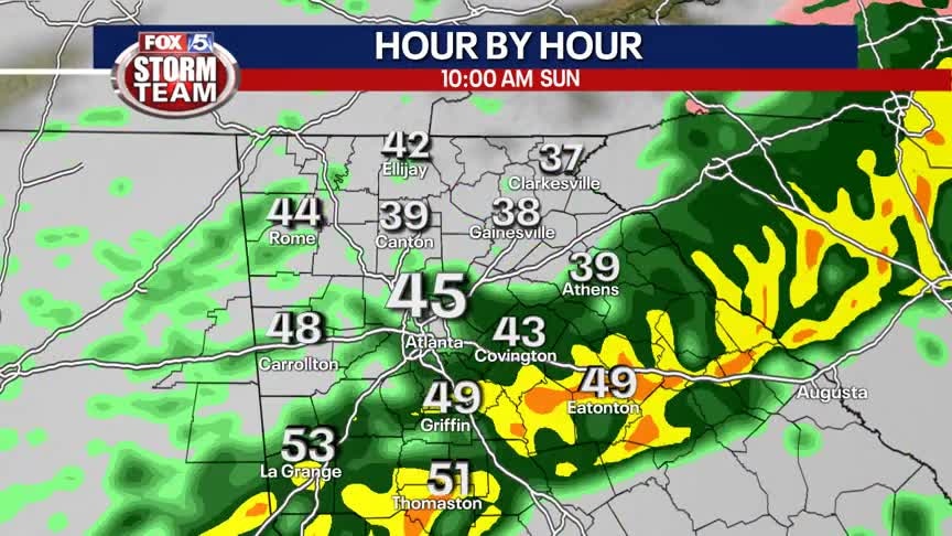
Soggy Sunday with a brief window for outdoor activities this afternoon before the cold front moves through. Get ready for major changes over the next 24 hours.
Soggy Sunday with a brief window for outdoor activities this afternoon before the cold front moves through. Get ready for major changes over the next 24 hours.
Saturday Night Forecast
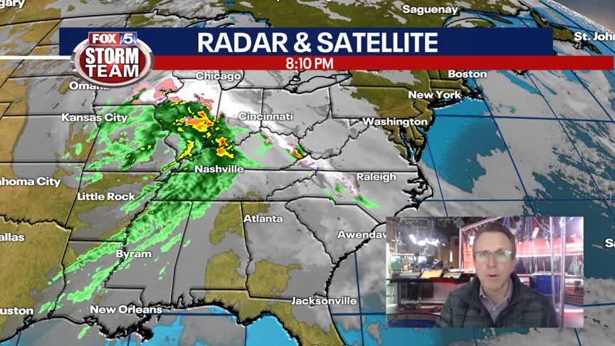
Showers will be moving in overnight and will continue for much of Sunday morning.
Showers will be moving in overnight and will continue for much of Sunday morning.

Saturday Forecast
More clouds than sun with most areas staying dry, better rain chances return tonight.
More clouds than sun with most areas staying dry, better rain chances return tonight.
Friday evening forecast
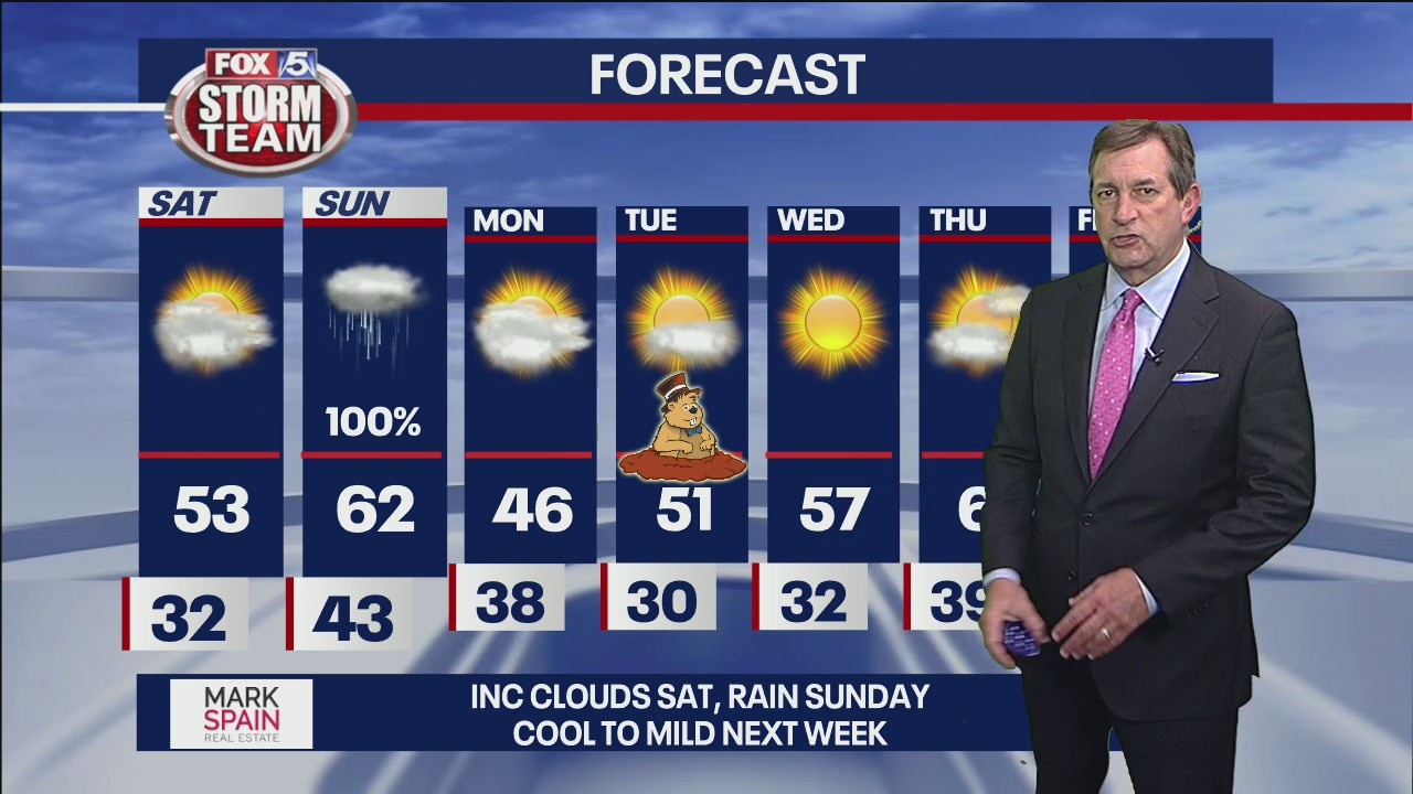
Clouds increase Saturday, rain follows Sunday. Sunday will be milder with highs in the low 60s and occasional rain. That will lead in a new blast of cold air for Monday. Most of next week looks quiet. And if the forecast remains sunny for Groundhog Day on Tuesday, in theory, he'll see his shadow = six more weeks of winter!
Clouds increase Saturday, rain follows Sunday. Sunday will be milder with highs in the low 60s and occasional rain. That will lead in a new blast of cold air for Monday. Most of next week looks quiet. And if the forecast remains sunny for Groundhog Day on Tuesday, in theory, he'll see his shadow = six more weeks of winter!
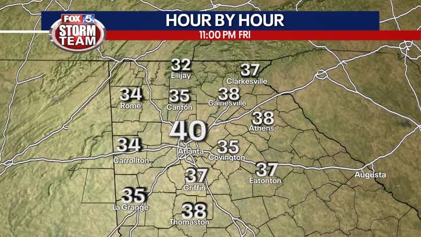
Friday Evening Weather Update
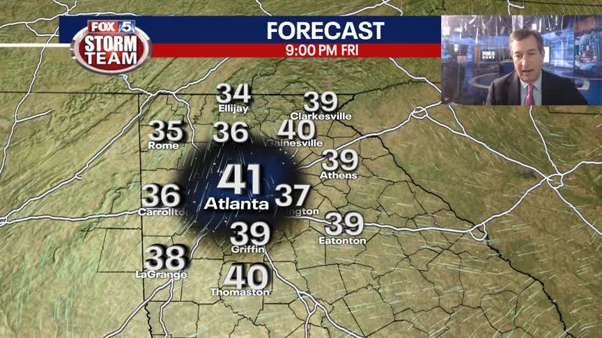
Clear and chilly again tonight with lows down around freezing by Saturday morning. Increasing clouds thru the day with highs in the 50s. Rain arrives by Sunday morning. Here is the breakdown.
Clear and chilly again tonight with lows down around freezing by Saturday morning. Increasing clouds thru the day with highs in the 50s. Rain arrives by Sunday morning. Here is the breakdown.
Friday Afternoon Forecast
Cool sunshine with less wind. Rain chances return late Saturday into Sunday.
Cool sunshine with less wind. Rain chances return late Saturday into Sunday.
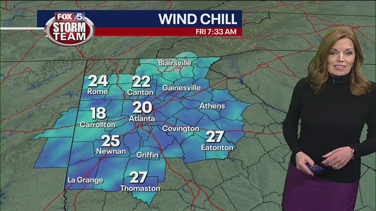
Friday morning forecast
Soak in the sunshine today because the weekend will bring some soggy weather.
Soak in the sunshine today because the weekend will bring some soggy weather.
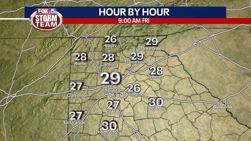
Thursday Evening Weather Update
Clear and cold for Thursday night into Friday morning. Most areas down below freezing to start the day. Sunny on Friday and increasing clouds on Saturday. Rain is likely on Sunday. Here is the breakdown.
Clear and cold for Thursday night into Friday morning. Most areas down below freezing to start the day. Sunny on Friday and increasing clouds on Saturday. Rain is likely on Sunday. Here is the breakdown.
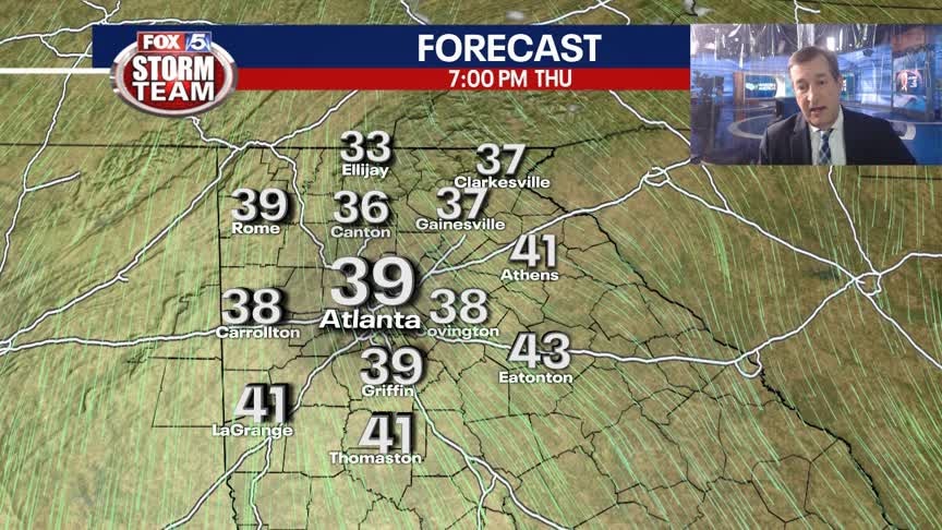
Thursday Afternoon Forecast
The unseasonably cold temperatures will stick around, but the wind will start to relax this evening. Next best chance for rain will be Sunday.
The unseasonably cold temperatures will stick around, but the wind will start to relax this evening. Next best chance for rain will be Sunday.
Thursday morning forecast
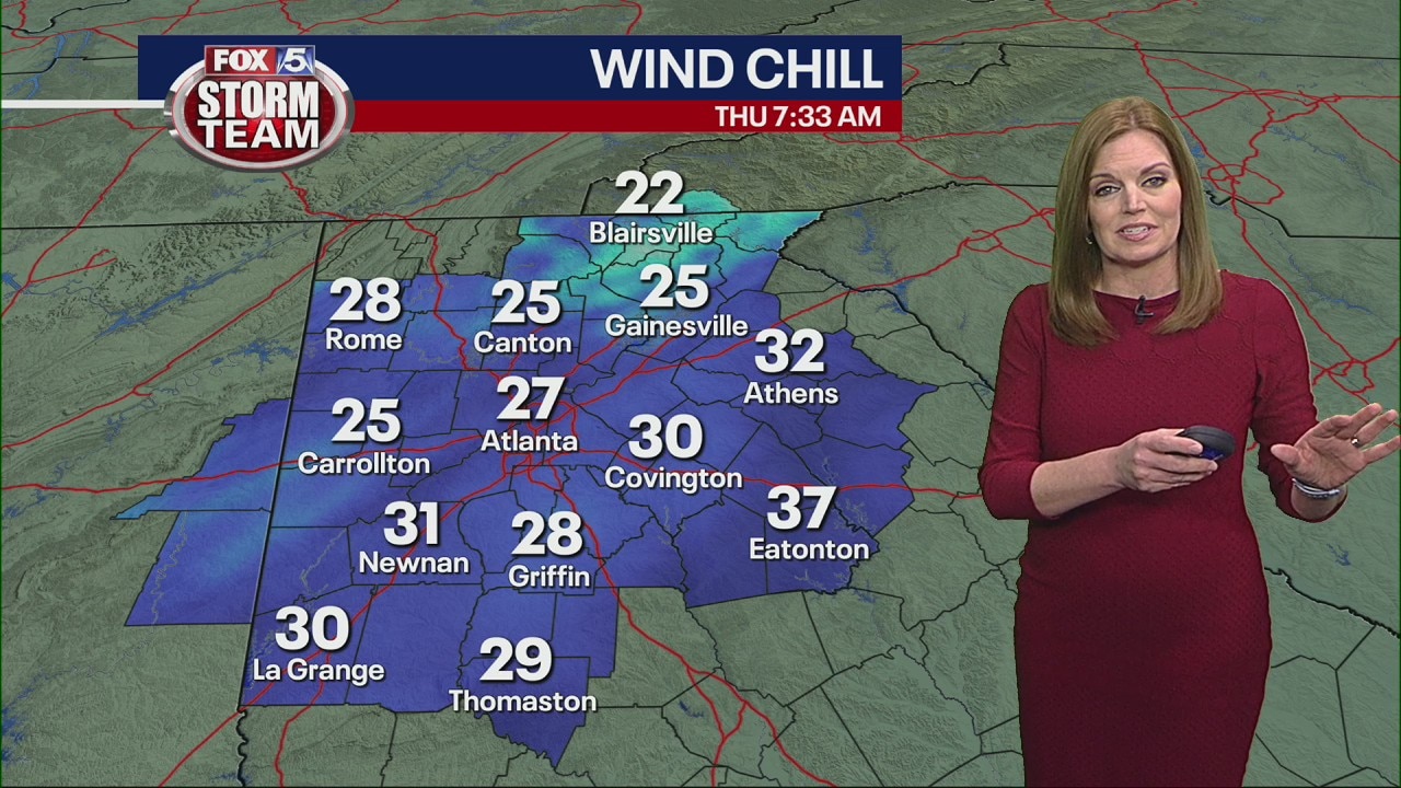
It's a blustery, cold day today with winds gusting over 20-30 mph this morning.
It's a blustery, cold day today with winds gusting over 20-30 mph this morning.
Wednesday night forecast
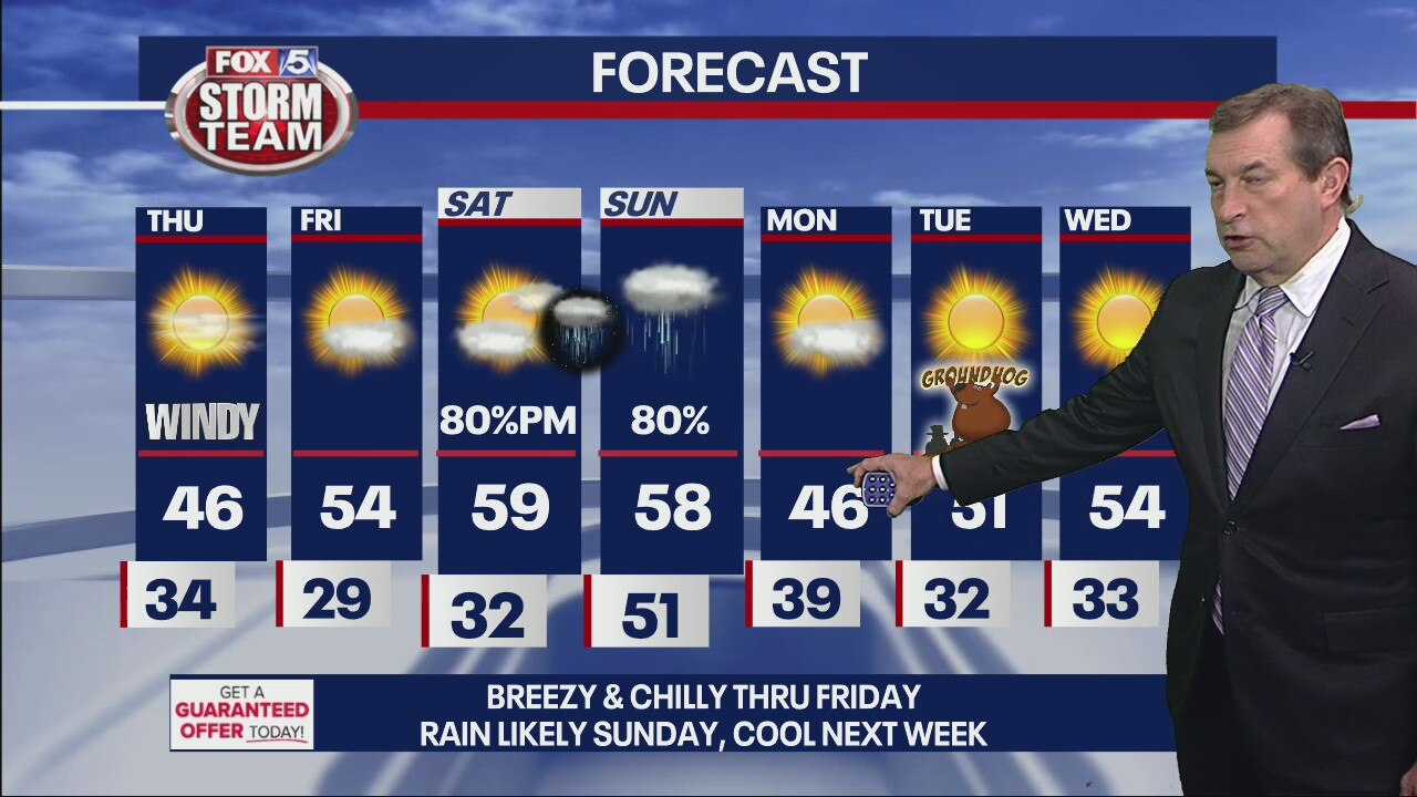
Welcome back January. Mostly clear, breezy and cold to start Thursday morning. Lows near 32, with wind chills in the 20s, teens in the mountains. Sunny and mid 40s by afternoon and then down into the 20s for Friday morning. Milder by Friday afternoon and then nice on Saturday with a high in the upper 50s. Rain returns Saturday night into Sunday. Seasonal temps again next week.
Welcome back January. Mostly clear, breezy and cold to start Thursday morning. Lows near 32, with wind chills in the 20s, teens in the mountains. Sunny and mid 40s by afternoon and then down into the 20s for Friday morning. Milder by Friday afternoon and then nice on Saturday with a high in the upper 50s. Rain returns Saturday night into Sunday. Seasonal temps again next week.