

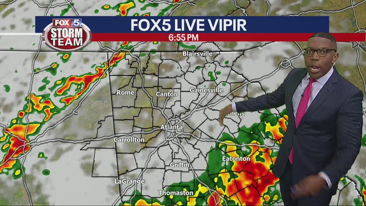
Line of strong storms in metro Atlanta, second headed for NW Georgia
Strong storms are moving along I-20 and heading north into Gwinnett County. Early evening, a line associated with a cold front is expected to move into northwest Georgia.
Strong storms are moving along I-20 and heading north into Gwinnett County. Early evening, a line associated with a cold front is expected to move into northwest Georgia.

Tracking possibly strong to severe storms Wednesday
New cells are firing ahead of a cold front, creating the possibility of multiple rounds of storms throughout the day.
New cells are firing ahead of a cold front, creating the possibility of multiple rounds of storms throughout the day.

Wednesday morning weather forecast
There were hundreds of severe weather reports and dozens of tornado reports across the South Tuesday and we are preparing for another round that is bringing an enhanced threat to the metro Atlanta area late Wednesday.
There were hundreds of severe weather reports and dozens of tornado reports across the South Tuesday and we are preparing for another round that is bringing an enhanced threat to the metro Atlanta area late Wednesday.
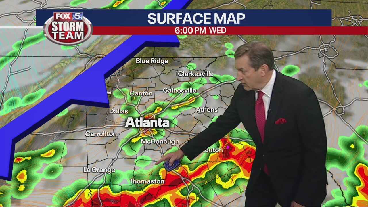
Tuesday night forecast update
Strong/severe storms late Wednesday. Cooler into the weekend.
Strong/severe storms late Wednesday. Cooler into the weekend.
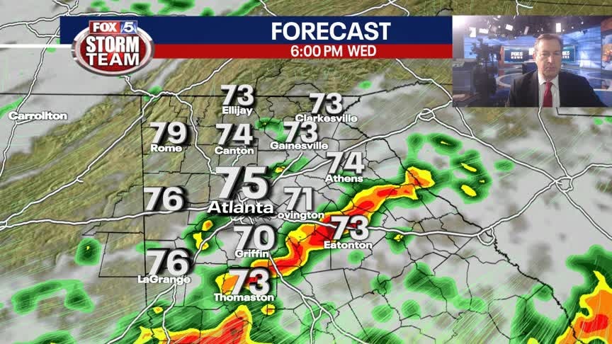
Tuesday Evening Weather Update
The rain and storms of earlier are gone, clouds and mild temps will remain overnight. More showers and storms expected later Wednesday afternoon into the evening. Here is the latest.
The rain and storms of earlier are gone, clouds and mild temps will remain overnight. More showers and storms expected later Wednesday afternoon into the evening. Here is the latest.

Storms move east of Atlanta
Widespread flooding is possible in parts of metro Atlanta Tuesday evening. A second round of storms is coming to north Georgia Wednesday afternoon.
Widespread flooding is possible in parts of metro Atlanta Tuesday evening. A second round of storms is coming to north Georgia Wednesday afternoon.

Tornado Watch issued in parts of middle, south Georgia
Severe storms are progressing into Georgia, bringing rain to North Georgia and south of Atlanta. There's a risk of some possible tornadoes south of I-20, but the current watch box didn't extend far north of Macon at around noon.
Severe storms are progressing into Georgia, bringing rain to North Georgia and south of Atlanta. There's a risk of some possible tornadoes south of I-20, but the current watch box didn't extend far north of Macon at around noon.

Monday morning weather forecast
Heavy rain and severe storms will be widespread across north Georgia by midday Tuesday and continue all day. People in the metro Atlanta area should expect heavy rain, possible flooding, high winds, and the risk of tornadoes.
Heavy rain and severe storms will be widespread across north Georgia by midday Tuesday and continue all day. People in the metro Atlanta area should expect heavy rain, possible flooding, high winds, and the risk of tornadoes.

Monday night forecast update
Two rounds of strong to severe storms, Tuesday morning and Wednesday night. Cooler through the weekend.
Two rounds of strong to severe storms, Tuesday morning and Wednesday night. Cooler through the weekend.

Two rounds of strong severe storms
The FOX 5 Storm Team is tracking two rounds of strong to severe storms, one on Tuesday and the other on Wednesday.
The FOX 5 Storm Team is tracking two rounds of strong to severe storms, one on Tuesday and the other on Wednesday.

Monday evening forecast update
Two rounds of strong to severe storms. Cooler by Friday and the weekend.
Two rounds of strong to severe storms. Cooler by Friday and the weekend.

Monday Evening Weather Update
A quiet Monday evening before rounds of strong to severe storms on Tuesday and again Wednesday. The storm risk rises after 10am on Tuesday. Here is the latest breakdown.
A quiet Monday evening before rounds of strong to severe storms on Tuesday and again Wednesday. The storm risk rises after 10am on Tuesday. Here is the latest breakdown.

'Enhanced' risk for severe storms beginning Tuesday, second round Wednesday
The system may move into North Georgia after 9 a.m. Tuesday. Areas south of I-20 have the highest risk of potential tornadoes on Tuesday.
The system may move into North Georgia after 9 a.m. Tuesday. Areas south of I-20 have the highest risk of potential tornadoes on Tuesday.

Monday midday forecast
A sunny, warm Monday ahead of severe weather on Tuesday and Wednesday. Thunderstorms will be widespread in the area.
A sunny, warm Monday ahead of severe weather on Tuesday and Wednesday. Thunderstorms will be widespread in the area.
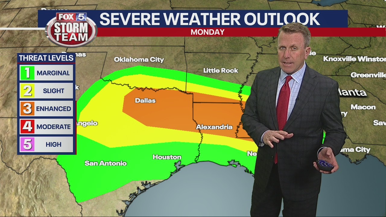
Monday morning weather forecast
Monday is warm with cloud coverage, but get ready for showers and thunderstorms to arrive Tuesday morning with another round late Wednesday.
Monday is warm with cloud coverage, but get ready for showers and thunderstorms to arrive Tuesday morning with another round late Wednesday.

Sunday night forecast
Temperatures will fall into the mid 40s overnight before warming into the mid 70s on Monday.
Temperatures will fall into the mid 40s overnight before warming into the mid 70s on Monday.

Sunday Forecast
Full sunshine with seasonal temperatures. Breezy at times with gusts up to 20mph.
Full sunshine with seasonal temperatures. Breezy at times with gusts up to 20mph.
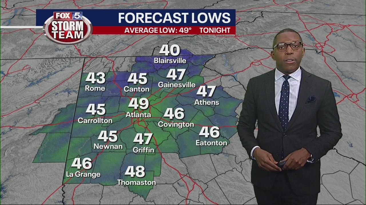
Saturday evening forecast
Temperatures will fall into the high 40s throughout Saturday night.
Temperatures will fall into the high 40s throughout Saturday night.
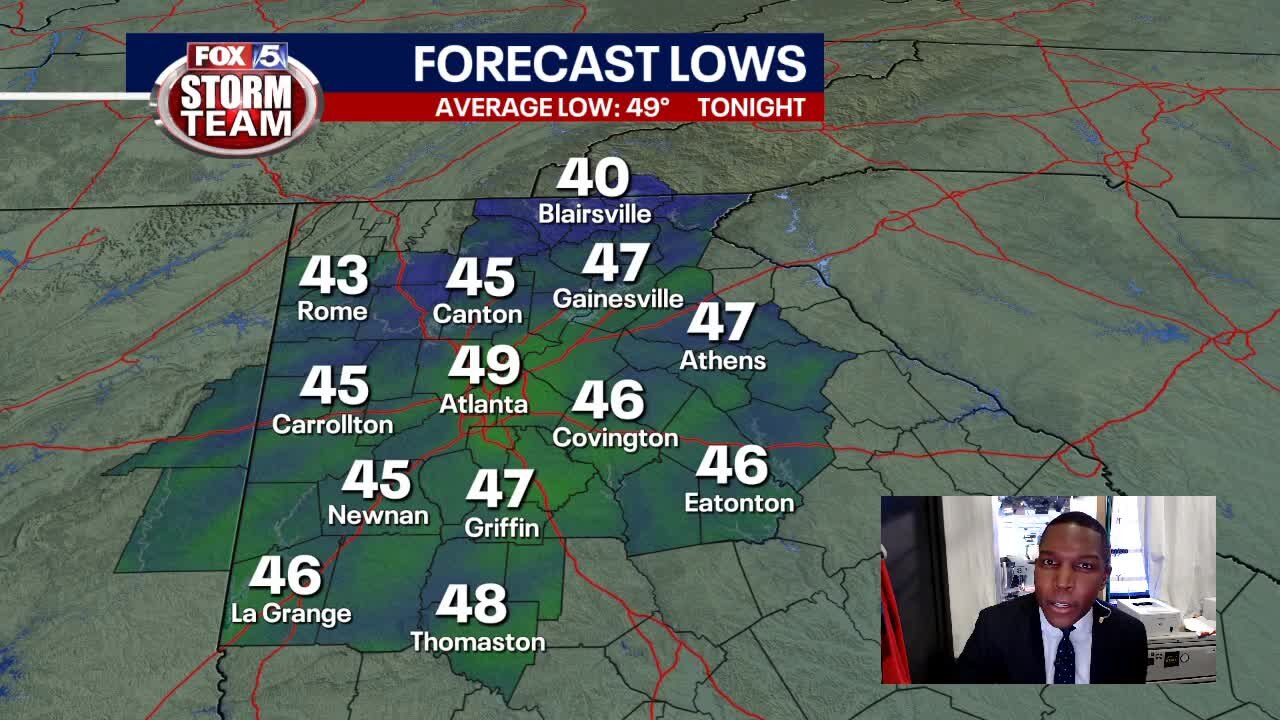
Saturday Evening Weather Update
Sunday is bright and breezy. But dry conditions are short-lived as spring storms will return by midweek.
Sunday is bright and breezy. But dry conditions are short-lived as spring storms will return by midweek.
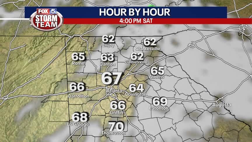
Saturday Forecast
Mix of sun and clouds with seasonal temperatures. A few light showers are possible, but they will have a low impact on your outdoor plans.
Mix of sun and clouds with seasonal temperatures. A few light showers are possible, but they will have a low impact on your outdoor plans.