

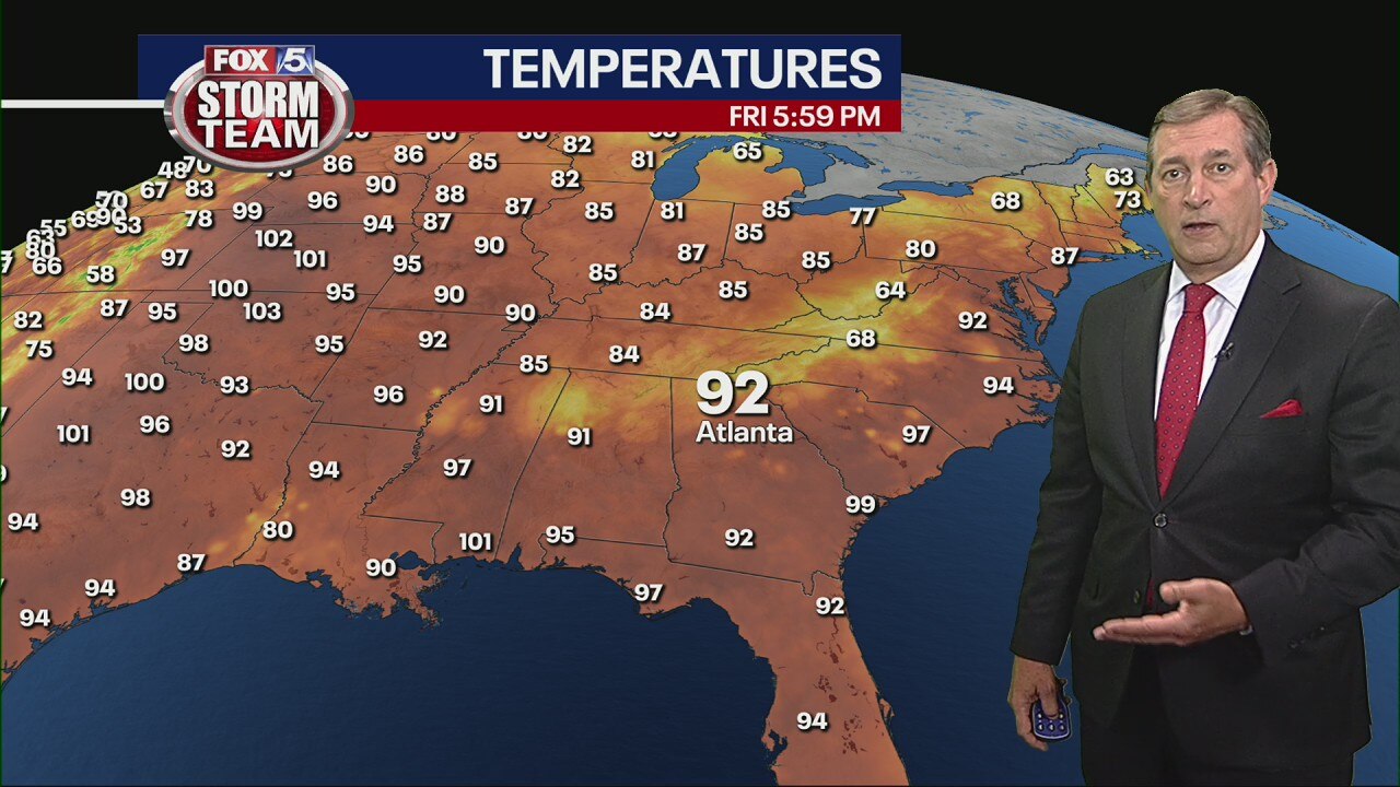
Friday evening forecast
The storms are expected to move out as a front moves through Georgia on Friday ushering in some drier weather. How that will impact the weather into next week.
The storms are expected to move out as a front moves through Georgia on Friday ushering in some drier weather. How that will impact the weather into next week.

Friday morning forecast
Georgia has one more day of sweltering, humid weather before dry air moves in for Father's Day Weekend.
Georgia has one more day of sweltering, humid weather before dry air moves in for Father's Day Weekend.

Thursday Evening Weather Update
Slow to cool Thursday evening with lows by morning in the 70s. Hot again Friday with a high around 96. Another Heat Advisory for most of N GA for Heat Index values near 105. Expect some strong to severe storms late Friday, before a dry weekend. Here is the latest.
Slow to cool Thursday evening with lows by morning in the 70s. Hot again Friday with a high around 96. Another Heat Advisory for most of N GA for Heat Index values near 105. Expect some strong to severe storms late Friday, before a dry weekend. Here is the latest.
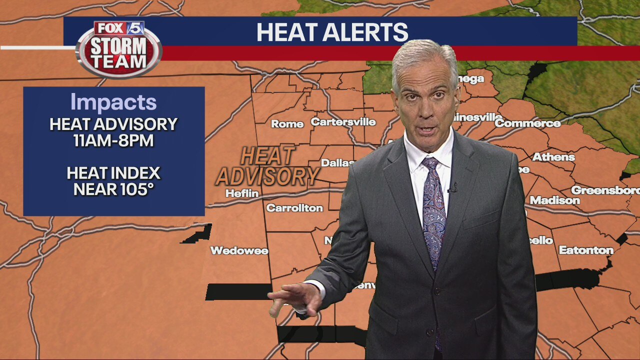
Thursday late morning forecast
Heat alerts in effect with Heat Index figures back in the triple-digits. Weekend may provide a break from humidity.
Heat alerts in effect with Heat Index figures back in the triple-digits. Weekend may provide a break from humidity.

Thursday morning forecast
Temperatures are in the mid-to-upper 90s again and more heat advisories are coming. Some spots will see afternoon showers.
Temperatures are in the mid-to-upper 90s again and more heat advisories are coming. Some spots will see afternoon showers.

Wednesday Evening Weather Update
RING THE BELL! Atlanta set a record high on Wednesday at 99. The old mark was 96 set back in 1952. A few t-storms thru the evening capable of damaging winds and hail. Slow to cool overnight and then another scorcher on Thursday. Here is the latest.
RING THE BELL! Atlanta set a record high on Wednesday at 99. The old mark was 96 set back in 1952. A few t-storms thru the evening capable of damaging winds and hail. Slow to cool overnight and then another scorcher on Thursday. Here is the latest.
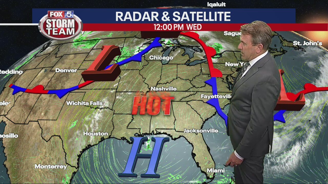
Wednesday midday forecast
Heat Index values have reached dangerous levels. Try to get inside as much as possible and stay hydrated.
Heat Index values have reached dangerous levels. Try to get inside as much as possible and stay hydrated.
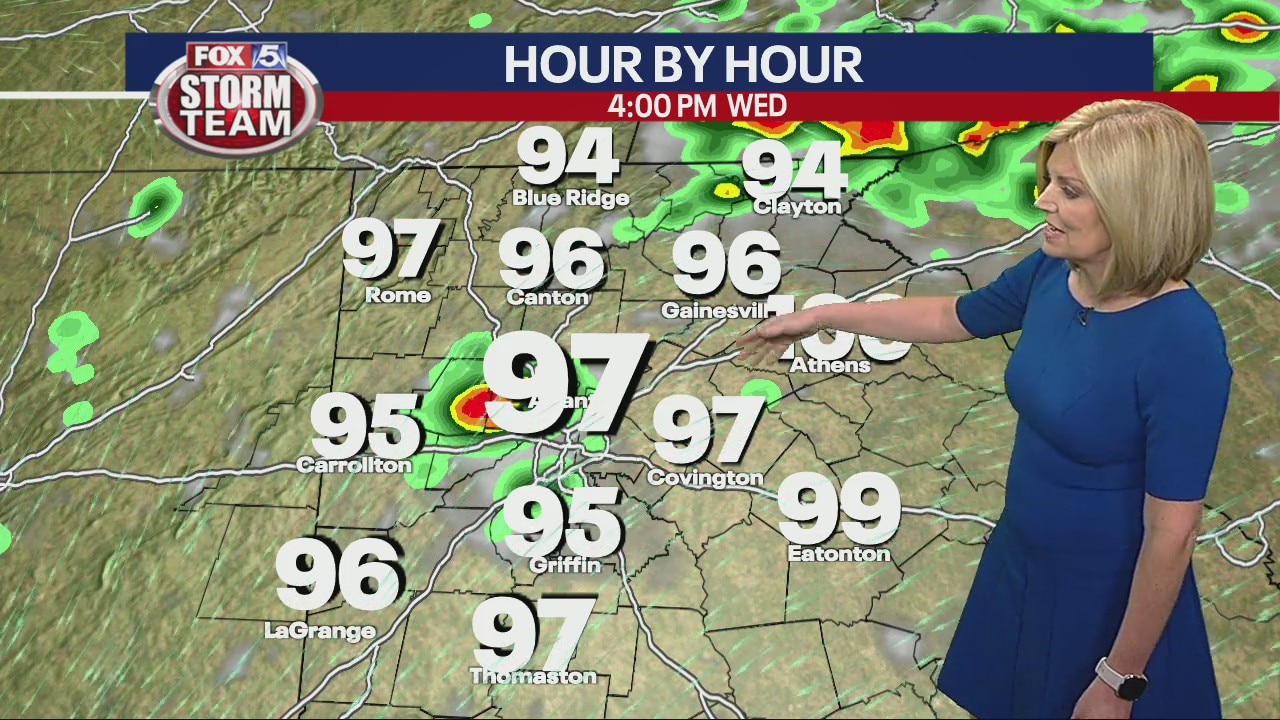
Wednesday morning forecast
Today's forecast high could past Tuesday's high as multiple heat warnings are in effect.
Today's forecast high could past Tuesday's high as multiple heat warnings are in effect.
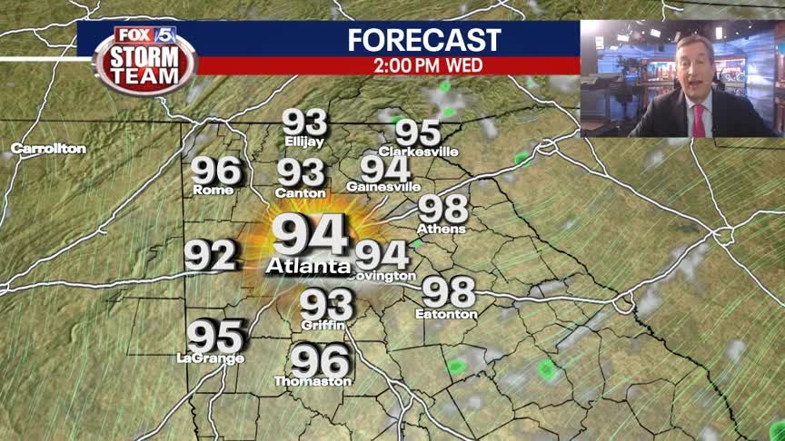
Tuesday Evening Weather Update
Slow to cool again Tuesday night with lows by morning only in the 70s. Another sizzler on Wednesday with highs in the mid 90s and heat Index levels in the 100 to 110 degree levels. Another round of strong to severe t-storms is also possible. Here is the breakdown.
Slow to cool again Tuesday night with lows by morning only in the 70s. Another sizzler on Wednesday with highs in the mid 90s and heat Index levels in the 100 to 110 degree levels. Another round of strong to severe t-storms is also possible. Here is the breakdown.

Tuesday morning forecast
Scattered thunderstorms may provide little relief from the heat. The heat index could exceed 100 yet again, and the heat doesn't show sings of receding for at least a few days.
Scattered thunderstorms may provide little relief from the heat. The heat index could exceed 100 yet again, and the heat doesn't show sings of receding for at least a few days.

Monday Evening Weather Update
Hot temps and high humidity mean summer is in full swing. Highs in the 90s, but it will feel like 100+. Heat Advisory for Tuesday. The only relief may be a few t-storms. Here is the breakdown.
Hot temps and high humidity mean summer is in full swing. Highs in the 90s, but it will feel like 100+. Heat Advisory for Tuesday. The only relief may be a few t-storms. Here is the breakdown.

Monday morning forecast
Warm temperatures and humidity all week, unlikely to change soon. The heat index may increase each day this week
Warm temperatures and humidity all week, unlikely to change soon. The heat index may increase each day this week

Sunday Evening Forecast
Extremely warm temperatures and high humidity surge across North Georgia sending heat indices into the low 100s.
Extremely warm temperatures and high humidity surge across North Georgia sending heat indices into the low 100s.
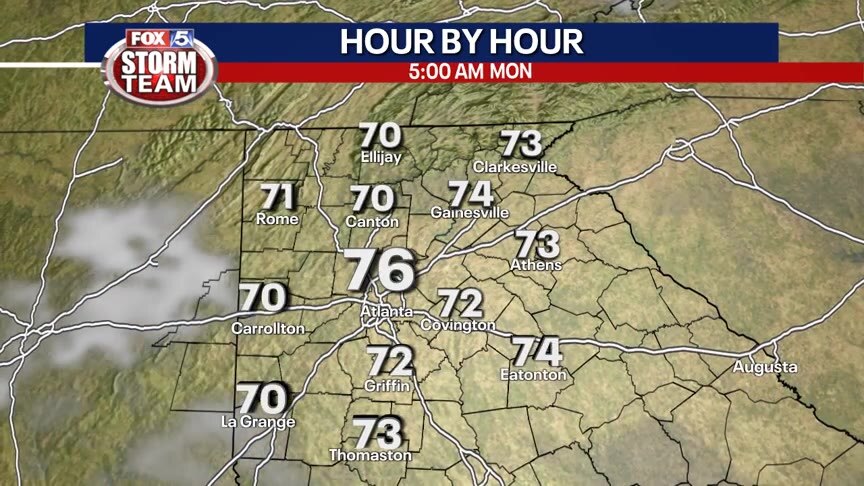
Sunday Forecast
Hot and humid with most areas staying dry.
Hot and humid with most areas staying dry.

Sunday morning forecast
The humidity and heat is setting in. Winds out of the south may enhance humidity over the next few days.
The humidity and heat is setting in. Winds out of the south may enhance humidity over the next few days.
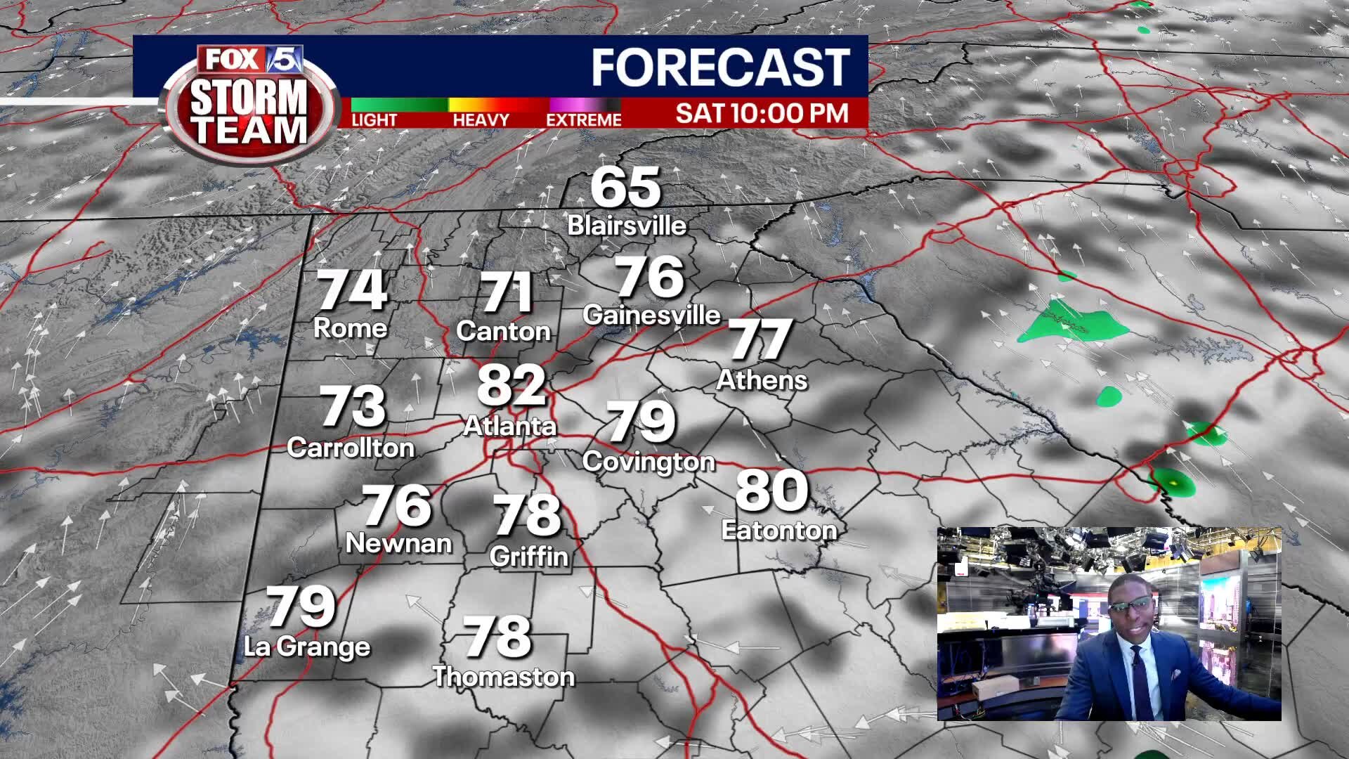
Saturday Evening Weather Update
High heat and humidity spread across north Georgia next week.
High heat and humidity spread across north Georgia next week.

Saturday Forecast
Partly cloudy with seasonal temperatures. Most areas will stay dry, but a few showers are possible.
Partly cloudy with seasonal temperatures. Most areas will stay dry, but a few showers are possible.

Saturday morning frecast
Dry, comfortable air is making way for sticky humidity. There's a possibility of a light sprinkle or shower Saturday before 90s-plus days take over next week.
Dry, comfortable air is making way for sticky humidity. There's a possibility of a light sprinkle or shower Saturday before 90s-plus days take over next week.
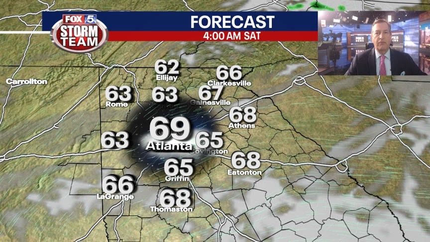
Friday Evening Weather Update
One more comfortable evening with lower humidity before changes for the weekend. It will get much hotter next week. Here is an update.
One more comfortable evening with lower humidity before changes for the weekend. It will get much hotter next week. Here is an update.

Friday Afternoon Forecast
Sunny and warm today with less humidity.
Sunny and warm today with less humidity.