

Tornadoes carve path of destruction in Georgia over the weekend
A funnel cloud spotted in Hall County on May 2, 2025. (Photo used with permission)
ATLANTA - Two EF1 tornadoes touched down in Georgia over the weekend during a wave of severe weather.
It caused damage to trees and property but resulted in no injuries or fatalities, according to the National Weather Service.
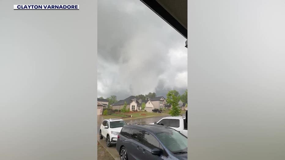
Talbot County tornado
What we know:
The more destructive of the two storms struck Talbot County on Saturday, May 3, carving a path nearly six miles long through the town of Woodland and surrounding areas. The tornado touched down at 9:14 p.m. just east of Shiloh and lifted around 10 minutes later near the Seaboard Coast Railroad Line northeast of Woodland.
Timeline:
According to the National Weather Service in Peachtree City, the tornado was produced by a supercell thunderstorm transitioning into a bowing line segment. It initially touched down in a wooded area between Highway 116 and Rush Creek, downing large oak trees and damaging a home’s window and chimney.
As the storm moved east, it weakened briefly to an EF0 as it passed through an area south of the Judge David Turner Reservoir. But radar indicated it remained on the ground as it approached Woodland, regaining strength and intensifying to EF1 status.
Dig deeper:
Significant damage was reported between 5th and 6th Streets in Woodland, where trees were snapped and up to 10 homes were damaged. The tornado reached peak intensity on 7th Avenue, where winds hit an estimated 95 mph and several porch roofs were torn off. It dissipated by 9:24 p.m.
Despite the damage, there were no injuries reported.
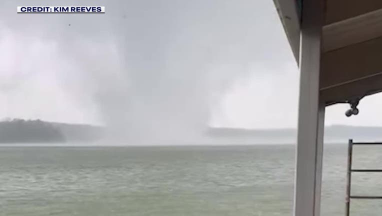
Hall County tornado
By the numbers:
A second EF1 tornado touched down the evening before, on Friday, May 2, over Lake Lanier in Hall County. That tornado developed from a small, isolated supercell and remained on the ground for approximately nine minutes, from 6:55 p.m. to 7:04 p.m.
The Hall County tornado traveled 2.75 miles, beginning near Thompson Bridge Road just north of Gainesville and ending east of Murrayville. Much of its path was over water, sparing most structures from damage. However, numerous trees were uprooted or snapped along its track, including near an apartment complex on North Cliff Colony Drive and several residences on Cochran Road and Willow Trace. Peak winds were estimated at 90 mph.
A funnel cloud spotted in Hall County on May 2, 2025. (Photo used with permission)
Big picture view:
Both tornadoes were rated EF1 on the Enhanced Fujita Scale, which classifies tornadoes with winds between 86 and 110 mph.
The Source: The National Weather Service and the FOX 5 Storm Team contributed to this report.