

Jackson, Banks counties under flash flood warning until Sunday night
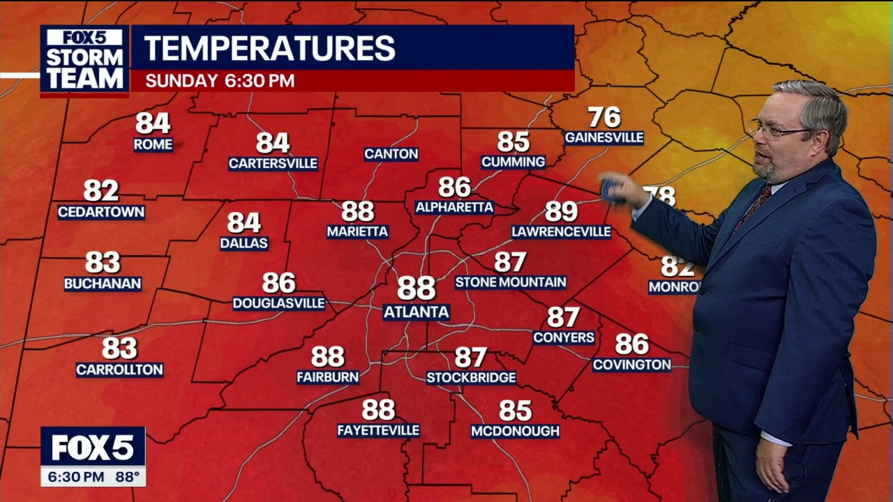
Sunday evening weather forecast
Heavy downpours slammed parts of North Georgia on Sunday afternoon, prompting emergency weather alerts.
JACKSON COUNTY, Ga. - Heavy downpours slammed parts of North Georgia on Sunday afternoon, prompting emergency weather alerts.
What we know:
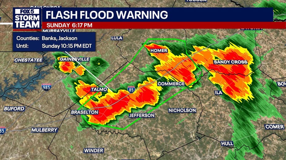
A flash flood warning was issued for Jackson County and Banks County until 10:15 p.m. Sunday. Drivers traveling along Interstate 85 between Jefferson and Commerce faced heavy rain and dangerous road conditions.
Radar estimates showed over three inches of rain falling in concentrated areas in just over an hour.
Local perspective:
The intense rainfall comes as parts of northeast Georgia continue to experience severe drought conditions. Updated drought monitoring maps scheduled for release on Thursday will show whether the recent storms provided significant relief.
Storms are expected to settle down late Sunday night, with temperatures dropping to around 71 degrees in the metro area and the 60s in North Georgia.
Isolated storms are expected Monday with highs near 87 degrees. Rain chances increase to 60% on Tuesday and Wednesday as an upper-level low pressure system moves into the region, bringing scattered showers before typical summertime patterns return for the weekend.
What we don't know:
Weather reports have not detailed specific road closures or property damage totals resulting from Sunday's flash flooding.
It remains unconfirmed how much overall drought levels will shift following Thursday's official state climate update.
The Source: The information in this story comes from the FOX 5 Storm Team.