This browser does not support the Video element.
Radar time-lapse loop of Spalding County tornado outbreak
The National Weather Service released this radar time-lapse loop showing how there were as many as four tornadoes circulating around each other and eventually merging in Spalding County on Jan. 12, 2023.
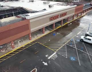
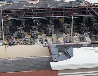
SPALDING COUNTY, Ga. - The National Weather Service has a better understanding of the outbreak of tornadoes which tore through Georgia on Jan. 12. A new groundbreaking report was issued on Thursday.
"As many as four tornadoes were on the ground simultaneously in SW Spalding County...rotating around the larger circulation, merging together in several cases and crossing paths," the report reads in part.
Meteorologists reanalyzed the tornadoes that crossed northeastern Meriwether, northwestern Pike, and southwestern Spalding counties. They were able to compare radar data and high-resolution aerial imaging following the outbreak to determine that several tornadoes were rotating around and within a large vortex. That vortex got as large as two miles in some areas.
"It was also noted that near and shortly after tornadoes merged, damage increased. The presence of three mergers was identified in the reanalysis," the report reads.
HERE'S WHY A 'SPY PLANE' WILL BE STATIONED AT DOBBINS AIR RESERVE BASE THE NEXT FEW MONTHS
The meteorologist say the proximity of the severe weather to the NWS radar helped. Two additional tornadoes were identified bringing the total to 14, including 10 that came from the same storm cell.
Wind speeds as high as 155 mph, or an extremely powerful EF-3 tornado, were reached.
The NWS also released a track and a video outlining the paths and rotations.