

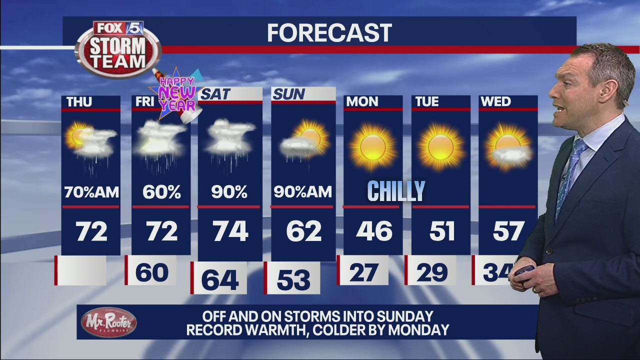
Thursday morning forecast
Off and on storms into Sunday. Record warmth, colder by Monday.
Off and on storms into Sunday. Record warmth, colder by Monday.

Wednesday Evening Weather Update
Storm Alert Night for most of North Georgia as a line of strong to severe storms will move over the area from 10pm to 3am. Here is the latest.
Storm Alert Night for most of North Georgia as a line of strong to severe storms will move over the area from 10pm to 3am. Here is the latest.

Strong to severe storms expected overnight
It is a Storm Alert Day in north Georgia. Please be weather aware as strong to severe storms are expected to move through the state late Wednesday into early Thursday. Some counties in extreme north Georgia are also under a Tornado Watch.
It is a Storm Alert Day in north Georgia. Please be weather aware as strong to severe storms are expected to move through the state late Wednesday into early Thursday. Some counties in extreme north Georgia are also under a Tornado Watch.

Noon weather forecast
It's dry now in metro Atlanta, but it won't last. Tracking "enhanced" threat from severe weather in northwest Georgia and "slight" threat in metro Atlanta on Wednesday night into Thursday morning.
It's dry now in metro Atlanta, but it won't last. Tracking "enhanced" threat from severe weather in northwest Georgia and "slight" threat in metro Atlanta on Wednesday night into Thursday morning.


Georgia severe weather: Strong to severe storms possible Wednesday
Those across the South will want to be "weather aware" on Wednesday as a powerful front is expected to move through bringing strong to severe storms.
Those across the South will want to be "weather aware" on Wednesday as a powerful front is expected to move through bringing strong to severe storms.

Wednesday morning forecast
Rain and storms ahead of a cold front. Starting out with seasonably warm temperatures.
Rain and storms ahead of a cold front. Starting out with seasonably warm temperatures.
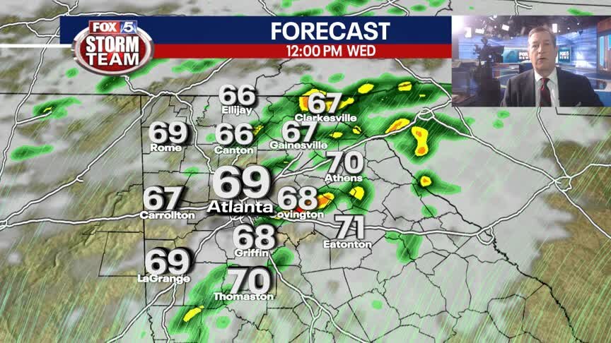
Tuesday Evening Weather Update
After record high in ATL on Tuesday, more warmth is on the way this week and with that, strong to severe storms late Wednesday into Thursday morning. Another round of storms by the weekend. Here is active weather picture.
After record high in ATL on Tuesday, more warmth is on the way this week and with that, strong to severe storms late Wednesday into Thursday morning. Another round of storms by the weekend. Here is active weather picture.

Tuesday morning forecast
Potential severe weather Wednesday in north Georgia and metro Atlanta. Cold air coming early next week.
Potential severe weather Wednesday in north Georgia and metro Atlanta. Cold air coming early next week.
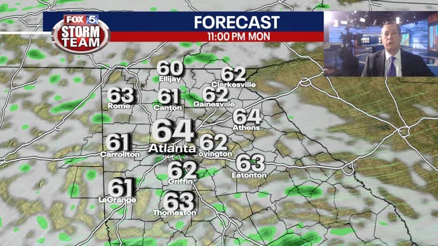
Monday Evening Weather Update
Another really warm overnight with patchy dense fog. Mostly cloudy on Tuesday and near the record high of 74. Showers and storms more scattered on Wednesday, but staying warm into the weekend. Here is the breakdown.
Another really warm overnight with patchy dense fog. Mostly cloudy on Tuesday and near the record high of 74. Showers and storms more scattered on Wednesday, but staying warm into the weekend. Here is the breakdown.

Noon weather forecast
Warm temperatures, but not as warm as the weekend. Chance of rain increases as week progresses.
Warm temperatures, but not as warm as the weekend. Chance of rain increases as week progresses.

Monday morning forecast
A few record highs in jeopardy this week. Visibility low in some areas. Rain possible heading into New Years weekend.
A few record highs in jeopardy this week. Visibility low in some areas. Rain possible heading into New Years weekend.

Sunday Evening Forecast
High temperatures attempt to reach into the 70s each day of the workweek ahead. Rain and storm chances increase starting Wednesday.
High temperatures attempt to reach into the 70s each day of the workweek ahead. Rain and storm chances increase starting Wednesday.
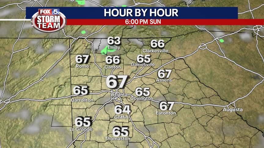
Sunday Forecast
Mix of sun and clouds with unseasonably warm temperatures.
Mix of sun and clouds with unseasonably warm temperatures.

Saturday Evening Forecast
Temperatures soar into the 70s and rain returns by midweek.
Temperatures soar into the 70s and rain returns by midweek.

Christmas Day weather forecast
No white Christmas this year. Temperatures in the 60s throughout the weekend with low chance of overnight showers.
No white Christmas this year. Temperatures in the 60s throughout the weekend with low chance of overnight showers.
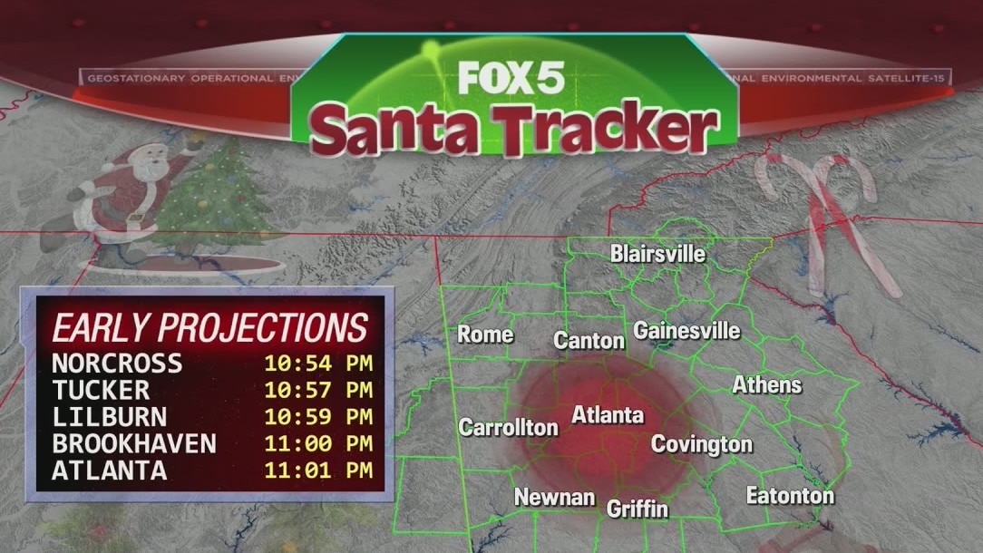
Santa Tracker - Part Five
FOX 5 Storm Team Chief Meteorologist David Chandley and his crew are once again tracking Santa as he makes his way around the world bringing toys to all the good girls and boys.
FOX 5 Storm Team Chief Meteorologist David Chandley and his crew are once again tracking Santa as he makes his way around the world bringing toys to all the good girls and boys.

Christmas Eve morning forecast
A major warming trend is expected over the next 24 hours ahead of an above normally warm Christmas Day. Rain chances increase beginning next week.
A major warming trend is expected over the next 24 hours ahead of an above normally warm Christmas Day. Rain chances increase beginning next week.

Thursday Evening Forecast
Another cold night on the way and then warmer temperatures through Christmas.
Another cold night on the way and then warmer temperatures through Christmas.
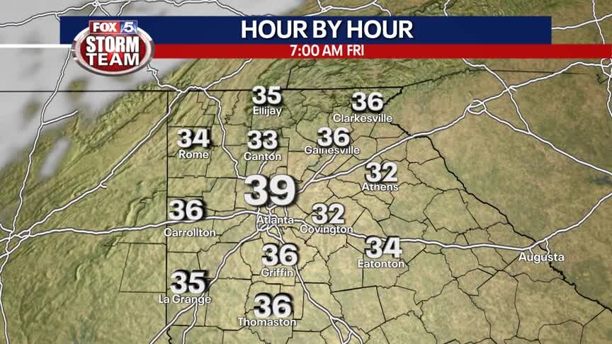
Thursday Afternoon Forecast
Sunny with slightly warmer temperatures. Staying cold and clear tonight before a surge of much warmer air returns Friday afternoon through the weekend.
Sunny with slightly warmer temperatures. Staying cold and clear tonight before a surge of much warmer air returns Friday afternoon through the weekend.

Thursday morning forecast
Rain chance remain low throughout the week ahead of an expected warm Christmas Day.
Rain chance remain low throughout the week ahead of an expected warm Christmas Day.