

Metro Atlanta weather: More storms are in the cards for North Georgia
Saturday night forecast
A sluggish stationary front will pull North Georgia temperatures below normal this week as an unsettled summer weather pattern unloads localized downpours and severe thunderstorm threats across the region.
ATLANTA - A sluggish stationary front will pull North Georgia temperatures below normal this week as an unsettled summer weather pattern unloads localized downpours and severe thunderstorm threats across the region.
What we know:
A powerful summer weather system triggered multiple severe thunderstorm warnings on Saturday.
In Athens, a severe downburst slammed the area, packing damaging winds that knocked down trees and disrupted local neighborhoods.
Forecasters warn that these pulse-style summer storms can expand rapidly with the heat of the day and collapse just as fast, unleashing heavy rain and dangerous wind energy directly to the ground.
Spotty showers will continue to drift through the area overnight as a pocket of atmospheric energy pushes out of Mississippi and Alabama into North Georgia.
Storms are sneaking closer to the Alabama border, prompting a close watch for folks near Rome and Cedartown. Downtown Atlanta hit a steamy afternoon high of 94 degrees with relative humidity levels sitting at a sticky 74 percent before storms rolled in.
The Atlanta FIFA Fan Festival's opening was delayed by several hours due to reported lightning in the vicinity. The festival has since opened.
By the numbers:
Overnight low temperatures will slide down to around 75 degrees in the Atlanta metro area and drop to a cooler 67 degrees up in mountain communities like Blairsville.
Saturday night temp readings hovered at 76 degrees in Duluth and Douglasville, 79 degrees in South Fulton, 80 degrees in Newnan, and 78 degrees in Forsyth. Sunday afternoon will bring a slight break from the extreme heat with an expected high of 89 degrees accompanied by scattered showers and thunderstorms.
Why you should care:
While the stormy pattern threatens to disrupt weekend outdoor plans, the incoming moisture provides crucial relief for communities fighting long-term drought conditions.
Pockets of northeast Georgia remain deeply impacted by dry conditions, making any measurement in the rain bucket a welcome relief for local families and agricultural regions.
What's next:
Forecasters warn that Sunday afternoon will bring a repeat severe weather threat, packing potential 60 mph wind gusts and intense lightning.
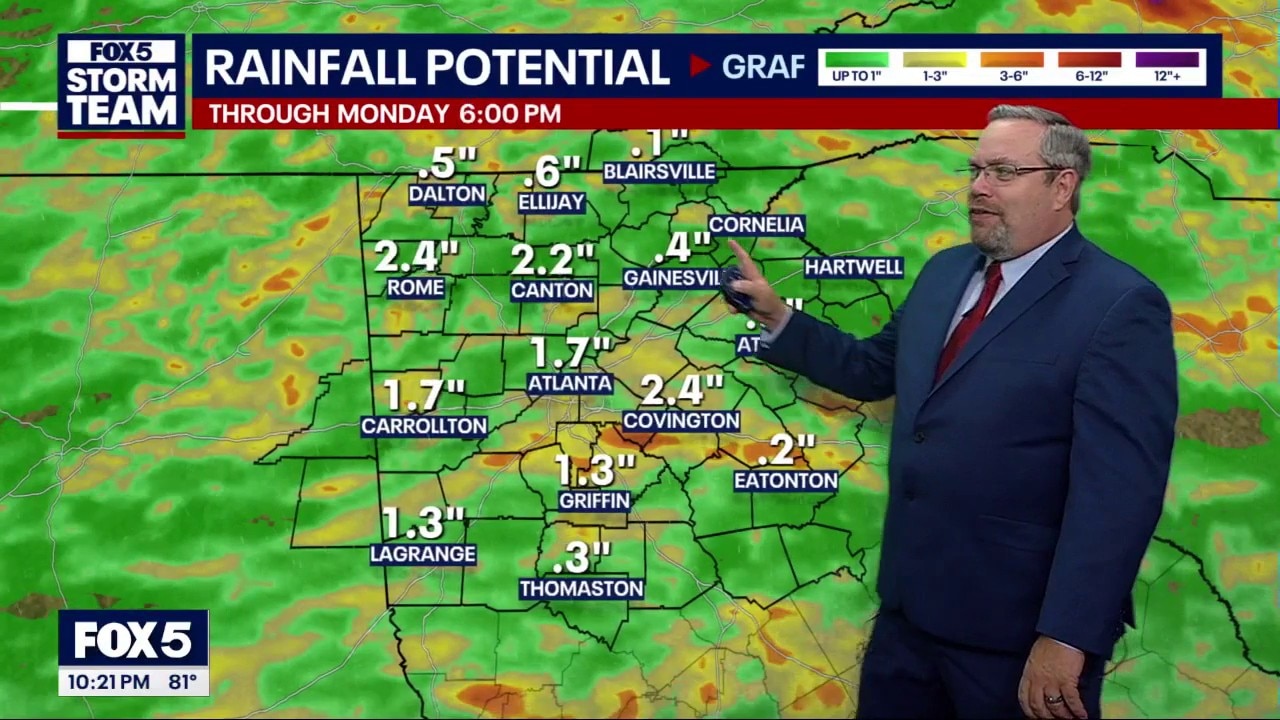
An upper-level disturbance will swing into the region by Monday afternoon, triggering widespread storm coverage and heavy downpours.
The wet and unsettled weather will linger into Tuesday before conditions slowly begin to clear out and dry up toward the middle of the week. High temperatures are expected to sit comfortably in the mid-80s on Monday and Tuesday due to thick cloud cover and rain, which is well below normal for a typical July forecast.
The Source: The information in this story was gathered from FOX 5 meteorologist Greg Majeski, who reviewed regional satellite weather models, atmospheric front data, and local temperature gauges.