

Flash flood warning issued for Fulton, Cobb counties Tuesday
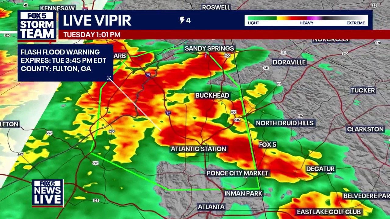
Flash flood warning issued for Fulton, Cobb counties
A flash flood warning is in effect for parts of Fulton and Cobb counties as heavy, slow-moving storms hit Metro Atlanta.
ATLANTA - A flash flood warning is impacting Fulton and Cobb counties after slow-moving storms dumped nearly two inches of rain in under an hour.
Wet weather ahead
What we know:
Storms sitting directly over the metro area have triggered a flash flood warning stretching from North Avenue up Interstate 75 toward Vinings.
Radar imagery shows widespread rainfall amounts between half an inch and two inches, with most of the precipitation falling in a single hour.
Meteorologists caution that the system is not moving north or south, functioning like a pot of boiling water and dumping heavy rain on low-lying roads, basements, and locations near Powder Springs and Hiram.
Stormy skies return
By the numbers:
Radar tracks show three-hour rainfall totals exceeding two inches across much of the urban core. Air traffic controllers issued an initial departure delay at 11:20 a.m. for outgoing flights, with FAA ground stops for incoming planes extended until 1:45 p.m.. Ground delays for departing flights held at roughly 45 minutes as dark clouds hovered over the runways.
What we don't know:
Officials have not yet confirmed the total number of flooded streets or structural damage reports across the area. It remains unclear when flight operations will return to a normal schedule at Hartsfield-Jackson International Airport after ground stops and departure delays.
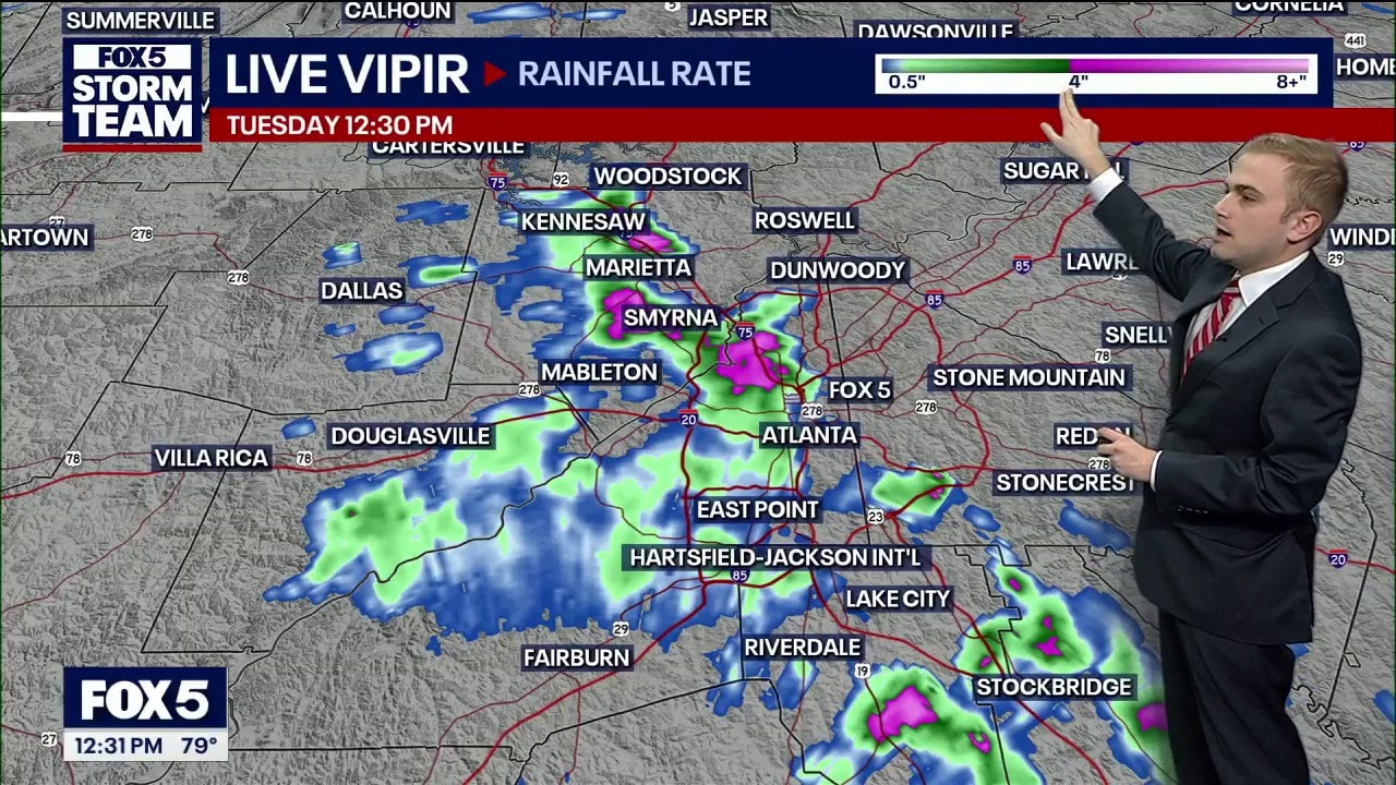
Tuesday noon weather forecast
Scattering summer thunderstorms are moving across Metro Atlanta on Tuesday, unleashing heavy downpours and sudden lightning strikes that threaten afternoon commutes.
Daily rain odds
Timeline:
Rain chances follow a typical summertime pattern, ramping up each afternoon during peak heating:
- Tuesday: A few early morning showers give way to widespread afternoon storms (60% chance). Highs reach the mid 80s.
- Wednesday: The wettest day of the week with widespread storms firing up by 2 p.m. or 3 p.m. (70% chance). Highs stay cool in the mid 80s.
- Thursday & Friday: Scattered to widespread afternoon storms continue (60% chance Thursday) before tapering heading into the weekend.
Upper low rules
Big picture view:
A mid-level cutoff low sitting high above the Southeast is controlling local weather conditions on the ground. As this system slowly meanders toward the Carolinas, it will continue to tap into deep moisture, squeezing out repeated rounds of rain across Georgia before high pressure builds back in over the weekend.
Soaking rain totals
Local perspective:
Widespread rainfall totals will generally range from 0.5 to 1.5 inches through Thursday evening, though localized spots under persistent downpours could see higher amounts. Intermittent rain and dicey roads may disrupt afternoon commutes and school pickups across North Georgia and metro Atlanta.
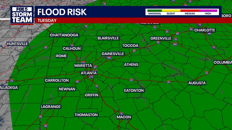
Schools back in session
Why you should care:
Damp grounds paired with gusty winds increase the risk of isolated downed trees and scattered power outages. Parents and kids heading back to school should pack umbrellas or rain gear for afternoon bus stops and outdoor activities.
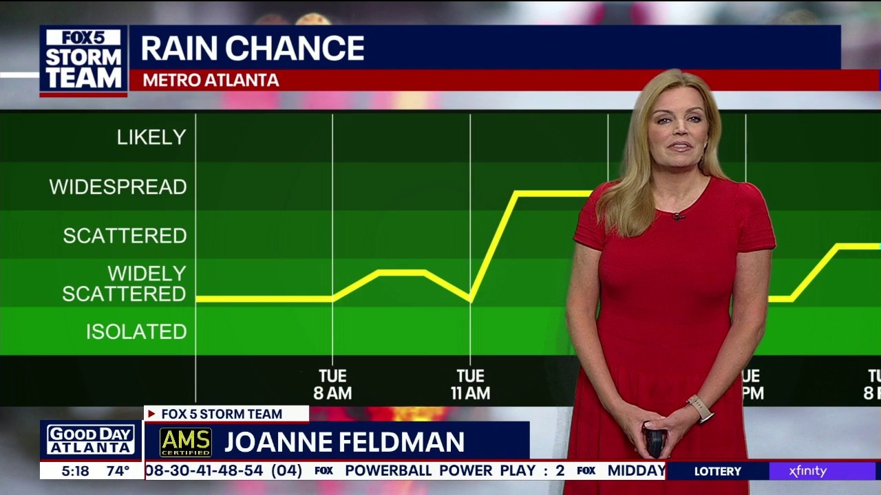
Tuesday morning weather forecast
Morning fog is possible, while temperatures will gradually climb back toward 90 degrees by the weekend. Scattered afternoon showers and thunderstorms are expected across north Georgia through the weekend.
The following school districts are going back to school on Tuesday:
- Dawson County Schools
- Floyd County Schools
- Calhoun City Schools
- Gainesville City Schools
- Marietta City Schools
- Paulding County Schools
- Pickens County Schools
- Putnam County Schools
- Fannin County Schools
- Haralson County Schools
Week at glance
By the numbers:
Metro Atlanta Forecast
- Tuesday: High 87 / Low 71 | Scattered Afternoon Storms (60%)
- Wednesday: High 88 / Low 72 | Widespread Storms (70%)
- Thursday: High 90 / Low 72 | Scattered Afternoon Storms (60%)
- Friday: High 91 / Low 73 | Scattered Afternoon Storms (50%)
- Saturday: High 93 / Low 74 | Isolated Storms (30%)
- Sunday: High 94 / Low 74 | Isolated Afternoon Storms (30%)
- Monday: High 93 / Low 73 | Isolated Storms (30%)
North Georgia Forecast
- Tuesday: High 81 / Low 65 | Scattered Afternoon Storms (60%)
- Wednesday: High 82 / Low 66 | Widespread Storms (70%)
- Thursday: High 84 / Low 66 | Scattered Afternoon Storms (60%)
- Friday: High 86 / Low 67 | Scattered Afternoon Storms (50%)
- Saturday: High 88 / Low 68 | Isolated Storms (30%)
- Sunday: High 89 / Low 68 | Isolated Afternoon Storms (30%)
- Monday: High 88 / Low 67 | Isolated Storms (30%)
Sunshine returns soon
What's next:
As the upper-level low pushes east toward the Atlantic coastline over the weekend, high pressure will build in from the east. Rain chances drop back down to standard summertime levels while summer heat pushes afternoon highs back into the lower to mid 90s.
The Source: Information gathered from the FOX 5 Storm Team and the National Weather Service. The latest forecast was added Tuesday morning.