

Tropical Storm Watches issued for parts of Florida ahead of heavy rain, gusty winds
The National Hurricane Center has issued Tropical Storms Watches for parts of Florida and Cuba as all eyes are focused on the Potential Tropical Cyclone One in southern Gulf of Mexico.
Whether the system organizes into a tropical storm or not, the Florida Peninsula and the Keys will see heavy rain and gusty winds beginning tonight as the system tracks in the direction of the Sunshine State.
A Tropical Storm Watch means winds of at least 40 mph are possible in the area within 48 hours.
The watch can be upgraded to a warning if meteorologists expect tropical storm conditions in the alerted area within the 36 hours.
WHAT TO DO WHEN HURRICANE OR TROPICAL STORM WATCHES AND WARNINGS ARE ISSUED FOR YOUR TOWN
On the forecast track, Potential Tropical Cyclone One is expected to strengthen into Tropical Storm Alex before landfall on Saturday in Southwest Florida.
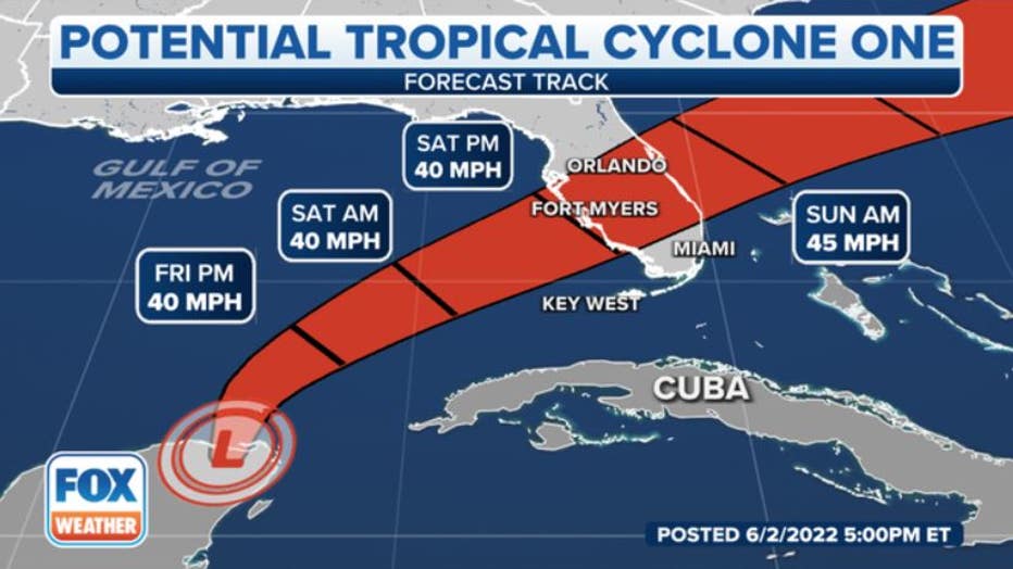
The potential tropical cyclone is expected to strengthen into Tropical Storm Alex within the next 24 hours. (Credit: FOX Weather)
Once the system's sustained winds reach 40 mph or higher and gains a true center of circulation, it will become a tropical storm and receive the name "Alex," the first name on this year's list of storm names for the Atlantic Basin.
WHAT'S THE DIFFERENCE BETWEEN A TROPICAL DEPRESSION, TROPICAL STORM AND HURRICANE?
Scattered downpours should arrive in portions of South Florida Thursday night, increase in intensity on Friday as winds gust to or near tropical-storm force (40-plus mph), and continue falling into Saturday.
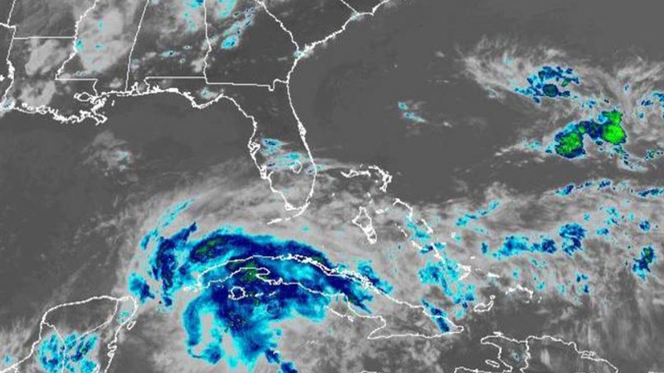
Satellite imagery of Atlantic coast and Florida. (Credit: NOAA)
By late Saturday, winds might still be gusty, but dry air on the back side of the system should arrive and cause the rain to gradually diminish.
The weather should significantly improve Saturday night and into Sunday as the system moves offshore into the southwestern Atlantic.
WHAT IS A POTENTIAL TROPICAL CYCLONE
The NHC says several inches of rain are expected across South Florida, including the Miami metro area. It's not out of the question that some locations could receive close to a foot of rainfall.
It's still uncertain how far north the heavy-rain swath will extend. Until the system gets more organized and forecasts become more certain, people along the Interstate 4 corridor from Tampa to Orlando need to stay aware.
Regardless of the system's exact track, the likelihood of heavy rain in South Florida is high.
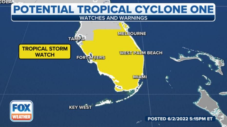
Tropical Storms Watches extend from the Keys into Central Florida. (Credit: FOX Weather)
The ground in many parts of South Florida is saturated from days of heavy rain, so stay aware of any flood alerts issued by the National Weather Service. Some fast-developing tornadoes sometimes occur in these situations as well.
It may very well be dangerous to be on the roads in the southern part of Florida from Friday into the daytime on Saturday. Think about changing your plans so that you’re settled in during the gustiest and rainiest part of the storm.
CLICK HERE TO GET THE FOX WEATHER UPDATE PODCAST
Stay updated on everything in the tropics this hurricane season. Download the FOX Weather app to get the latest forecasts, as well as any weather alerts that are issued.