

Humid afternoon conditions spark scattered North Georgia storms
Sunday evening forecast
Storms are popping up around North Georgia on Sunday night before a clear couple of days. Those dry days will precede a rainy Memorial Day weekend. Here's your latest weather update.
ATLANTA - Unstable air patterns are bringing scattered afternoon rain and variable storm threats to multiple communities across North Georgia on Sunday.
What we know:
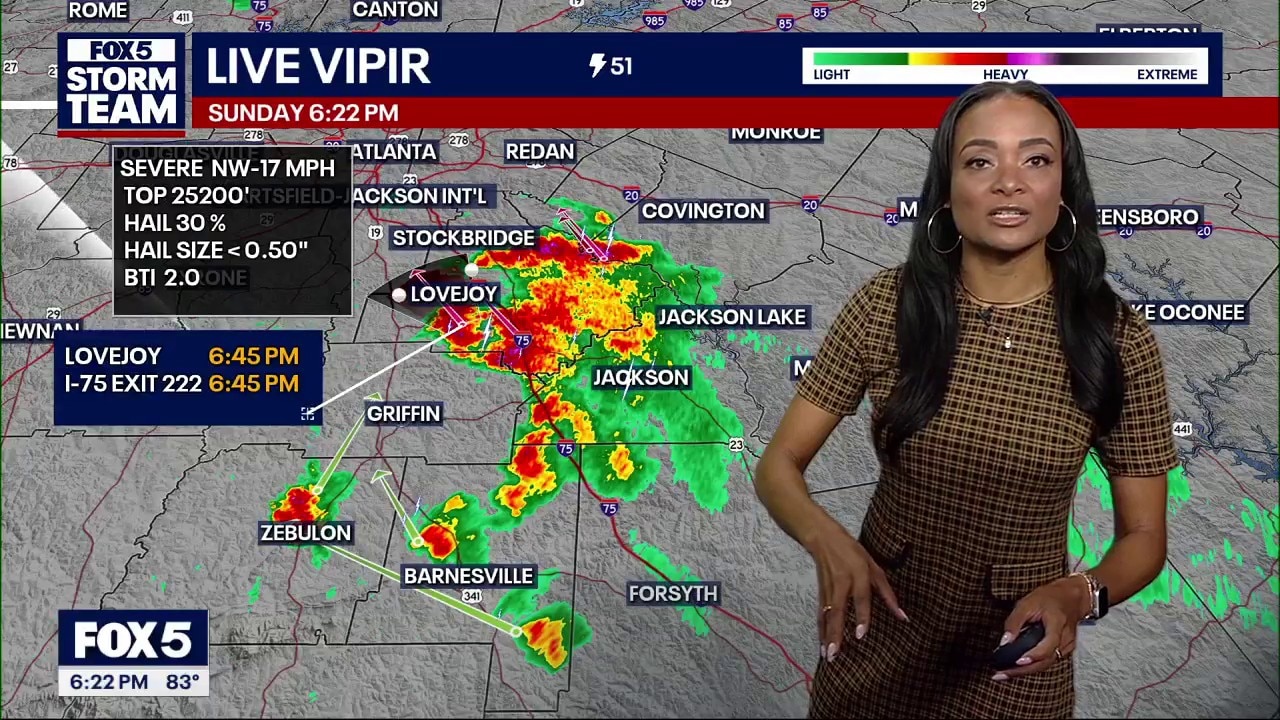
FOX 5 Storm Team meteorologists have placed a part of the state under a level 1 marginal risk for severe weather on Sunday. Muggy air is sticking around, making conditions feel significantly more humid than the region experienced over the last several days.
Scattered showers and storms are expected to pop up during the afternoon hours. While it is not a full-blown summer pattern, radar screens will mirror that exact setup, with most downpours tracking across the eastern side of Georgia on Sunday.
Isolated areas could easily see rain amounts climb past an inch. Localized storms are projected to line up near the Atlanta airport by 6 p.m. Sunday.
A ground stop is in effect at Hartsfield-Jackson International Airport until 5:30 p.m. due to thunderstorms.
Local perspective:
The weather will transition to a drier pattern on Monday and Tuesday, dropping rain chances to a minor 10% clip. Tuesday marks Election Day across Georgia, featuring mostly clear skies with hot and steamy afternoon highs stretching into the upper 80s.
A more active weather pattern returns later in the week. Rain chances will spike to 30% on Wednesday, climb to 50% on Thursday, and jump up to 70% by Friday.
Big picture view:
Long-range modeling indicates that regional drivers and outdoor planners will likely have to duck around rolling rainstorms over the upcoming holiday period. Wet conditions are projected to last straight into the extended Memorial Day weekend.
The Source: The information in this story was gathered from the FOX 5 Storm Team, who explained how we got it using real-time atmospheric modeling data presented by weather forecaster Greg Majewski.