

Tropical Storm Watch active as depression threatens Gulf Coast
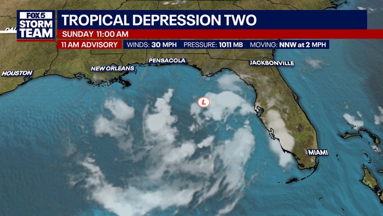
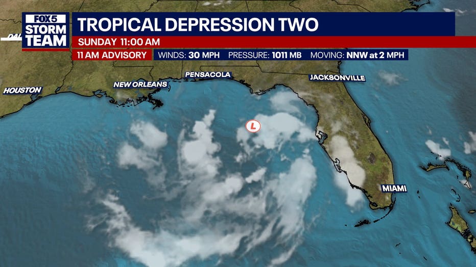
ATLANTA - A slow-moving tropical depression lingering in the eastern Gulf has triggered a Tropical Storm Watch for the Florida Panhandle and coastal Alabama, with forecasters warning the system will likely strengthen into a tropical storm by Monday.
What we know:
The National Hurricane Center said Tropical Depression Two is currently stationary about 180 miles south-southeast of Panama City. The system maintains maximum sustained winds of 30 mph, but meteorologists expect gradual strengthening to turn the depression into a tropical storm on Monday.
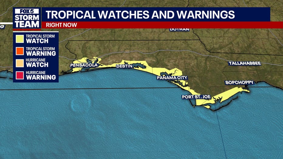
A Tropical Storm Watch is now in effect from the Ochlockonee River to the Florida-Alabama border, covering coastal areas like South Walton, Coastal Bay, Coastal Gulf and Coastal Franklin.
A separate Tropical Storm Watch extends across Escambia Coastal, Okaloosa Coastal and Santa Rosa Coastal.
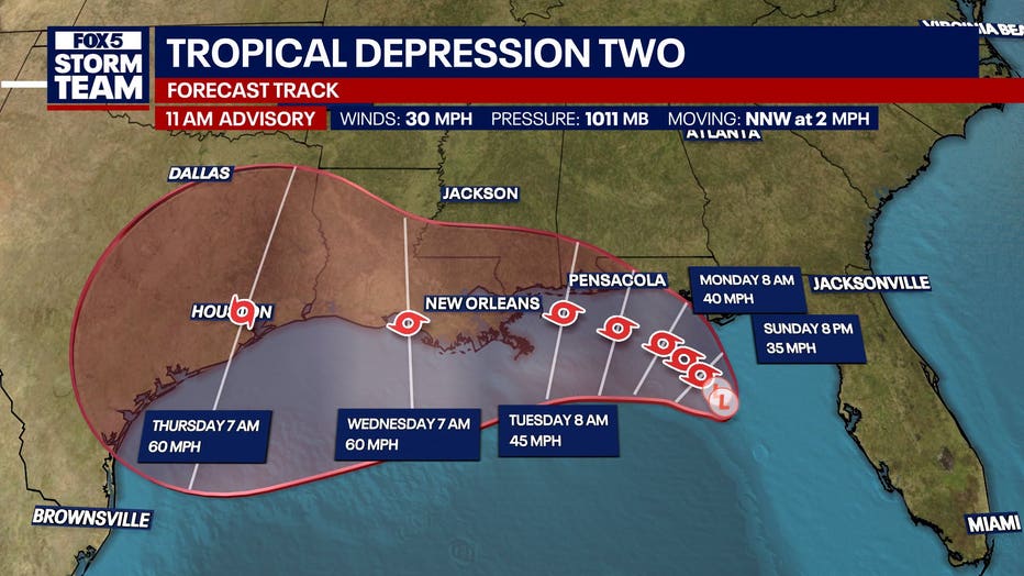
The sprawling storm is projected to drift northwestward over the next day or two before making a distinct turn toward the west, bringing it along or just offshore of the northern Gulf coast through the week.
Coastal communities could experience 2 to 4 inches of rain, with isolated pockets seeing up to 8 inches that could trigger urban flash flooding.
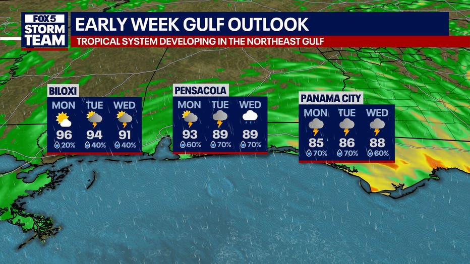
Along the Florida Big Bend, a storm surge of 1 to 3 feet is possible during high tide, while hazardous swells are already generating life-threatening surf and rip currents along the Florida coast.
What we don't know:
Officials have not yet confirmed the exact intensity the system will reach, noting that wind shear and potential land interaction create low confidence in the long-range intensity forecast. Weather models show a wide spread, ranging from a weak tropical depression to a full hurricane.
It remains unclear exactly which areas in Alabama, Mississippi, Louisiana and Texas will face the harshest impacts as the track shifts. Emergency managers have not yet issued mandatory evacuation orders, but they note that localized flooding could prompt future evacuations in vulnerable spots.
What you can do:
Residents and visitors across the Gulf Coast should immediately check their emergency plans and supply kits. The National Weather Service advises people to monitor local forecast offices rather than focusing strictly on the center line of the track, as hazards extend far from the eye. Out-of-town visitors should identify their specific county and consult hotel management regarding onsite disaster procedures. Additional preparedness guides are available at ready.gov and redcross.org.
The Source: The information in this story was gathered from the National Hurricane Center, which issued public advisories and discussions, as well as the National Weather Service offices in Tallahassee and Mobile, which provided local impact statements.