

Weather whiplash: Gusty winds, freezing temps & snow flurries in North GA
Monday morning weather forecast
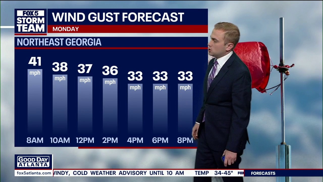
Monday will remain rather chilly, mostly because of the windy conditions. Today's high is only near 40, but warmer near end of the week.
ATLANTA - Residents across North Georgia are experiencing a literal case of "weather whiplash" this Monday morning. Just 48 hours after the region enjoyed record-breaking highs near 80 degrees, a powerful cold front has sent temperatures diving into the 20s.
🌤️ North Georgia Forecast
Today: 🌬️ High 42° | Blustery & cold. Wind chills in the 20s.
Tonight: 🧊 Low 26° | Clear skies and freezing temperatures.
Extended: 🌡️ Warming trend begins Tuesday. Highs near 71° by Sunday.
What we know:
The chill is even more pronounced in the North Georgia mountains. In Union County, snow flurries were spotted early this morning at Butternut Creek Golf Club near Blairsville. While no accumulation or "dusting" is expected, the sight was a stark reminder of the volatile February conditions.
In metro Atlanta, blustery winds of 20 to 30 mph are creating wind chills in the teens and single digits. Forecasters warn that even as the sun comes out, gusts in higher elevations could reach 40 mph today, keeping "real-feel" temperatures in the 20s and low 30s through most of the afternoon. The good news? A "spring-like" rebound is on the horizon, with 70-degree weather expected to return by the weekend.

What's next:
Despite a frigid start, models suggest the area should return to the 60s by Wednesday. A bout of rain is likely on Thursday.
The Source: Information in this report comes from FOX 5 Storm Team Meteorologist Alex Forbes.